The Kirks and Kirkyards of Rousay, Egilshay and Veira
by
Tommy Gibson
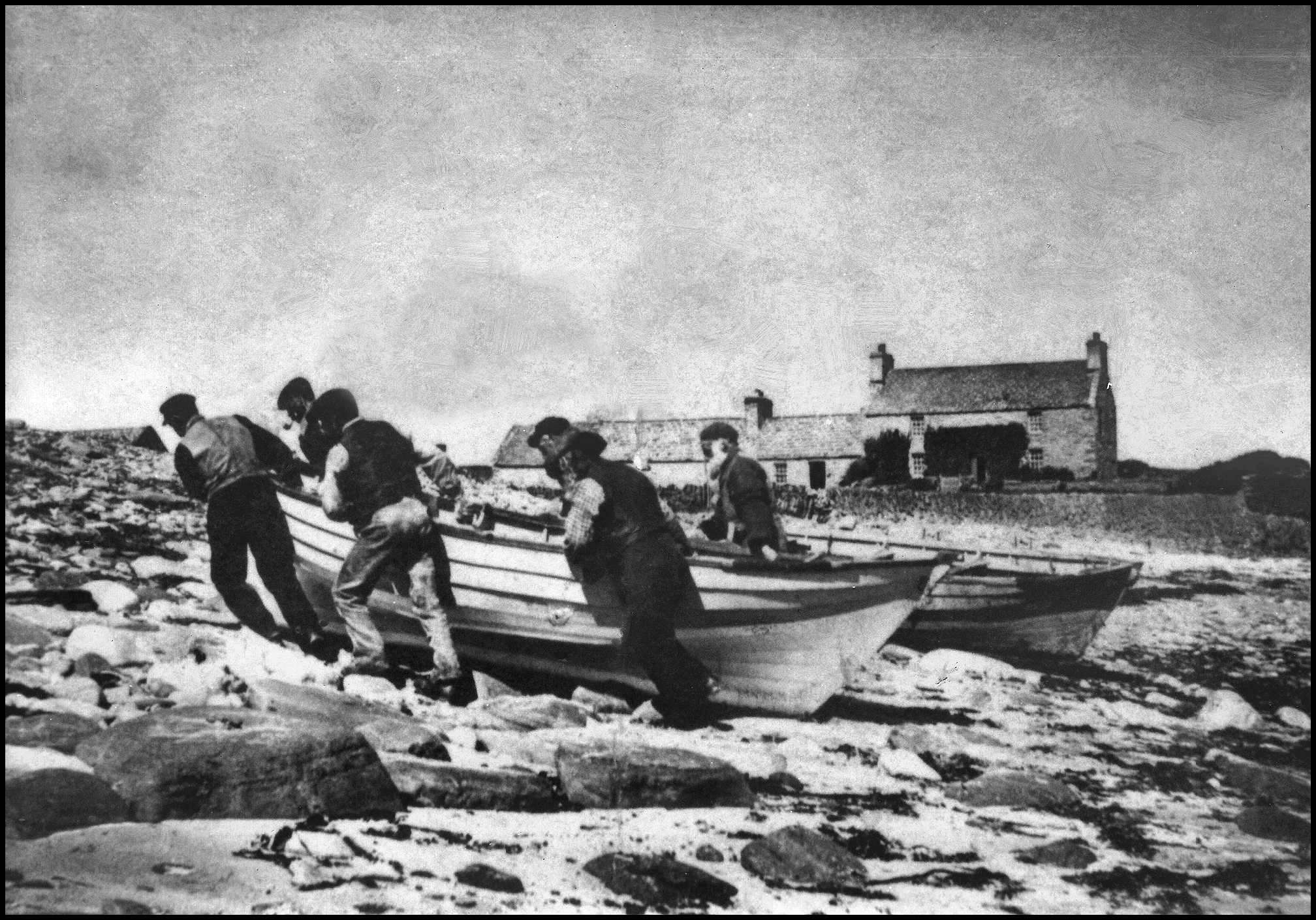
Being a three-island parish it would not have been the easiest to administer to the various religious needs of the people. Long ago, getting parishioners to the various churches on a Sunday morning would have been rather hazardous in bad weather. Boats carrying worshippers from Wyre to Rousay, boats from Egilshay to Rousay, boats to Egilshay from Rousay, also boats to Rendall or Kirkwall and, or Shapinsay. Safety must have been a priority for I have never come across any evidence of any accident concerning the transport of anyone between the islands for church matters.
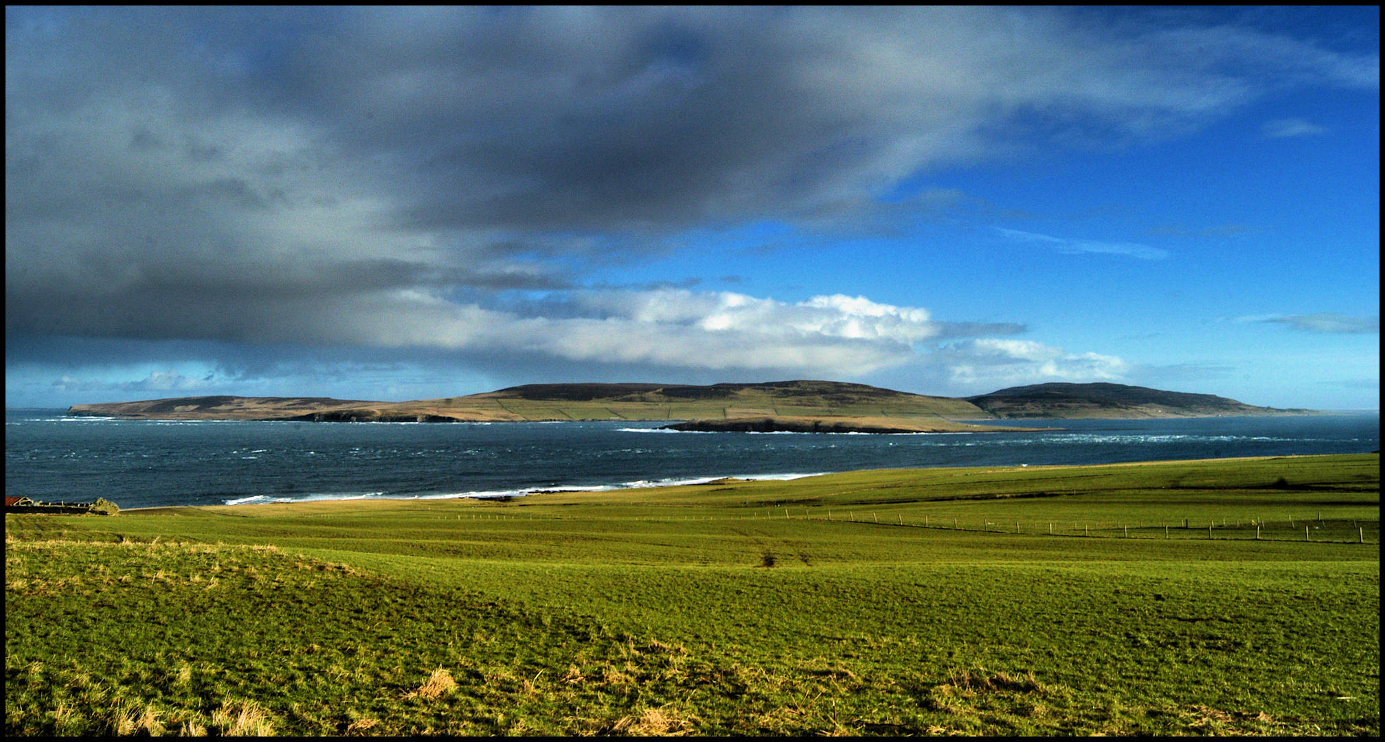
The small boats went in fairly bad weather and sometimes the passengers sat through a long sermon, soaking wet. The folk walked from Wasbister to Sourin up the Leean, and then they turned off the main road (now the council dump) onto a side road above the Blossan, Digro and Cruannie, down what was called the middle road at Ervadale to the Sourin Kirk. This road was well defined in the 1950’s and even now marks of that road are still there in places. It would have been slightly shorter than going down the Sourin Brae then up the Crossroads. Again this was a long walk in bad weather. Before the U.P. Kirk was built it was not uncommon for island parishioners to take a hazardous journey to Kirkwall for a service. Often in bad weather, they would have to get up before 3 o’clock in the morning to walk over the hill to the shore, sail directly into Kirkwall, or sail to and then walk from Evie or Rendall with no proper roads, over heather or rough ground. I recall a story about a Rousay man who wanted a particular minister to baptise his son. This Minister resided in Kirkwall, so the man took his son and made his way across Evie Sound and walked to the town. On arrival he discovered the minister was in Holm. The man set off to find the minister, was successful, had the son baptised, and returned to Rousay after walking maybe over 60 miles. Another story I heard long ago was about a Craigie man who lived up in the hill in Frotoft. This man was very religious, and wanted to see God. He pondered for a while, looking up at the Heavens wondering how to get up there. It suddenly dawned on him that birds fly to the Heavens. He gathered up feathers for days from dead whitemaa’s (sea gulls). When he thought he had enough, he climbed to the top of the lum, (chimney top) and jumped off; the feathers did no good, when landed he’d broken both his arms. Such was their devotion.
The earliest religious area I have found in Rousay is a mound about a half way down the Leean. The name of this place is Hendi-Midgathy. A translation would be “a steep slope halfway between hill dykes – a Holy-Garth, of some kind”. (Dr. Hugh Marwick’s Rousay Place-Names.) Nothing more is known of this place and nothing there to suggest that anything took place or any evidence that a building was there. The first time I heard this name it was called “The Henni Midgier Brae”, by Willie Inkster, who was born at Swartifield in 1902. There is no evidence of any building, chapel, or church on this site. Previous to 1796 there were no dissenters of any denomination in Orkney. The people were all nominally connected with the Established Church. This was also known as the “Old Kirk.”
The first recorded Minister in the parish was the Rev. Cuthbert Henderson who was in Rousay in 1580, and in 1585 the Rev. Ninian Halcrow A.M.(sic) was the second. In 1590 the third minister, James Tulloch took charge. In 1659 the charge was taken over by the Rev. Thomas Baikie. His charge only lasted for five years. He was buried in St. Magnus churchyard, Kirkwall on the 14th of April 1666, aged 42. This was the same year as the Great Fire of London. There is no record which church he preached in. In 1627 the Rev. James Brand had 400 communicants on the Roll. In 1733 the records show a meeting, all in the Kirk in Egilshay. The Elders were William and Alexander Yorkstone (this may have been Yorstone), John Gibson, George Alexander, John Grieve and Peter Reid, William Mainland was absent. The minister was The Rev. James Jamison. There were several persons guilty of fornication, such as Isobel Lennard relaps (sic) with one Andrew Moss in Avilha (could this be Avilshay?). Ursula Corsie also relaps! The last one being David Craigie in Bigland. Peter Cogle and Marion Yorkstone (any relation?) in Egilshay.
On October the 14th 1733 the Rev. James Jamison called the session in Rousay. William Craigie, William Folstar, John Flaws, Henry Inkster, George and James Marwick were the elders. Gilbert Brand and Marion Yorkstone, (again?) did not appear as they were appointed. The session did find that William Buchan and Catherine had some time ago confessed their guilt as adulterers. The scandal is not yet removed. The Session considered that they wanted sackcloth for the appearance of adulterers, so it was recommended to William Folstar to buy six yards for that purpose. Take the money from the box of the needy to buy same. Elizabeth Traill daughter of deceits (sic) and William Traill of Quendall brought forth a child in uncleanness to servant John Flaws, of John Robertson of Skaill. Christian Corsay servant to Henry Inkster, Wysbister, had a child, to appear before the session, as soon as she recovered from childbed sickness. Has anything changed?

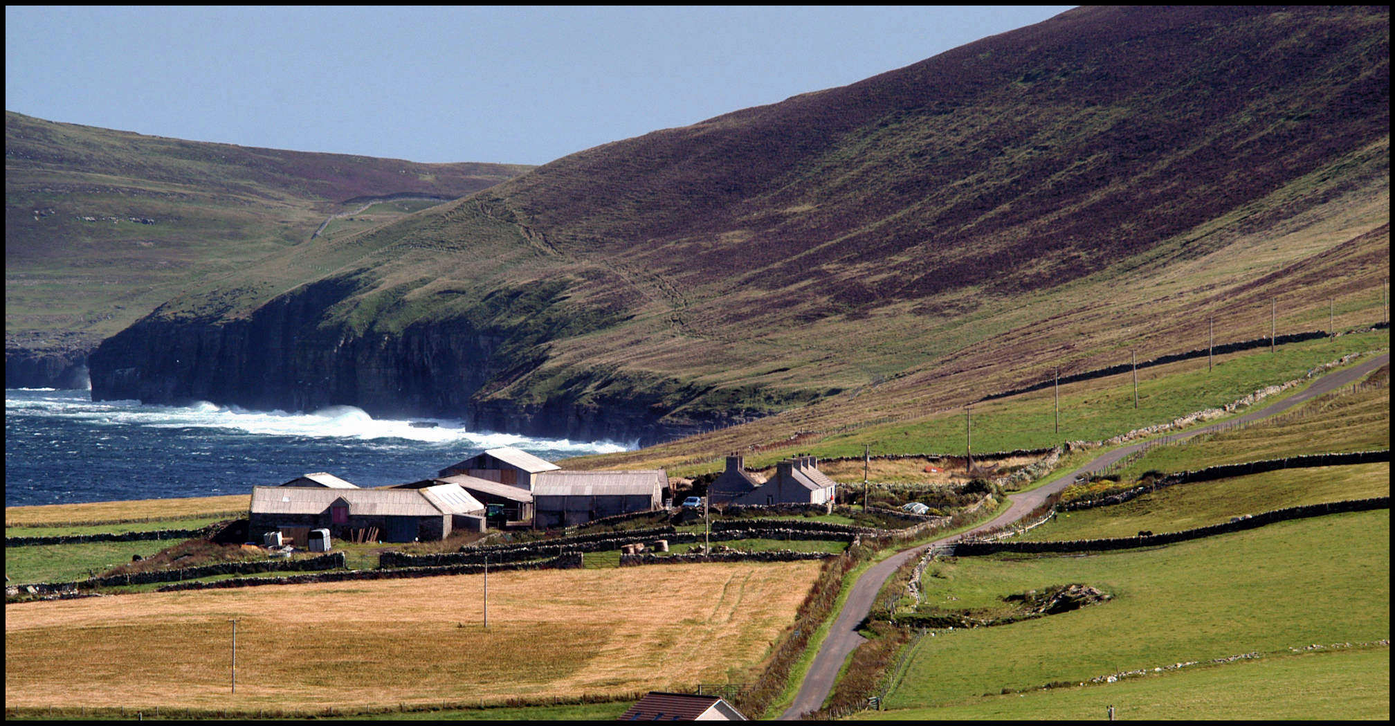
Kirk Brae, mentioned in the text below, was sited at the sea-end of the green field middle right in the above photo. Yorville is in the centre, with Breek, Burrian, Brough, Cott and Langstane stretching away. Cotafea is at the top, and Tratland just appears below it and to the right.
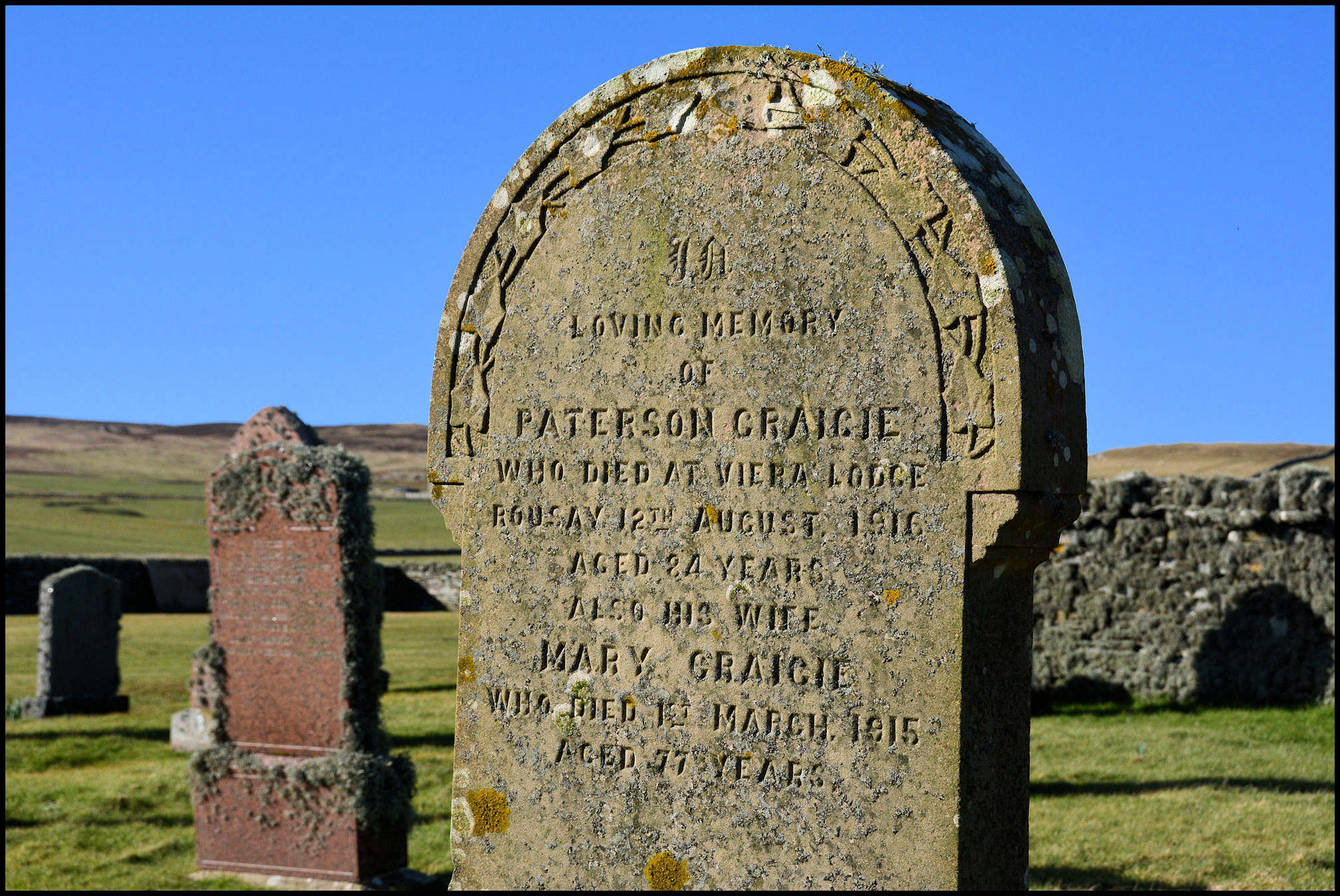
In about 1890 the Roll of the three Churches in Rousay was 454. The Established Church 59. Free Church 195 and the U.P. 200. The population of the parish in 1891 was 988. The Established minister always received the highest stipend. As in any old kirkyard wherever, all graves and all Churches face the East, and in some cases the ends of the building was a landmark or a bearing, for sailing ships and boats. The oldest graveyard found was in a field in Frotoft at the Hullion Pier. This was known as Kirk Brae, and was excavated in the mid 1970’s. Seven shallow graves were found, slightly scattered. Over the years the plough had done damage to the area. The date is unknown, but very old. There is no record of any burial place before the existing Kirkyards. In Quandale there are a few burnt mounds, possibly this was for cremation, maybe not. Long ago when dead sailors were found they were always buried on the shore above high water mark where they were found. There are a lot of graves around the coastline. Some of the places are The North Sand, Scockness. Hunber, Faraclett. Gruthin, Wasbister. Below Banks, Sourin. The shore around Quandale, the North shore on the Holm of Scockness and Eynhallow. Most of the sites of these graves have long disappeared.
When the end came to someone in the parish there was usually a neighbour woman in attendance. This woman usually went around the district when help was needed. The undertakers were always local, usually each district had their own. The minister played a large part in the funeral. Visiting the bereaved, arranging the funeral service and the committal. The family usually mourned for long periods, always wore black clothing, they would not visit, or receive visitors, go anywhere except to the Kirk.
Also a certain woman would be in attendance at a birth. If a birth was in Wasbister, a neighbour would say to his wife, “there’s a ship ashore at Shalter the day”. They would never say “a bairn is being born at Shalter the day”. It was supposed to be bad luck to mention a birth taking place and its location in the same sentence.

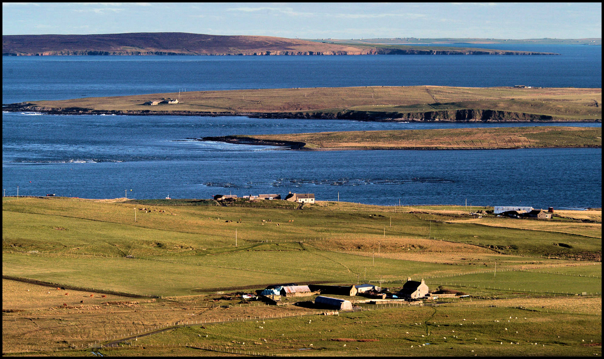
and Burrian and Bretta Ness in the Wester Loch
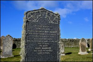
The old kirkyards in Rousay were filling up or full. In Wasbister the kirkyard known as the Corse Kirk, was full a lot of times over. The size is only 31 yards by 27. There are 42 headstones in the old section; this was for a very small percentage of the population interred here. This included three flat vaults built up to a height of about six inches. I have heard that it was for people who died of a particularly nasty disease and the stones were built on the grave so it would never be disturbed again. I know that one or two stones fell and are hidden by the rabbit warrens in the north end of the yard. The oldest date on a headstone is 1831, but the Kirkyard is a lot older. The stone dykes are of an older construction. In the southwest part of the old kirkyard is a raised area, what maybe a foundation of part of an old Kirk. An old map dated 1881 referred to an old Kirk being in the east end of the yard. There is no evidence of any foundations there. We will probably never know the details. A new section was needed for the graveyard. The middle section of the Wasbister kirkyard was opened about the turn of the 20th century. This was slightly smaller than the old section at 20yds. by 25. The earliest inscription on a headstone in this section is 1904. This again soon filled up. 44 headstones adorned the site but they did not face the east. This broke tradition, and was the first time in Rousay that the graves were laid to the square.

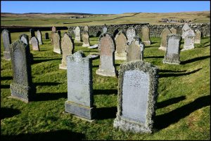

Soon another section was needed. James Munro, mason, Breval, and his son Byng, built a high wall around the newest section. This was just before the Second World War. This was quite a large area with over 700 layers. When the wall was built, steps were built in the gate between the pillars. This was a peculiar tradition in the parish. The Kirkyards at Scockness, Glebe, the Westside, and Wyre have steps built across the gate, which had to be climbed over to get into the cemetery. Whether this was built when the kirkyard was closed or earlier I do not know. The steps into the Wasbister kirkyard were removed soon after it was built. The first interment was in 1942. This was in the northwest corner. It will take several hundred years to fill up. The population in the district now is only about 26. According to the census of 1841 two hundred and ninety persons lived in Wasbister. To date there are 21 headstones in the newest section.
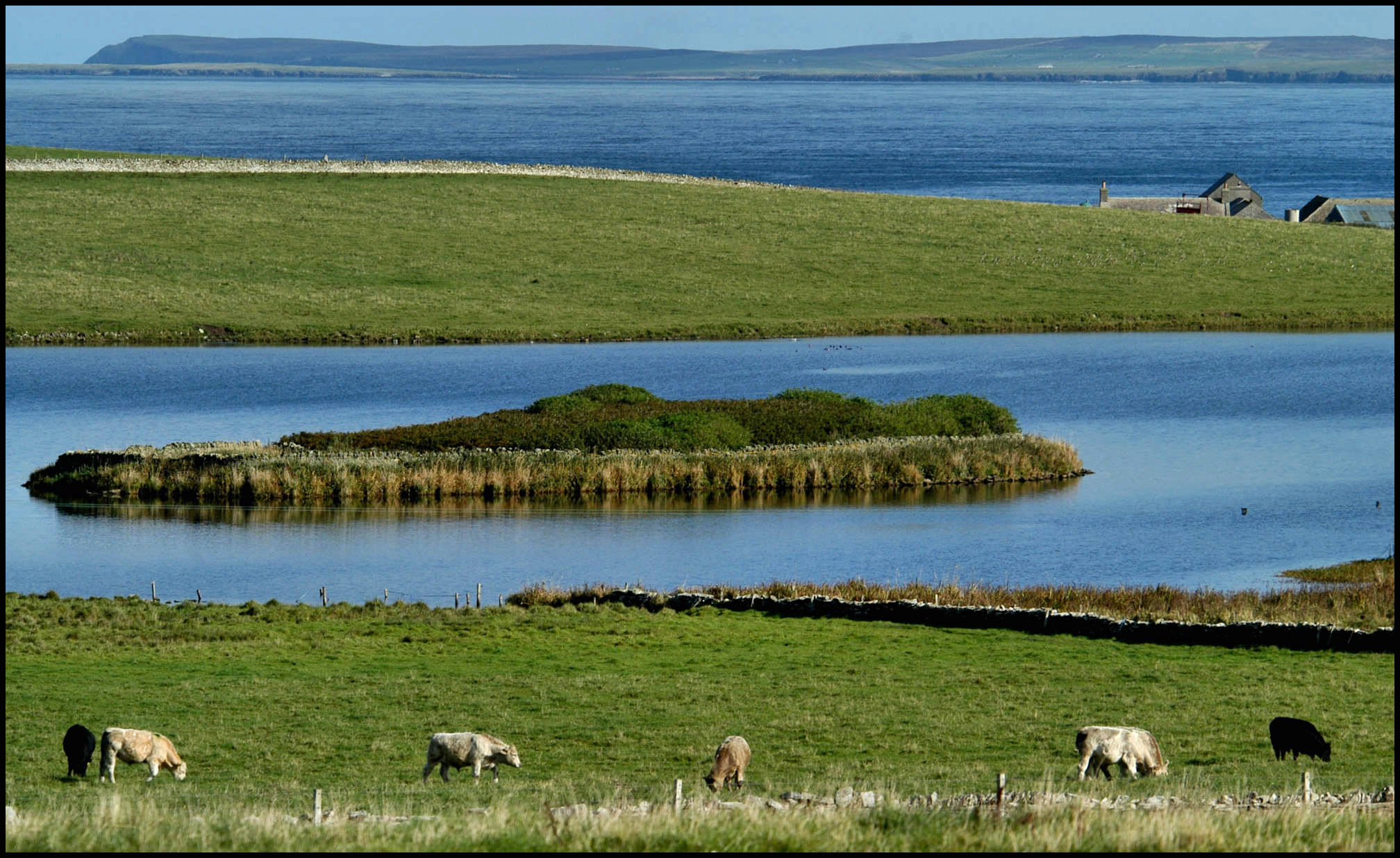
Across from the kirkyard in the loch is a small island called Burrian. Tradition has it that this was man-made. A causeway connecting the island was built across on the westerly side. This is now sunk well below the waterline. The Wasbister loch, as we know it now, was at one time, supposed to be three small lochs, but this was made into one when a dam was built for the grinding mill at Saviskaill. Burrian is now overgrown with bushes and it is very difficult exploring, but there is no evidence of a Kirk or Chapel or any building. The only building is a dyke built around the small island. A word of warning, do not try to wade or find the causeway across, as this is very dangerous. The loch is very muddy in this area.
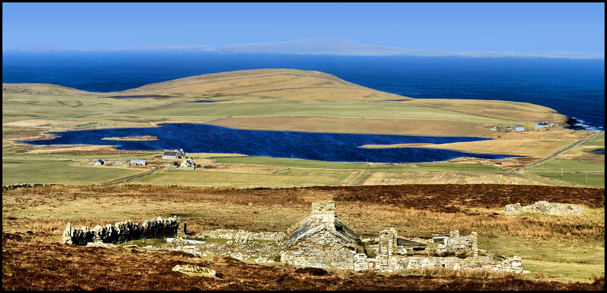
[Photo courtesy of the author]
Below Langskaill, on the shore was the site of St Colm’s Kirk, now completely eroded away by the sea. All I know about this place was that fishermen used to go inside and leave a token, this may have been money, or a trinket for good luck and hopefully for a safe return from the fishing grounds. I have heard that even after the Kirk had gone, small amounts of money were found in that area. This Kirk must have disappeared a few hundred years ago, for the only record I have seen is only on very old maps of Rousay.