A Wander Through Places and Items of Interest
Extracted from Hugh Marwick’s The Place-Names of Rousay

AXNI-GEO is a narrow geo on the coast at Scockness, the rocks on the north side of which form a natural ‘lade-berry’ or jetty.
BAILLIE COURTS. After Orkney came under Scottish rule, baillies and lawrightmen looked after local affairs. From old Baillie Records in the Sheriff Court Record Room we learn that about 1690 the Sourin district of Rousay, together with Egilsay, and Work and Carness in St Ola, formed one bailliewick with Douglas of Egilsay (the owner of these lands) as baillie-principal. From one record we get an insight into local matters that year.
“At St Magnus Kirk in Egilsay…The Balzie (name not stated) continues James Craigie in Avilshay, Patrick Yorstone in Banks, and John Allan in Faraclet as former Lawrightmen of Sowrick, and adds to them Magnus Banks in Cudraw.” There follow edicts requiring everyone to “keep their own cornland”; no one in Egilsay or Sowrick to take sheep “without the sheepman”; the people of both districts to pay a herd; the officer of Rousay has to keep an account of all beasts in Sowrick, and all dogs above a hundred are to be killed, except with special permission.
BENYIECOT: The lower part of Bregaday, a field on the north side of the Loch of Wasbister, is known as the Skuttos o’ Benyiecot. Skutto is an obsolete Orkney term for some small kind or portion of field, and the latter word might seem to indicate an Old Norse *boena-kot, ‘prayer-cot’ (= boena-hus, chapel), the more so as there happens to be a tradition of an old chapel at this site.
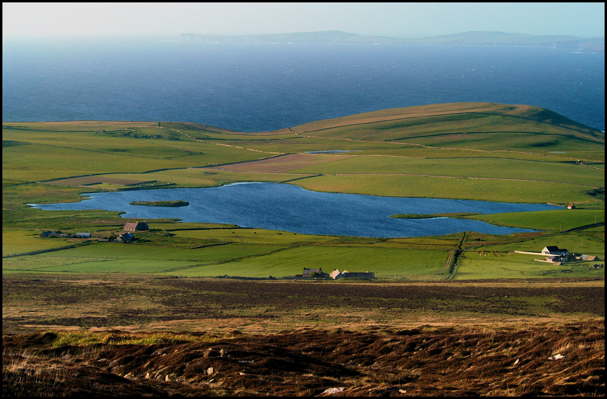
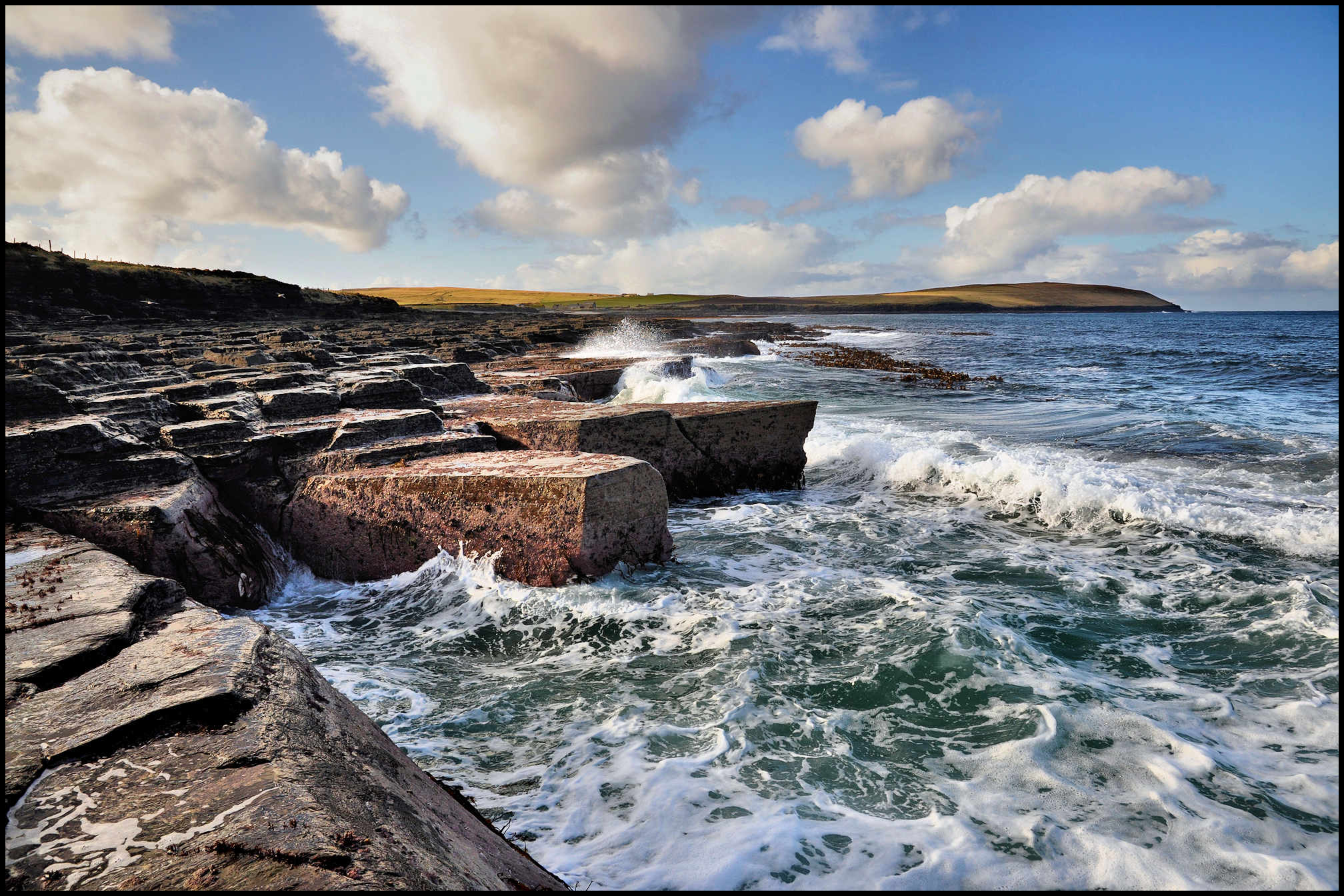
BLEACHING KNOWE. Surveyed in 1935 a much-destroyed burnt mound, known locally as ‘The Bleaching Knowe’, was discovered on the southern shore of the Loch of Wasbister [pictured below], immediately north of the school. There were also traces of cist-like boxes formed of slabs set on edge in and close to the water. Little or nothing survives today though.
BROKISLAND, also called Rigers-land, is on record in 1634 as a halfpenny-land situated somewhere in Wasbister, evidently so named after the owner named James Brok. In 1624 a daughter of umquhile [the late deceased] James Brok in Howatow, Wasbister, sold one third of the half-penny udal land under the house of Howatow to Thomas Alexander of Saviskaill.
CANNAMISURDY, the name of a well on the beach in Frotoft, below the house known as Cott, occupied in 1861 by Peter Louttit, an 89-year-old farmer of 5 acres. There is a local tradition that the body of a woman was washed ashore here. She was from Canisbay in Caithness and her name was McUrdy – or something similar.
CASTAL. In a field immediately to the north of the old house of Stennisgorn in Wasbister is a site known as the Castal. Here an old building once stood, and the late proprietor told Hugh Marwick that when his father was removing stones from the site he came across a metal basin-shaped object. It was broken, but standing out in relief on its outside were figures of what he termed ‘an angel and a dragon’. The dragon ‘had scales marked on it.’ Some who saw it thought it might have been a bell, but from his description it must have been too shallow for such a purpose. It ‘lay about the house’ for some time, but he had lost sight of it for many years.
CHRISTMAS. Alexander Marwick, who farmed Corse for many years, left a description of how Christmas was celebrated in his younger days in Rousay, early in the 19th century:- ‘In the first of my minding, the Christmas was kept as follows; every house that grew crop brewed some ale for Christmas. On Christmas Eve every house killed a sheep but they neither had white bread or tea; their bread was oatcakes and sowan scones. When they got cod in the Christmas week they baked a cake of bere meal and cod livers which was as good and as well liked as any shortbread of the present day.
The young men then played football till dark, then went to a fiddler’s house and danced until 12 o’clock at night. The Christmas Day well spent, on New Year’s Eve a number of young men went from house to house singing the New Year songs where the door was quickly opened and the singers sat down to the best that was in the house. It was looked upon as a token of respect to those they visited but ill-loved neighbours were generally passed over.’
CREYA. Two small crofts, East and West Creya, were sited in the face of the hill north of Curquoy in Sourin. In a legal process of 1823, John Gibson of Broland was prosecuted for slander by Janet McKinlay, wife of John Pearson of Cruannie. He was alleged to have called her ‘a thievish limmer,’ and this he did on ‘the day of the last sheep-shearing at Creya.’ This happened in the days when the hill was public common, and when the sheep of the whole district grazed upon it. Mrs Pearson must thus have been so insulted on the public sheep-shearing day when all the sheep were rounded up and confined in enclosures at Creya for shearing or ‘roo-ing.’

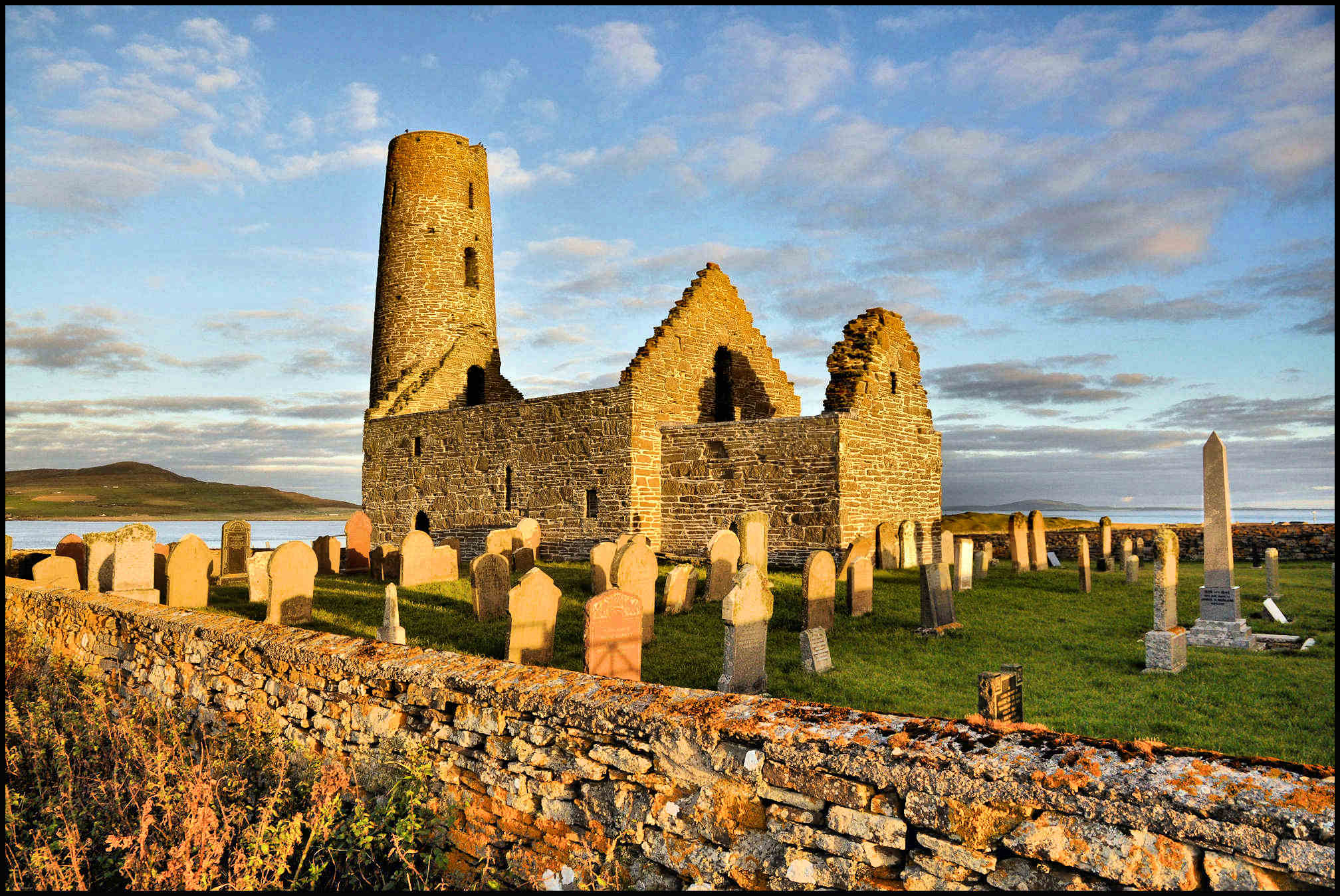
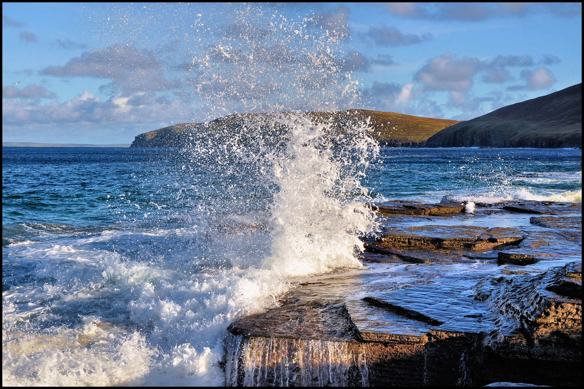
CUBBIE ROO. A cottage at the roadside in the Brinian, so named from a nearby mound known traditionally as ‘Cubbie Roo’s Burden’. Cubbie Roo is the modern form of the name of a famous Saga chieftain, Kolbein Hruga, who had his seat in Wyre [pictured above]. Somehow or other his name is commemorated all over Orkney as that of a giant who used to hurl boulders from one island to another. Rousay tradition has it that he once proposed to build a bridge between Rousay and Wyre, and for that purpose was carrying a kubby-load of stones when the fettle or shoulder-strap broke at this spot, and the mound of stones represents his fallen burden. It is in fact a pre-historic chambered burial cairn – now in a ruinous condition.
DIPHTHERIA. Early in 1879 there was an outbreak of diphtheria in Rousay which was to last for most of the year. Eight or nine people died of the disease, most of them being children. Three of the children were from one family, the Leonards of Digro. The youngsters’ names were Arthur, William and George. Although the outbreak first appeared in Sourin, and most of the victims belonged to that district, the school there does not appear to have been closed till August, by which time there had been several deaths. The school then remained closed for the rest of the year. Most pupils were kept at home for much of that year as parents were convinced that children ran a greater risk of catching the dreaded disease if they attended school. There were deaths in Wasbister and Frotoft too, and although Wasbister school was closed for a time early in the year, the Frotoft one remained open. Scarlet fever was also present in the island that year. The Frotoft teacher recorded that he took precautions against its spread by placing disinfectants in the school.

EASTAFEA is an old farm, later incorporated into the farm of Faraclett [pictured above] and mentioned in a rental dated 1595. Between this and the houses of Faraclett lay another old farm – Midfea, now also vanished.
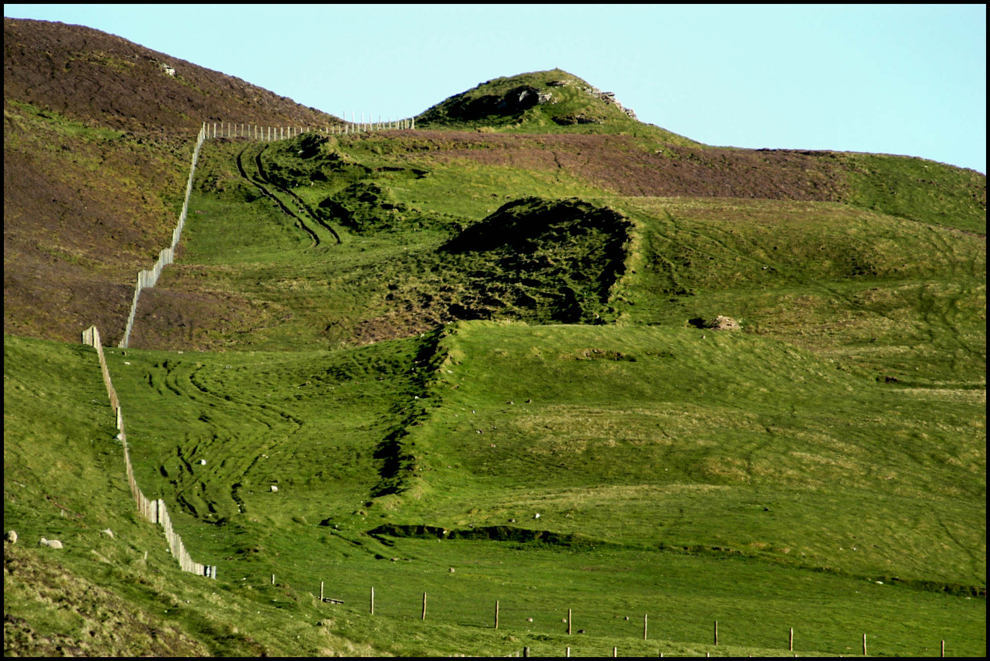
FEELIE DYKES. At many points close to the Westside road remnants of the old hill dykes can still be seen. These dykes separated the common land on the higher ground from the arable land lower down. Most of them follow the contours of the land at a height of 200-250 feet above sea-level. In the old days, those who farmed the arable land had grazing rights on the common. These dykes, which are much older than most of the stone dykes now seen on the island, were built of turf and were commonly referred to as feelie dykes. They were built from material dug from the land near where they stood. To have been effective they must have stood at least four of five feet high and would have required frequent repairs. Stone, although plentiful enough, provided a dyke that needed little in the way of maintenance but in some instances the stones had to be transported quite a distance to where they were required. This would have been a difficult task until carts appeared on the island in about 1839, so most of the stone dykes in Rousay are little more than 150 years old. Long stretches of the feelie dykes, now reduced to grassy ridges a foot or two in height, can still be seen snaking across the rough pasture land in many parts of Rousay. The one pictured below is just to the west of Cat Hill, Westness.
FESBER is the name of a cliff to the east of Grithin on the north-west coast of Saviskaill Head. There used to be a large quoy or fold for sheep here known as The Queer o’ Fesber. The Old Norse word kvíar, pronounced ‘Queer,’ means fold or enclosure for animals.
FISHING ROCKS. Bya-steen was reputed to have been one of the best fishing rocks in the Leean. Nearby is the Finger Steen, a roughly cubical rock measuring about a fathom [six feet] each way, attached to which is a very old traditional story, as well as a little superstitious dread. It is told that once upon a time a giant on Fitty Hill across the firth in Westray (sometimes identified with Cubbie Roo) hurled this block at an enemy on Kierfea in Rousay, but falling short, it came to rest here. And in proof of that, tradition points to certain indentations on the stone which indicate the giant’s fingerprints – hence the present-day name. Before the public road was created between Sourin and Wasbister, the old track ran along the Leean shore and close past this Finger Stone. Hugh Marwick remembers how it was told that if on passing the stone a pebble or other trifle was not placed upon it, disaster would overtake the traveller on his return journey;…….
Garaber, below that curious ridge in the Leean known as The Green Gairsty; Hunber, one of the most renowned fishing rocks in Rousay, situated a little way east of the Knee of Faraclett; Klettber, between Lair Geo and Garaber in the Leean; Koldeross, a narrow shelf on the face of the crag immediately west of Hunber; Kribbany, another fishing rock in the Leean, the origin of which is doubtful, but a similar site in Faroe is so called as being a place on the crags which can only be reached by creeping; Kuthiny-klett, a rock on the Quandale shore south of Skarataing, noted for being a good spot to catch cuithes; Longapol, a long narrow spit of rock somewhat resembling a pier, running out obliquely from the line of cliffs in the Leean – another notable fishing site;……..

Luizber, part of the crags west of the Knee of Faraclett. Probably Old Norse ljos(a)-berg, ‘light-coloured rock(s)’, perhaps named by fishermen on account of guano on the cliff face; Lyber, a noted fishing rock east of Garsniegeo. In Orkney the usual name for the pollack is lythe – though it is puzzling why such a name should be applied to a rock where tens or hundreds of cuithes were caught for every one lythe or pollack!; The Queer o’ Myres is a name applied to some low crags at the beach below Myres in Sourin – a notable fishing site for ‘pocking’ sillocks in the old days; Salt Hellyie, Sandber, Sandber’s Tongle, Steenathy, and Verpino – more fishing rocks in the Leean.
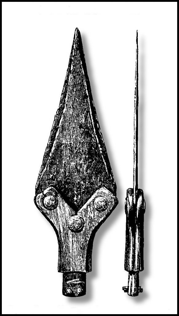
FLANDERS MOSS. In the spring of 1905, Fred Inkster, tenant of the farm of Innister, found a bronze dagger or spear-head while cutting peats at Flanders Moss, an area to the right of the peat track up from Westness, just to the south of Peerie Water. It was handed to James W. Cursiter, a Fellow of the Society of Antiquaries (Scot) in Kirkwall. It was found to consist of a thin flat blade of bronze, about six inches in length, inserted into a horn shaft. In early days light spears or javelins were frequently used for throwing, both in hunting and in fighting, a use to which, it was thought, this particular weapon might well have been applied.
FLOTTAHALL. Flotty was the name of a field on the south side of the road at Langskaill. An entry made in 1821 in the Rousay Birth Register records a house called Flottahall in Wasbister, and in the census of 1841 its entry was located somewhere on the hill between Whitemeadows and Langskaill. At that time it was occupied by 40-year-old fisherman James Flaws and his 30-year-old wife Betty Barnetson. They had four children; James was born on July 22nd 1829 when they lived at Vacquoy, and the other three were born at Flottahall; William, on May 27th 1831, Betsy Sutherland, on August 3rd 1834, and Margaret, who was born on August 25th 1836.
GALLOWS. The methods of administering law and order in the old Norse days are very obscure, but, arguing from what is known of other Norse lands, there were local assemblies or ‘things,’ as well as a central ‘thing’ for the whole group. In Rousay this would appear to have been held at a place half-way up the Sourin burn, where a rocky knoll deflects the course of the burn and is half-encircled by it. This place is called the Gallows. It is practically in the centre of Rousay and its name testifies to the summary methods of punishment in those downright times.
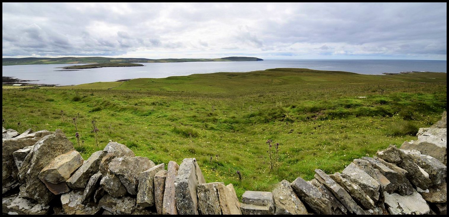
GOLF COURSE CORNER. In the l920’s a golf club was formed in Rousay and a nine hole course was created in Inner Quandale, the site of which is pictured above. This was a very popular pastime with a large membership of young and not so young men. Hugh Marwick of Moan in Wasbister was employed as the green keeper. A corrugated iron shed was bought and placed above Whome to keep the mowers and flags. Members of the Kirkwall and Stromness golf clubs were invited and came out to Rousay and played many tournaments. This club was finished by the end of the l930’s.
GREEN GAIRSTY is a prominent earth-dyke or ridge running down at right-angles to the beach in the Leean, half a mile or so east of the house of Langskaill. The adjective is applied by reason of the fact that this grass-grown ridge stands out prominently green against the adjacent pasture ground. At the shore end of the gairsty is a fishing-rock called Garaber, meaning ‘garth – or dyke-rock.’
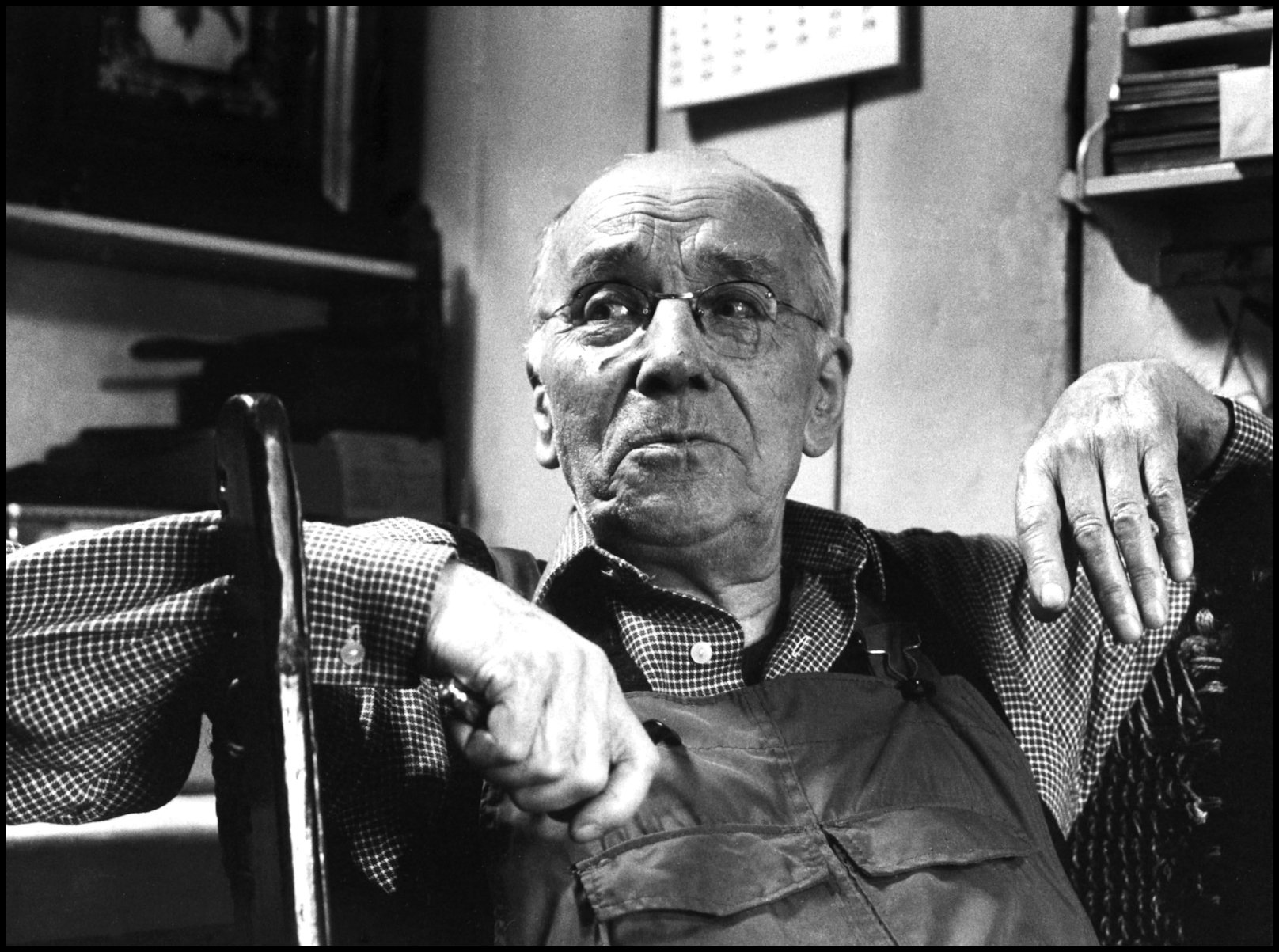
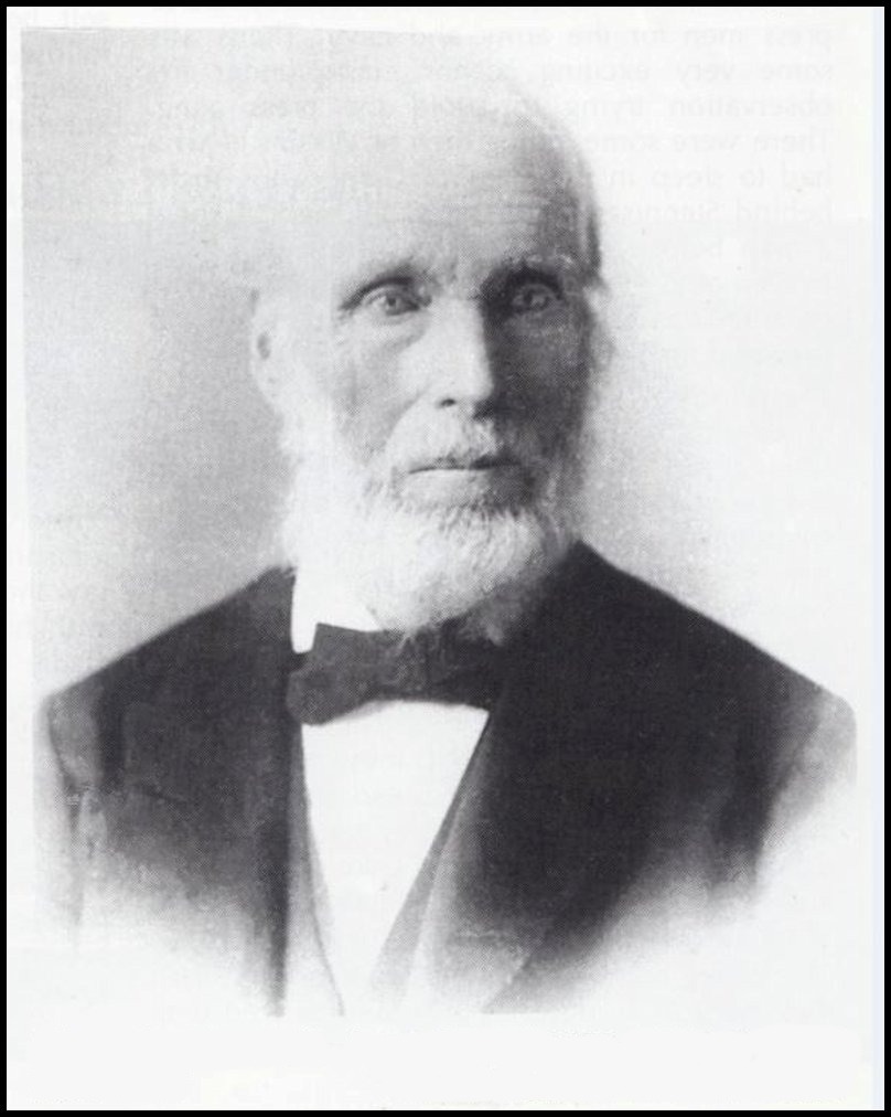
HAMMER-CHUNKY is a name applied to ‘hammers’ [rocks projecting from the face of a hill] on the hillside above Shalter in Wasbister. Netherbow is another feature in the landscape in this area. The name applies to a hollow striped with portions of rough pasture situate 19 chains N. from “Erne Tower” & 10 chains N.E. from “Brae of the Pits” & 18 chains N.W. from Tower of Loomashun. Years ago James Campbell Bruce Craigie, Jim o’ Deithe [pictured above in 1975], composed many a fine fiddle tune and ‘The Road to Hammer Junkie’ and ‘Netherbow’ were just two of them. Both of these have been recently recorded by Orkney bands The Chair and Saltfishforty. Other interestingly-named sites in this area include Betenlongie, Brae of the Pits, Cuppers of Vacquoy, Hogsets of Catagreen, Knowe of Whirliegar, and Withamo.
HAMMERS OF KNARSTON is the name given to a short stretch of coastline below Knarston consisting of rocks projecting into deepish water, and providing, in the old days, excellent opportunities for sillock fishing by the use of ‘pock-nets.’ Here vast quantities of these fish used to be caught in late autumn, and their livers, when ‘braithed’ or melted down, provided oil for use in old-time ‘cruisies’ or ‘koly-lamps’ before the introduction of paraffin.
HOUSTEITH. On 31 March 1614 Robert Craigie disponed to Robert Chalmer ‘his fourth part udal lands extending to a fourth part of the whole town and lands called Housteith lying in Trimland in the isle of Rousay.’ Sasine [a legal document that records the transfer of ownership (usually a sale or an inheritance) of a piece of land or of a building] was given on December 10th 1619 by William Trimland, indweller in Hunclet as bailie in that part. John and Henry Trimland in Trimland were among the witnesses.
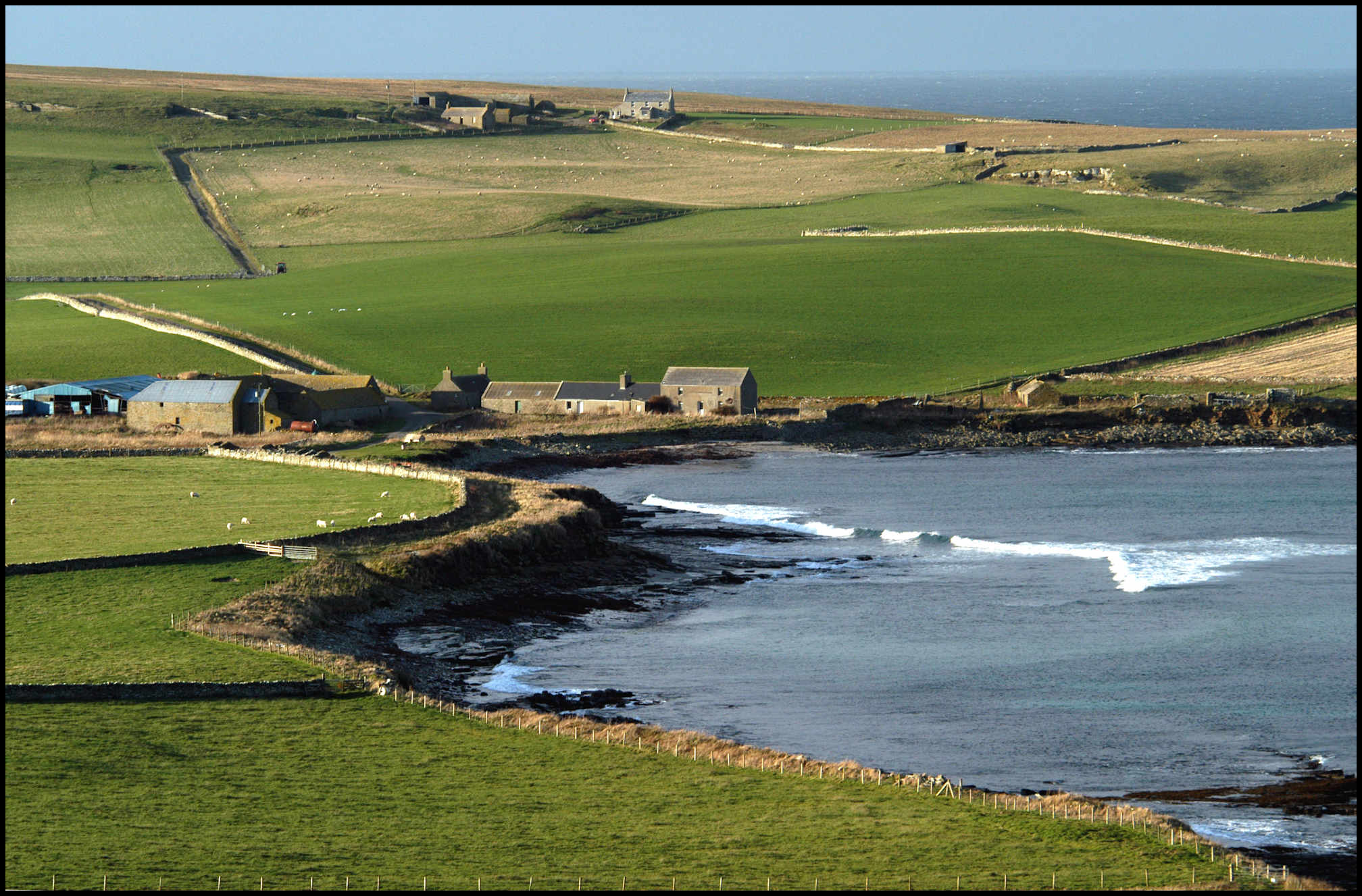
HOWATOFT was the name of an old Wasbister house, probably in the neighbourhood of Saviskaill, the farm buildings of which are closest to the shore in the picture above. In Heart’s Sasines is a record of a sale to Thomas Alexander, eldest lawful son of Henry Alexander in Saviskaill, by Katherin Brok, one of the lawful daughters and heirs portioners of James Brok in Howatow of her third of the halfpenny udal land under the house of Howatow in Wasbister. Sasine was given on March 5th 1624.
On April 26th 1625 Thomas Alexander obtained sasine on a charter to him from William Craigie of Papdale of 1 pennyland of udal land in Howatoft, of which half was called Brokeisland half Rigersland, which had been sold to him by James Craigie in Westray and Margaret Brok with consent of Magnus Hourston in Skabrae – heritors thereof.
In 1634 William Craigie got a decree against Thomas Alexander’s widow for unpaid dues in respect of Howatoft, and two centuries later, in 1828, John Inkster had the cot-house of Howatoft included in his sasine of Saviskaill lands. The Brok ownership of lands in Howatow and Howatoft seems to be sufficient proof that both names refer to the same property, and are only different forms of the same name.
To Hugh Marwick the name seemed to point to an Old Norse hauga-topt, ‘taft of mounds,’ the site of some structure at or near mounds. He could not say definitely though that Howatoft actually meant a site marked by natural hillocks, or whether the mounds marked the ruins of previous structures, or whether they were perhaps prehistoric burial cairns, so-called picts-houses.
INSKIFT was the name of a landing place and boat-noust below the old house of Hurtiso in Sourin, and of the field above it. Hugh Marwick thought this an interesting name, dating from a time when the run-rig system prevailed, and most probably before Orkney came under Scottish rule. The word represents the Old Norse eignarskipti, a division of land in such a manner that the portion divided became the sole property of one individual, and was not held in joint ownership with the other proprietors of the tunship or farm. In other words, the Inskift was a field that was owned by one, and not shared with the other proprietors of Hurtiso.
JUPITER FRING. On a line between the eastern end of Muckle Water and the top of Blotchniefield is a curious ridge called the Camp of Jupiter Fring, some 600 yards long by 40 or 50 broad, and having very steep scarped sides on its northern and southern sides. How it came by this name no one knows; Wallace referred to it in his ‘Description of Orkney’ of 1693, and seemed to think the name had been given by some ‘dominie from Jupiter Feriens’ [an expert on the Greek epic poem Homer’s Odyssey] on account of its being ‘frequented by Jove’s bird’ [an eagle]. Hugh Marwick, on the other hand, suggests an alternative, more plausible suggestion which stems from the Old Norse ‘djupi torf hringr’, which translates to ‘deep turf ring’, and refers more to the surrounding hollow than the ridge itself.