The second of a four-part article,
written by Tommy Gibson, Brinola, Rousay
Squaring of the land
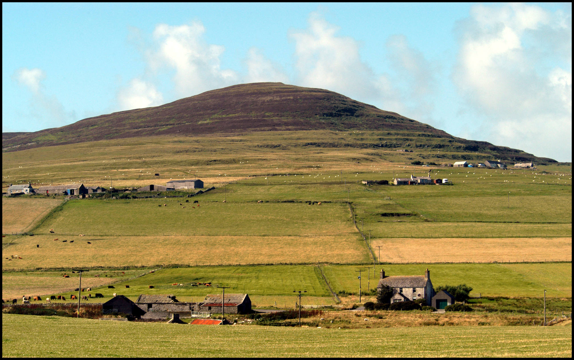
In about the 1850’s the land in Rousay was squared. Before this the ownership of the land was scattered about. For example, Scockness used to own small pockets of land in the meadow of Bigland, which was about a mile away, Woo had land across the boundary of the Sourin burn. This meant that the farmer owned or rented all the land within the boundaries of his farm or croft. Some of the houses came out better than others. For example Essaquoy originally was 300 hundred yards to the north, and was moved to its present site. The land was squared and this took some of the good land of Hurtiso and Broland and this was given to Essaquoy. Hurtiso and Broland had to take some poorer land. New fields were marked out and dykes and ditches were built and dug to mark the boundaries. Most of them are still there. Few houses were moved in Sourin. Breck was moved to the north about 150 yards; Hurtiso was moved to the west about 100 yards. Classiquoy on the land of Avilshay was moved 200 yards to the west. The Manse at the Glebe was moved 30 yards to the South of its original site.
Rights of way
Sourin like any other place has its own rights of way; this gave access to an individual across someone’s property for a particular purpose. One thing sticks to mind was the sand links at Scockness in the mid fifties and very early 1960’s. When someone wanted sand for the land this was taken from the links, and if it was for cement this was taken from the shore. The road went past the steading of Scockness down the valley, over the brae, then to the shore. I can remember 10 to 15 tractors carting sand off a day. The rule of the road for sand was the same as the peat road. The travelling people going around the houses had a hawkers licence to sell. They also had right of way over any field. They would never cross a field of grain or hay turnips, they always went along the side. If they took a turnip from a drill, they always ate it. Taking away a neep was theft, eating was not. The worst episode of trespass I ever saw was about 1953-4. This was some terribly posh upper class twits out on a shooting spree. They came out of a car near to Hurtiso, armed themselves with shotguns, their dogs were chasing the cattle at Hurtiso. Next minute, the five of them was walking across a field IN the crop. In that days NO one ever walked in crops. They walked on; shooting and killing or wounding anything that flew. It mattered not to them. They continued crossing fields of Essaquoy, Bigland, Broland, Swandale, Breck and Myres. Funny thing in that days no one did anything to stop them. Was this a hint of the gentry returning? Even at that time, these gentlemen (I use the term loosely) they did not have any right to walk across any field or less to shoot. They did not even have the manners to ask the landowners to shoot on the land. May the Lord help them if they were caught doing that now.
A lot of those rights have been lost through time. At one time all the openings to the shore was a right of way. The shore being the source of ware, sand, gravel and stone. Most of them are gone, but I can remember some of the Sourin ones. The peat roads, this was for carting peats only. There was a path, a public right of way from the corner at the shop down past Hanover, across the burn past a long gone house called Quaddraa, (near to Faroe) then to the Kirk. I can mind Dorothy Munro leaving Breval at 8.45 every morning and walking to the shop where she worked, we were walking down the Sourin Brae to the school at the same time. There were ways past Nethermill at the west side, past Lopness, down the Leean Burn to the old fish house, in front of Breck, back of Breck, down past Myres, across the South Meadows and to Ham and up to the Kirkyard at Scockness. The last one can never close. There were also lots of ways to wells and springs. I suppose, due to its locality the Meean well had the most use by its various neighbours for use of its water. I also can suppose that this right may never be used again due the use of boreholes. I can also say that rights of way caused more arguing than any other subject.
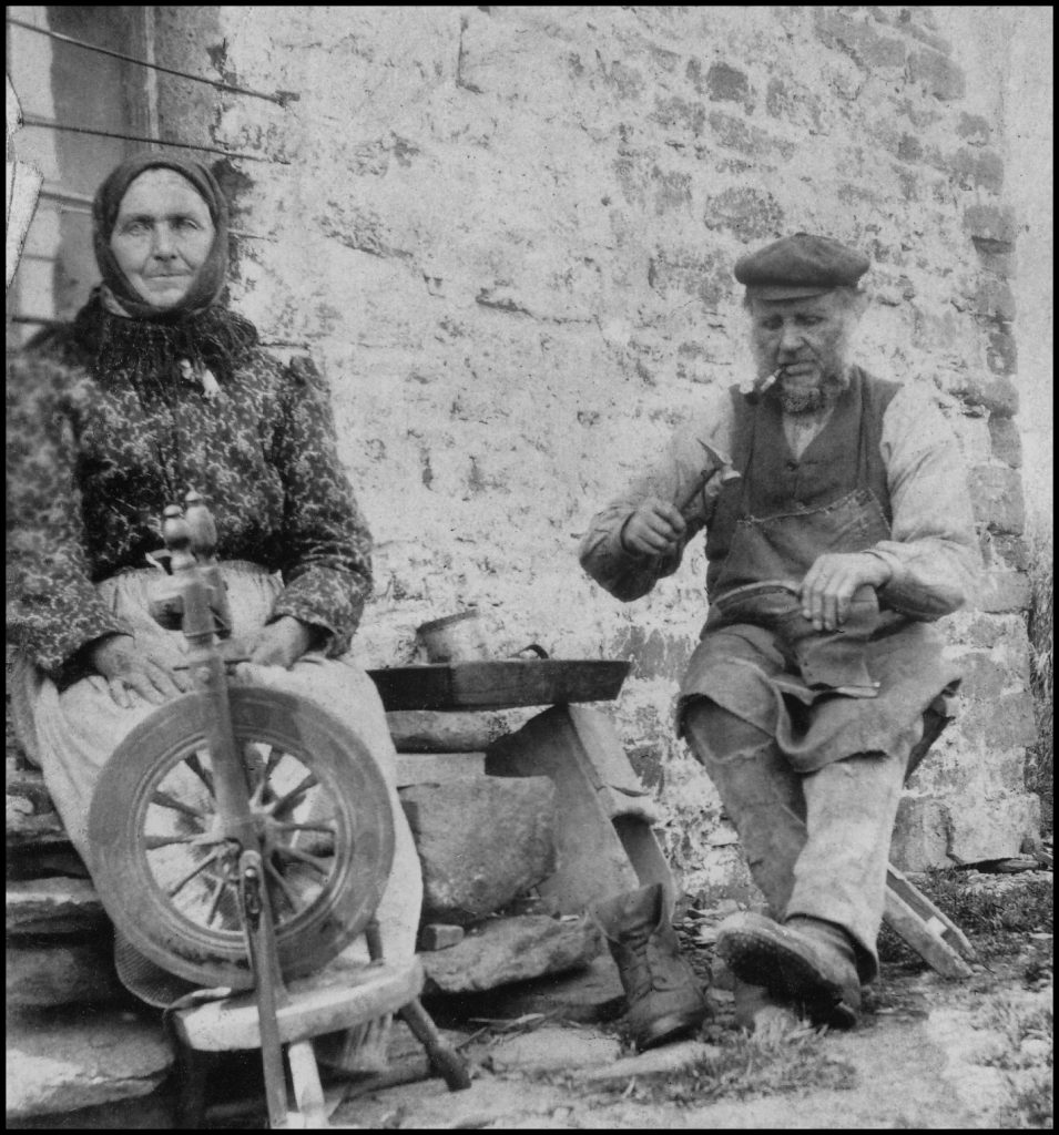
Shops
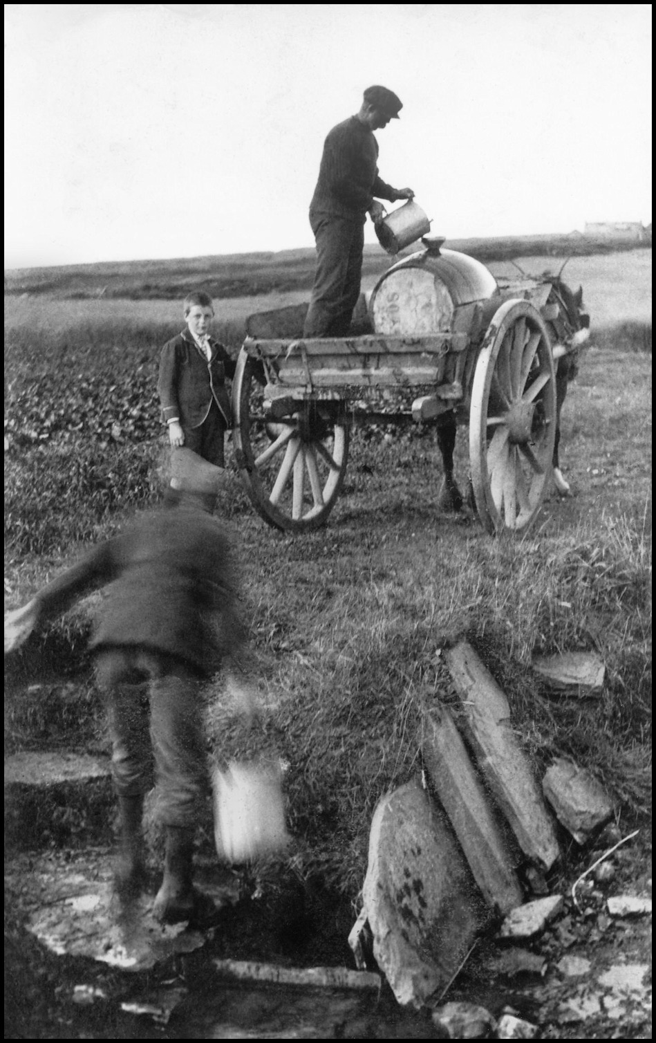
The shops in the district were at Guidal, Isaac Marwick, pictured here with his wife Betsy Yorston, was a general merchant also a joiner shop and cobbler. Many other things took part as well. The registrar was at Guidal for many years. The odd tooth was extracted, hair was sometimes cut. Another shop was at Banks; this was situated in the east end of the dwelling house. This shop closed in 1896 when the Mainland family left Banks and the Seatter family came from Ness in Westray. The Seatters lived and farmed in Banks till the mid 1960’s. In 1870, James Yorston started up a small grocery store at the Old Man. I would have thought that this was not a very good site, but he carried on and was taken over by a Co-op about 1890. A new building to house the Co-op was built near the school. The Co-op was moved to its new premises about 1906. A house was then built for the manager. The Co-op used to employ 3 to 5 workers. They were managers, van men and assistants. The van went out most days with deliveries and for collections. A horse van was used for delivery and collections. The Co-op kept a horse for the van, but when the van was due for Wasbister, the horse of Woo was traced into the van. This horse helped pull the van to the top of the Sourin Brae. A two-ton Commer lorry was then purchased in the mid 1930’s. The Co-op stable was converted as a garage to house the lorry. For deliveries and collections the platform was used; old lorries were high and the platform was about 5ft. 6ins above the ground. Top speed was about 30 mph. For selling groceries, the old horse van was converted to fit the lorry, with an arrangement at the rear for the elderly and infirm to get into the van. There was a remarkable amount of groceries in the shelves for sale. The van usually stayed on the public road, but if a farm road was good the van went to the house. When the van was not used, an endless chain fixed to the garage roof lifted the van off the platform.
Some van men I remember were John Seatter of Banks, then John Grieve, Digro, Fred Craigie of the Bu in Wyre. This shop, like the Hullion one, was remarkable. The shops carried all the groceries and animal and poultry feeds, oils, tools, and hardware needed by all the families in their respective districts.

The first manager was a Mr. Work from the Mainland; next was Sandy Grieve of Nethermill, then Harry Gibson, whose parentage came from Upper Knarston, married Hannah Grieve, Fadoon. By the 2nd World War a Mr. Walls from Rendall took over as manager. Mr. Wall’s son Thomas lost his life in the war in Burma building an infamous railway. The next manager was Magnus Flaws from Wyre, then two brothers from Kirkwall John and Gib Taylor was manager and store man respectively. Two ladies were next, Annie and Bella Craigie, they were born at Treblo. Their father, John Craigie, owned the Queens Hotel in Kirkwall. He had been a miller in Sourin for many years. John and Dorothy Inkster, from Hurtiso were next. They had the post office and telephone exchange. This was transferred with them. The Sourin Shop as it was then, closed in 1973-4. It was sad day for Sourin. At one time the shop did deliveries of animal and poultry feed and collected 1000’s of eggs. Hullion’s shop closed in 1989. This was transferred to Marion Clark who opened a shop at Essaquoy in November. Shelves were erected, groceries were bought, and a large van was acquired. A remarkable amount of groceries adorned the shelves. Petrol pumps, and a tarmac road for easy access were put in in 2000. The first recorded shop was at the Oldman in the 1871 census, with Robert Yorston. This would have been, to say the least, modest. With merchants at Banks, Guidal and the Co-op, and a period of about 15 years without a shop, Sourin folk have been shopping for 115 years.
Post Office
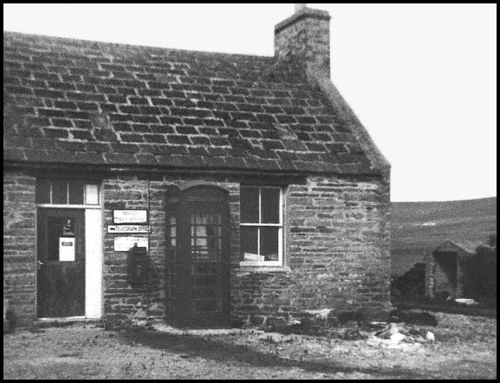
There is no record of any early post offices in Sourin. The first record I can find is one Barbara Craigie of Pharo (Faroe) who was a letter carrier. The first post office in Sourin was at the Old School. Mary Ann Munro was the first Postmistress. The first postman in Sourin I think was John Inkster of Swartifield. Born on August 3rd 1864 and as a young man went fishing and later took the tenancy of Essaquoy, He was appointed to the postal service in 1898. His round was a daily one. During the First War this was reduced to three times a week till 1931 when it went to a daily service again. John retired after 35 years service and he said that on his rounds he walked 65,000 miles. The next place for the post office was a new house called Millburn near the Mill, when Rene and Robert Lyon took over. This was in the early 1950’s. They left and went to farm Curquoy. The next house was Hurtiso where John and Dorothy Inkster took over. Annie and Bella Craigie from the shop were due to retire and wanted to go to Kirkwall. John and Dorothy took over the shop and the post office, pictured to the right, was moved back up to the shop. This remained in Sourin till the early seventies, when the office moved back to Frotoft, to Broch.
Postmen I remember in the Island were Albert Munro, who lived for a time in Eastaquoy, his niece Dorothy Munro, Breval, who delivered the Sourin mail. This postal round was walked. This round started at the School. They delivered up to Curquoy, then the hill houses, up to Cruannie, down to Swandale, across to Scockness, back by Myres and Lopness to the School. This was a long walk every day. John Marwick, Breek, William Gibson, Hullion, Roy Russell, Myres, John Inkster, Co-op House, were Rousay postmen, each one of them looked the part and were excellent. Mailboxes were situated at the road of Avelshay as it is today. The Old School was the position of the next one. The road end at Faraclett, this was called the South-Meadow box and again below Cruannie on the Sourin Brae.


The Smithy
Smithy’s and blacksmiths played an important role in any community. In Sourin there used to be smithies at Hanover, Woo, Banks, Cruannie, and Faraclett. On the northeast land of Hurtiso near the old fish house, was said to be an old smithy in that vicinity, but there is no evidence now. The spring was a busy time for the smith with the shoeing of horses and repairing implements.
Fa’doon above it, Digro top left, and Blossom at the top.
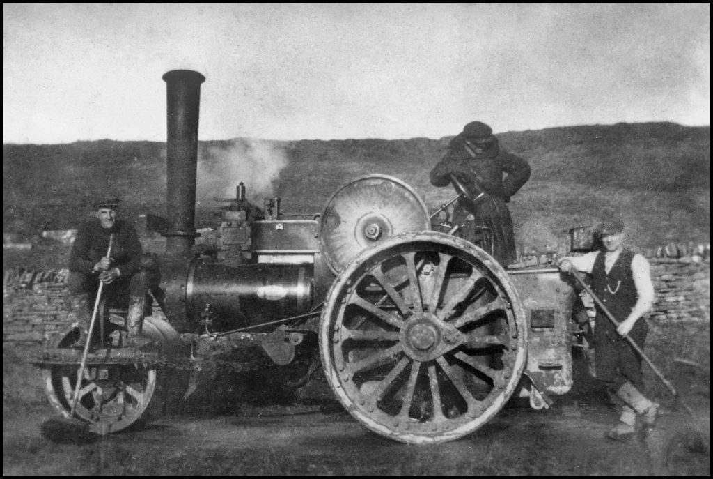
Roads
The Sourin Brae, a long steep road, goes from 44 feet above sea level at the cross roads straight up past the road of Digro to a height of 364 feet. That makes this road the highest, longest and straightest road in Orkney. I can remember in the late fifties or early sixties the public road at the Blossan was in a bad state of repair. I think it was after frost and the surface softened. Tractors and trailers made severe ruts in the road. The council, at the time had no money to effect repairs. This state of affairs went on for some time; the road got worse, a letter sent to The Orcadian from an irate Wasbister farmer, said, “when travelling along this bumpy road at 30 mph, false teeth were ejected from the mouth.” The road was eventually repaired.
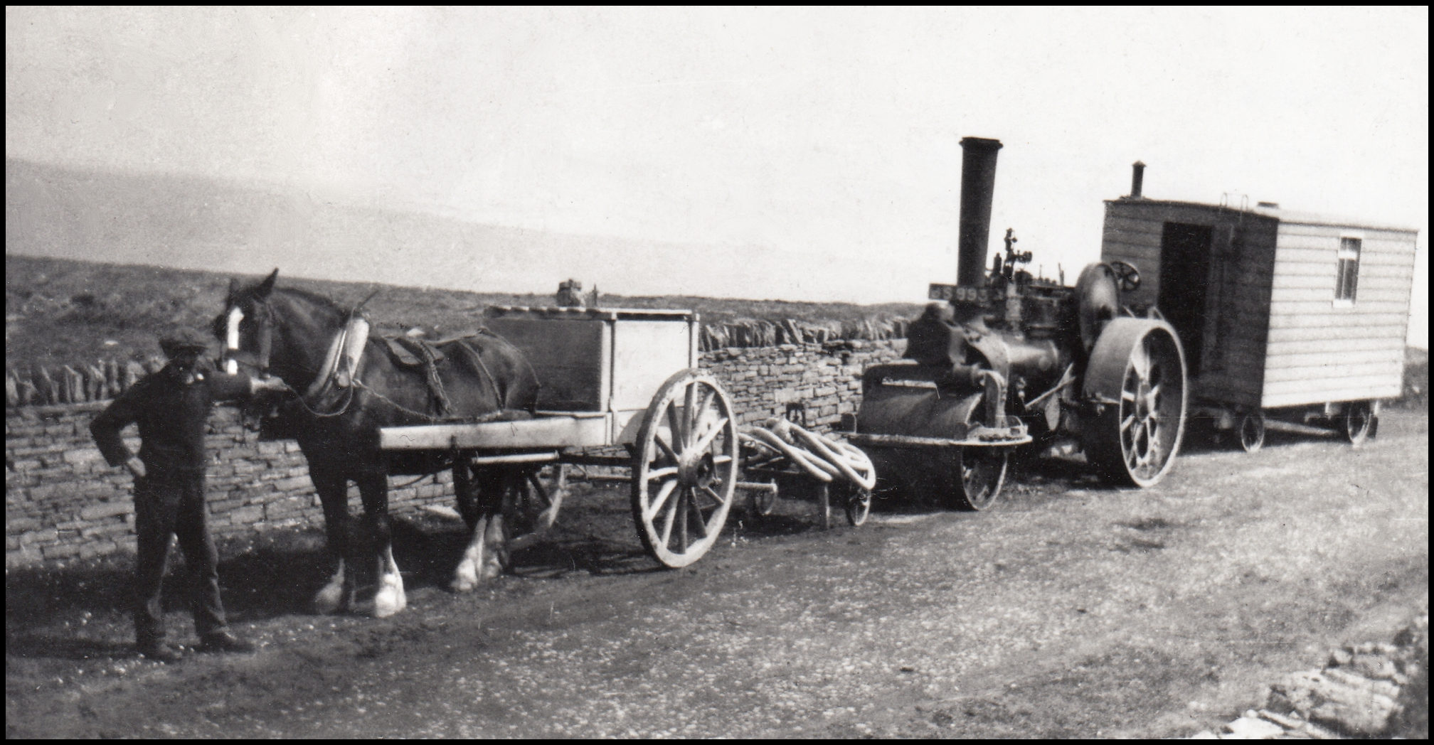
of the road maintenance crew at the top of the Sourin Brae, c1920.
The late 1950’s the District Council decided to build a road into Curquoy, Wasdale, Ervadale, Brendale and Knapper. When the road was applied for there were people living in Gripps. The road then was built to the next house, which was Curquoy. This road was built in 1958-9. Total length of the road was about two thirds of a mile. 10 men and one lorry were used. All the ditches, verges, any moving of earth or clay was dug out by hand. No mechanical aid was used in those days. All the work was done by pick and shovel. Large amount of stones and bottoming was carted from the quarry at the Blossan, all loaded by hand. Tarmac was also laid by hand, and a very large road roller finished off the job. 16 inhabitants lived along the hillside and this road made it possible for them to have cars and drive them home. Two wooden caravans, belonging to the Council, were in the quarry of Grindleysbreck; they housed some of the workmen. One of the men living in one of the caravans was a Englishman, and if I remember correctly his name was John Sharky; he was a gifted pianist, who 40 years later I heard that he was living in Edinburgh writing poetry. The next road in Sourin was to Bigland, this was only about a third of a mile. This road was built about 1962-3. Seven or eight workmen built this road, still with picks and shovels, but this time with the help of tractor and loader and a lorry. This was the last time that the old District Council paid for new road building in Sourin. A short private road was laid into Marion’s Shop at Essaquoy; this made easier access to the shop and fuel pumps.
Lochs, Brigs and Burns
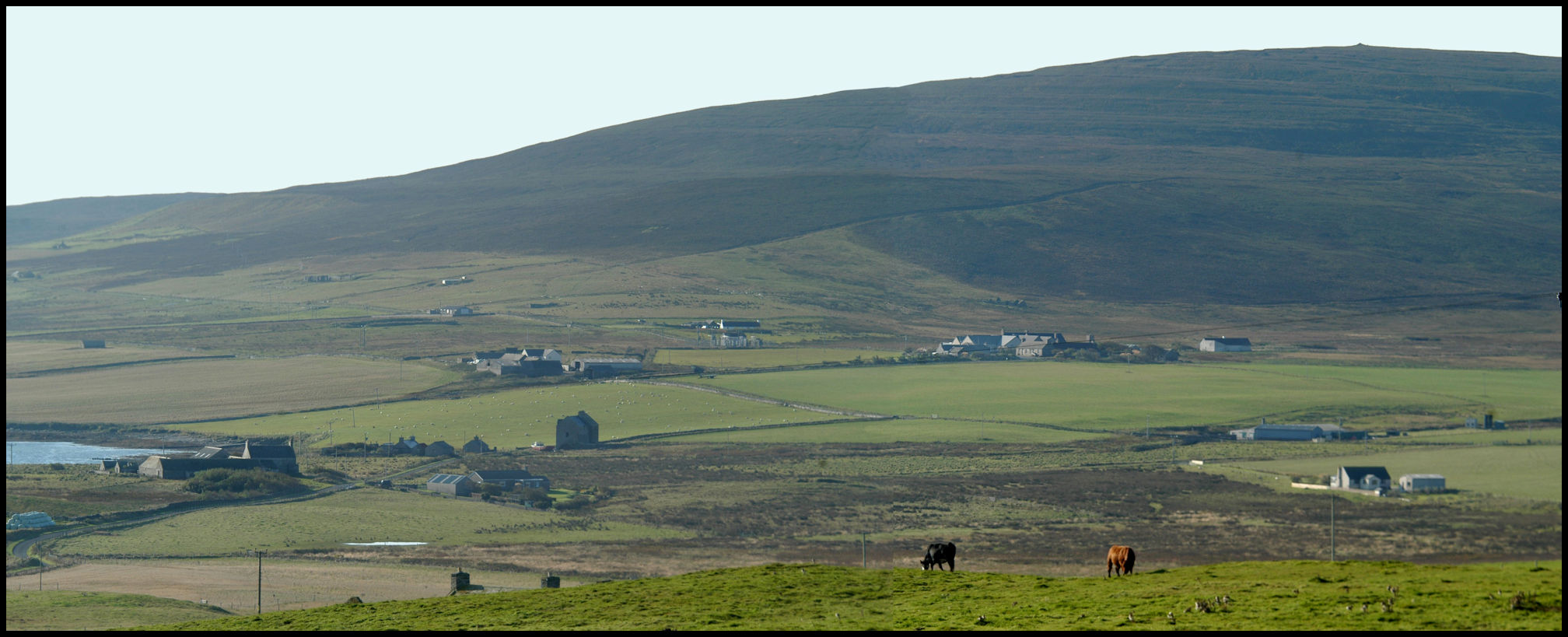
There are only two lochs in Sourin. On the land of Scockness is a small salt-water loch near the point of Longataing; the area is 4 acres but seems to be getting smaller. Between the farms of Scockness and Faraclett is the fresh water loch extending to 12 acres. This loch is mainly fed by springs. The Loch of Quoys, near the school has filled in over the years; this water was used to drive the thrashing mill at Banks.
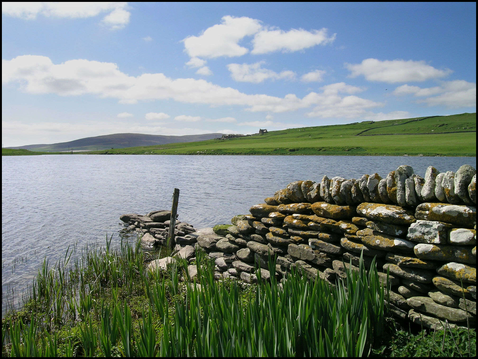
About the 1840-50 transport in Rousay was non-existent. There would have been horse and sledges, I doubt if there were any carts in use in Sourin. Walking was only mode of transport. Let us take a walk in the winter time, after a day of rain, from the Blossan to the old Kirk in 1840. We leave the house and walk down the Sourin Brae; we come to a large ditch between Cruannie and Digro, a torrent of water, but we manage to jump across. Next is the Sourin burn; how can we cross a wide burn in spate? The narrowest place to cross is near to Hanover or go down to the shore. We walk on, and another ditch, below Quoys past what will be near to the school, we can jump this one. We carry on past Knarston, to the burn of Cruar. We have to go up the side of the hill to cross over. We can carry on to the Kirk. As you can see it was not very easy to walk across districts long ago. Through time bridges and roads were built. A square bridge was built at the top of the Sourin Brae and at the bottom was the Sourin Brig. This was a single-span bridge built perhaps about 1853-4. I have never seen any record of this; another brig was built across the burn at the mill. The Leeng burn has a square brig built below Breck. At the Loch of Quoys a square brig and sluice was built, perhaps in 1852. The brig of Cruar has a central pillar and this supports very thick flagstones. There is an arched brig across the burn of Peeno near to Hanover.
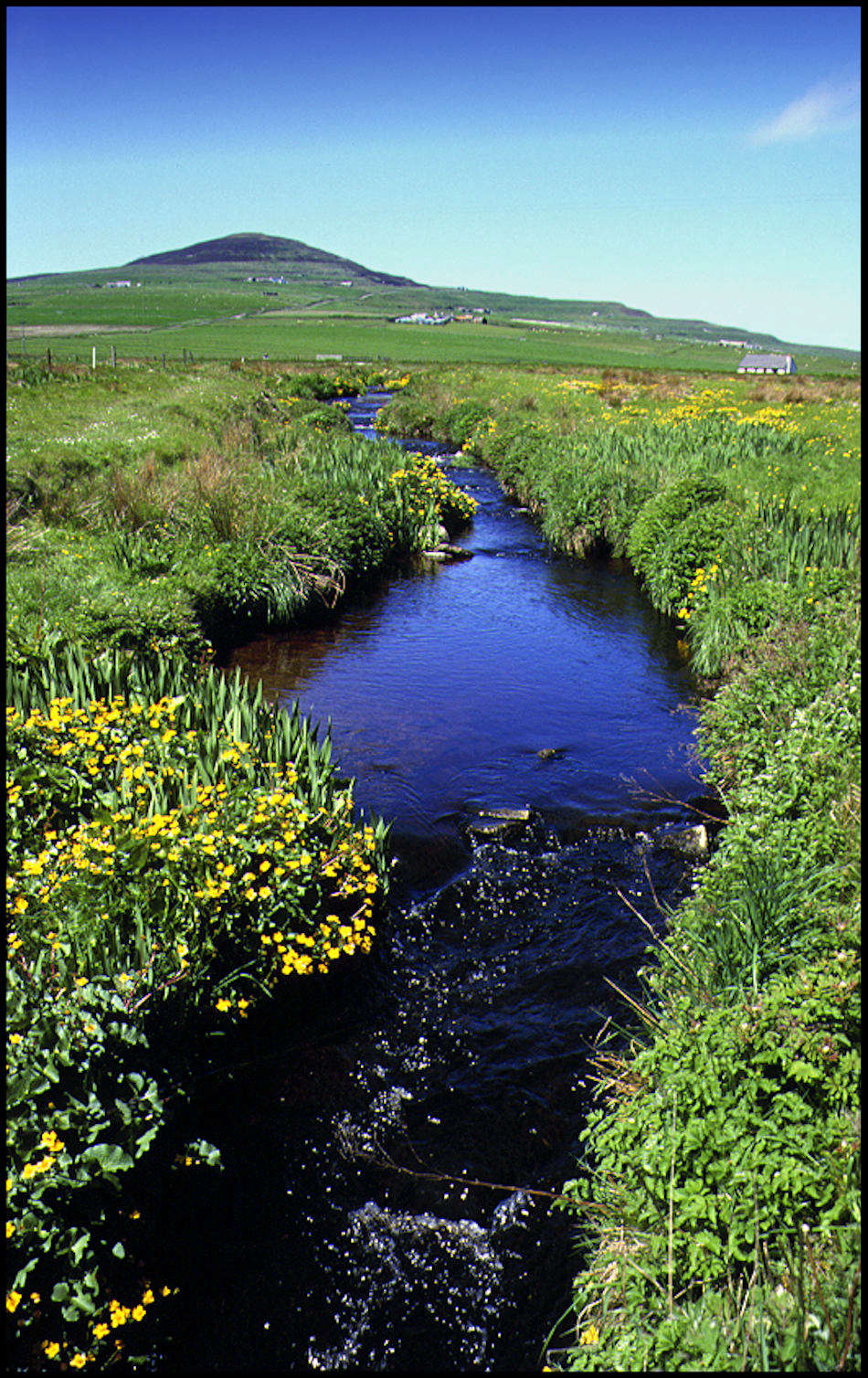
One of the strangest names in Sourin is a field on the land of Essaquoy called Fananoo, in this field is a very strong spring called the “Meean” Well; this is attached to the “Leeng Burn”. This flows into the Geo of Bigland, below Breck. The Leeng burn has quite a large catchment area, from Lea on the side of Kierfea down the valley to Swandale, and Bigland on the other side of the valley. The Sourin burn was at one time called the Suso burn. This flows from the Muckle Watter to the mill at Lopness. At one time the course of the burn was changed below the Sourin Brig. (The Sourin Brig is the bridge at the salmon hatchery.) The burn below the brig used to flow through the field of Hurtiso called Volespreed in a large curve and go to the mill. The laird had the burn dug out to a gentle curve to the mill. Above the brig is a dam at Woo to which a large ditch was dug to feed the waterwheel at the mill. He also had a track quarried out for the last part of the burn at Nethermill down to Kirsty Pabies Pow. This is the name of the pool at the end of the Burn. A large heavy stone was placed across the burn. This was moved by a huge amount of water in the mid 1960’s.
All black and white photos are courtesy of the author – Tommy Gibson