The Orkneys and Shetland; Their Past & Present State
by
John R. Tudor – London, 1883
CHAPTER XXVII.
[Section covering Gairsay, Wyre, Egilsay, Rousay, & Eynhallow]
A small steamer, the Lizzie Burroughs, plies regularly between Rousay and Kirkwall, calling at Egilsay, Veira, Gairsay, and several places on the east side of the West Mainland. As, however, her head-quarters are in Rousay, she is, on her regular trips, of no service to the tourist who wishes to return to Kirkwall the same evening after visiting the three smaller islands. One day in every week she is generally off the passage and remains at either Sourin or Trumland, and persons anxious to visit Egilsay and the other two small islands, might arrange to hire her for the day. The only place, at present, in Rousay where lodgings can be obtained, is at Mr. Reid’s, at Sourin. [Thomas Balfour Reid was Inspector of Poor and the island’s Registrar. He lived at Old School with his wife Betsy]. A sailing-boat however can always be got in Kirkwall, and if tides suit Egilsay, Veira, and Gairsay might all be visited in the course of a long summer day.
GAIRSAY
The chief object of interest in this island is the old mansion house of the Craigies, now turned into a farmhouse, situated on the western side of the island.
It is said to have been erected by that William Craigie whose marriage to Mrs. Buchanan of Sandside in 1690 has already been referred to.
The house consists of buildings on the north, east, and south sides of a court with a rather ornate curtain wall, loop-holed for musketry, containing the entrance. Outside are the ruins of the chapel.
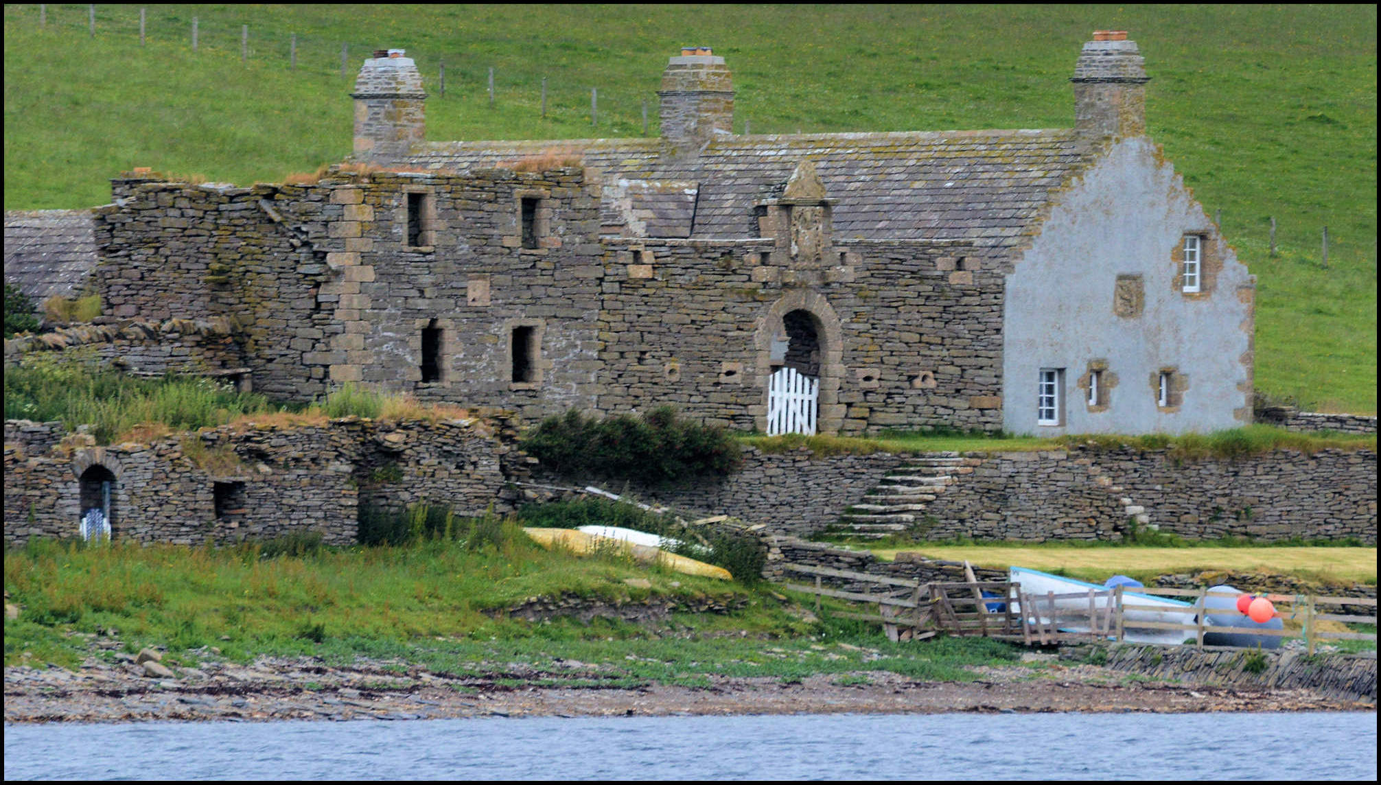
No traces have as yet been found of the big drinking-hall said to have been erected by Swein. It was probably like the Icelandic sketlas, composed chiefly of wood. On the narrow isthmus which connects the promontory known as the Hen with the island, is a grass-grown tumulus, which may or may not cover the remains of a broch or later building. The situation is an admirable one for a Viking station, as, in case of bad weather coming on, the boats had only to be taken from one side to the other round the Hen to ensure smooth water, and might even, if necessity compelled, be dragged across the isthmus. The name of Swine, applied to the holm on the east side of the island, is clearly a misnomer, and should be Swein. A very pretty view of the Northern Orcadian archipelago is to be got from the top of the little conical hill which constitutes the greater part of the island.
VEIRA
Veira, Weir, or Wyre, the Vigr of Norse days, is a peculiarly shaped island, that from Rousay appears not unlike some huge cetacean lying on the water.
The grass-grown mound, which is now all that remains of Kolbein Hruga’s fortalice, locally called Cobbe Row’s Castle, is about a quarter of a mile from the shore on the west side of the island, where the ferry crosses from close to the Established Church in Rousay. According to Wallace’s description it must have been of no great size, as he says ” It is Trenched about, of it nothing now remains, but the first Floor, It is a perfect Square the walls eight feet thick, strongly built, and cemented with Lime, the breadth or length within Walls not being above ten foot, having a large Door or Slit for the Window.”
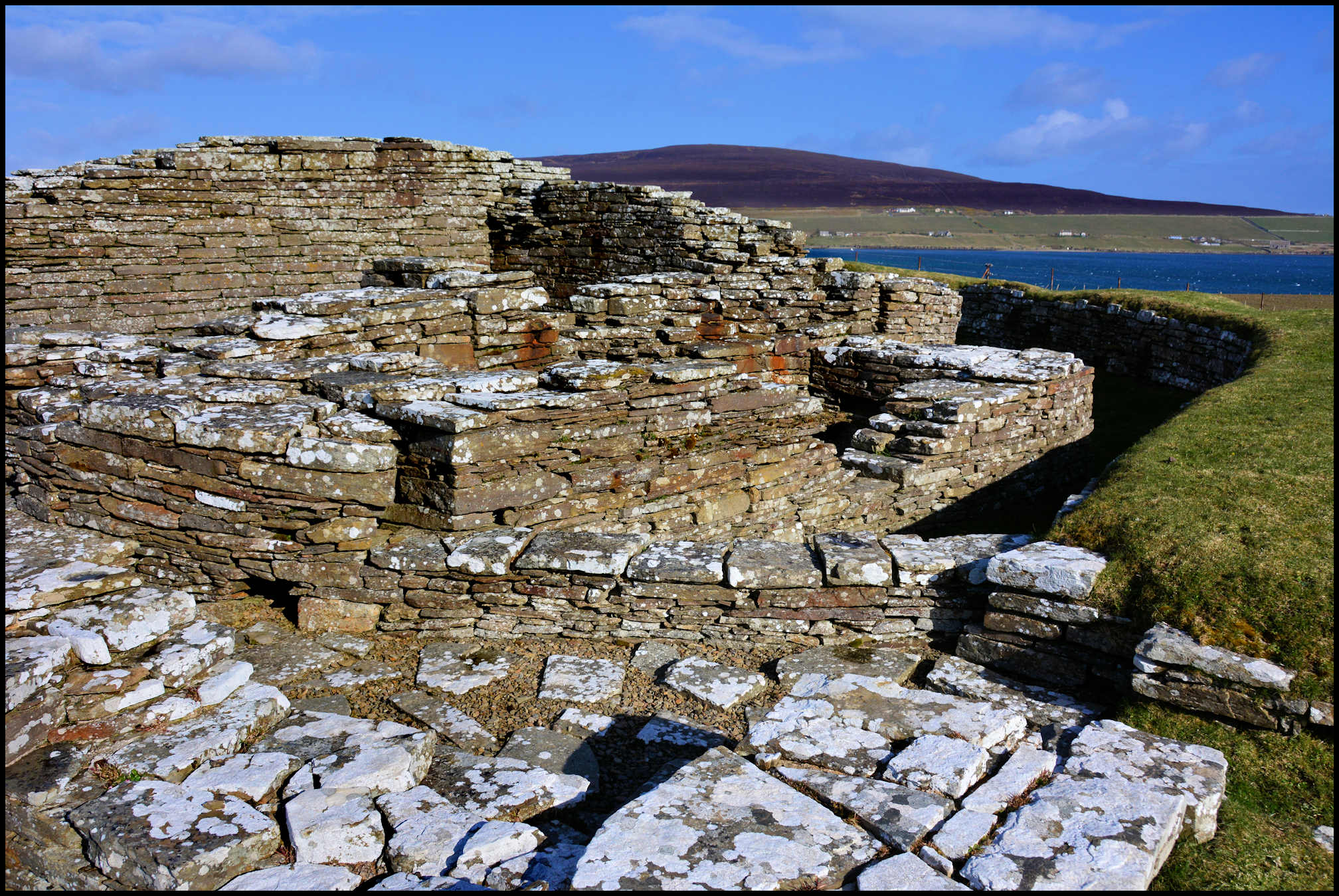
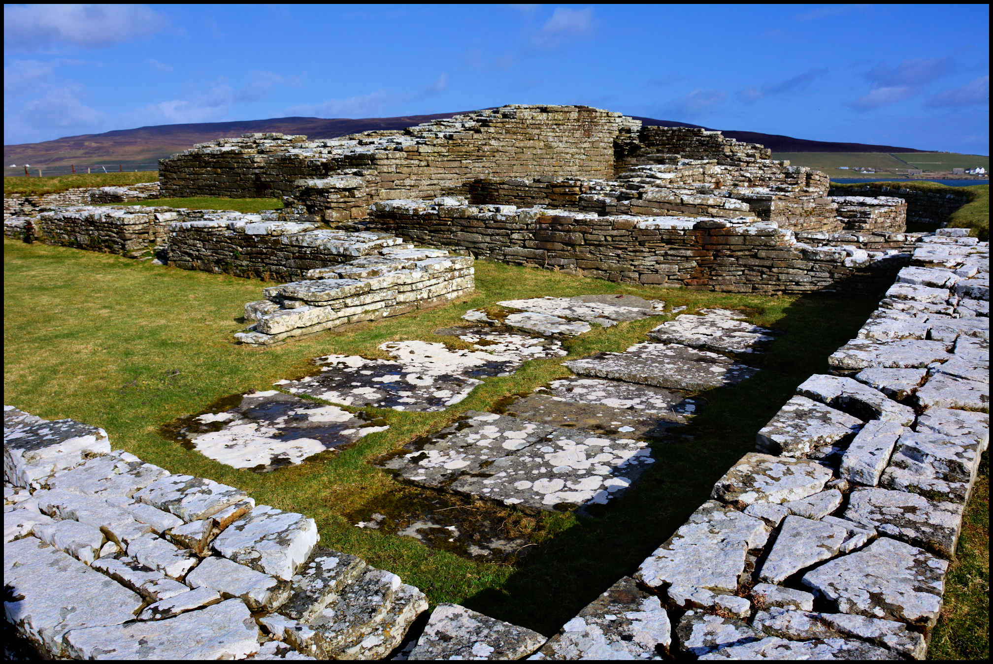
The fosse or ditch is still to be traced. About thirty yards or so from the mound is the old church, now roofless, which, as Dryden is of opinion that it was erected in the twelfth or thirteenth century, may have been built by Kolbein Hruga, or his son, Bishop Bjarni.
It consists of nave and chancel, of which the nave measures 19 ft. 2 in. by 12 ft. 10 in. The door is at the west, and “is 2 ft. 6 in. wide at the bottom, with a semicircular head, the feet of which are set back at the impost 2½ in. at each side. This mode of fastening the arch on was probably done to give a support to the centre on which the arch was built. The jambs are parallel, 3 ft. 2 in. thick, and having no rebate for doors, nor any traces of there having been one. There is no cap. The impost is 4 ft. 11 in. above original stone sill.” Such is the technical description. The semicircular head may be described, for the non-technical visitor, as being composed of a number of thin slaty stones set on edge, and radiating like the spokes of a wheel. An arch, with a like semicircular head, leads into the chancel, 7 ft. 10 in. by 7 ft. 2 in.

All the windows are on the south side, two in the nave and one in the chancel. Only one of those in the nave is supposed to be original, and it is flat-headed, 1 ft. 10 in. by 8 in., and splays inwards to a width of 2 ft. 3 in. The one in the chancel, supposed to have been round-headed, is 2 ft. 7 in. by 11 in., and splays inwards to a width of 2 ft. There is no trace of ambry, altar, or altar place. In the chartulary of the Monastery of Munkalif, near Bergen, is preserved a deed, by which Bishop Bjarni gave to the monastery certain property known as Holand, near Dalsfiord, north of Bergen, in order to provide masses “for the souls of his father, his mother, his brother, his relations, and friends,” a tolerably comprehensive list. According to Barry, the churchyard of Veira contains graves of an extraordinary length, but, when the writer was there, it was in the usual disgraceful state common to Orcadian “bone-yards,” so much so, that even the boatman who had ferried him across commented on it.
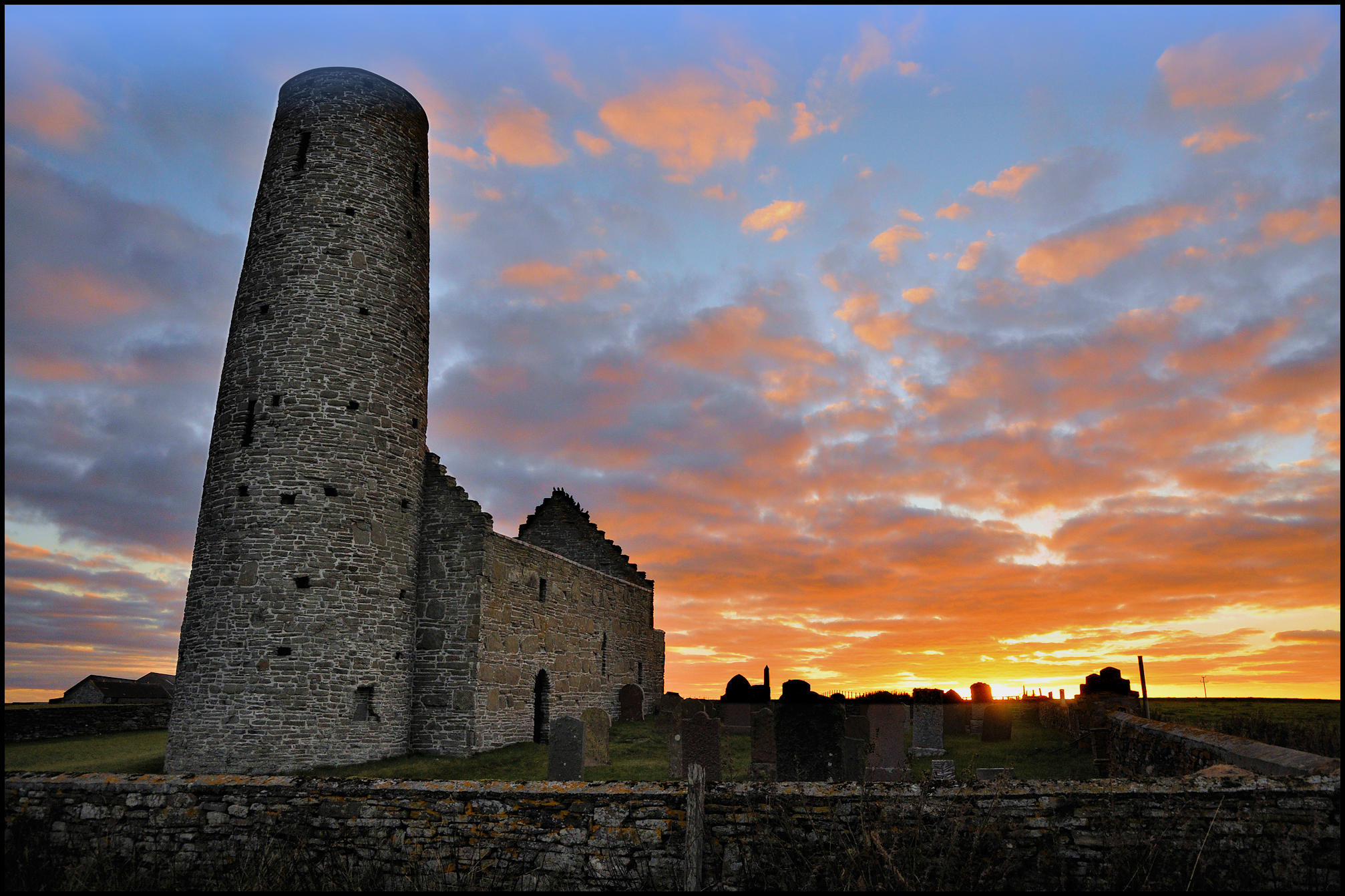
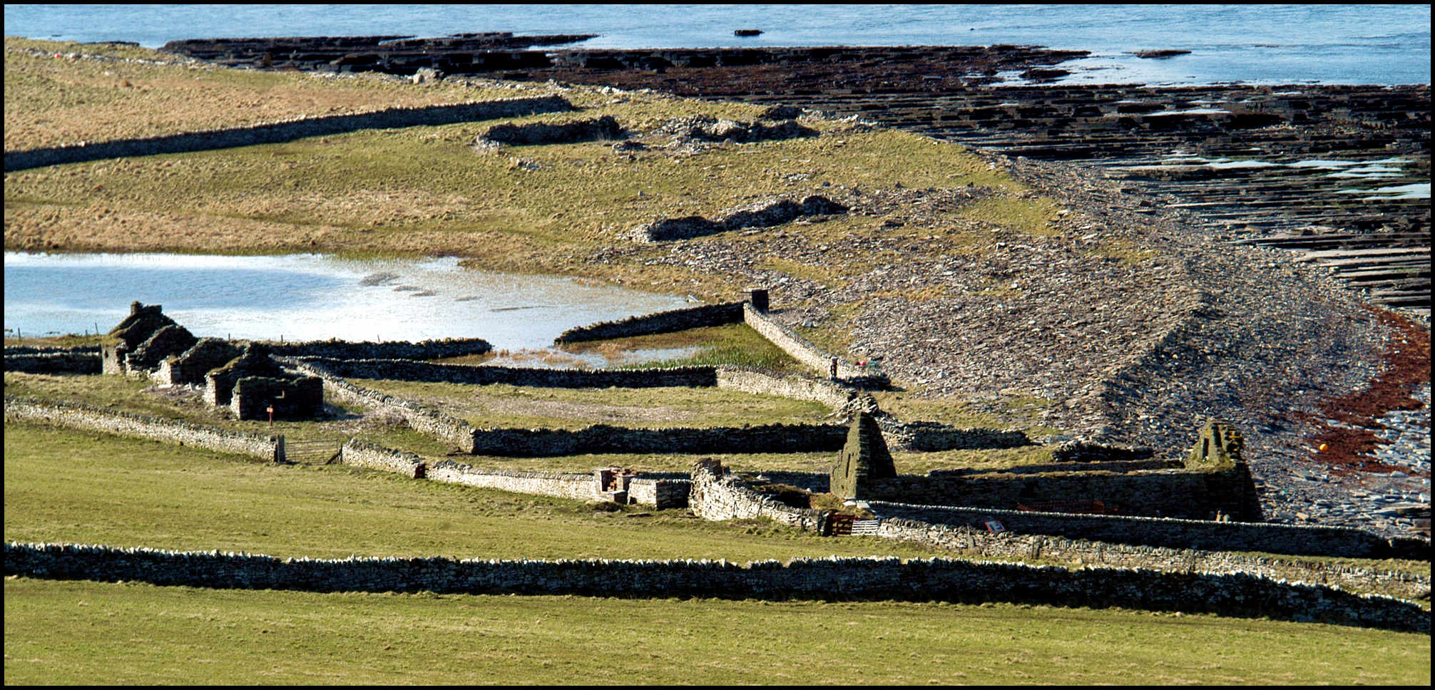
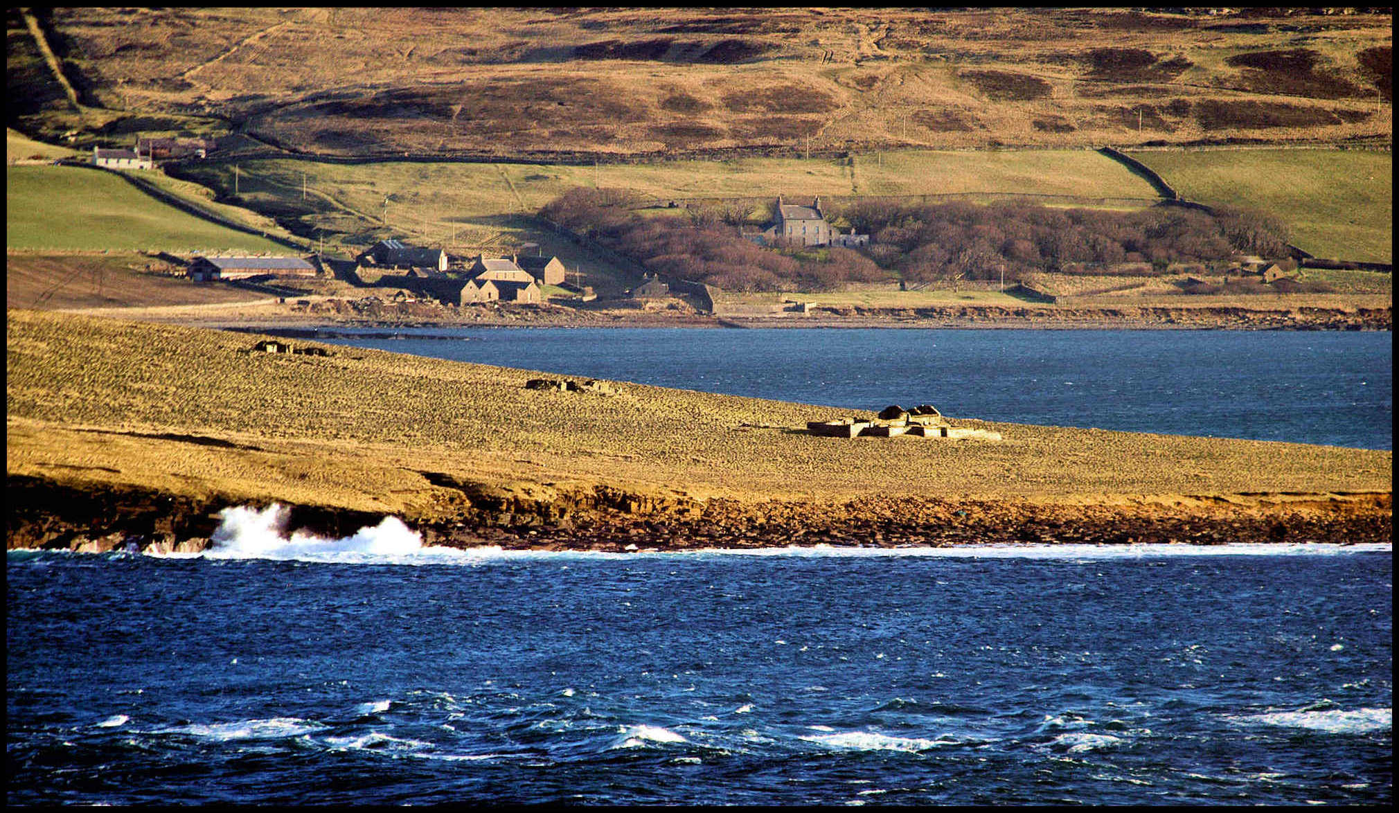
EGILSAY
Crossing over from Sourin, on the eastern side of Rousay, you land at Shelting, which is about a quarter of a mile from the church. On your road to the church you pass a green knoll on which local tradition says Jarl Magnus was executed. The church consists of chancel, nave and circular tower, access to which is from the nave. Internally the nave measures 29 ft. 9 in. by 15 ft. 6 in., entrance to which is by two doorways facing each other on the north and south sides, each having a round arched head, and being 2 ft. 6 in. in width. On the north and south sides are windows, each 3 ft. 3 in. high, and 8½ in. wide, splaying inwards to a width of 2 ft. 9 in. On the south side are also two other windows, not original.
The chancel is 14 ft. 11 in. by 9 ft. 5½ in., and is roofed with a plain barrel vault, of which the semicircular chancel arch forms part. There was no window at the east, and but one on the north, and another on the south sides, each semi-circular headed, 1 ft. 7½ in. by 11 in., and splaying inwards to 2 ft. 1 in.

Over the vault of the chancel is a chamber entered by a doorway semicircular headed, 6 ft. 4 in. by 2 ft. 2 in. above the chancel arch. This chamber is lighted by a flat-headed window in the east end, 1 ft. 6 in. in height, and is called by the natives the “grief-house,” from some idea that it was used as a prison.
Each gable was corbie stepped, and from the drawing in Hibbert, the roofs seem to have been formed either of stone slabs, or of very coarse slates. The feature of the building is, however, the round tower, 14 ft. 10½ in. in diameter, external measurement, at the ground, and 7 ft. 8 in. internally. The entrance is by a semicircular headed doorway from the nave 2 ft. 5 in. wide. At present the tower is 48 ft. in height, and 15 ft. is said to have been removed many years back. In Hibbert’s sketch it is surmounted by a conical cap. In its original condition the tower is supposed to have had four chambers, the fourth of which was lighted by four windows facing the cardinal points; below these, on the east side, is a flat-headed opening, and below this again a semicircular headed opening 4 ft. 1 in. high by 1 ft. 9 in. wide. There are also small windows on the second and fourth stories looking north, and a modern one near the ground on the south side. In addition, above the door leading from the nave 16 ft. 3 in. from the floor, is an arched opening 5 ft. 4 in. high by 2 ft. 3 in. wide. All the windows and the north doorway have now, for preservation, been built up, and an iron gate has been placed in the south door, the key of which is kept at North Toft farmhouse.
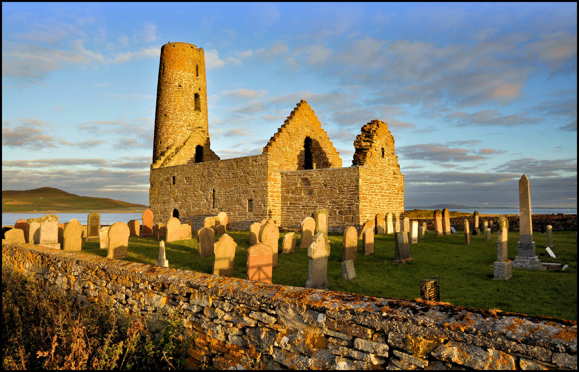
The churchyard is surrounded by a good modern wall, and is a marvel of neatness for the Orkneys. The church itself has been used for service within the present century. What is the date, at which this almost unique church was built, will probably be never satisfactorily settled. Munch is of opinion that the Norsemen found a church here, and joining the Celtic or Gaelic word for a church, eaglais (derived from ecclesia) to the Norse ey, an island, made Egilsey. Others, again, Mr. Karl Blind amongst them, are of opinion, that the Egils is taken from the genitive of the Teutonic and Scandinavian name Egil. There is, by the way, an Egilsay in Shetland, in which, so far as the writer is aware, no trace of a church has ever been found. Assuming Munch to be correct, and that this is the original church, and not a second building erected on the site of the first, we should have to go back to the ninth century at least, if not earlier.
The round tower has made many people assign it a Celtic origin, but, after weighing the pros and cons both for Celtic and Norse buildings, Dryden is of opinion that it was built after the Irish model shortly after the re-conversion of the islands to Christianity in 998. Be the date of its erection what it may, when standing by the old walls covered with the marks of a hoar antiquity in the grey and yellow lichens which give such a variegated appearance to the whole building, and especially to the tower, you cannot help letting your thoughts go back to that 16th of April, 1115, when the bloody tragedy was being enacted on the green mound between here and the beach. You see Magnus, surrounded by his followers, watching Hakon’s vessels crossing from Wyre Sound into Howa Sound; then, the mass being celebrated in fear and trembling by the priests of the church; the execution itself; and, finally, when the drink had begun to tell on Hakon, Thora, mother of the murdered one, imploring his murderer to allow her to give his victim Christian sepulture.
in the forground, and the hills of the mainland away in the distance
ROUSAY
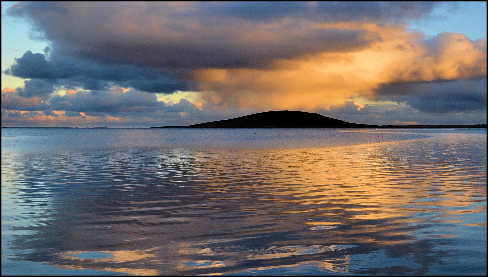
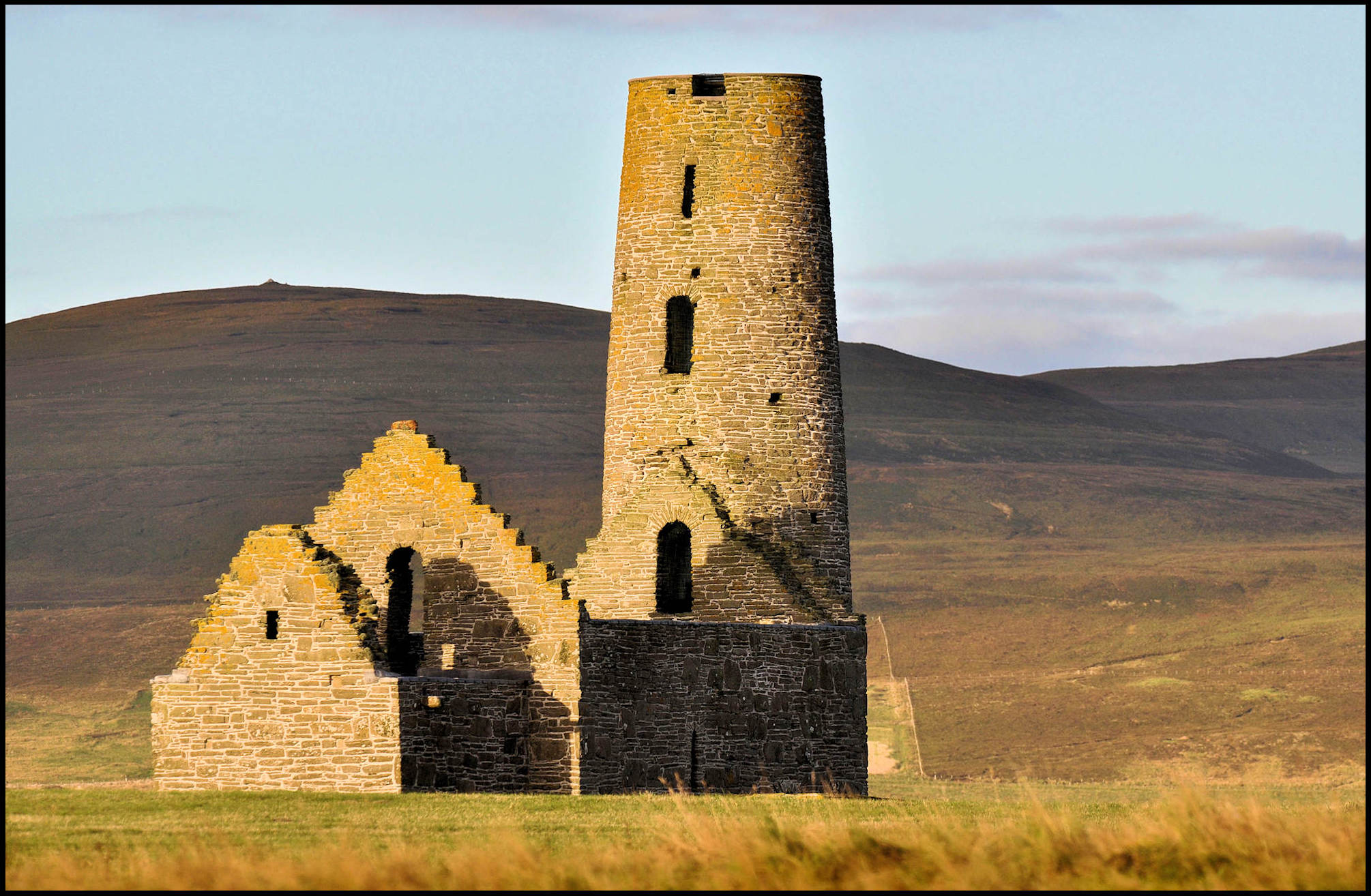
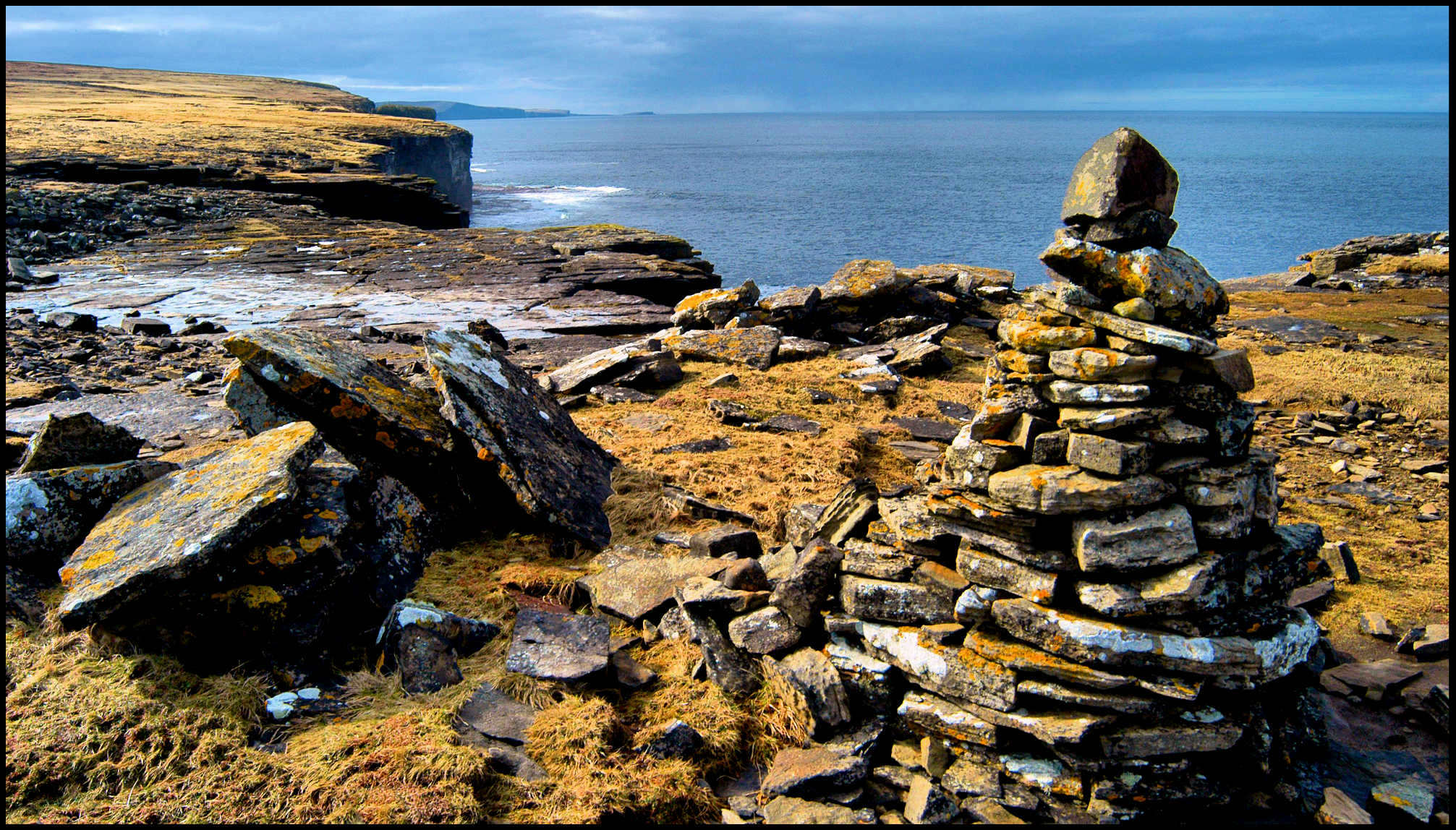
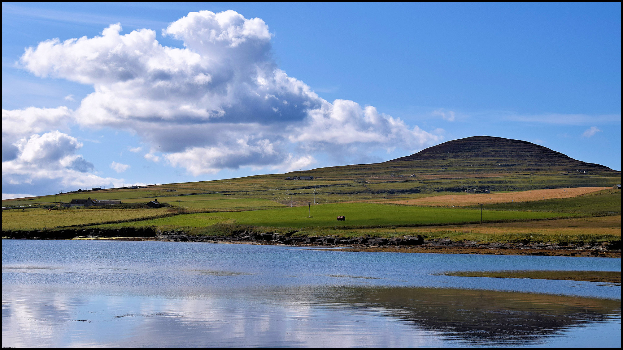
This, the Hrolfsey of the Saga may be roughly described as a circular island, from five to six miles in diameter. On its eastern, southern, and south-western shores it slopes gently to the sea, whilst from Scabra Head round to Faraclett, or the Knee of Rousay, as it is called on the chart, with the exception of a small portion of the bay of Saviskaill, the coast is more or less precipitous. On the south-east side a range of hills, of which Blotchinfield (811 feet) and Knitchenfield (732 feet) are the highest points, runs from a little to the west of Sourin to nearly above Westness; north of this again a valley, of which Muckle Water (322 feet) is nearly the summit, runs across the island; north of which is another hill range, of which the pointed peak of Kierfea (762 feet) is the highest point [and pictured below].

One special peculiarity about the Rousay Hills is the terraced outline of their slopes. This is very marked above Westness and again on Kierfea. Following up the valley down which the Sourin Burn flows from Muckle Water, you come on the southern side of the burn to the Goukheads, a very rough bit of broken-up bog ground overgrown with heather, and fissured with numerous holes, which, to save a sprained ankle or worse, necessitate very careful walking. This is the habitat of the Pyrola Rotundifolia, and is said to be the only spot in the Orkneys where this flower, known in the island as the ” Round-leaved Winter Green,” is to be found. On a line between the eastern end of Muckle Water and the top of Blotchinfield is a curious ridge called the Camp of Jupiter Fring, some 600 yards long by 40 or 50 broad, and having very steep scarped sides on its northern and southern sides. How it came by this name no one knows ; Wallace referred to it two hundred years ago, and seemed to think the name had been given by some dominie from Jupiter Feriens on account of its being frequented by Jove’s bird. From the camp to the summit of Blotchinfield is a very short distance, and the view from the top, in clear weather, must be very fine. It is said that, not only Fair Isle, but even Foula has been seen at times from either Blotchinfield or Kierfea.
just to the left of the kirk’s inland gable end.
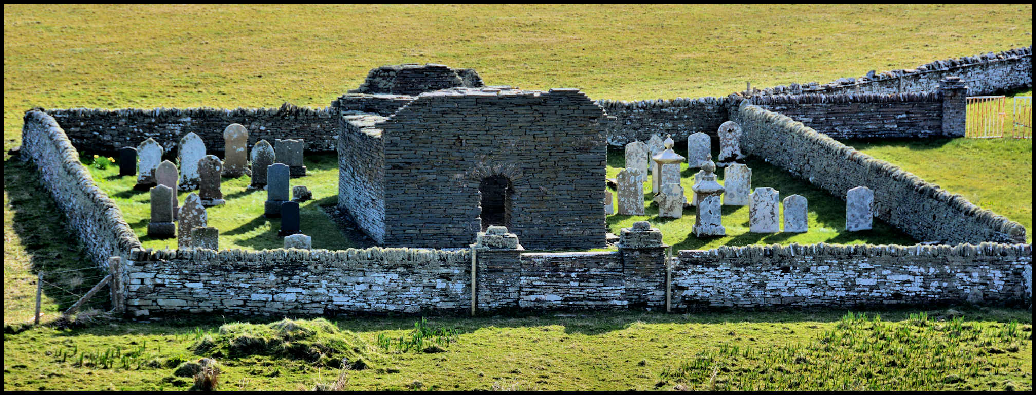
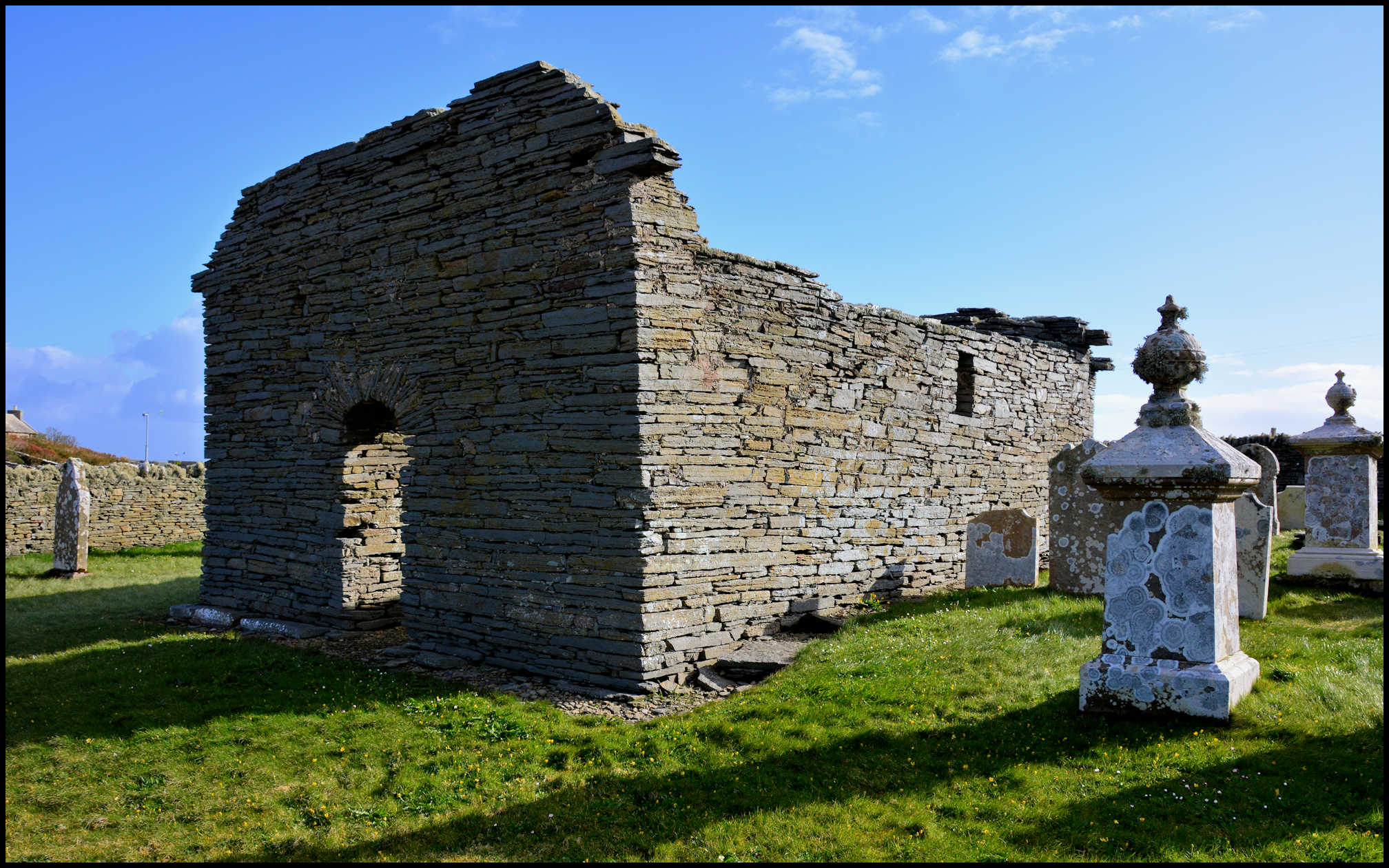
From the top of Blotchinfield a course, a little to the south of west, will bring you to Westness, the gardens of which, planted almost entirely by the late Dr. Traill of Woodwick, a former proprietor of the island, are the most beautiful thing of their kind in the group. Standing in them, on a warm summer’s day, when a shower has brought out the full fragrance from tree and plant, when the wild bees are flitting from flower to flower, and the whole atmosphere full of the sounds of insect and bird life, and looking out on the rapid-flowing sound below you, it is hard to realise that you are not in the land of clotted cream and cider, and that you are on the north side of the Pentland Firth of evil repute. About a mile further west you come to the church of Swandro, till quite recent days the parish church of the island. It is a parallelogram, 52 ft. 11 in. by 14 ft. 5 in. inside. The doorway is on the south side, near the west end, and on the same side are three flat-headed windows splaying inwards and outwards. There are also windows at the west end, north side, and east end. Close to the door is a recess, probably for holy water.
North-west of the church, and just outside the churchyard are the remains of mason-work, which local tradition says formed part of Sigurd of Westness’ dwelling-house. West again of this are the grass-grown remains of one if not more brochs. To the east of the churchyard are some curious impressions on the rocks, as if made with naked feet.
On the south side of the little islet of Eynhallow (the Eyin-Helga, Holy Isle of the Saga) were discovered some years back the remains of an old chapel, which, a gentleman informed the writer, have since been wantonly thrown down by a yacht-full of gorillas. It is somewhat rough on the gorilla, and, one could hardly realise such a piece of gratuitous vandalism, had there not been the case of the Logan Rock in Cornwall. The chapel, so far as could be made out, consisted of a nave 20 ft. 7 in, by 12 ft. inside, at the west end of which was a round arch, 4 ft. 3 in. wide, leading to a building 7 ft. 9 in. by 7 ft. 5 in., which Dryden is of opinion might have been a sacristy added at a later date, the doorway leading to it being the original entrance to the church, and the south doorway being opened when the chancel was added.
There was a regular chancel at the east end, 12 ft. by 8 ft. 9 in. Outside the south door of the nave was a square addition, 8 ft. 1 in. by 7 ft. 7 in. inside, with a radiating staircase. The building had long been occupied as a dwelling-house, and of course had been very much mutilated; but summing up the probabilities, Dryden is of opinion that the nave and chancel were nth or 12th century work; that a new chancel arch was put up in the 14th century, at which date the buildings at the west end and on the south side were added. Mr. Karl Blind is of opinion that the name Eyin Helga meant “The Sanctuary (Heiligthum in German) of the Isles,” and that the islet held the same position to the rest of the group that Heligoland did to the Frisian Isles.
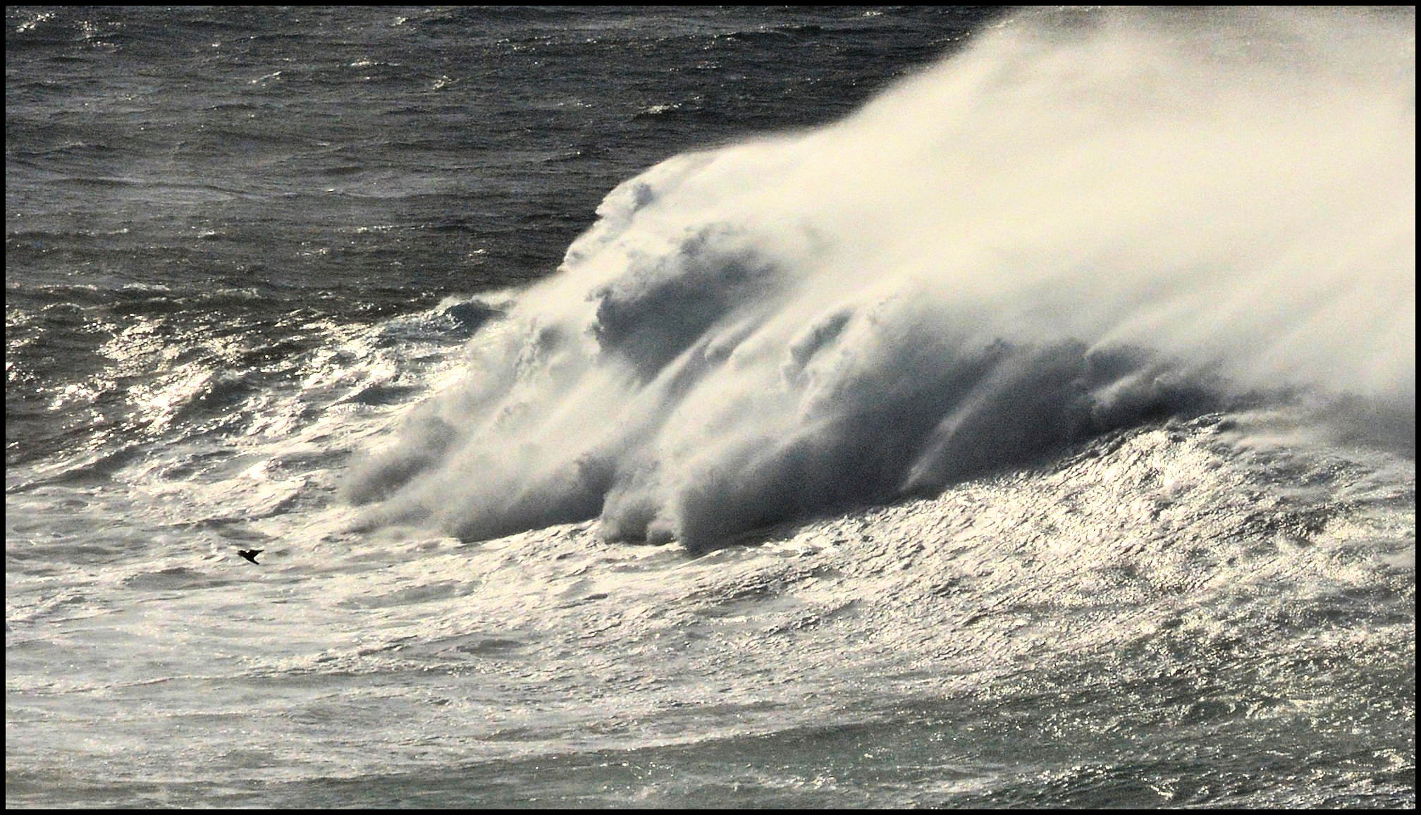
On the north-western and south-western sides of Eynhallow are the Burger and Wheal Rostis, which, as the flood-tide, with springs, runs seven knots an hour, must be a sight to see, when a nor’-wester has for some days been piling the waters of the Atlantic on the Orcadian coast. A little west of Swandro Church is a geo, rejoicing in the significant name of Paradise, in which boats sometimes take shelter, till the tide turns. Somewhere about here Swein captured Jarl Paul, when hunting otters near Scabra Head, and the name of the district, Swandro, appears to have some connection with that incident. A cave on Eynhallow Isle bears the name of “the Cave of Twenty Men,” which may also have owed its name to the abduction of Paul.
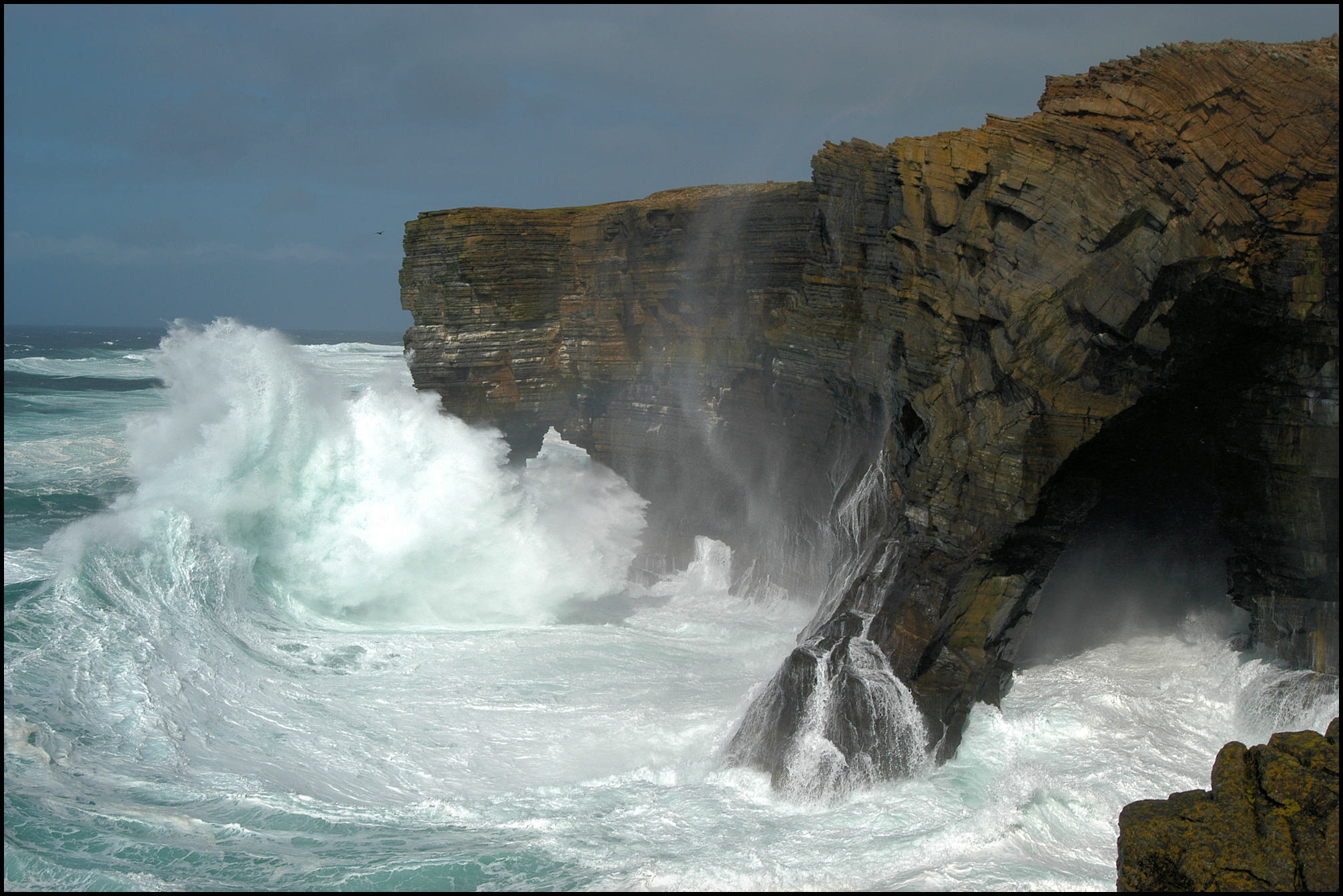
A short distance beyond Paradise Geo you come to a series of gloups, or blow-holes, known as the Sinions of Cutclaws. The first is about thirty yards from the sea, thirty yards long, and twenty-four broad; the second a few yards beyond, circular, and about ten yards in diameter. Before, however, coming to the Sinions, and between them and Scabra Head, are some curiously formed arches, known as the Hole of the Horse, and Auk Hall; and without being of any great height, the cliffs are very picturesque and bold. A mile further you come to another sinion, known as the Kiln of Dusty. Here Bring Head commences, a very fine stretch of cliffs in places overhanging the water, the highest point of which, Hellia Spur, is probably about 300 feet. Close to Hellia Spur is the Stack of the Lobust, a long, narrow portion of rock which has slipped away from the cliff, from which it is now separated by a chasm not much over twenty feet in width. A little east of this is another similar stack in process of formation.
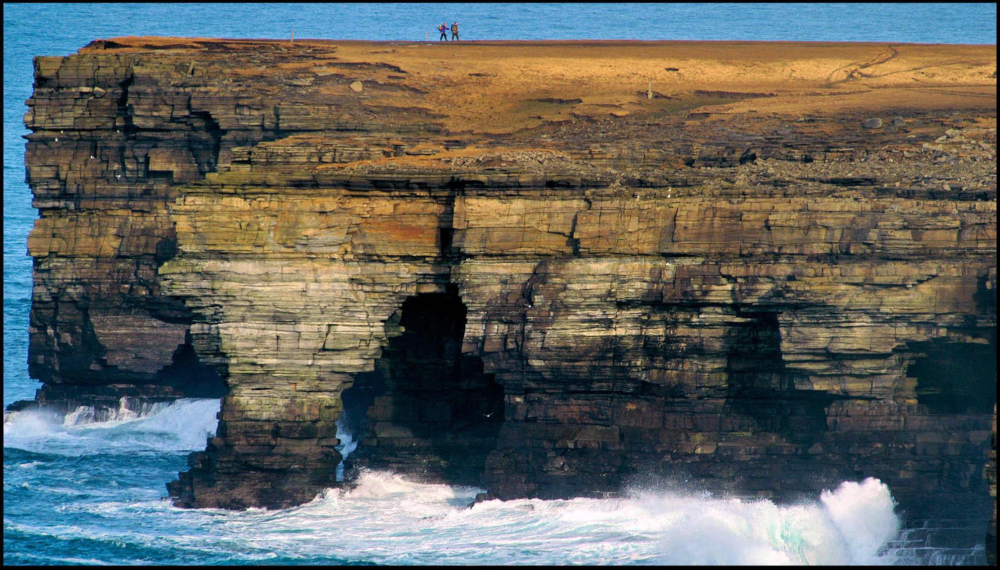
[The two walkers on the top of Sacquoy Head give a sense of perspective, and show just how high – and dangerous – the cliffs in the North-Western part of Rousay are.
To the right is the ‘storm beach’ at Sacquoy Head, littered with boulders thrown up by the action and power of the sea.]
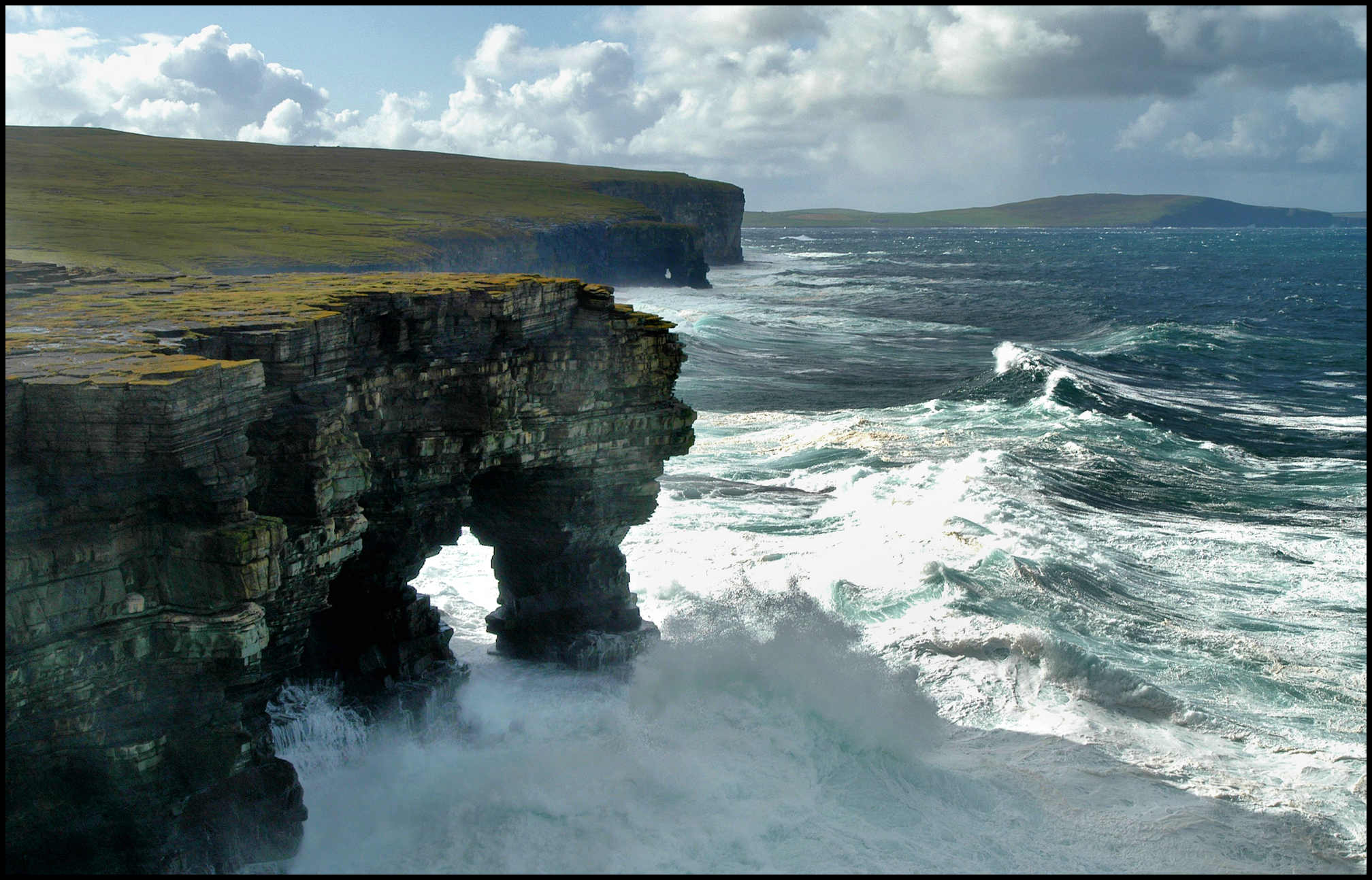
From this point you get a very pretty view of Sacquoy Head, with Westray behind it. Close to Sacquoy Head are the Kilns of Brin Neven, before coming to which is a gigantic edition of the well-known Grind of the Navir in Shetland, though not so accurately cut. The sea has seized hold of a weaker than usual spot in the stratification of the cliff here, and has carved out a huge gateway, or embrasure, the stones from which lie piled in heaps to the rear. The Kilns are a series of three gloups, extending about 200 yards, from east to west. The western one is a gruesome abyss. Both of the eastern ones have arches opening seaward, through one of which you get an exquisite peep of the sea outside. All this coast line, to be properly appreciated, should be seen from a boat, and there are any amount of caves to be explored. Owing, however, to the strong tideways off the points, and the “lift ” of the sea close to the rocks, the weather must be something exceptional to render it worth a trial. Probably a week or so of light winds from east or south-east and tides at dead neap would be most favourable.
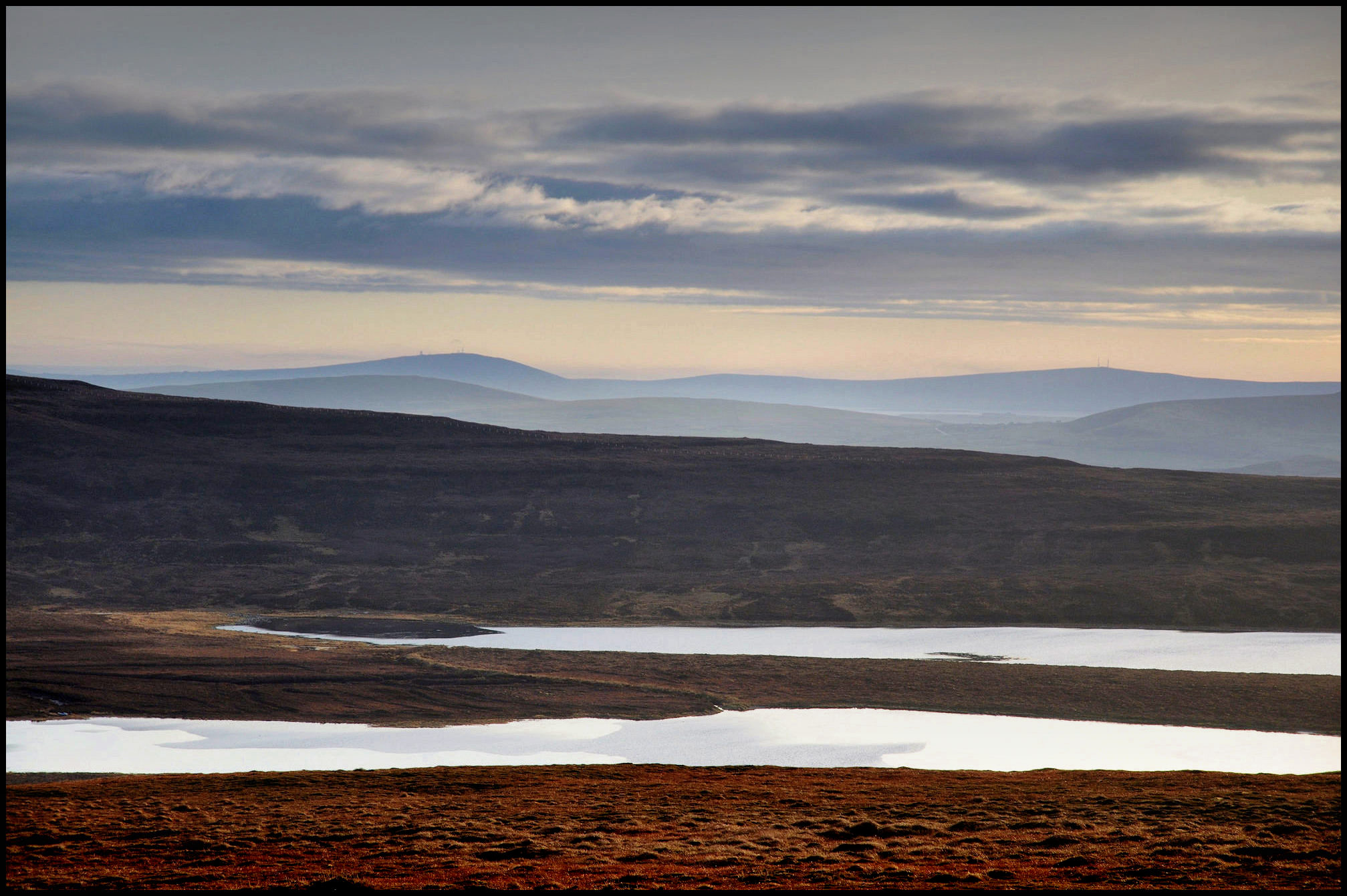
From the Kilns of Brin Neven it is best to make straight for Saviskaill, as the rest of the coast-line is not worth following round. The loch of Saviskaill, or Wasbister, though not more than forty-five acres in area, is one of the best in the islands for fishing, as the trout average nearly three-quarters of a pound each. On a small holm in the loch, where quantities of wild duck breed, are said to be the remains of a small chapel, known as the Chapel of Burrian — a name which looks as if it had been built, like the chapel dedicated to St Tredwell in Papa Westray, on the site of an old broch. There must have been in ancient days a perfect nest of these small chapels around this loch, as at the north end, close to the old burial-ground, was one known as Corse, or Cross Kirk; on Bretaness, a small promontory jutting out on the east side, was another; and N.N.E. of Langskaill, close to the sea, and dedicated to St Colm, a fourth.

[Above left is an eastern view from the top of the Sourin Brae, with the farm of Bigland in the
foreground, the northern ends of the Holm of Scockness and Egilsay, and the western coast
of Eday across the firth. To the right is a view of Kierfea Hill from the Bay of Ham in Sourin.]
Here you strike the carriage road again, a splendid instance of misplaced ingenuity, being carried over the shoulder of Kierfea Hill, instead of, as might have been done with very little trouble, round it From the highest point (411 feet above the sea), you get some good views of Faraclett Head, in the face of which is said to be a very fine cave, access to which can, with the aid of a rope, be had from land, by a steady head and strong arms. The whole round from Sourin past Westness, if Blotchinfield and Jupiter Fring are not visited, will take some eight or nine hours. There ought to be very fair sea-trout fishing with wind off shore, and water slightly coloured by rainfall, at the mouth of the Sourin Burn; but, as a portion of the shootings is let, and the proprietor, Lieut-General Burroughs, C.B., generally has a houseful of visitors staying at Trumland, the tourist must not expect to get any fishing…..

Extracted from
The Orkneys and Shetland; Their Past & Present State.
by
John R. Tudor
Printed in London by
Edward Stanford, 55, Charing Cross, S.W.
Kirkwall: Wm. Peace & Son. Lerwick: C. & A. Sandison.
1883