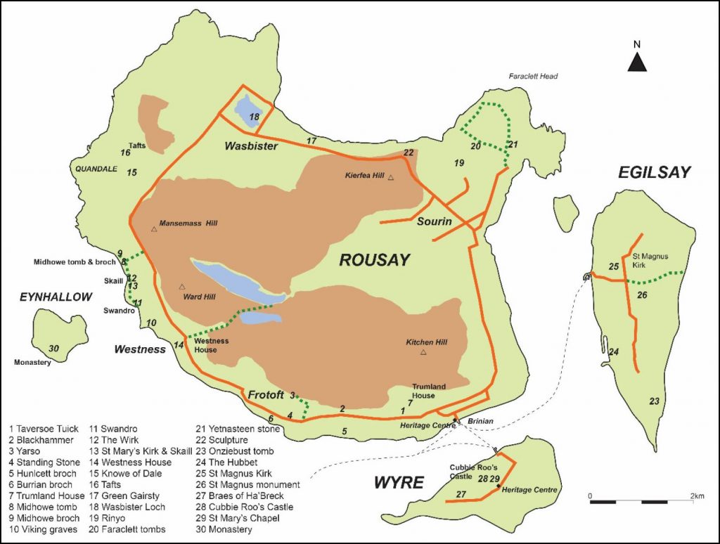
Rousay, Egilsay and Wyre
Digital Archaeology and Heritage Resource Pack
Digital Archaeology and Heritage resource pack
The Rousay, Egilsay and Wyre Development Trust has teamed up with the University of the Highlands and Islands (UHI) Archaeology Institute to support islanders during and beyond the Covid-19 Pandemic. Fieldwork activities on Rousay in 2020 (e.g. Skaill farm and Swandro) have been postponed. This project provides an opportunity to support residents (young and old) to discover, access and enjoy archaeology and heritage resources on the internet.
This digital resource pack is designed to provide islanders with a basic guide and links to online archaeology and heritage resources. This will support training sessions where participants can undertake their own research, or this pack can be used for general interest.
This pack contains:
• Guide to key online resources with live links to websites
• Map resources
• Historical research resources
• List of online resources specific to Rousay Egilsay & Wyre
• Links and resources for current archaeological excavations
• Tasks drawing from the resources
The aims will be to:
1. Increase your awareness of online resources for archaeology and heritage
2. Provide you with basic skills to research a task or topic
3. Find out more about the archaeology and history of Rousay, Egilsay and Wyre
Archaeologists and historians use a wide range of sources of information to research sites and landscapes to understand how and why things have changed over time. Archaeologists frequently undertake archive research and use old maps as part of a desk-based assessment. This examines a range of resources including local and national archives, historical maps, publications and historical archives. This job is made easier today as many of these resources have been digitised and are available online.
For example, did you know that all the Ordnance Survey maps for the whole UK are available in glorious detail on the National Library of Scotland website? Did you know that you can look at the National Record for the Historic Environment to find the records for sites and buildings? Did you know that many journals which contain original survey and excavation reports for Orkney are freely available online? These could all help you follow up your interest in researching your house, land or finding out more about your favourite place.
[For more information on the archaeology and history of Rousay Egilsay and Wyre see the “Rousay, Egilsay and Wyre Stepping Back in Time” Archaeology and History Booklet (2018). If island residents require a copy, please contact the REW Development Trust office.]
Key resources:
Canmore
Link: https://canmore.org.uk/
Canmore is the National Record of the Historic Environment database which is freely available online. It contains more than 320,000 records and 1.3 million catalogue entries for archaeological sites, buildings, industry and maritime heritage throughout Scotland. Canmore is compiled and maintained by Historic Environment Scotland (HES) drawing information from a wide range of sources in order to better understand the past and manage resources nationally.
• Sites – each site has an individual record including fieldwork, survey, other organisation and publications. A site could be a township, farmstead, building, structure, wreck or earthwork
• Collections – historic photographs, drawings, manuscripts and digital archives.
• Images – search digitised and digital photograph archives
• Digital publications – search digitised inventories, reports, surveys, publications and catalogues.
Searching Canmore:
You can search the Canmore database using keywords (e.g. Rousay), site names (e.g. Faraclett) and classification (e.g. chambered tomb)
Link: https://canmore.org.uk/site/search
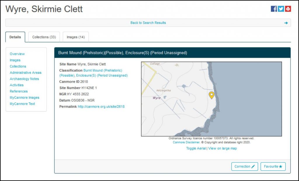
Here is the Canmore record for Skirmie Clett on Wyre, an interesting and enigmatic prehistoric complex of enclosures and burnt mounds on the north-eastern tip of the island. Site link: https://canmore.org.uk/site/2618/wyre-skirmie-clett
Canmore Records:
Searches will bring up lists of sites which can be accessed by following the links.
Site records contain the site name, ID numbers and grid reference. There is a map to show the site location, and details of any digital images, collections and archaeology notes below. The notes contain previous descriptions and fieldwork at the site and bibliographic references. This information is really useful if you want to find out more about the site and follow up information.
My Canmore:
You can register for MyCanmore and add photographs and information to site records online:
Link: https://canmore.org.uk/contributions
As you will see, some sites have lots of information, others have very little. Sometimes a simple photograph of the site can really add to the record. Photographs of a site should include the site in its landscaper context, the site itself, and any useful details. Why not write a brief description as well?
Enjoy the highlights of Canmore in the Galleries section, which contains themed galleries of images: e.g. Scotland from the Sky has some fabulous aerial photographs.
Canmore has a good guidance section with help, a glossary and user guide.
Pastmap
Link: https://pastmap.org.uk/
Pastmap displays the Canmore database on a series of map bases, including modern maps, historic and aerial. If you are like me, then viewing all the sites in an area on a map is a great way of finding out about a place or your home.
Watch an introductory video to Pastmap here
If you enter the site and go to the map page, you can zoom into your area of interest using the mouse roller wheel and left click to pan. Select the information (data layers) in the left-hand menu. Coloured dots will appear on the map when you are zoomed in close.
When you have zoomed into your area of interest, click on a dot and a site link will appear in the left-hand menu. Click the link you are interested in and this will take you to the Canmore record page.
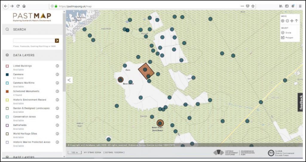
Above, Pastmap page is displaying the sites in Quandale clearance township on the west coast of Rousay. The Canmore sites are shown as blue dots and the Scheduled Ancient monuments as red areas. You can go to the schedule listing as well.
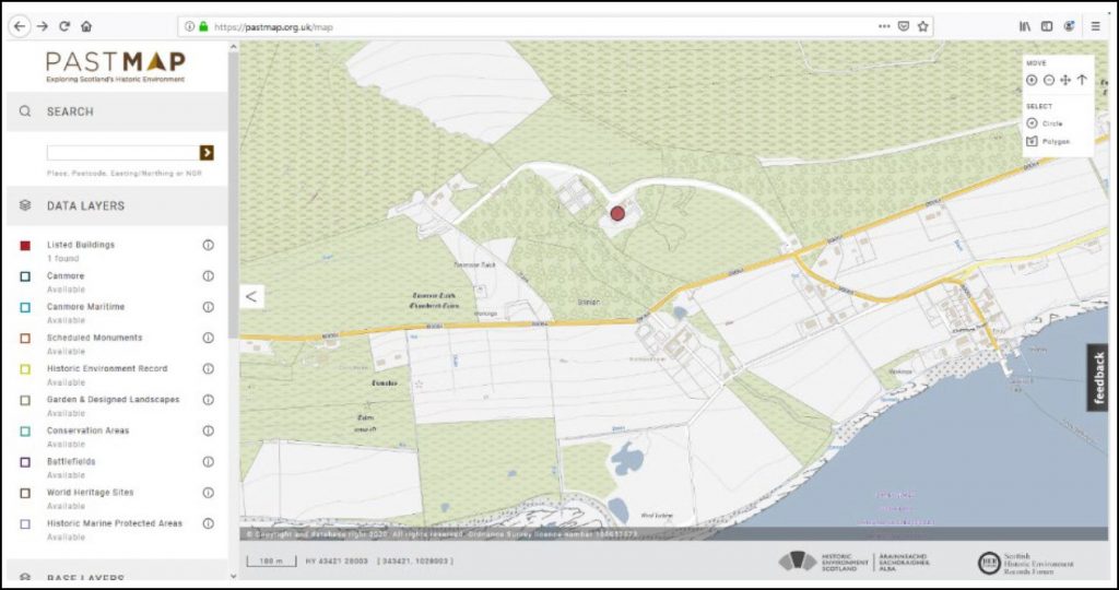
Above, Pastmap page is displaying the listed buildings at Trumland. Click on the dot and link to go to the original listing and find out about the history and significance of the site. Is your house a listed building? You can view the listing held by Historic Environment Scotland like this online.
Selecting a group of sites in Pastmap:
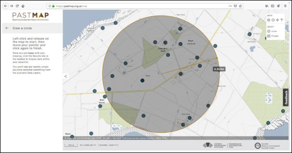
You can easily select a number of sites in Pastmap. You can draw a circle or polygon to select a group of sites you are interested in. Once you have drawn your circle, click the results option in the top right menu. All the sites you have selected will now be displayed in the left-hand menu. Click at the top to download these results. This takes you to a screen which displays all the sites in a list. You can download your selection as a .csv file, save this to your computer and open this in Excel to make a database. You can clear your selection from the map if you want to start again. This is a great way to start some research into an area or building!
[Task 1: Find your house on Pastmap. Select Listed Buildings, Canmore and Scheduled Monuments in the left-hand menu. Use the Select menu to draw a 0.5km radius circle centred on your house. Go to the results page. How many sites are close to your house? Are there any surprises? What is the oldest and the most recent site listed?]

Scotland’s Rural Past:
In 2006 to 2011 the Royal Commission on the Ancient and Historical Monuments of Scotland (now HES) ran the Scotland’s Rural Past project and trained volunteers to record rural settlements. The website has been archived now (hence the long links below), but still contains a wealth of information.
They have some great videos for the Interpretation of Rural Settlement Remains.
This includes a fantastic Practical Guide to Recording Archaeological Sites, with information on researching, interpreting and recording rural sites.
Grid Reference Finder:
Link: https://gridreferencefinder.com/
Find accurate grid references for sites and places of interest using this online map. Simply zoom into your area of interest, find your site on the aerial map and right click. This displays a box with the grid reference, nearest address and postcode!
This is useful for locating things you might find when you are out for a walk or visiting a new site that is not listed on Canmore.
SCRAN:
Link: https://www.scran.ac.uk/
SCRAN provides access to educational digital materials online, including images, films, galleries, archives and media.
To enable learning from home during the Coronavirus pandemic, access to SCRAN is now FREE until the end of October 2020. Follow the link for access and use discount code SCRAN-COVID in the shop.
Orkney Image Library:
Community archive of images of Orkney past and present.
Geology:
Geology of Britain viewer. Explore the geology of Orkney and your local areas using this online map viewer. Zoom in and click on the coloured areas to find out more.
Journals:
Lots of archaeology and vernacular architecture journals are now freely available online, you just need to know where to look! You can search and download a PDF document to your computer to read at home.
Proceedings of Antiquaries of Scotland:
Scotland’s leading archaeological journal. Volumes can be browsed online.
Highlights include lots of the Rousay excavations in the 1930s (Rousay tombs such as Geord of Nears cairn, Westness chambered cairn, Midhowe chambered cairn, Knowe of Yarso, Knowe of Ramsay, Blackhammer, Lady Burrough’s diaries of Taversoe Tuick excavations, Taversoe Tuick, Knowe of Lairo, Rinyo Neolithic settlement First report and second report, Burial mounds in Quandale, Gripps souterrain, Midhowe broch)
Archaeologia Scotica:
Occasional archaeology journal from the late 18th to late 19th century.
Discovery and Excavation in Scotland:
Archaeology Scotland publishes a yearly summary of all the sites and excavations in Scotland. You can access all past editions free on their website up to 2016. There is an Orkney section which includes all the reported work for the year.
Archaeology Monographs
Download free monographs of some Orkney excavations, such as the Brough of Birsay and Howe.
Scottish Vernacular Buildings Working Group
Resources and information about traditional buildings. This includes a free access to their annual journal: https://www.svbwg.org.uk/publications.html
Highlights include lots of articles about Orkney and Shetland buildings, many by Paul Newman, including his recording in Quandale, Rousay (Volume 17).
Society for the Protection of Ancient Buildings
Learning resources and archive.
Vernacular Buildings in Orkney
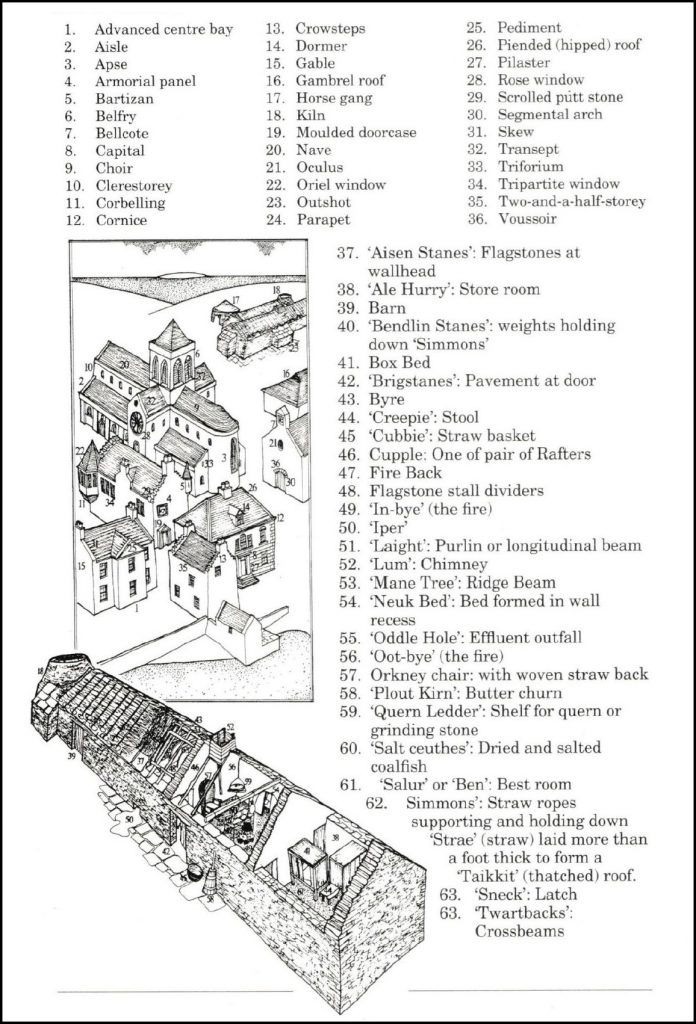
This pictorial guide to Orkney vernacular buildings provides a useful reference for features, terminology and local names.
The Royal Incorporation of Architects in Scotland.
Historical maps
Looking at old maps is a really good way to understand how things have changed over time. Some dramatic changes have occurred even in the last few hundred years in Orkney. Archaeological studies often include a ‘map regression’ which looks at a series of maps for a location through time and records changes. This can often identify lost farmsteads, old enclosures and former field systems. In Orkney, agricultural improvements in the 19th century swept away the run rig and old head dykes and replaced them with squared regular fields. The Ordnance Survey mapped Orkney in the late 19th century.
National Library of Scotland maps
Link: https://www.nls.uk/
The National Library of Scotland has some wonderful online resources and information about their archives. The Digital Resources section hosts a digital gallery, eResouces, moving images, data foundry and learning zone. You can lose hours happily browsing!
Map images provides free access to thousands of maps online, from some of the first maps of Scotland to the full Ordnance Survey maps series from the late 19th century to mid-20th century for the whole of the UK.
Find by place – zoom into the map and select the map sheet you want. Change the series in the left menu. The 25 inch OS series has wonderful sharp detail when you zoom in.
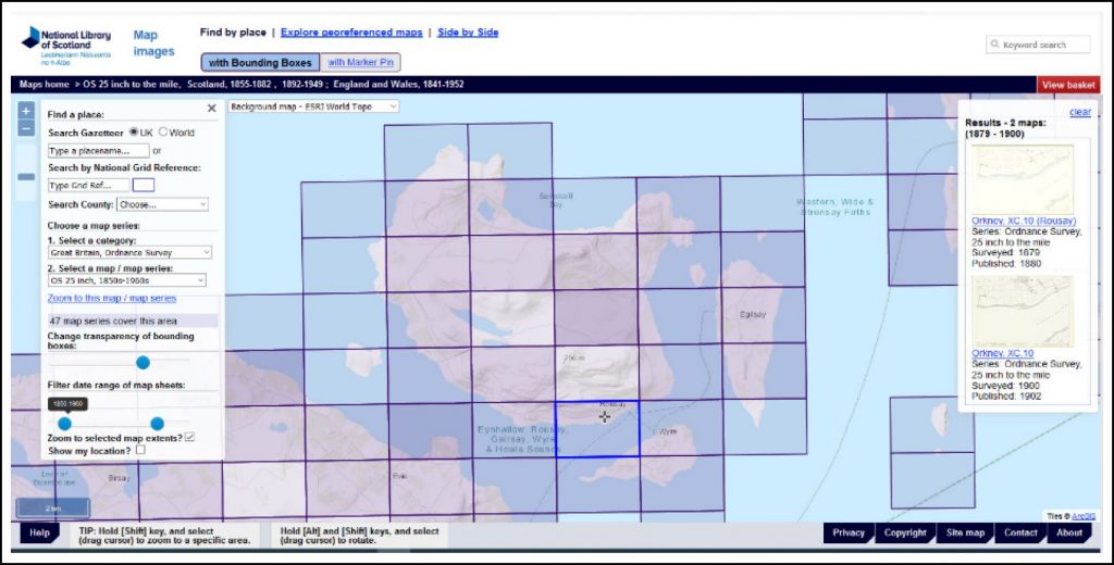
National Library of Scotland Find by Place map screen above, showing the selection menus on the left, map sheets for Rousay, Egilsay and Wyre, and the available series in the right hand menu.
Side by Side Viewer – now this is great! Move the slider at the top of the map to switch between historical maps of your choice and satellite imagery. This is a really handy tool to see how things have changed. For a dramatic example in Orkney, see the Flotta Oil Terminal.
Browse by Mapmaker – find and explore mapmakers in Scotland and view their maps. Have a look at Murdo McKenzie’s 1750 maps of Orkney, including this one showing Rousay, Egilsay and Wyre.
Other ‘Map Images’ resources include estate maps, coastal charts and Bartholomew maps.
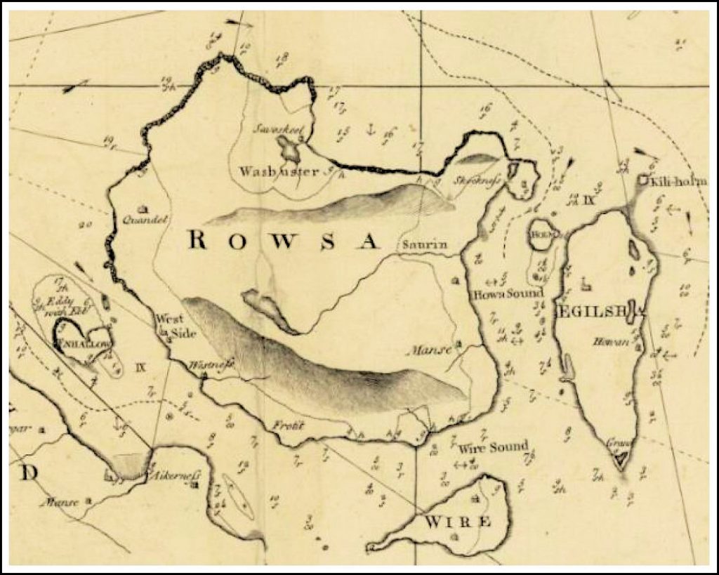
Above, an extract from Murdoch Mackenzie 1750 map of the north west Coast of Orkney (available from National Library of Scotland)
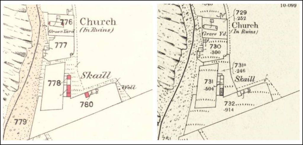
Above are Ordnance survey maps showing Skaill farmstead and St Marys Church, Westness, Rousay. The left-hand map was published in 1880 (Orkney LXXXIX.4, National Library of Scotland). Note parts of the farmhouse and barn are roofed (red areas). The right-hand map was published in 1902 (Orkney LXXXIX.4, National Library of Scotland). Note, in a short period of time only part of the farmhouse is roofed (hatching) and a wall has been built to the east.
Aerial mapping:
You can access high resolution modern aerial maps online. Map sets used by different providers are taken at different times and can show different things. Comparing aerial maps is therefore a useful tool to identify recent changes. Sometimes maps change when you zoom in and out a different data sets are used at different scales.
Google Earth – good all-round mapping for Orkney. Install Google earth for best results but you can also view online.
Bing Maps Aerial View – high resolution maps for Orkney which can be viewed online. This also has Ordnance Survey maps as a selectable layer.
Canmore – there are lots of air photos on Canmore for various sites. HES has a specific air photo team who record sites form the air.
National Collection of Aerial Photography – Searchable collections for the UK with galleries and features.
Vertical and Oblique Aerial photographs – aerial photographs taken at an angle (oblique) and straight down (vertical) from an aeroplane are very useful for archaeologists. Different light conditions, snow and crop marks created by different crop heights from areas of drying in fields caused by buried archaeology. These are all very useful to identify new sites and map extensive areas. For example, whole prehistoric settlements can show up as crop marks in field of wheat given the right ground conditions and light.
[Task 2: Go to the National library of Scotland Website, Digital resources, map Images. Using Find By Place, select the ‘OS 25 inch, 1850s-1960s’ map series. Locate your house on the map or another place of interest. Select the corresponding map sheet. The maps available are displayed in a right-hand menu. Select the map published in the 1880. then compare it to the map published in 1902. Use the Side by Side viewer to look at the same location. Can you see any changes in the buildings and fields? How does that compare to what is there now? Can you see any very recent changes by comparing modern aerial maps?]
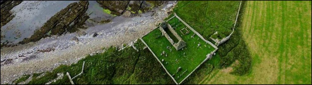
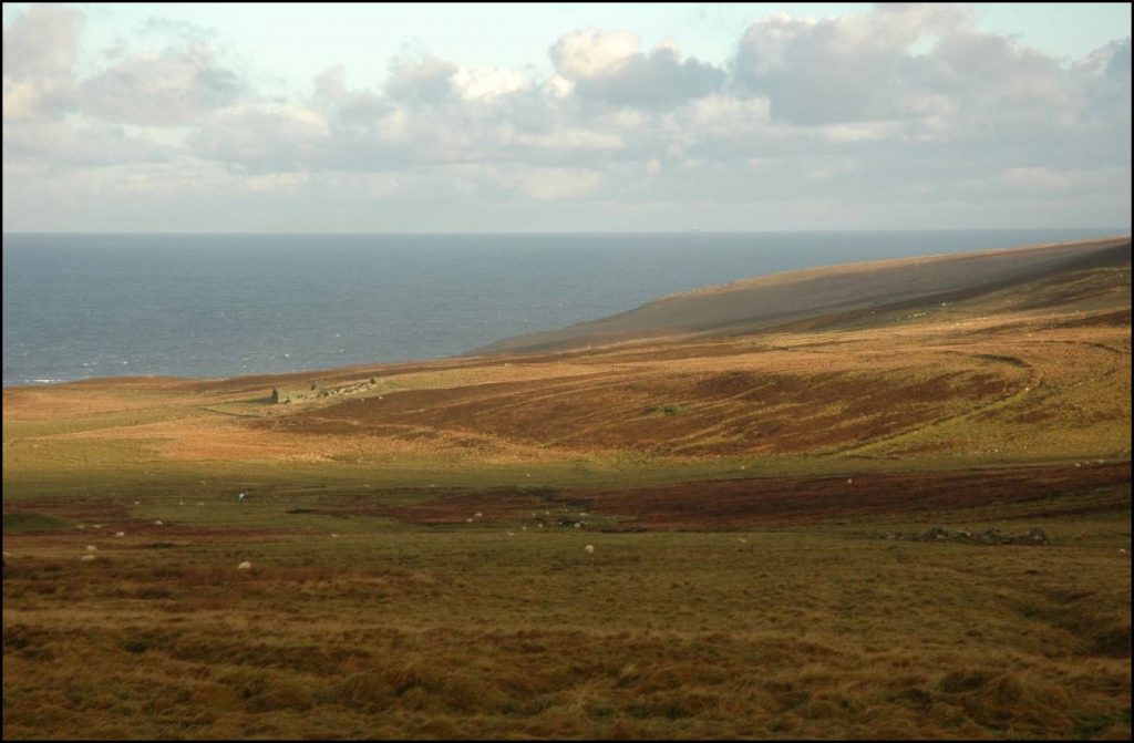
(Image: Bobby Friel @TakeTheHighView).
Historical research:
There are lots of resources available online for historical research. Many of these are offering free access whilst they are closed. Below is a list of useful resources and links:
• Orkney Archive guides – download a guide to the records held by the archive.
• National Records of Scotland – Research collections include registers of births, deaths, marriages etc., government records, courts and church records, census books, NHS register and more.
• The National Archives at Kew host historical records for the UK. There are many records for Orkney. The National Archives are offering free access to their digital archives whilst they are closed to the public.
• Tobar an Dualchais – online repository of Gaelic and Scots recordings made by the School of Scottish Studies, University of Edinburgh, includes a wealth of Orkney material.
• National Library of Scotland, digital resources including map images, moving images, digital gallery and research tutorials – they have beginners learning resource to learn more about reading and using historical maps.
• Internet Archive, many Orkney-related published books that are out of copyright are available here. For examples is a search for keyword ‘Orkney’ to show the variety
• British History online (currently free access)
• Gen UK website: wide range of historical information, with a Rousay and Egilsay bibliography
• JISC Historical Texts – https://historicaltexts.jisc.ac.uk/
• Rentals of the County of Orkney: Peterkin’s 1820 compendium of all the rentals from 1497 to 1739, digitised by Google. Rousay, Egilsay and Wyre are listed showing what rents were paid for farms (often in produce).
• The Statistical Accounts of Scotland 1792 – 1845 with some listings for Rousay and Egilsay.
• Orkneyjar – a website dedicated to the preserving, exploring and documenting the ancient history, folklore and traditions of Orkney, created by Sigurd Towrie.
• Orcadian genealogy – Page of resources hosted by Orkneyjar website
• Family Search – genealogy records for Orkney, with parish records for Rousay and Egilsay (Wyre was often included with Rousay)
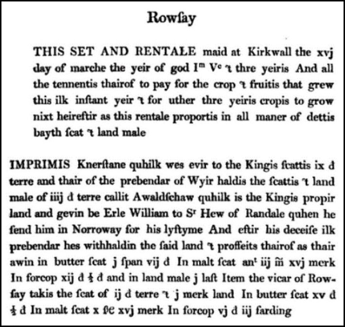
of the Orkney rentals, here page 74 from
Lord Sinclair’s Rental 1497 – 1503.
Resources list:
This section lists online resources that are specific to Rousay, Egilsay and Wyre. Click on the links which will take you to websites and resources.
Rousay:
Rousay Remembered – local history, archaeology and folklore
Rousay Roots – genealogy (warning, unsecure website)
Discover Rousay
Vision of Britain
Swandro excavations website (includes links to reports)
3D models:
There are several 3D models of sites on Rousay. Follow the links below to load them and explore sites from the comfort of your home!
Taversoe Tuick Chambered Cairn, Rousay
Blackhammer Chambered Tomb
Midhowe Chambered Cairn (expansive)
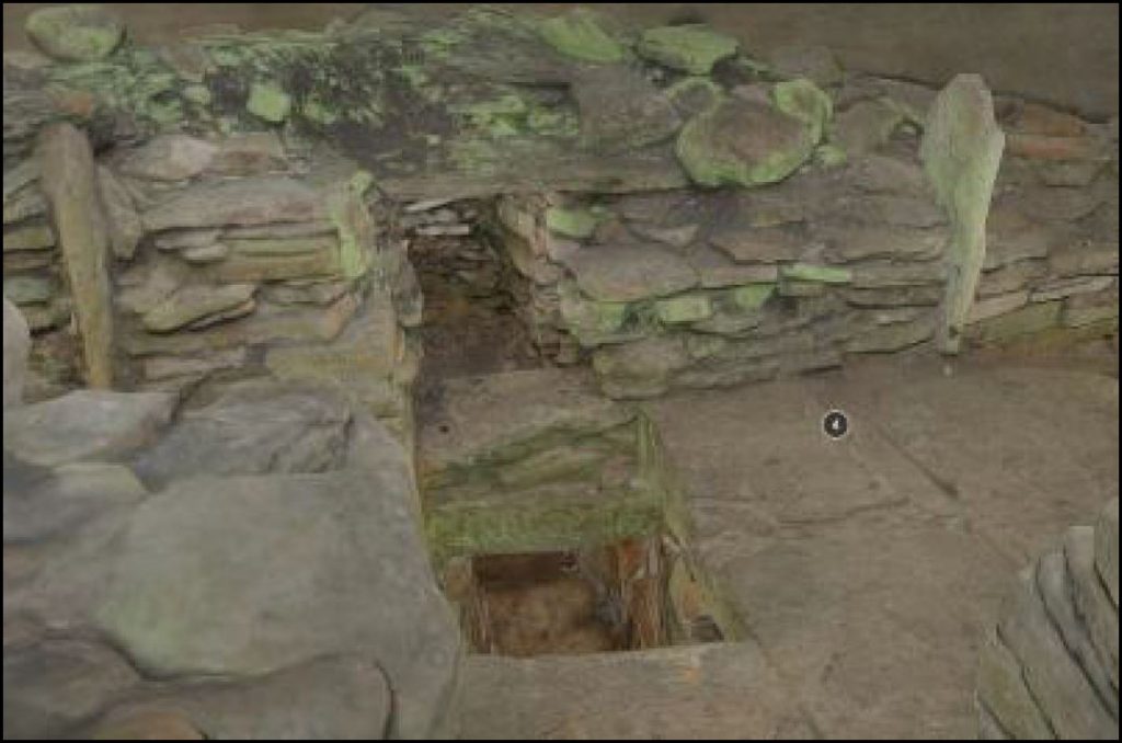
Midhowe Chambered Cairn (chamber)
Lairo tomb
Knowe of Yarso
Kierfea Hill chambered cairn, Rousay
North Howe Broch, Westness, Rousay
(Historic Environment Scotland)
Finds:
3D models have been made stones tools, click the links below:
Carved stone ball, Rinyo
Largs-type macehead, Rousay
Sculpted stone, Rinyo
Neolithic stone axe, mid Howe Broch, Rousay
Pestle Macehead, Taversoe Tuick Tomb, Rousay
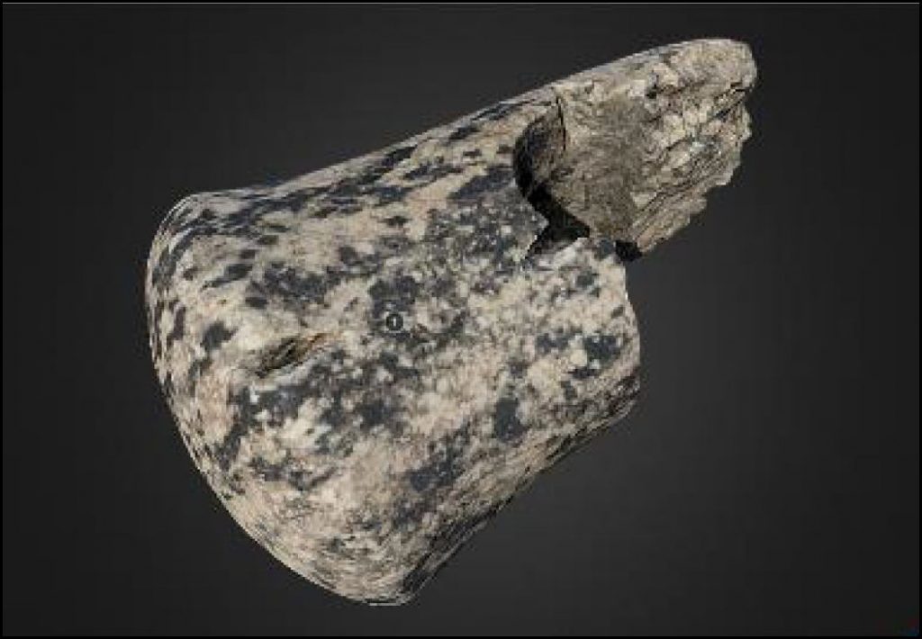
(Image: Hugo Anderson Whymark).
Sites:
Follow the links below for detailed description of sites from the Orkney Stone Tools project:
Blackhammer Chambered Cairn
Rinyo Neolithic settlement
Midhowe Chambered cairn
Rowiegar Chambered Cairn
Rowiegar film (c.1937) silent film of the excavations made by William Kirkness.
Taversoe Tuick Chambered Tomb
People:
Follow the links below to find out about some of the people who excavated and recorded archaeological sites in the early 20th century, from the Orkney Stone Tools project:
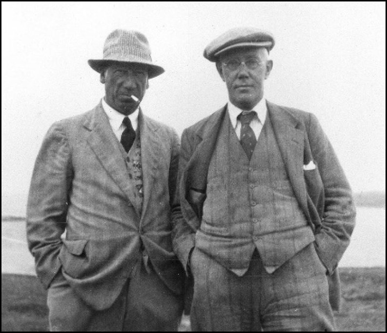
J. Graham Callander – worked with Walter grant to excavate sites in Rousay in the 1930s
Vere Gordon Childe – excavated Skara Brae and Rinyo (Rousay) Neolithic settlements
Joseph Storer Clouston – excavated at Cubbie Roo’s Castle (Wyre) and The Wirk (Rousay)
John Corrie – made the first inventory of Orkney archaeological sites in the 1920s
Walter Grant – owner of Westness estate in early 20th century, excavated many sites. There is an appreciation of him here.
Egilsay:
Egilsay Community Association
Vision of Britain
Orkneyology
Pestle Macehead, Egilsay
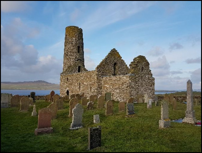
Key sites: St Magnus’s Church, Onziebist chambered cairn
Wyre:
Scottish places
Orkneyjar, Cubbie Roo’s Castle
Canmore enties for Cubbie Roo’s Castle and St Mary’s Chapel, Wyre.
Film. Drift Back (Margaret Tait 1957)
Eynhallow:
Orkneyjar, Eynhallow and the lost kirk. An island steeped in folklore.
Vision of Britain
Canmore entry for Eynhallow Monastery
The Landscapes of Eynhallow – dissertation report available
The Eynhallow Landscape Project 2007 Includes a link to the report where you can see the results of geophysical survey around the monastery and island walkover survey.
Current archaeological projects:
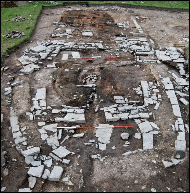
Landscapes of Change: Archaeologies of the Rousay clearances and the Westness Estate: Skaill farmstead, Westness, Rousay:
UHI excavations in 2019 discovered a Norse hall below the post-medieval farmstead.
Videos of Skaill
TV programme – Digging for Britain Series 8, Episode 2, North (Skaill features)
3D models of the farmstead – Domestic range and kiln barn
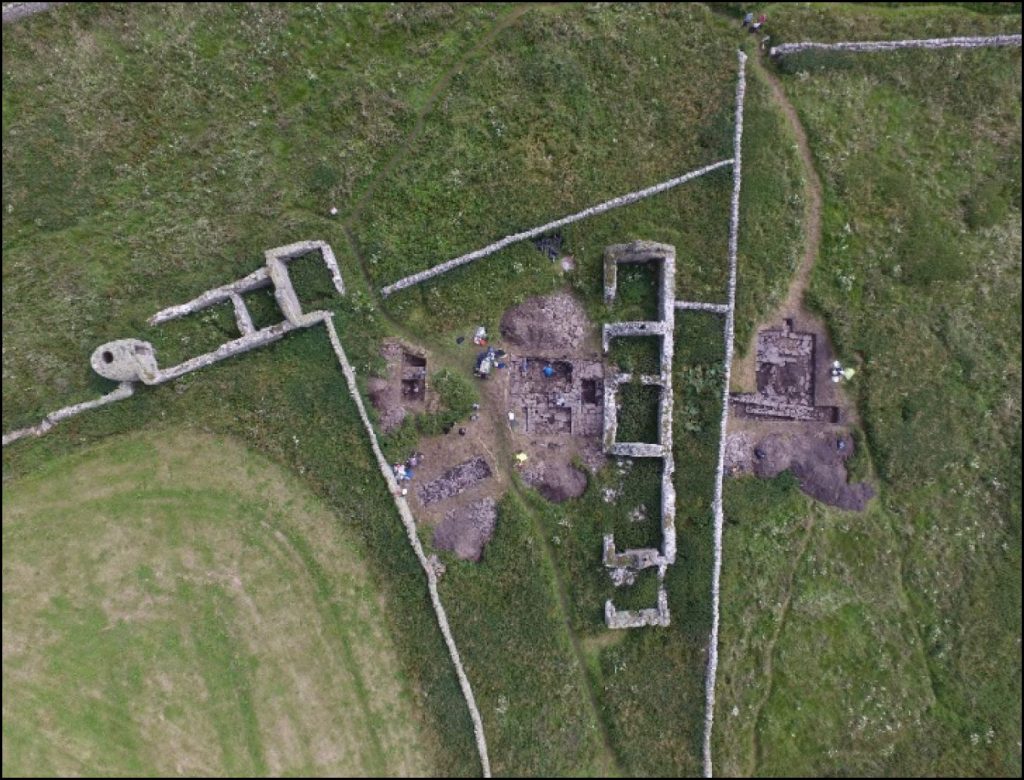
Swandro, Westness, Rousay:
The excavation has its own website with background, reports, a yearly dig diary and information about coastally eroding archaeology.
[Task 3: Pick a farmstead. Can you find any entries in the Orkney rentals? Is there any census information about the people who lived there? Are there any records held in the National Records of Scotland archives? Can you find any relevant documents in the Orkney Library and Archive? Ask your friends and neighbours if they have any stories.]
Quandale, Westness, Rousay:
Quandale was the only large-scale area in Orkney which was cleared in the 19th century. A landscape survey was undertaken in 2008 and the report can be found here. This has also been summarised in a paper which you can download here.
Brae of Ha’breck, Wyre:
Excavations at this Neolithic settlement were undertaken in 2006 to 2013 by UHI. A summary in Current Archaeology is here. More detailed information can be found in a paper available here.
Further reading:
Available at the Orkney Library and Archive
Clouston, J.S. 1922. ‘Old Orkney Houses I’. Proceedings of the Orkney Antiquarian Society 1 (1922-3), 11-19.
Fenton, A. 1997. The Northern Isles: Orkney and Shetland. (Reprint of 1978 edition). Phantassie, East Lothian: Tuckwell Press
Lamb, R. 1982. The Archaeological Sites of Rousay, Egilsay and Wyre, Orkney. Archaeological Sites and Monuments of Scotland Series No. 16. Edinburgh: RCAHMS.
Marwick, E.W. 2000. The Folklore of Orkney and Shetland. (Reprinted from 1975 edition). Edinburgh: Birlinn.
Marwick, H. 1947. The Place Names of Rousay. Kirkwall: Macintosh.
Newman, P. & Newman, A. 1993. ‘Quandal: The buildings in a pre-improvement agricultural community on Rousay, Orkney. Vernacular Building 17, 23-35
RCAHMS 1946. Twelfth Report and Inventory of the Ancient Monuments of Orkney and Shetland. (Volume II: Orkney). Edinburgh: HMSO
Thomson, W.P.L. 1981. The Little General and the Rousay Crofters. Crisis and Conflict on an Orkney Crofting Estate. Edinburgh: John Donald
Thomson, W.P.L. 2008. The New History of Orkney. Birlinn, Edinburgh.
Thomson, W.P.L. 2008. Orkney Land and People. The Orcadian Limited (Kirkwall Press), Kirkwall.
Credits:
Published: August 2020
Resources Pack Author: Dan Lee ORCA / UHI Archaeology Institute

REWDT Project Lead: Helen Castle
Funded by: #WellbeingFund Hunter Foundation

Voluntary Organisations
Copyright: CC-BY-NC
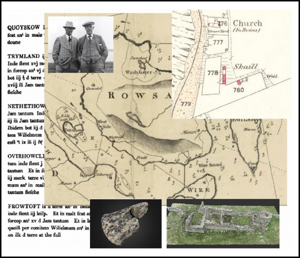
Cover images: Maps – National Library of Scotland, people – Orkney SMR, text – Peterkin 1820, Orkney rentals, 3D models – Hugo Anderson Whymark / UHI Archaeology institute.
This page is also available as a Portable Document Format (PDF) download.
Digital-Archaeology-and-Heritage-resource-pack
Below is a link to four YouTube videos of talks by the project team on the background, place names, survey & excavation, and marine resouces at Skaill farm, Rousay, Orkney. The team from the University of the Highlands and Islands (UHI) Archaeology Institute have been working at this Norse to post-medieval farmstead since 2015. In 2019 a large Norse hall was discovered.
Video talks about the Skaill project