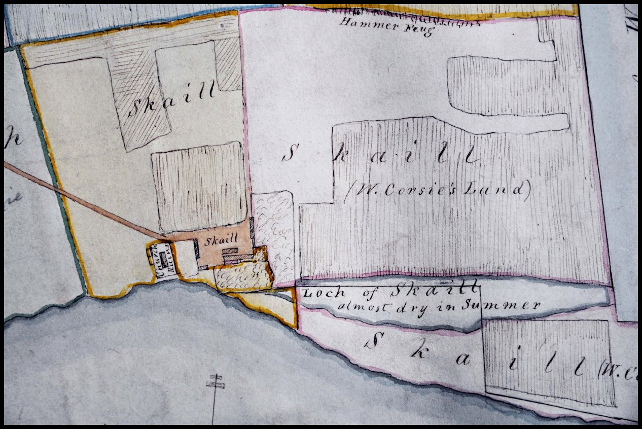
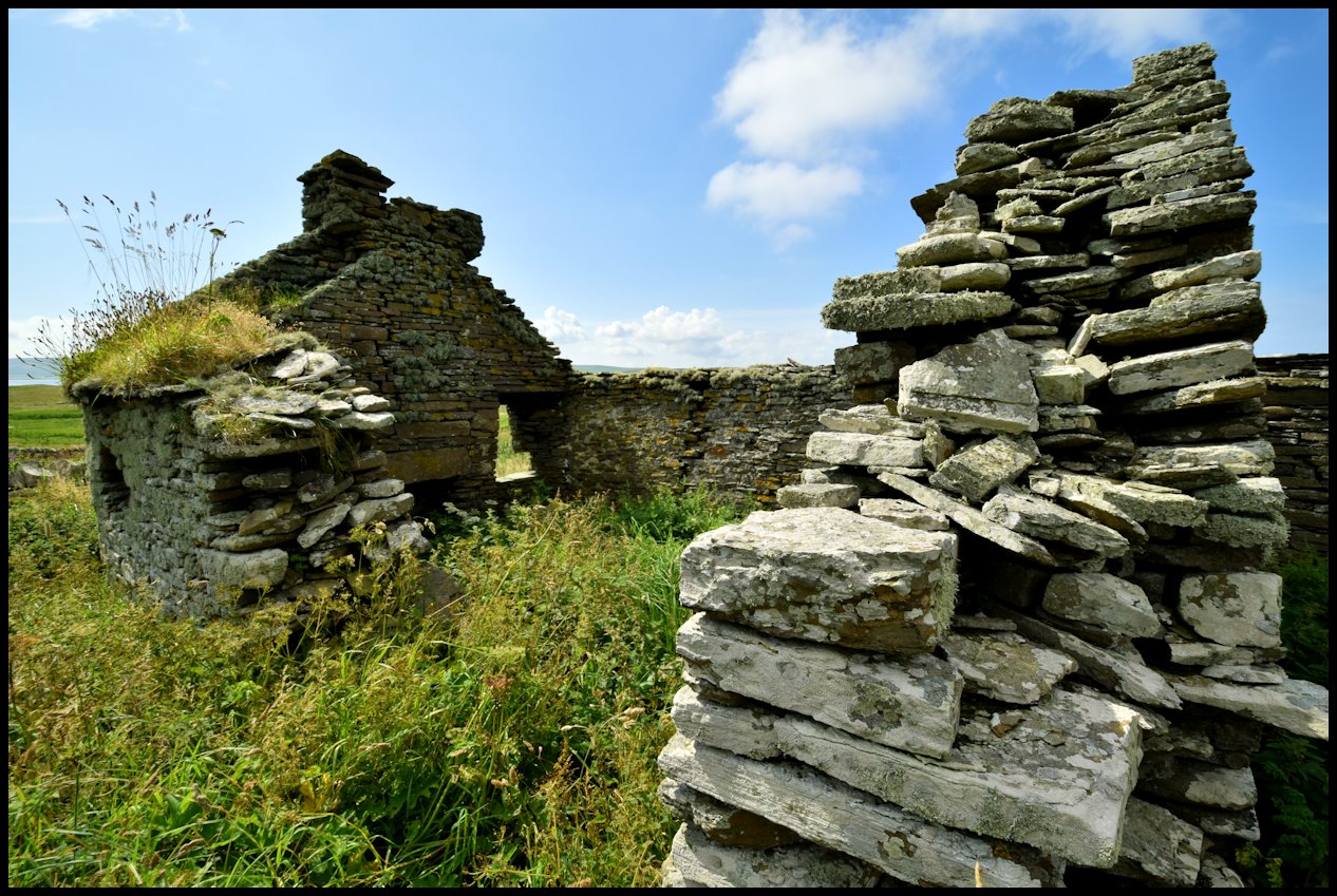
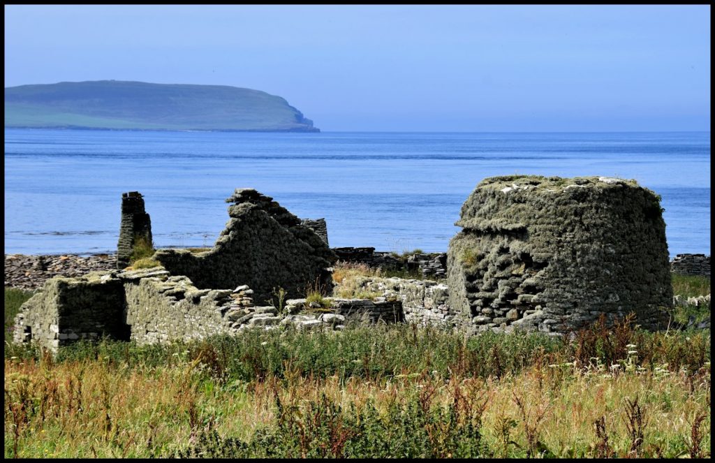
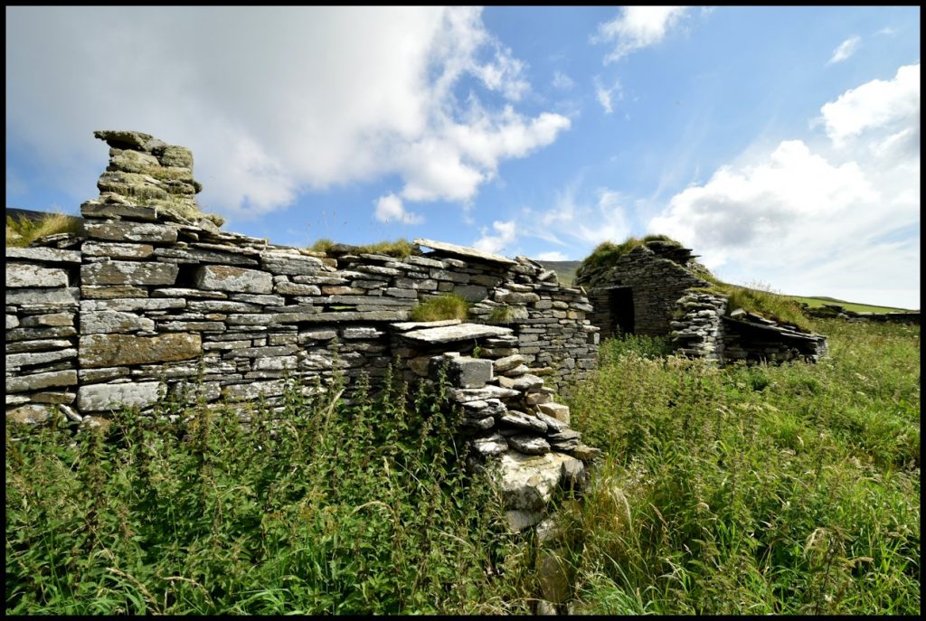
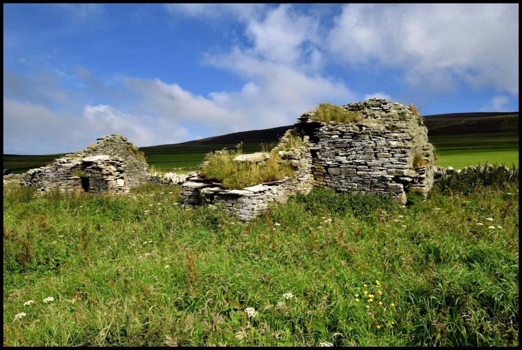
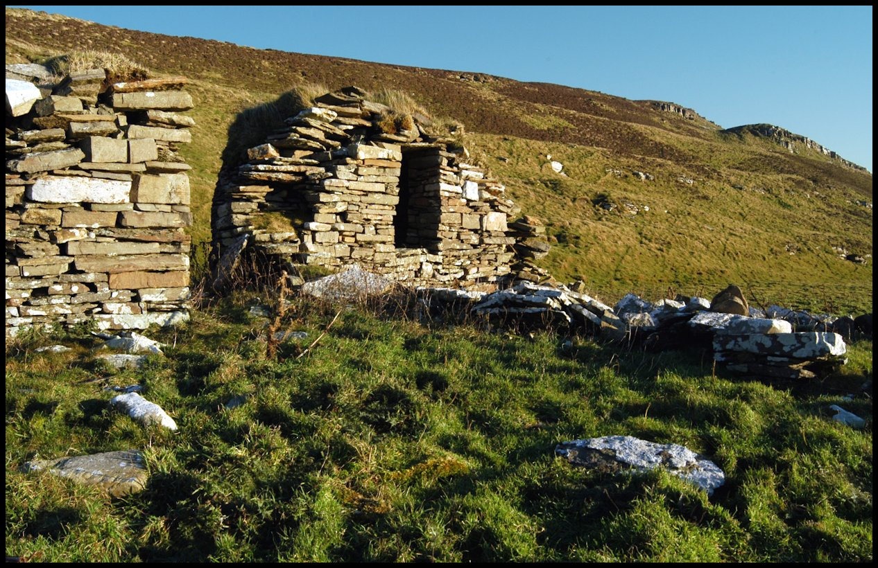
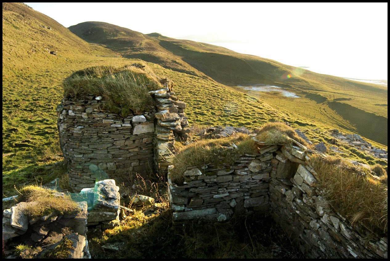
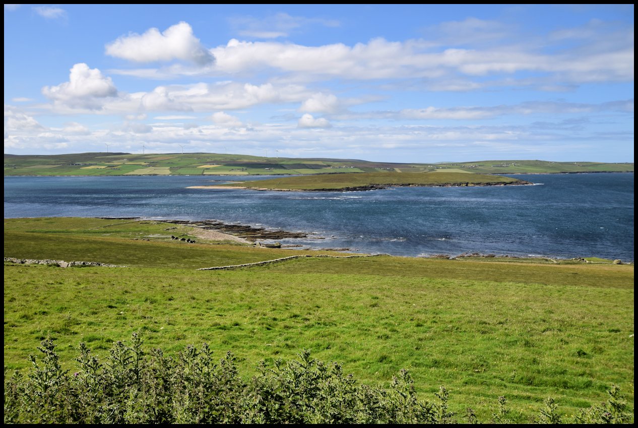
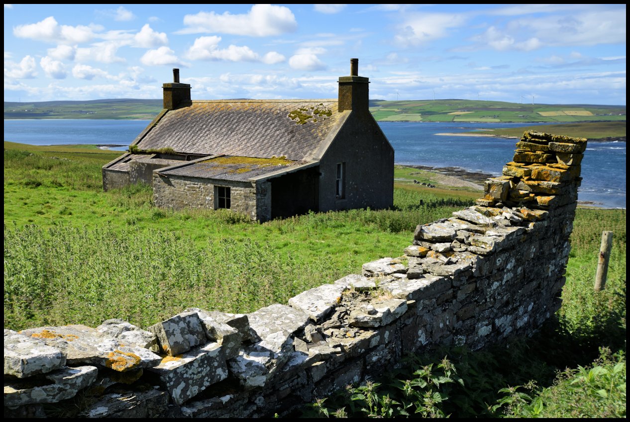
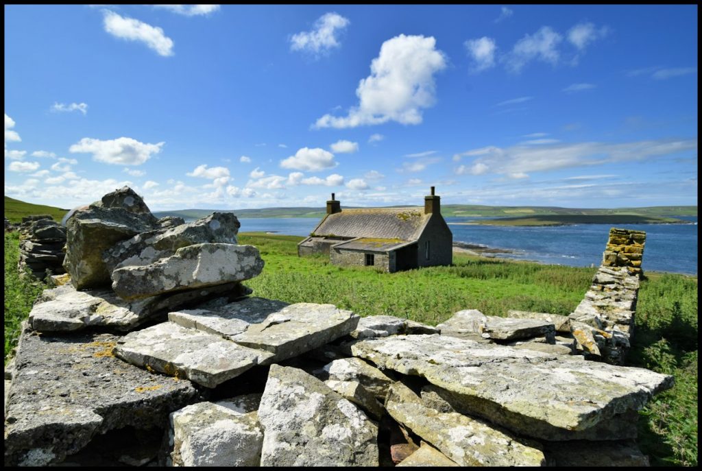
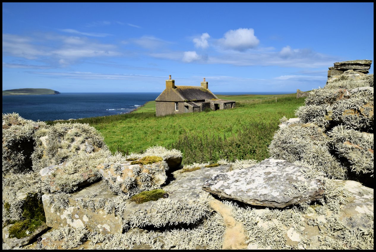
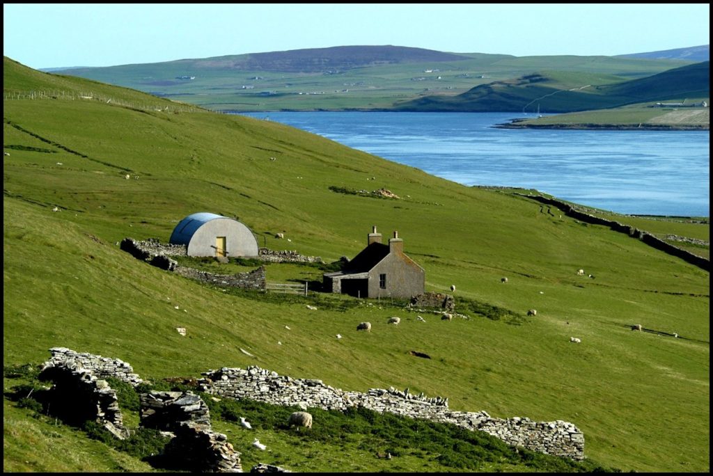
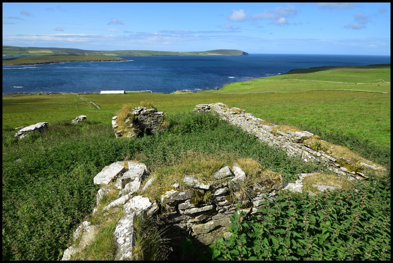
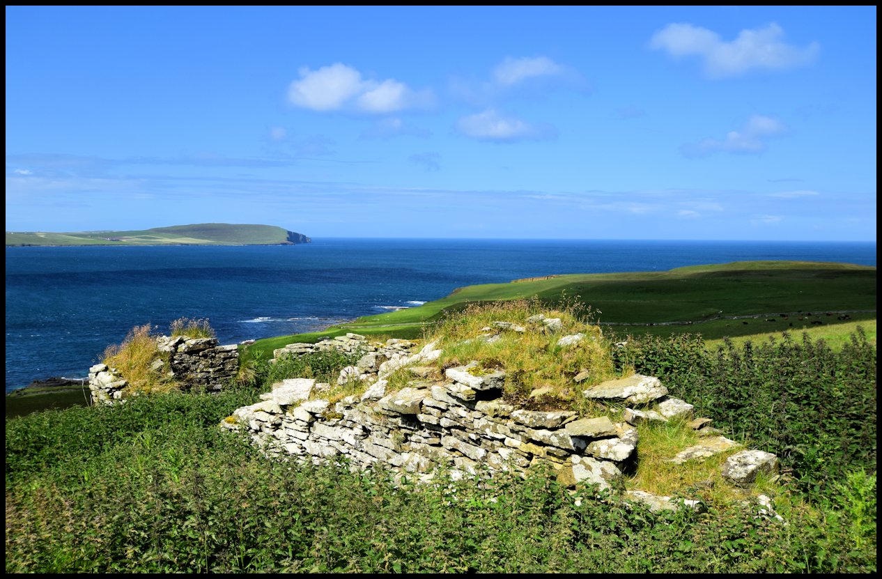
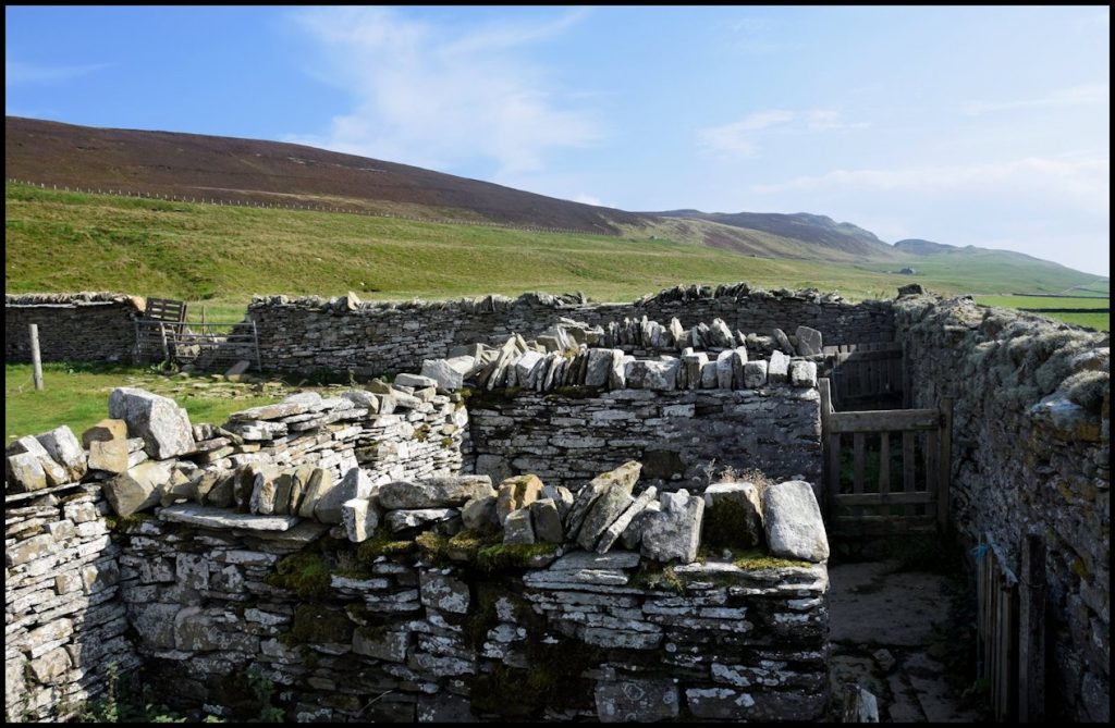
Skaill is a deserted farm on the Westside, adjacent to The Wirk and St Mary’s, the old parish kirk. In Old Norse the word skáli means hall or house.
Marjory Sandilands was the tenant of Skaill from 1586 to 1593, followed by Hugh Craigie from 1626 to 1651, and Magnus Craigie from 1651 to 1679. George Moss held the tenancy briefly in 1735, as did John Robertson in 1736. James Donaldson was there between 1781 and 1785, but then it reverted to Hugh Craigie and his brother Henry, between 1785 and 1793. James Yorston and Hugh Craigie were joint tenants from 1793 to 1796, but between 1796 and 1799, James Yorston was the lone tenant, as was William Louttit in 1799.
In the early 1800’s Drummond Louttit and William Corsie were joint tenants. Drummond was born about 1774, and he married 27-year-old Betty Flaws on September 7th 1804, and they had seven children between 1807 and 1823. Drummond farmed the land which surrounded the farm at Skaill.
William Corsie was the son of William Corsie and Margaret Harkus and he was born on September 30th 1799. He married Janet Louttit, one of twin daughters born to William Louttit and Isabella Craigie of Faraclett on January 19th 1803. Between 1826 and 1844 they had eight children, the second oldest of whom was Harriet, who later married the Rev. James Gardner.
By 1851 Drummond Louttit and his family had moved to Scar and William Corsie was the sole tenant of Skaill, paying an annual rent of £12 9s. 6d. Daughters Harriet and Eliza were employed at home, 18-year-old son John worked on the farm, and youngsters James, Allan, and Lydia were all at school at this time. His oldest son, 25-year-old William, was an agricultural labourer, and his 25-year-old wife Harriet and their six-month-old son Charles also lived at Skaill.
William and Janet Corsie both died in 1863, at the ages of 64 and 60 respectively.
In the early 1860’s, Skaill was occupied by stonemason Alexander Gibson and his wife Janet Marwick. Alexander was the son of James Gibson and Katherine Inkster of Stennisgorn, Wasbister, and was born in 1789. On January 10th 1822 he married 23-year-old Janet Carmichael Marwick, the daughter of David and Janet Marwick of Force (Furse), Wasbister and they had six children born between 1823 and 1838; Betty and John Inkster were born at Stennisgorn; Janet and Mary Sarle were born at Bucket, Wasbister; David was born at Hulterburn (Kirkgate); and James was born at Pow, Westside. Later the family lived at Geo, Westness, and latter still the parents lived at Skaill. Alexander died in 1873 when he was 84 years of age, and Janet died in 1878 at the age of 81.
Also living at Skaill at this time was Barbara Smith, an unmarried 38-year-old general servant, her widowed mother Ellen Yorston who was 74, and her two nephews, 17-year-old George Smith, a house carpenter, and his brother John, who was 13.
In 1871, Barbara was employed as an agricultural labourer and nephew John earned a living as a tailor. In April of that year when the census forms were completed, they had visitors staying with them, 22-year-old Georgina Harcus, who was married to Hugh Inkster of Gorn, and her two children John (3) and Helen (1). Georgina was born in Westray, and was the daughter of John Harcus and Barbara Smith. [Whether these two Barbaras are one and the same I have been unable to ascertain.]
Barbara Smith was the last tenant of Skaill. The census of 1881 tells us she was 57 years of age and still employed as an agricultural labourer – but ten years later Skaill was empty. Barbara had moved into Westness Cottage with her 23-year-old grandson John Inkster, who was employed as a farm servant.
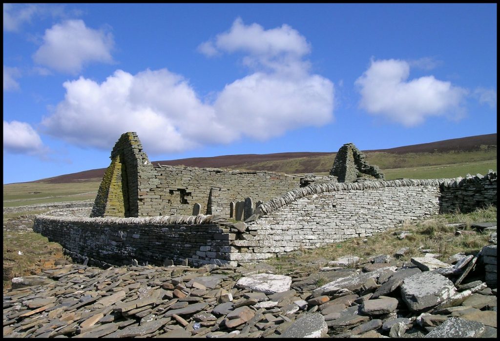
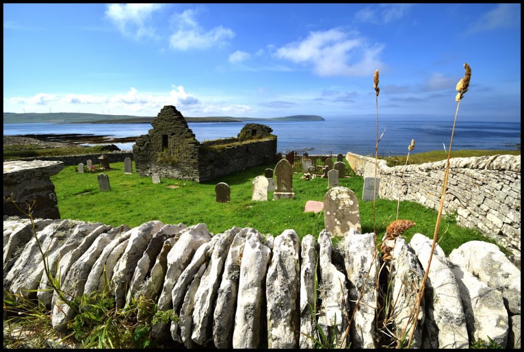
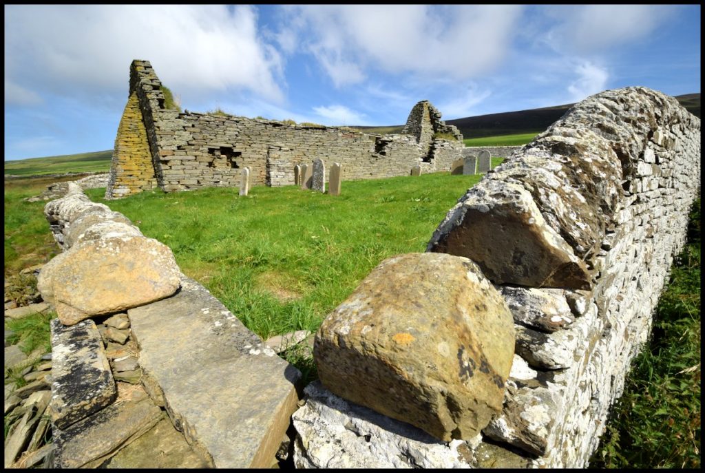
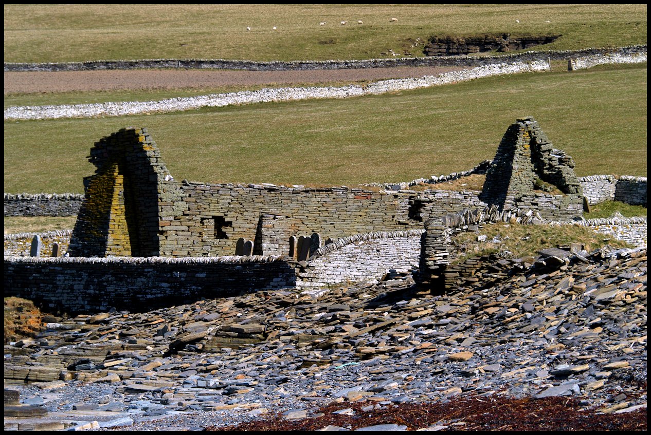
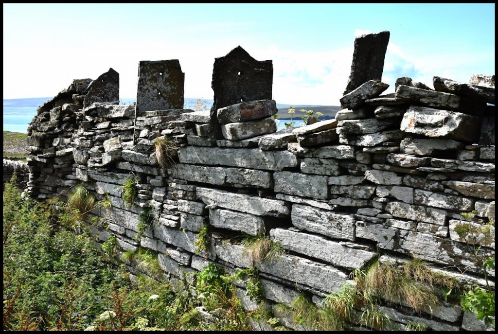
This is all that remains of St Mary’s kirk on the Westside. It is variously referred to as the Swandro or Westside kirk, and is the shell of the former parish church of Rousay, going out of public use when a new kirk was built at the Brinian in 1815. Despite buttresses being built against the outer west and inner east walls in the late 19th century, the structure is in a precarious state.
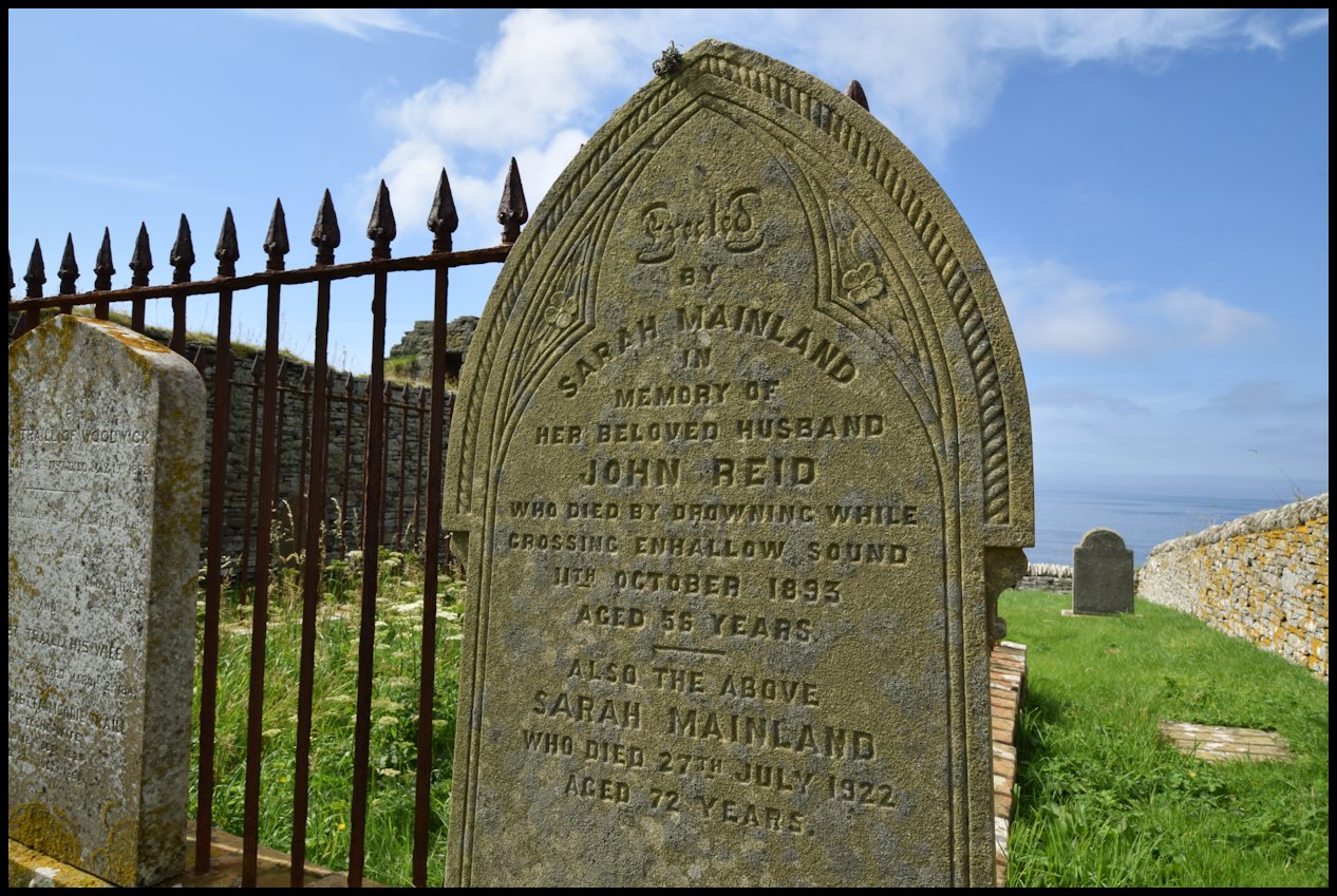
Above are two of the most poignant gravestones in the kirkyard – those of James Sinclair, News, and John Reid, Tratland, who drowned when the mailboat was lost in Eynhallow Sound on October 11th 1893
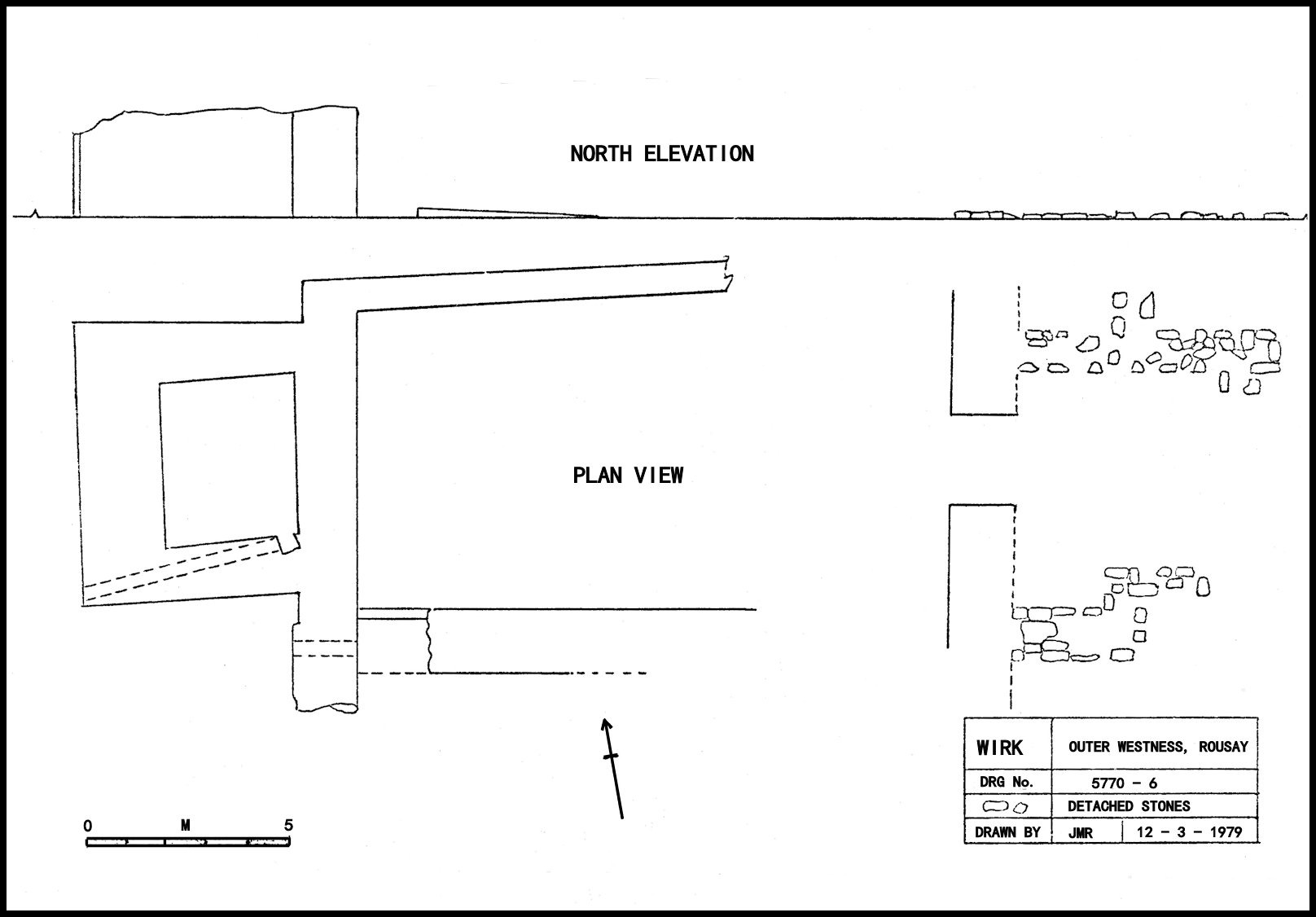
The Wirk
The Wirk is a square tower associated with a large rectangular building which extended into the field on its landward side. The rectangular building is thought to have been a grand hall along the lines of the Bishop’s Palace in Kirkwall, and the Wirk itself was a bell tower. Excavated in 1929 by Joseph Storer Clouston the tower was compared to those in Norway and Sweden, where bell towers are sometimes separate from the actual churches. The nearby kirk in Viking times would have served its purpose for the lord than his people, and such a prestigious place as Skaill could well have had its own church and bell tower.
Brough, spelled Brugh in a rental dated 1503, is the famous old homestead of the Craigie family, situated in Outer Westness. Westness – the home of Earl Paul Thorfinnson’s great friend, Sigurd – features prominently in the Orkneyinga Saga, but there is no doubt at all that Sigurd’s homestead was not at the site of the Westness of today, which is in the old Inner Westness, but at Skaill – in the old Outer Westness. There it must have been that Earl Paul was on a visit at the time of his capture and final disappearance from the Orkney scene.
How much of the original Westness was Sigurd’s own property it is now impossible to say. The Saga twice speaks of Earl Paul as being a veizlu when staying there with his friend Sigurd. Veizla was a technical term for the ‘guesting’ a vassal was obliged to provide for his lord when on a tour round his estates, and hence one would infer that some part, at least, of the Westness area was private earldom property. Sigurd too, was married to a granddaughter of Earl Paul I, and it is possible that part of Westness may have come to him through his wife, as a daughter’s portion.
That is merely a speculation, but two facts may be held to support it. In the 1503 Rental it is recorded that the rents of 2¼ pennylands in Quham, part of Outer Westness, which had belonged to Sir Malise Sperra were then “in Sir Thomas Cragy’s and John Cragy’s hands – I was nocht quhy. Remember thereon…..” The compiler of the Rental apparently suspected that these rents should be paid to the Earl, and intended to investigate the matter. But the real interest lies in the reference to Sir Malise Sperra who had died over a century previously. The Rental further refers to 1½d. land in Quandale, also in Outer Westness, as having belonged to Sir Malise Sperra. He was of course of Earl’s descent, and was an actual claimant for the Earldom in 1379, when it was granted instead to Earl Henry St. Clair. The 1503 Rental mentions his having owned lands also in Instabillie in North Sandwick, and the most obvious explanation is that all these lands represented some part of his udal inheritance through descent from the earls. Here then is a clear hint that part of Westness at least had been in private earldom property.
The other fact is the presence of the Craigies in Rousay, and in particular as the udal owners of Brough in Outer Westness through most of the 15th and 16th centuries. As udallers, their property must have come to them through the female line, for Craigie is of course a Scottish name. One of the earliest recorded in Orkney was James of Cragy – described in 1422 as “dominus in Hupe,” and he was in fact married to a daughter of Earl Henry St. Clair. In an inventory of the Brough charters there is a record of a charter of February 28th 1415 between “the brethren of the Craigies,” and it is not at all improbable that it was through James’s marriage with the Earl’s daughter that Brough first came into Craigie hands.
From the foregoing facts it would appear there is every probability that Sigurd owned at most only part of the old Westness, and that as a gœðing of the earl he held the rest of the estate as veizlu-land from his overlord. He lived there in the 12th century, and three or four hundred years must by then have elapsed since the date of the earliest Norse settlement at Westness.
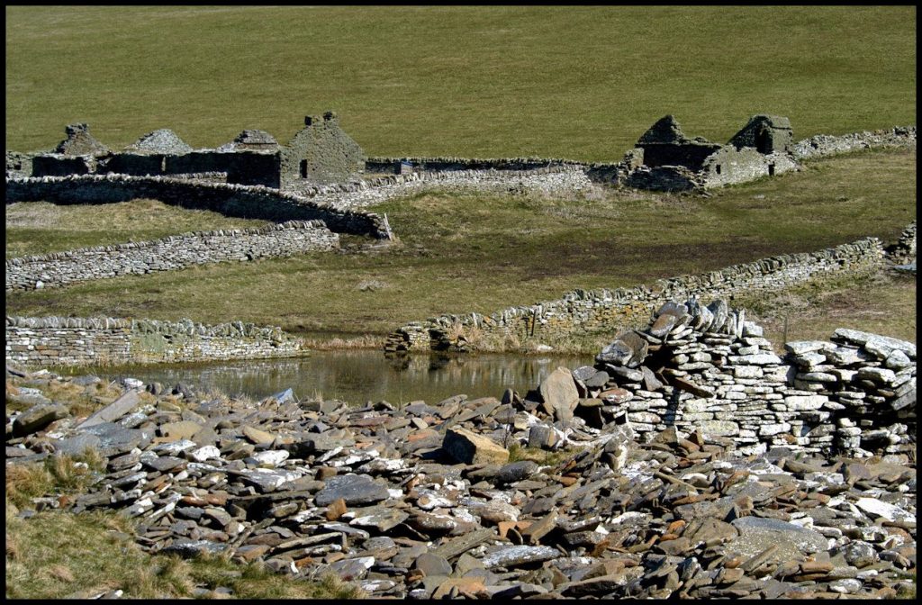
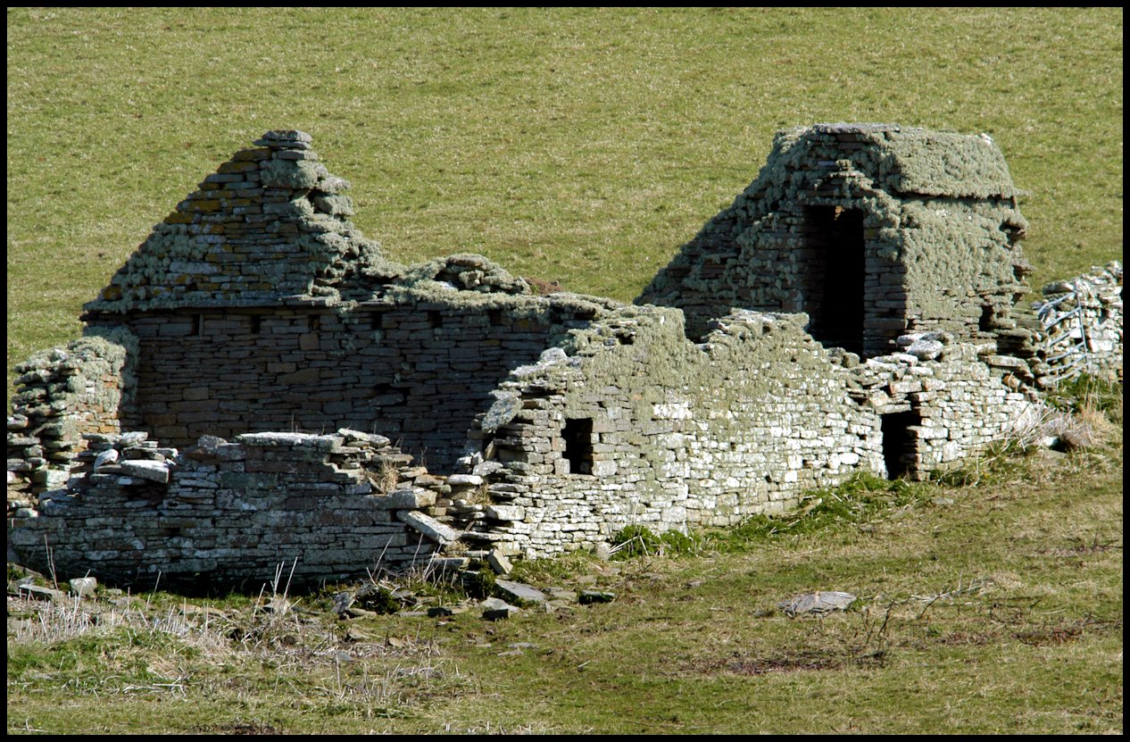
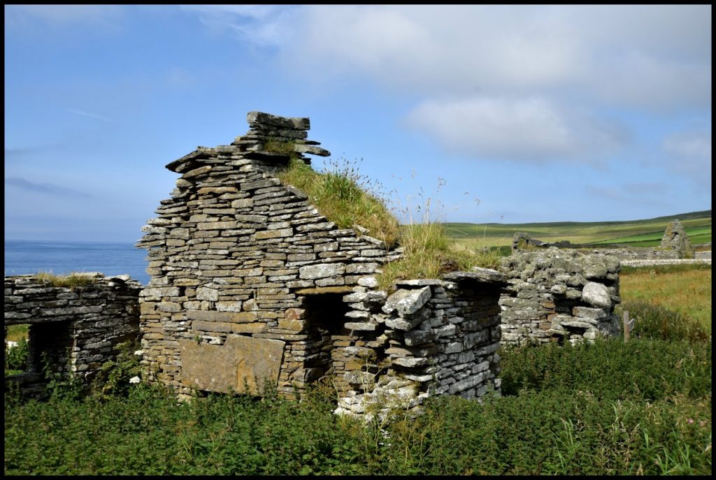
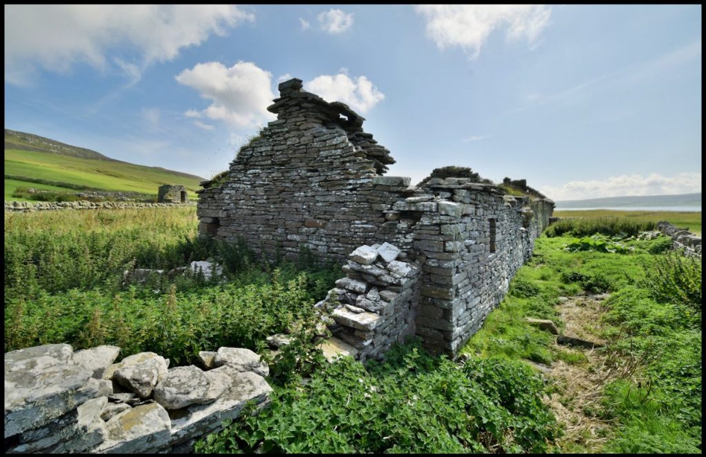
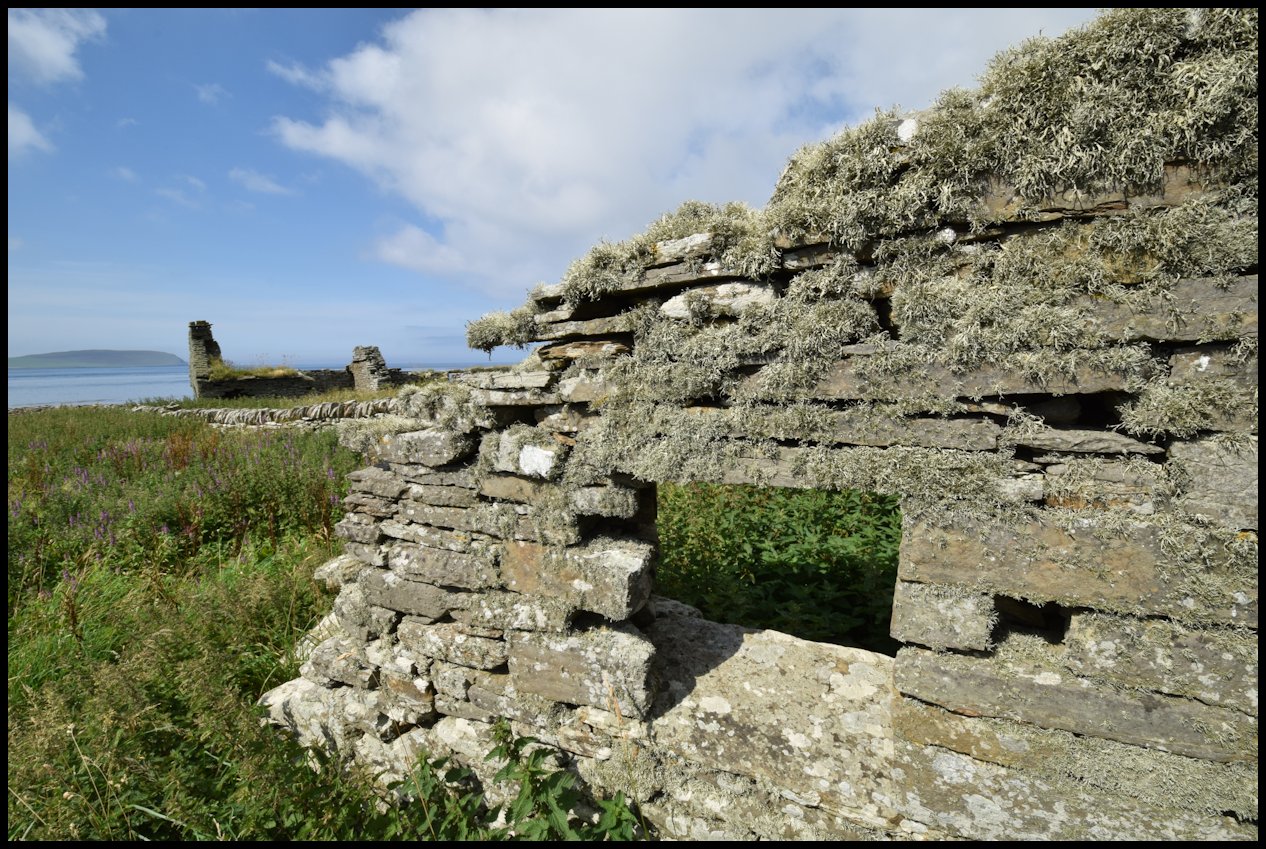
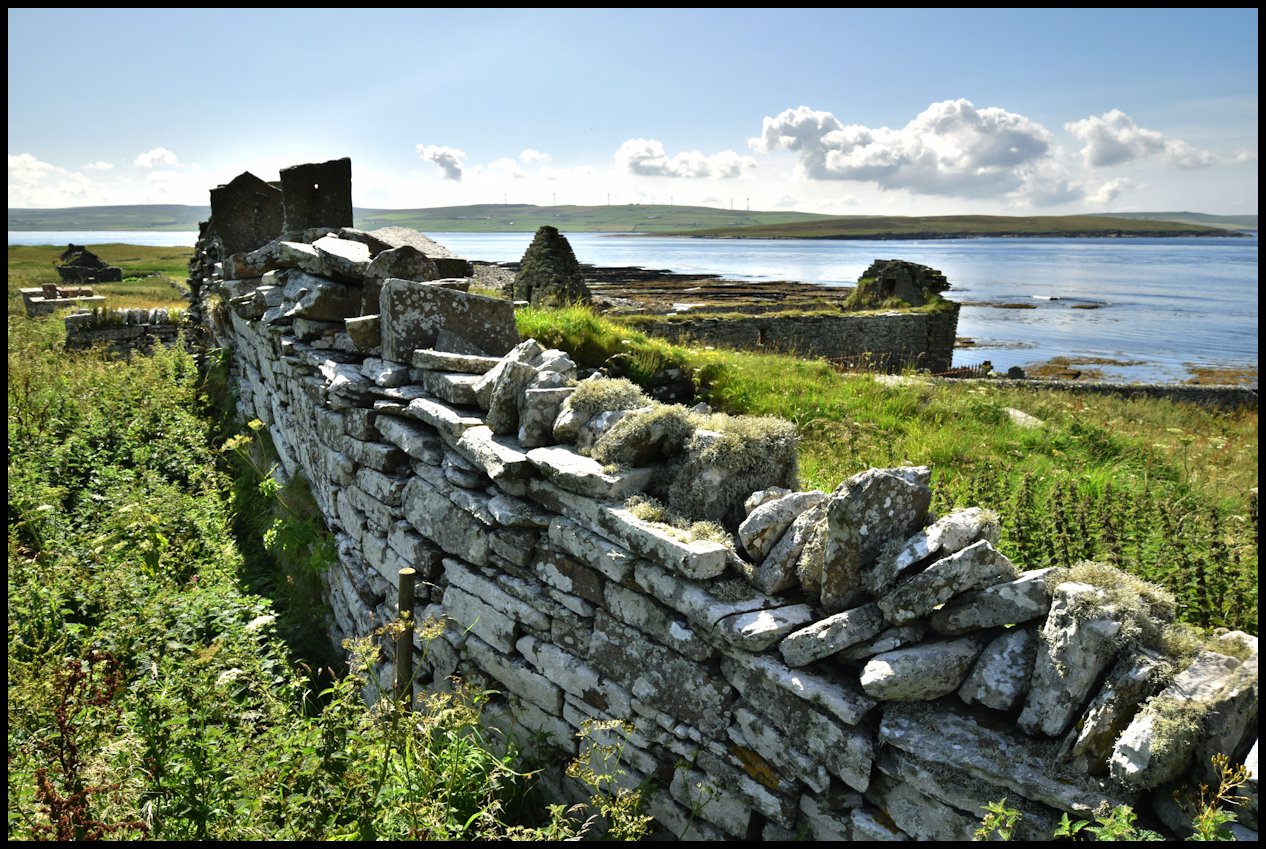
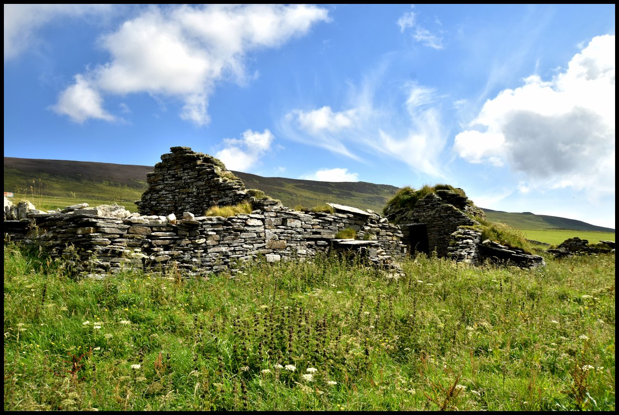
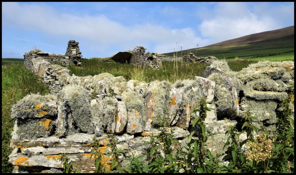
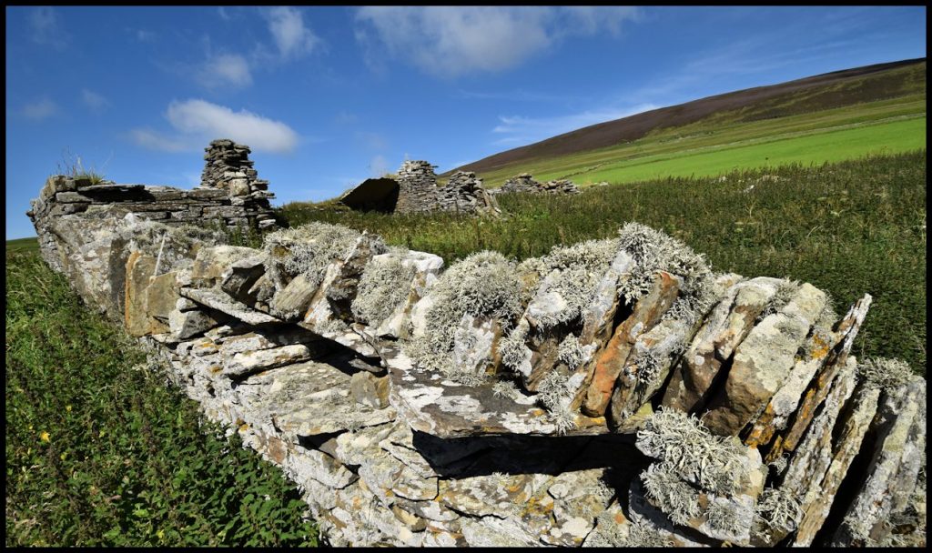
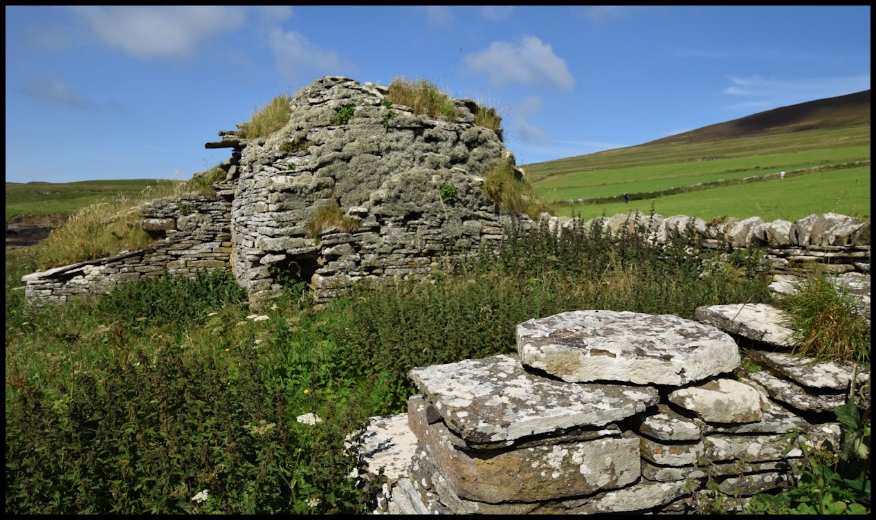
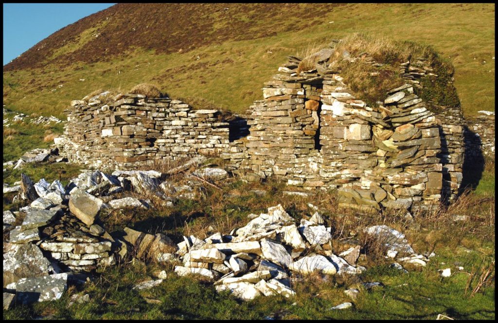
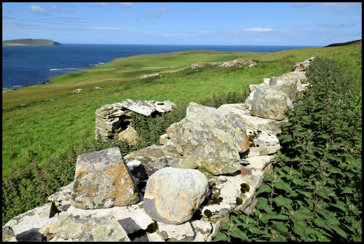
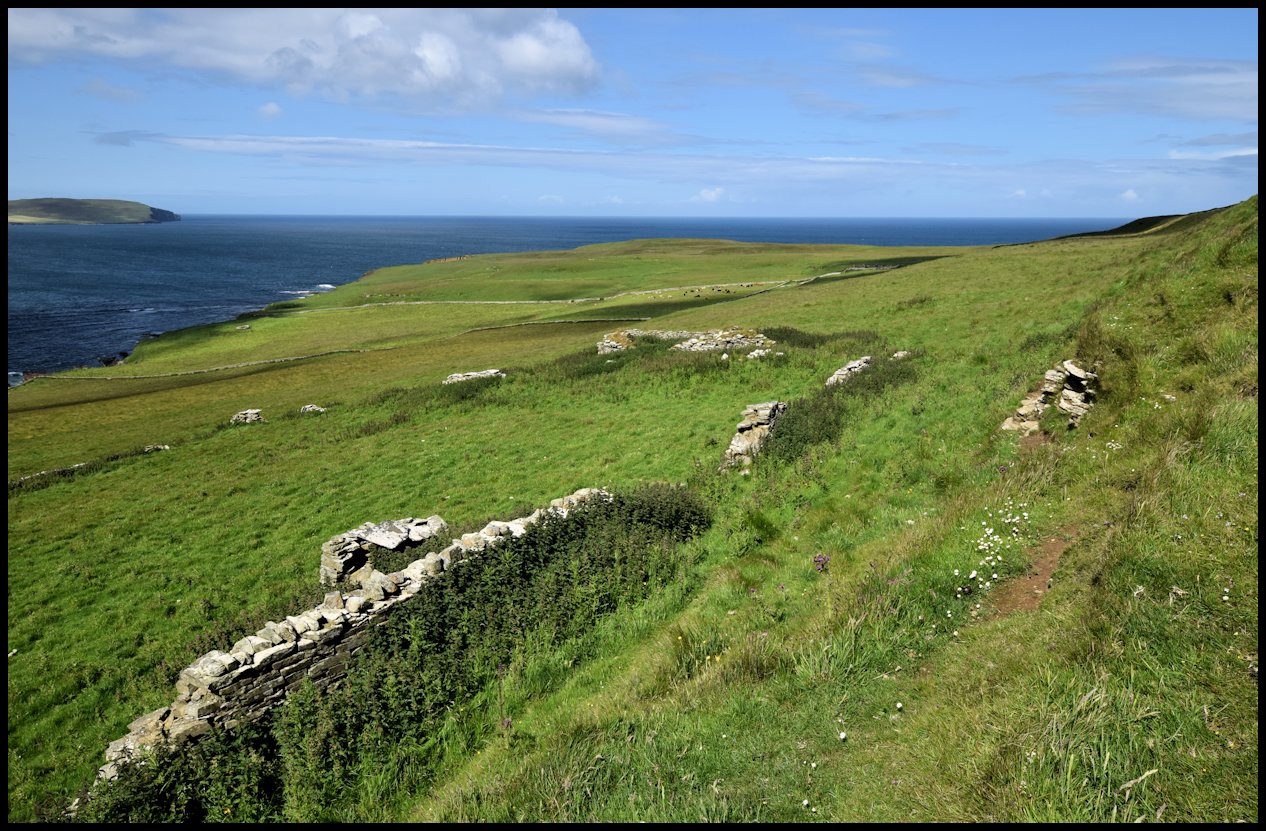
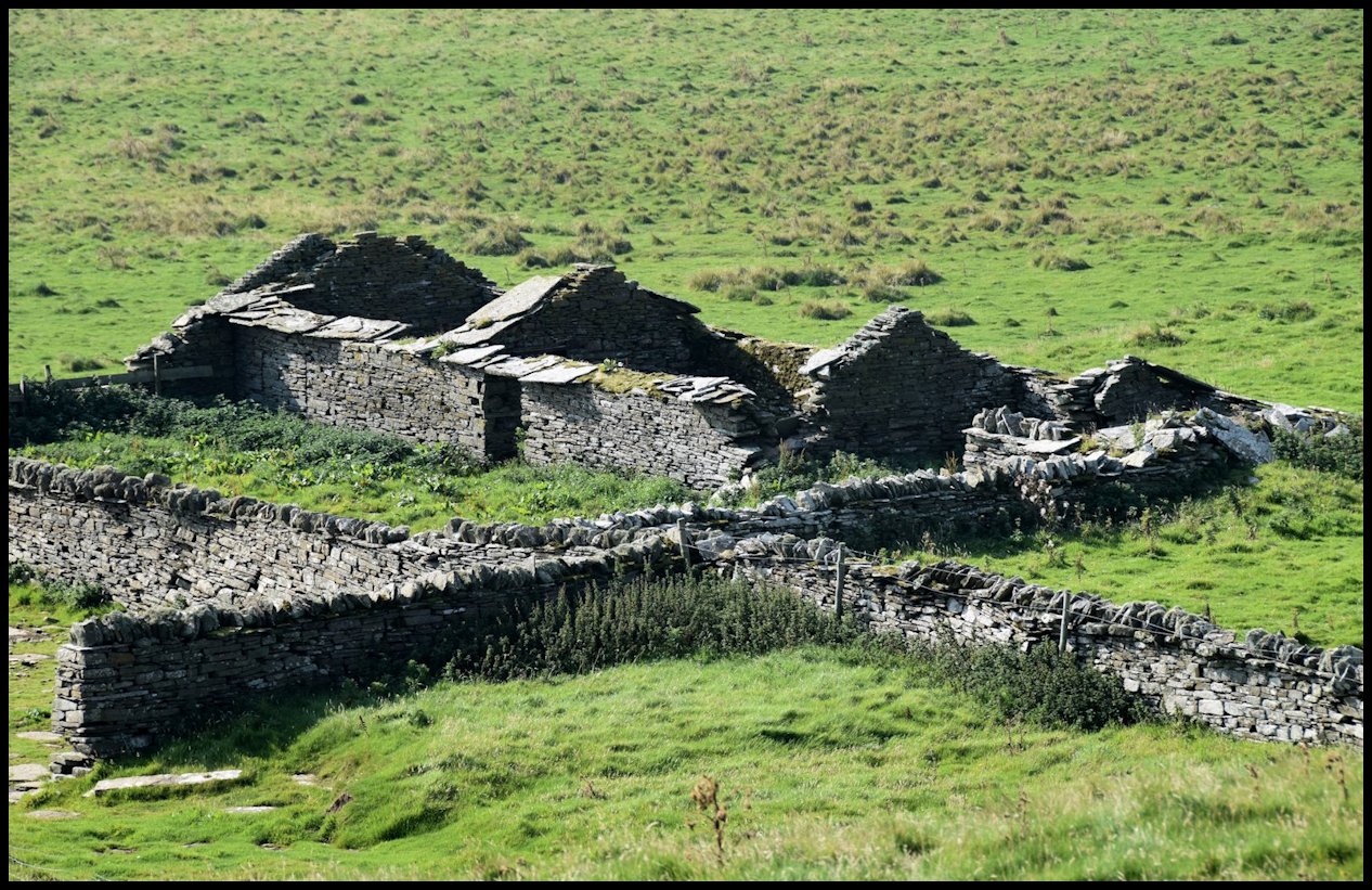
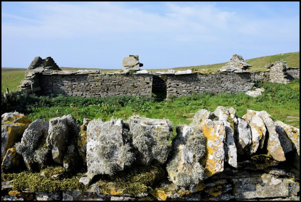
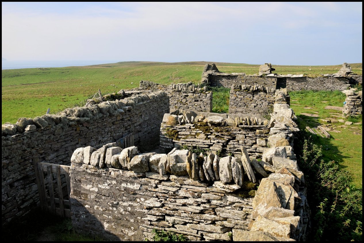
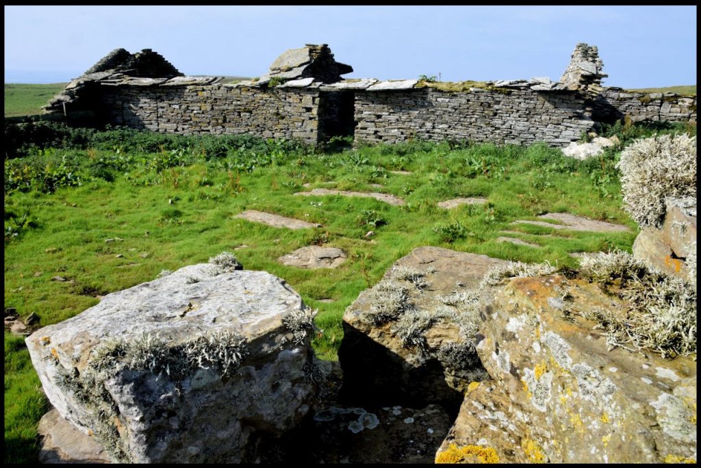
Of that original Westness settlement, the two old farms of Skaill and Brough may be looked on as the very heart or core. The houses and farm buildings of both are now derelict and deserted – the lands being all part of the modern huge farm of Westness – but no nook or corner of Orkney speaks more poignantly of the past.
Brough was, in the 15th and 16th centuries, one of the most important houses in Orkney, no fewer than three Craigies of Brough having been Lawmen of Orkney. The farm was a 7d. land, and in 1503 the Rental shows us that 6d. land was the udal property of John Craigie the Lawman, who also occupied the seventh pennyland as tenant of the Earldom.
Brough remained in Craigie hands up to 1556, when Magnus Craigie sold it with the ‘fortalice’ and head-house (capitale messuagium), mill, and the right of patronage of the chapel of St. Christopher in the Cathedral of St. Magnus, to his kinsman Magister Magnus Halcro, precentor or chantor of the Cathedral – a cleric whose career, if not altogether exemplary, was perhaps only too typical of churchmen of that time.
At this period the Reformation in Scotland was about due, and he was not slow to move with the times. In 1560 – the very year of the Reformation – he secured from the Bishop and chapter a tack of the Bishopric lands in Rousay, including the lands of Inner Westness and all the lands or Sorwick (Sourin), and he quickly celebrated his legal release from celibacy by marrying no less a lady than Margaret Sinclair, daughter and heiress of Sir James Sinclair and his wife Barbara Stewart, daughter of the first Lord Ochiltree.
After Magnus’s death, his Brough property was ‘adjudged’ in a suspicious manner to Earl Robert Stewart in 1584 for alleged arrears of dues by the widow and other heirs, and in 1586 the Earl assigned 500 marks from the lands of Brough and Eynhallow to Marjory Sandilands – a Caithness woman who had borne him three illegitimate sons. By 1593, however, Brough was again in possession of the Halcros – Henry Halcro owning the property between then and 1609. The following are the names of those who owned Brough from that time onwards. 1609 – 1626, Robert Elphingstoun; 1626 – 1638, Roland Ingisgar; 1639 – 1653, Robert Stewart the younger; 1659 – 1675, James Traill; 1675 – 1683, Roland Mowat and William Harcus; 1733 – 1751, John Flaws; 1774 – 1781, Magnus Harcus and Nicol Robertson; 1781 – 1785, Magnus Harcus and William Corsie; 1785 – 1796, William Harcus and others; 1796 – 1809, Hugh Craigie and John Inkster; 1809 – 1823, Hugh Craigie the younger.
From 1823 Brough was occupied by Magnus Craigie. The census carried out in Rousay in 1841 tells us that Magnus was then a 40-year-old farmer, his wife Mary was 35 years of age, oldest daughter Janet was 20 and employed as a servant, and younger daughter Mary was 13 years old.
In 1851 there were some new faces at Brough. Magnus Craigie was still there, but he was joined by two farm labourers, David Gibson (18), and John Harcus, who was 12 years old. Margaret Craigie (23) and Margaret Louttit (19) were employed as farm servants. Mary Flaws also lived at Brough. She was a 46 year-old pauper.
By 1861 Magnus and Mary Craigie had moved from Brough at Westside to Frotoft and were living in what the census of that year called Section 3 (Brough). Magnus was in his 63rd year, and he was farming five acres of land there. His wife Mary was then 56 years of age
At this time Brough at Westside was occupied by Peter Reid, a fifty-year-old ploughman. He had recently moved from the nearby farm of Garson. He was the son of George Reid and Barbara Logie of Pow and Garson, Westside, and he was born in 1810. He was married to Mary Louttit, the daughter of Drummond Louttit and Betty Flaws, who was born in 1807. They had three children; Elizabeth Traill, born on June 16th 1841, Mary, born on December 7th 1842; and Peter, who was born on January 22nd 1847.
Elizabeth Traill Reid died in Glasgow in 1863 and her brother Peter died in 1872. Their father Peter Reid died in 1879 at the age of 69.
Head of the household at Brough in 1881 was Alexander Learmonth Reid. He was the son of Peter and Mary Reid’s daughter Mary, and he was born in 1862. In 1881 he was earning a living as a farm servant, and living with him at Brough at that time was his widowed grandmother Mary. She died in 1893 at the age of 86.
Alexander Learmonth Reid married Harriet Logie. She was the daughter of Robert Logie and Mary Murray of Geo and later the Old School, Westside, and she was born in 1866. They had two sons, Alexander, born in 1890, and Harry, who was born in 1894, but Harriet died shortly after his birth.
[Hugh Marwick’s The Place-Names of Rousay was referred to in the early part of this text.]
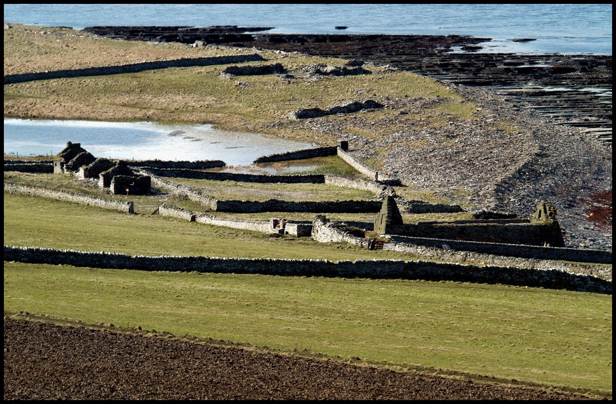
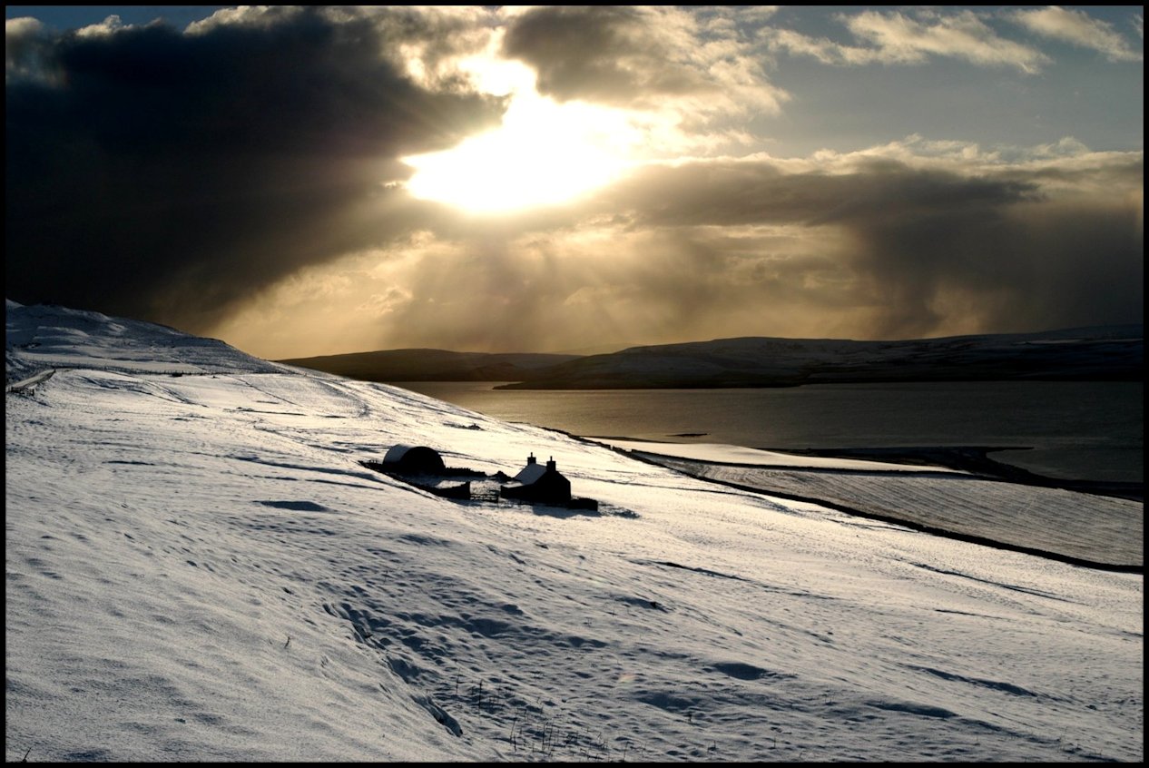
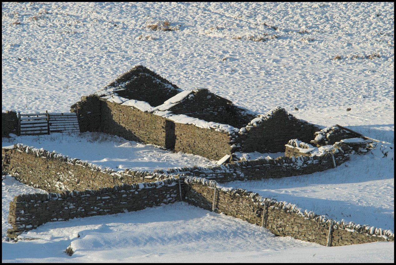
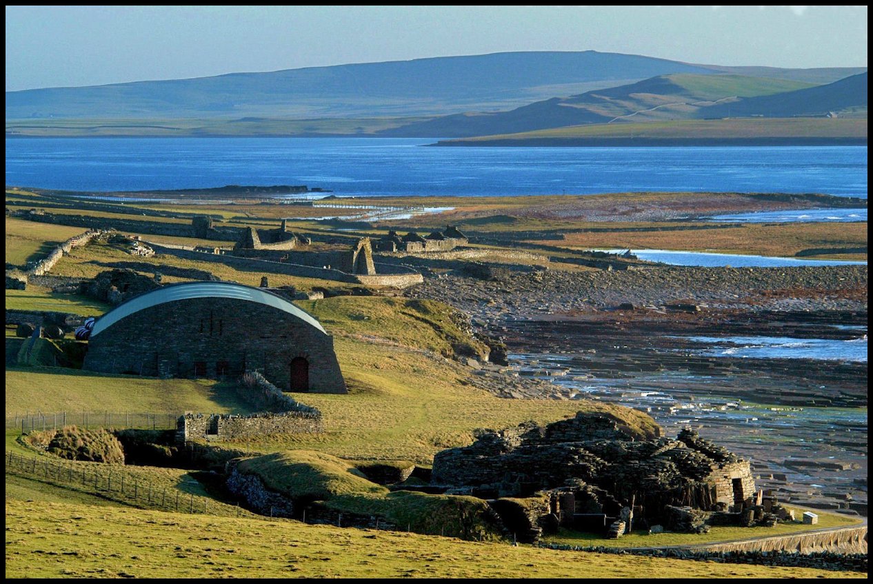
Brough and Skaill farms, St Mary’s Kirk & The Wirk 1980
Orkney has a wealth of Archaeological remains dating from c. 3,500 BC. These are mostly well known, published sites covering the period up to and including the Vikings. Post Medieval sites are however crumbling away whilst attention is turned toward sites which are earlier, but no more important. A very great deal is known about the early sites, due to the concentration of manpower and resources in relatively recent times; the same cannot be said of sites dating from only 500 years ago.
It is not the object of the Rousay Archaeological Rescue Group to preserve the sites discussed in this report, but to record and gain as much data as possible, so that a complete picture is recorded for the future.
The survey took a long time, (about 5 years) and during this period many of the buildings changed their outline, due to wind, rain, storm-waves and sheep. The drawings each show the earliest form presented to RARG members during this survey.
BROUGH and SKAILL Farms.
l. Historical Background. 2. Past Owners and Tenants. 3: Survey of Buildings. 4. Discussion. 5. References. 6. Acknowledgements.
1. Historical Background.
From circa 1000 until 1415 AD the land of Outer Westness was in Earldom hands, and exactly how it came into private possession is not known. We may draw our conclusions from the fact that the first private owner married the daughter of the last Earl – however the land was not owned by the Earl, but put in his trust. The actual owner in this case was the King of Norway.
Information from AD 1415 is less vague, and a total record of owners has been traced. The list of tenants is less complete.
The early part of these times was troublesome, and in some cases violent. Sails on the horizon would more than likely result in the inhabitants of Outer Westness taking to their defensive tower, or Fortalice. One record exists of an early owner selling Brough Farm with the Fortalice, as if to add value to his property. Inhabitants of Brough fought in the battles of Flodden and Summerdale and all survived.
Later, peace came to the area, and prosperity too, for many of the owners held important positions in the County.
Lastly, during the times of the Lairds, poverty again returned and eventually the entire area was cleared for the grazing of sheep. Fortunately, most of the tenants were resettled in crofts and farms in neighbouring districts, but one or two families left Orkney. None of the families discussed in the report left Rousay.
2. Past Owners and Tenants.
Outer Westness held by the Earls of Orkney;
Norse Earls 1000 – 1231 Angus Earls 1231 – 1312 Earl Magnus V 1312 – 1320 Earl Malise 1320 – 1350 Earl Erngisl Suneson 1353 – 1379 Earls of St Clair 1379 – 1471
The Earls of St Clair;
Earl Henry St Clair I 1379 – 1400 Earl Henry II 1400 – 1418 Earl William 1418 – 1471
The Exchange of Crowns. – Earl William having no male heir, and being of extreme age, decided to exchange his rights for those of Ravenscraig in Fife. Norway sold Orkney to the Scottish Crown and Orkney (along with Shetland) became part of Scotland and subject to Scottish Law.
The Charter of Feu. – Proprietors who had held land under the Norwegian Earls had no security of tenancy or undisputed proof of ownership of their lands. The granting of this charter in 1471 rectified the situation.
Owners of Brough Farm;
c1380 – 1415 Brethren of the Cragys 1415 – 1424 Sir James of Cragy (m Margt St Clair) 1424 – 1455 John of Cragy 1455 – 1480 William Cragy 1480 – 1509 John Cragy m. Christin Halcro 1509 – 1546 James of Cragy (m. Mgt Stewart)
1546 David Cragy held wadset
1546 – 1556 Master Magnus Craigie 1556 – 1571 Meister Magnus Halcro 1571 – 1576 Henry Halcro 1576 – 1584 Magnus Halcro (again) dies 1584
1584 Lands confiscated and sold to:-
1584 – 1586 Earl Robert Lord Stewart 1586 – 1593 {Marjory Sandilands his mistress 1586 – 1593 {George Stewart, his son – half each
Earl Robert Stewart was an illegitimate son of James V, and a half-brother of the later King James VI and I. Therefore upon his death, the lands reverted to the Crown.
1593 – King James VI holds lands 1593 – 1615 Earl Patrick Stewart disputes ownership 1593 – In September John Sinclair given lands and sells to:- 1593 – 1675 Hugh Halcro. He built up his estate by buying more and more property, so that by his last rental, he owned about a quarter of Rousay. 1675 – 1679 Sold to James Traill 1679 – 1707 William Traill of Westness 1707 – 1733 George Traill of Westness 1733 – 1781 John Traill of Westness & Woodwick 1781 – 1792 James Traill of Westness 1792 – 1801 George Craigie of Saviskaill 1801 – 1845 William Traill of Westness & Woodwick 1845 – 1847 George William Traill of Viera 1847 – 1905 General Sir Frederick William Traill Burroughs 1905 – 1922 Trustees of the above Brough and Skaill Farms have been included with Westness Farm since this date, and are at the present [written in1980] held by Mrs K Scarth of Breckness. 1997 – 2003 Jim Marwick 2003 – Russell Marwick
Owners of Skaill Farm;
Skaill land owned by the Church 1558 – 1584 Magnus Halcro “obtains land” 1584 – 1653 Confiscation prevented by Bishop 1653 Land bought by Hugh Halcro
from here, as Brough Farm owners.
Tenants of Brough Farm 1564-1900 1564-1584 William Halcro of Aikers 1584-1593 George Stewart 1593-1609 Henry Halcro 1609-1626 Robert Elphingstoun 1626-1638 Roland Ingisgar 1638-1639 Empty ? 1639-1653 Robert Stewart the younger 1653-1659 Empty 1659-1675 James Traill 1675- Roland Mowat & William Arcus 1774-1781 Magnus Harcus & Nicol Robertson 1781-1785 Magnus Harcus & William Corsie 1785-1796 William Harcus and others 1796-1809 Hugh Craigie (d. 1809) 1809-1823 Widow Craigie and son Hugh 1823-1859 Magnus Craigie (leaseholder) 1859-1861 Farm empty 1861-1881 Peter Reid 1881-1887 Widow of Peter Reid 1887-1900 Alexander Reid
The Reids were shepherds to Westness Farm, and Brough was used as a bothy until about 1900. It has been empty since.
Tenants of Skaill Farm;
1584-1586 Farm empty 1586-1593 Marjory Sandilands 1626-1651 Hugh Craigie 1651-1679 Magnus Craigie 1781-1785 James Donaldson & William Marwick 1785-1793 Hugh and Henry Craigie 1793-1796 James Yorston & Hugh CraigieRental of Lord Dundas 1796-1801 James Yorston 1837-1858 William Corsie (leaseholder)
Empty since 1858, although since used as farm outbuildings and possibly also as a workshop. There are no records to show usage after 1858.
3. Survey of Buildings; Reference numbers () are those shown on drawings;
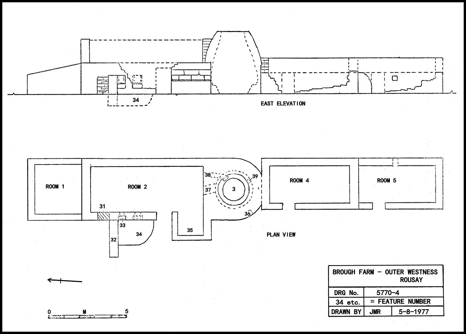
Brough Farm:- See drawing below
Room 1. This is a shed or outhouse of 18th Century date, built against the main building complex, and has neither doors nor windows. The access must have been through room 2, but no sign of this door exists. The roof seems to have been flagstones set on four couples. At the northern end the later field-dyke is butt-jointed to the wall at its lowest part, but the junction is partly obscured by the very sweeping fillet.
Room 2. By far the most interesting room from the Brough complex. It seems originally to have been built as an Orkney longhouse, containing the But, Ben and the Oot-by, but later (possibly during the 16th Century) it saw much alteration, including the removal of the baak wall. The site of the Oot-by then became the present room 3. The present door has survived all alteration work and is still centrally disposed, if rooms 2 and 5 are taken as the original structure. This unit would have formed the dwelling house and the byre for the milking cow and her calf. The rough cattle at this time were never brought in to byres, but roamed the hill all year. The later uses of rooms 2 and 3 were for corn drying and storage. The main area was probably for storage of Bere sheaves which had been dried in the kiln. Fuel for the kiln was stored in the alcove (35), whilst secondary access, necessary due to blockage by storage, was gained by door (3l) which seems to have been blocked at a late 18th Century date. This tends to suggest that a different system or product was adopted, perhaps kelp. Further 18th Century alterations include the wall (32) and the boxed hatches (33) and the shallow pit (34).
Most probably these boxed hatches were converted from existing windows, but remain something of a puzzle. They consist of a small window for half the thickness of the wall, whilst the outer half is enlarged but contains a box constructed of two upright slabs of stone set parallel to one another. The joints are by no means water or even grain-tight and their use must remain a mystery. Excavation of the pit area below may show light on this matter. (Possible sheep-dip).
Room 3. The kiln is a massive structure and is dry built with tight joints that must have been almost smoke-proof. The walls at the base are 1.3 metres thick and average 450cm. at the top. The kiln access door (37) is at 1.1 metres from ground level and probably had steps but as none remain today, they may have been wooden. The internal profile of the kiln is shown dotted on the drawing. The main firebar sat in a socket (39) and traversed the fire smoke chamber to another socket (a) by the door. The stoke hole (38) is 300 mm square in section and 1.5 metres long. One stone on the west wall of the kiln has a masons mark (36) but is now very faint. The roof seems to have been turf for most, if not all of the life of the building.
Room 4. This room dates from the l7th Century and is expertly butt and lap-jointed to the kiln. The eaves height of 1.5 metres is low and can have only been used for animals. No windows are present.
Room 5. An 18th Century addition to the foregoing, and butt-jointed to it. It is of similar size, but with the addition of a small window.
Room 6. The complex comprising rooms 6,7,8 & 9 form the second phase dwelling house. Room 6 is rather small, and judging by the two small wall cupboards may have been a bedroom with a wooden box-bed at its northern end. Entrance was through the east wall via room 7.
Room 7. This was the living room of the 16th Century dwelling house, and at 4 by 4.5 metres is quite large. It is not clear where the original door was, although there has been one in the eastern wall, later blocked and used as a cupboard. The roof was probably turf at this stage.
Room 8. When rooms 8 & 9 were added on in the early 18th Century, they were butt-jointed to room 7. The west wall was modified to form a fireplace and another cupboard. The entrance was evidently in the south wall, although very little remains of this entire wall. The eaves height of the new house was increased by 29 cm, a difficult process of which the reasoning is not clear. The old eaves height was quite adequate for most persons, and this may suggest a new owners ideas.
Room 9. This room is slightly larger than the others, and also contained a door in the south wall. There had at one time been a door between rooms 8 & 9, but this was later blocked and re-used as a cupboard. The gables of this later part of the house are all of equal height, which tends to suggest a flagstone roof. The floors in all 4 rooms are of earth, and each is near level and in the same plane.
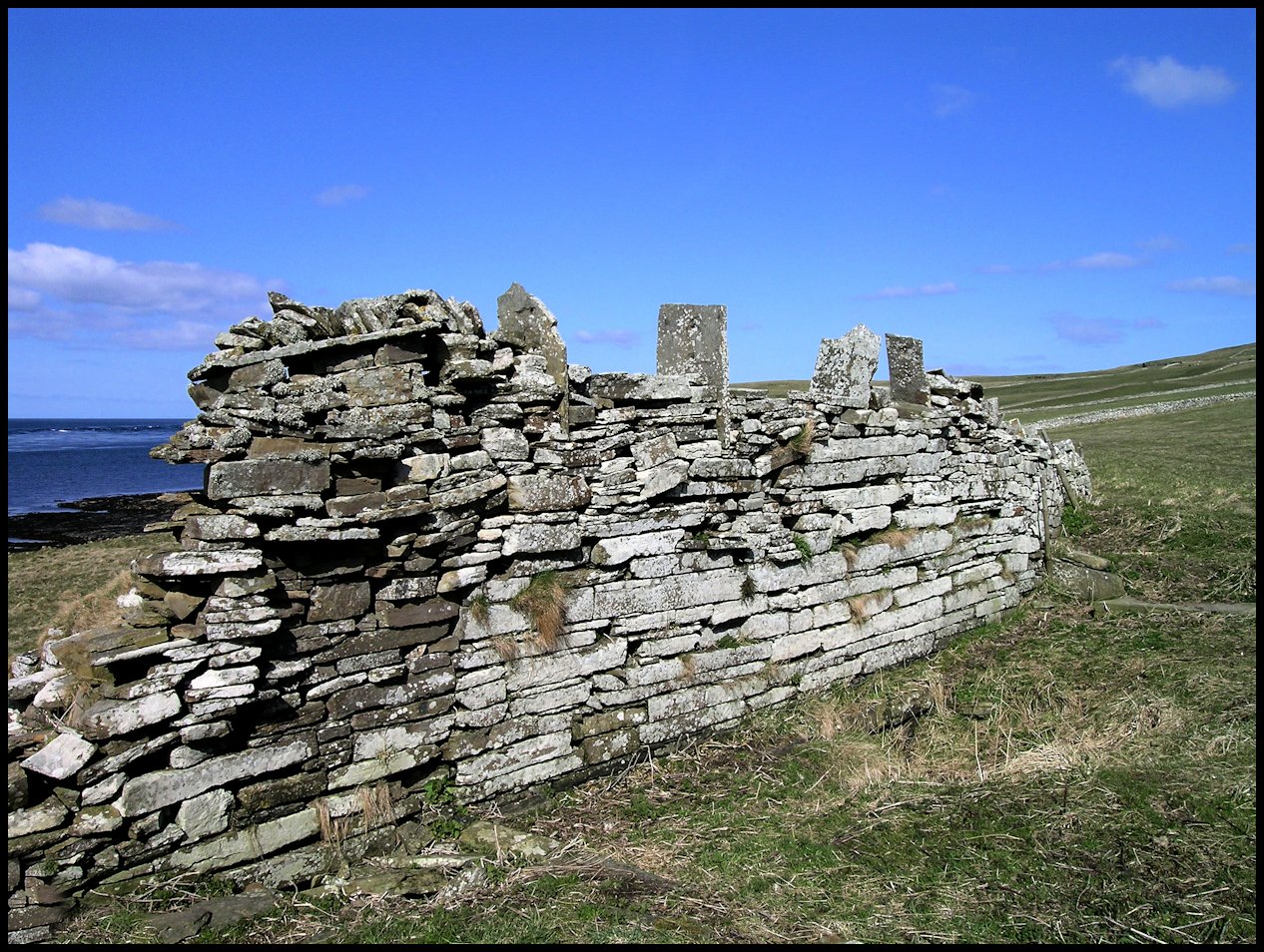
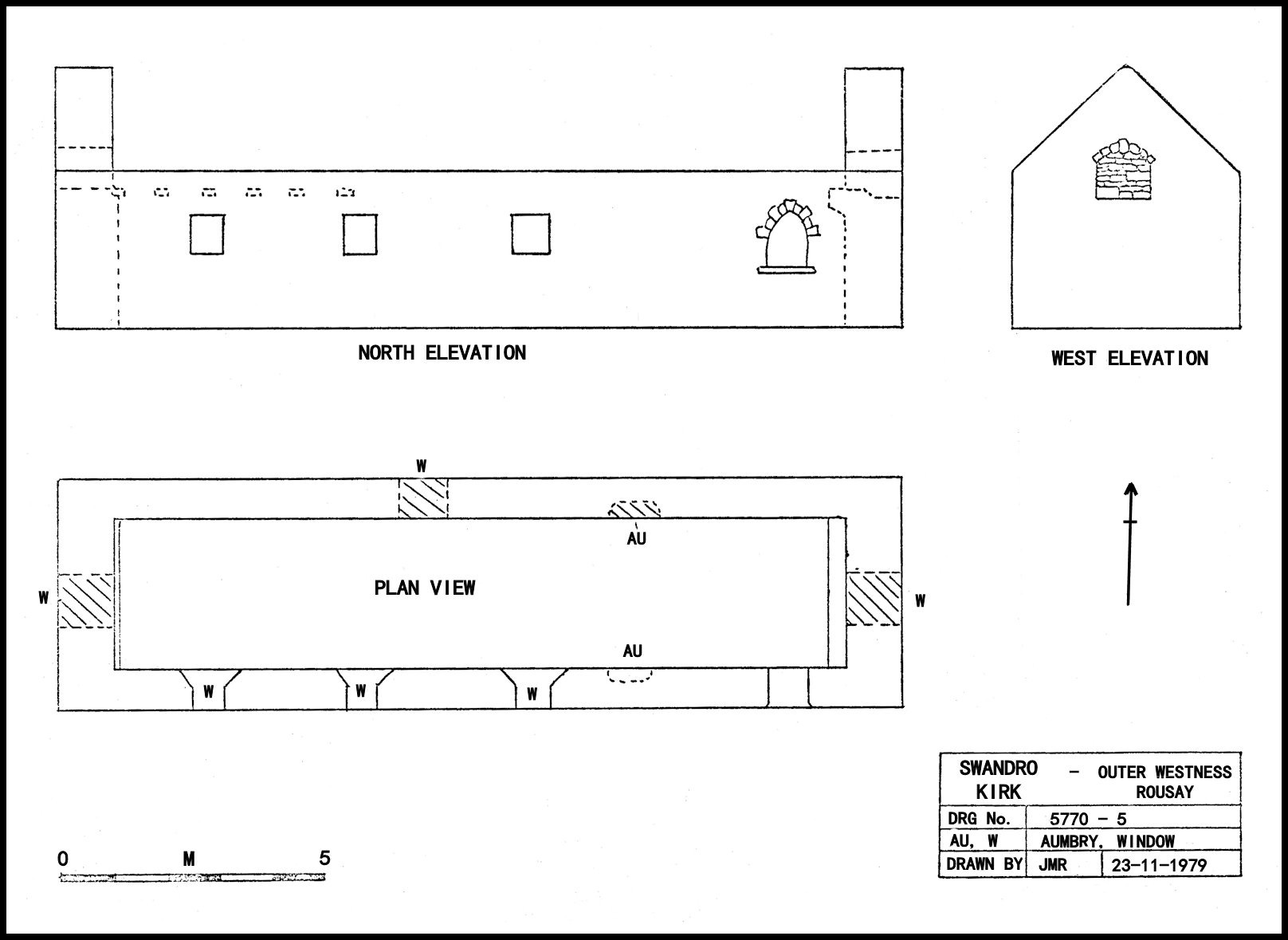
Saint Mary’s Kirk, Swandro.
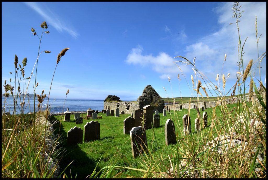
Perched on the edge of the low cliffs at the Geo of Skaill is the old Parish Church, known locally as Swandro Kirk. The present building, measuring 16 by 4.4 metres is roughly aligned East-West, and dates from the Reformation year of 1560. It remained the Parish Church until 1815, when the new U.P. Church was built some 4 miles to the South-East. The whole land area is slipping to the west, due to coastal erosion and to prevent the gables from collapsing, two buttresses have been built in recent times. These are not shown in the drawing. The building is a unicellular type, at one time containing a first floor gallery. It will be noticed that the entrance to the Kirk is at 1.2 M from the present ground level. This, together with the Kirkyard style, suggests the presence of sheep at an early date. This entrance together with three windows is in the South wall. There are two aumbrys present, one in the North wall, and the second in the South wall. The latter was for Holy water, the former now blocked. There is a lot of evidence that the present church stands on the footings of an earlier Church of similar size. This earlier building seems to have been a Church dating from possibly the 12th or 13th Centuries. The kirkyard contains about 100 graves, many now becoming illegible, and a survey of these is being carried out by the RARG.
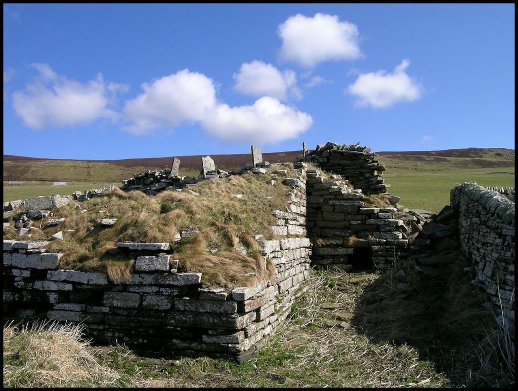
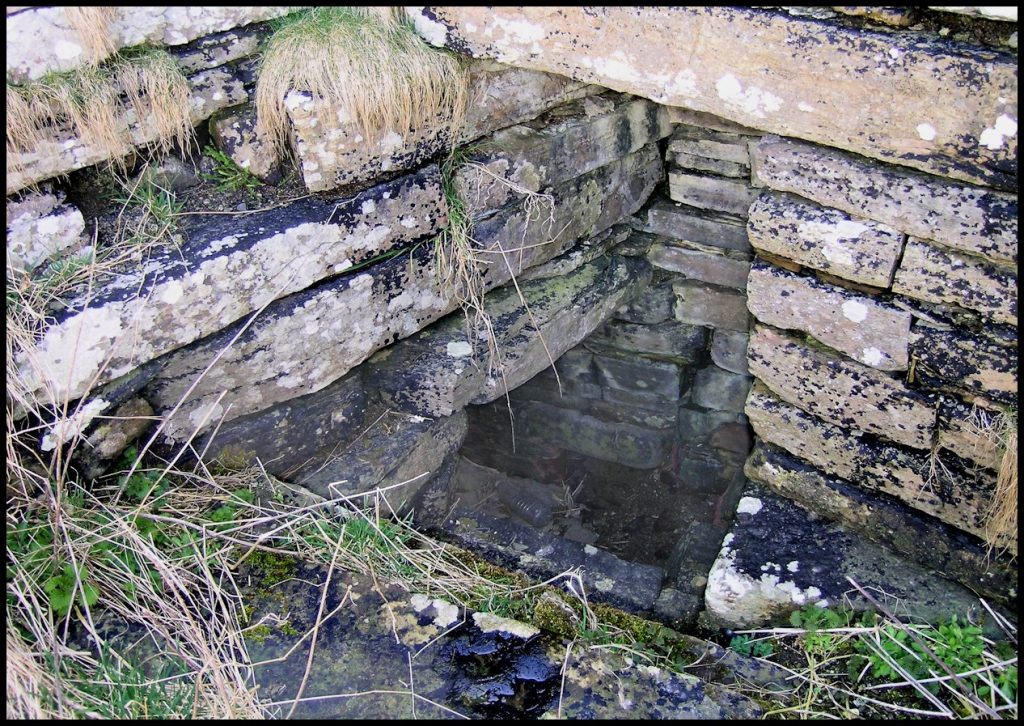
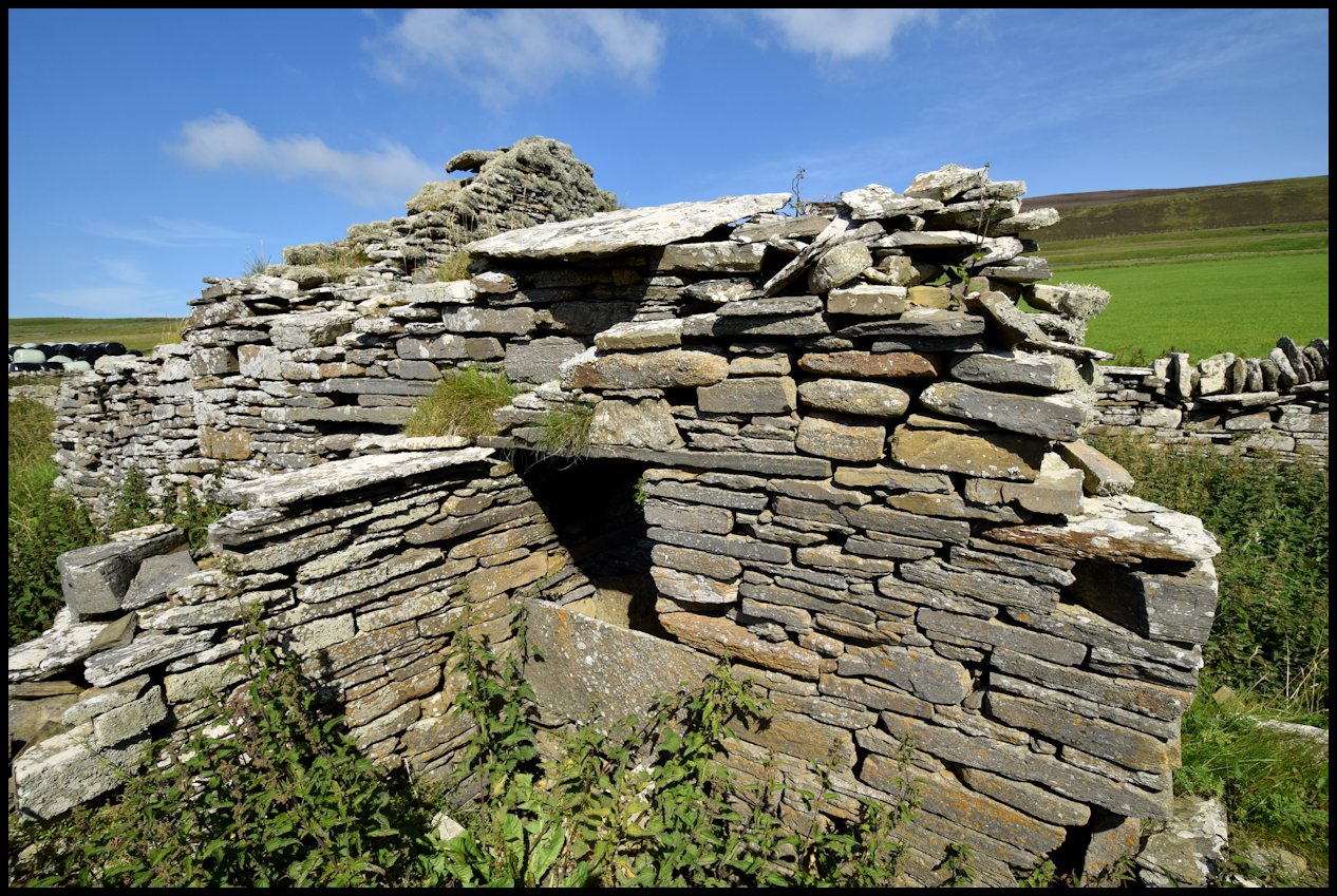
The Wirk.
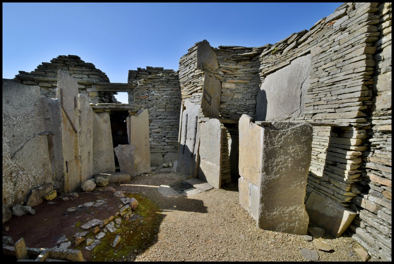
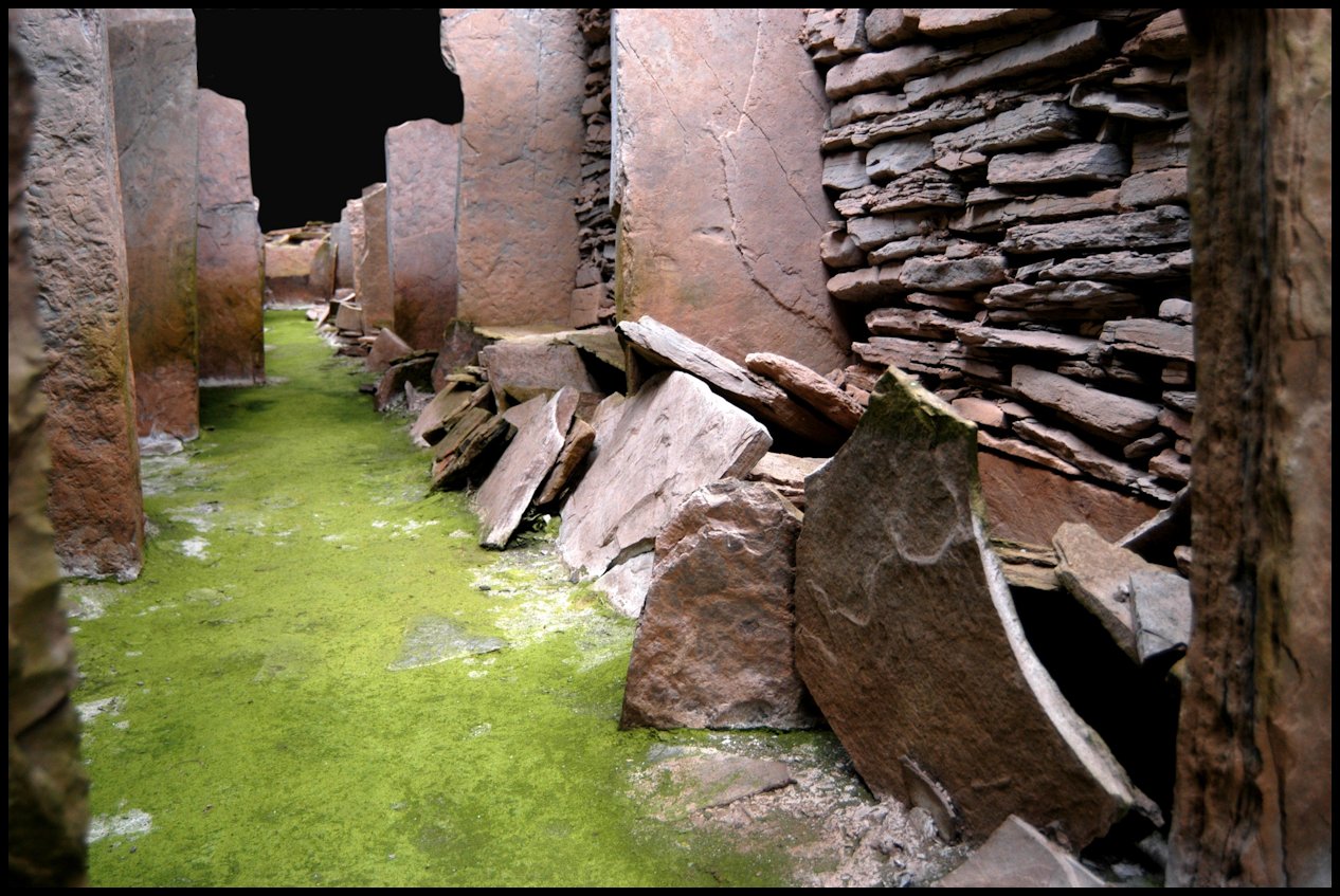
The building known traditionally as the Wirk stands near the shore, close to Skaill Farm. It consists of a two storey, almost square tower built over some earlier footings of indeterminate dimensions. Of this second storey, however, little remains today, but Mr J. Storer Clouston made notes and sketches a long time ago, and the whereabouts of these is unknown. The tower remains in a good state of preservation to a height of 2.25 metres, probably due to the good workmanship in its construction. The walls average over 1.5 m in thickness although each wall is of varying dimension. A drain runs obliquely through and under two walls, and this was presumably to prevent flooding. We believe that this building was the old “Fortalice” sold in 1556. This would mean that it was a defensive structure or fort; the translation of Wirk (Virki) from Old Norse is “fortified place”. Under the whole structure is a cellar or well-pit, partly excavated from living-rock; this can best be seen via the hatchway in the East wall. The building has been repaired in the l6th Century using some of the imported red sandstone blocks of a type brought to the Island by Magnus Halcro. This stone was intended to be used in the construction on the Cathedral of St. Magnus in Kirkwall, but was surplus, and Mr Halcro obtained it by some means and brought it to Rousay. At the time Mr Halcro was sub-chanter of the Cathedral and also a land-owner in Rousay. It is possible that he was the motivating force in the building of Swandro Kirk. Several pieces of this red stone can be seen in Rousay, perhaps the best known are those that are now incorporated into an archway at Trumland House. There is a low turf dyke partly surviving and clearly part of this structure, as too is the western-most extension shown in the drawing.
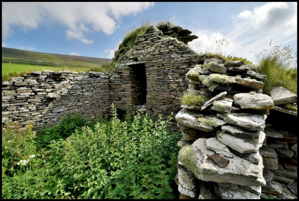
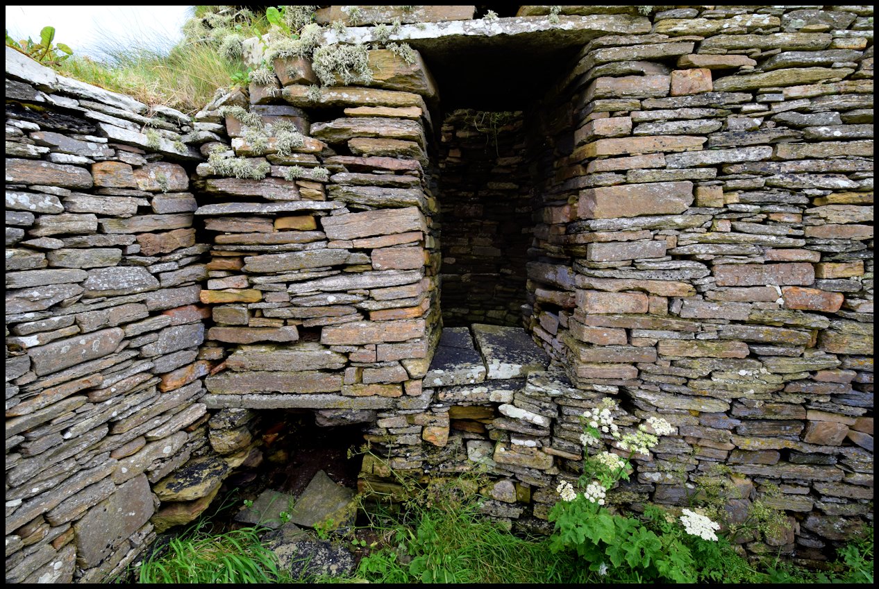
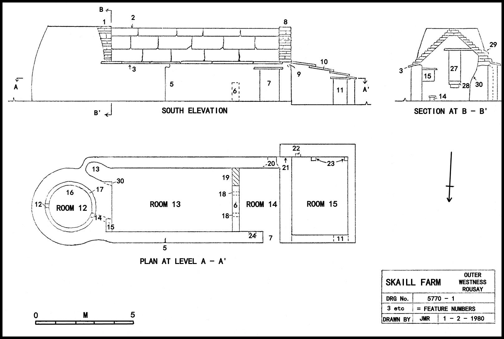
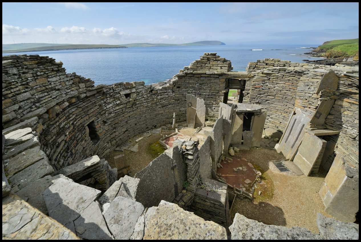
Skaill Farm.
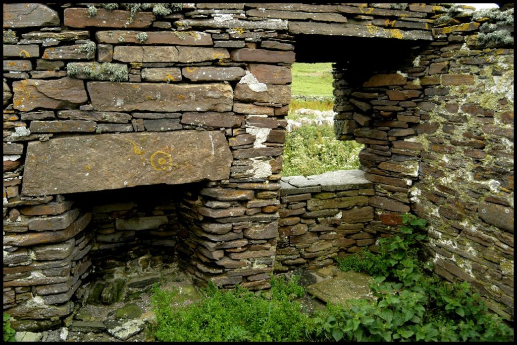
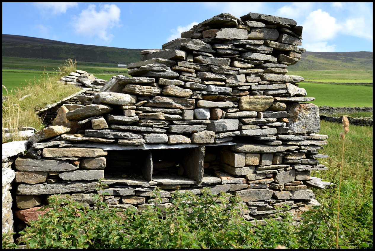
Room 12, Corn Drier. This is drystone built and tied-in with the rest of the rooms, although various dates apply to various parts of the complex, An early 16th Century date is suggested for the corn drier which predates rooms 13 & 14. The sectional plan shows the drier to be almost circular, but narrower than the rest of the complex. This was probably to allow a small heated alcove (13) for fuel storage. A little to the North is the doorway which is 1.2 metres from the present floor level. There would have been a simple wooden ladder fitting into the socket (28) with possibly five steps. Continuing Northwards we come to the small stokehole (14) which is a little smaller than its counterpart at Brough Farm. Immediately above this is a mural cupboard (15) for an unknown use. As at Brough Farm the elevation of the drier is cylinrdo-conical, whilst the interior contains a similar step (17) for firebars a short distance from the floor (16). In this case the main firebar socket (12) is exactly opposite the door (27). It can be seen on the wall-head that special provision of under eaves slabs have been laid at a slight angle to the horizontal (3). This was to provide some form of guttering, and may be found on crofts of a much later date. Further water-proofing is evident from the soaker (29) present over the alcove (13). Lastly, it can be seen that this alcove has at its entrance, one rebated wall and one half-undercut wall (30), for if these features were not present the entranceway would be very narrow.
Room 13. This is the rebuilt Croft later to be used for grain storage, when the new house was built. The slab roof (2) shown in the drawing, no longer remains and was drawn from an early photograph. Originally the roof would have been turf covered. Similarly, the flat flag roof (10) no longer remains.
The early entrance to the house was at (5). There are no windows at present in this room and it is possible that there never were; The floor has some flags of a later date, and was probably originally an earth floor.
Room 14. Separating room 135 from 14 is the original baak wall (6) between the ben and the oot-by. This wall shows that door (19) was blocked at a probable 18th Century date. This action would have meant that access to the room could only be effected by climbing over the low baak wall. Included in this wall are the two yarphs (18) neither of which seem to have been altered since their original construction. These were used to heat the house using a few peats heaped either side of the hole, whilst one lit peat was pushed into the hole. The smoke swirled around the roof area and also the room before eventually leaving through a hole some way from the fire. As shown in the drawing a small window (20) with splayed ingoes has been incorporated into the south-west corner of the room. This shows wooden dukes so that a window frame must have been fitted, and thus a late date must be suggested. Facing North is the low wide door (7) as is usual with these old crofts. On the inside of this doorway is a small recess (34) for oil lighting.
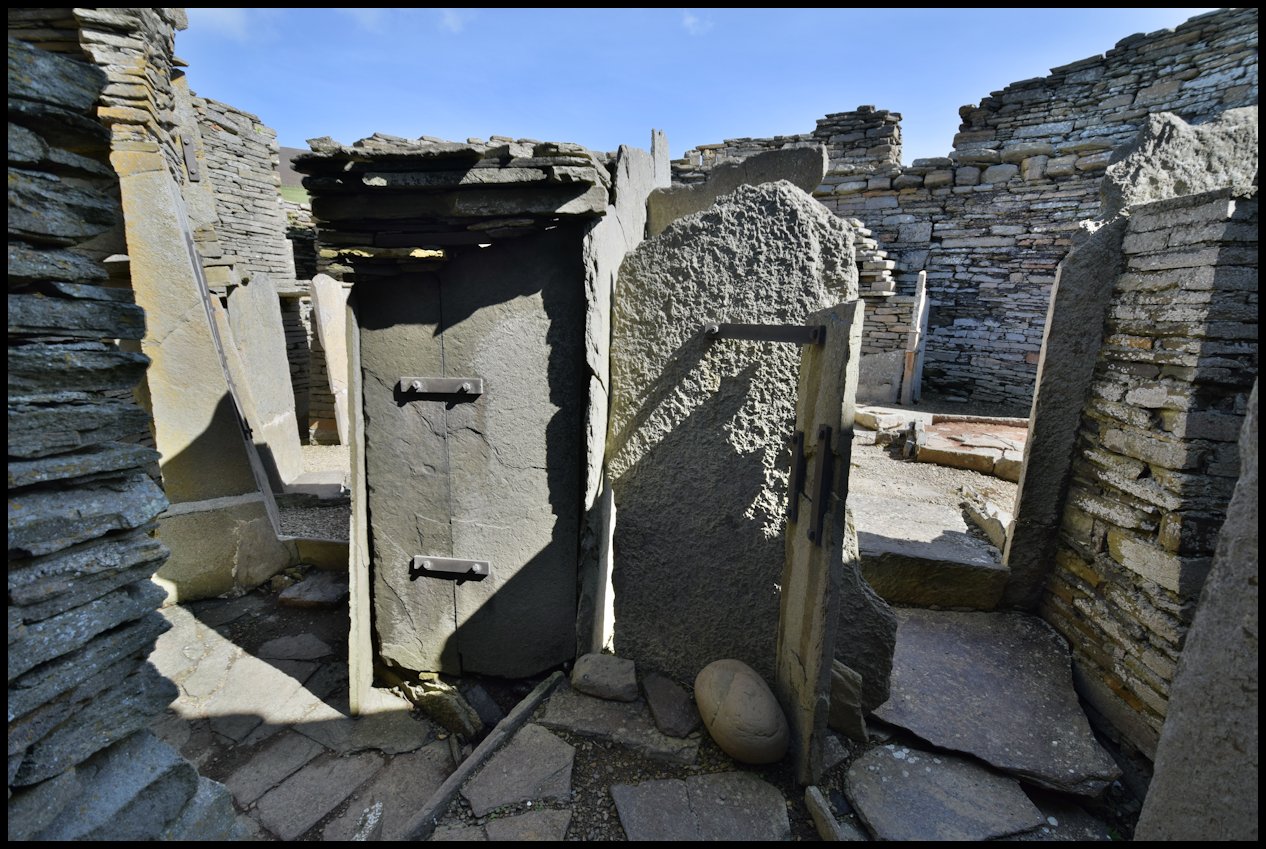
Room 15. Possibly a workshop of 19th Century date, the new walls being butt-jointed to the West gable (8) and clay and dung plastered inside. The South wall contains a three level cupboard (22) and when seen in conjunction with the stone pillars (23) suggests a cobblers workshop. This may account for the plastered walls, dampness would be detrimental to the leather. The door to the workshop (11) is slightly smaller than that at (7). The roof was supported on each of the two east-west walls and on seven wooden couples each fitting into socket holes hewn into the West gable. The floor seemed to be well paved with flags, but was so overgrown at the times of our visits that little of it could be seen. Permission to excavate was not granted.
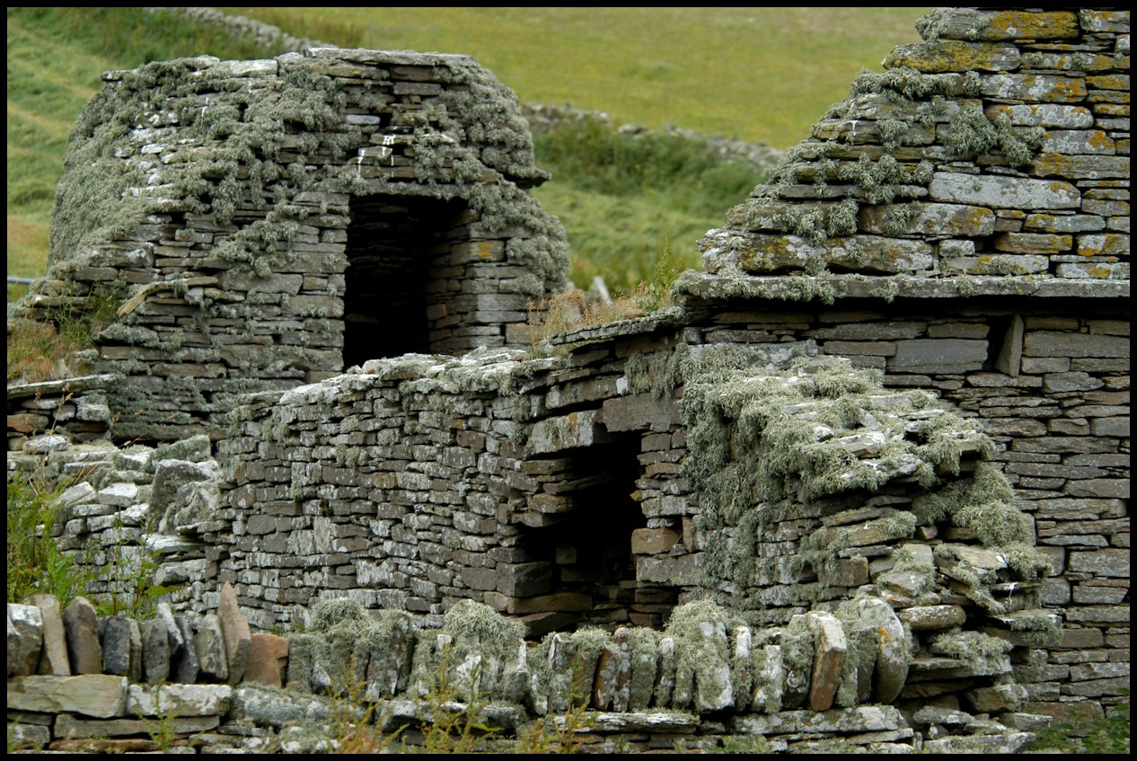
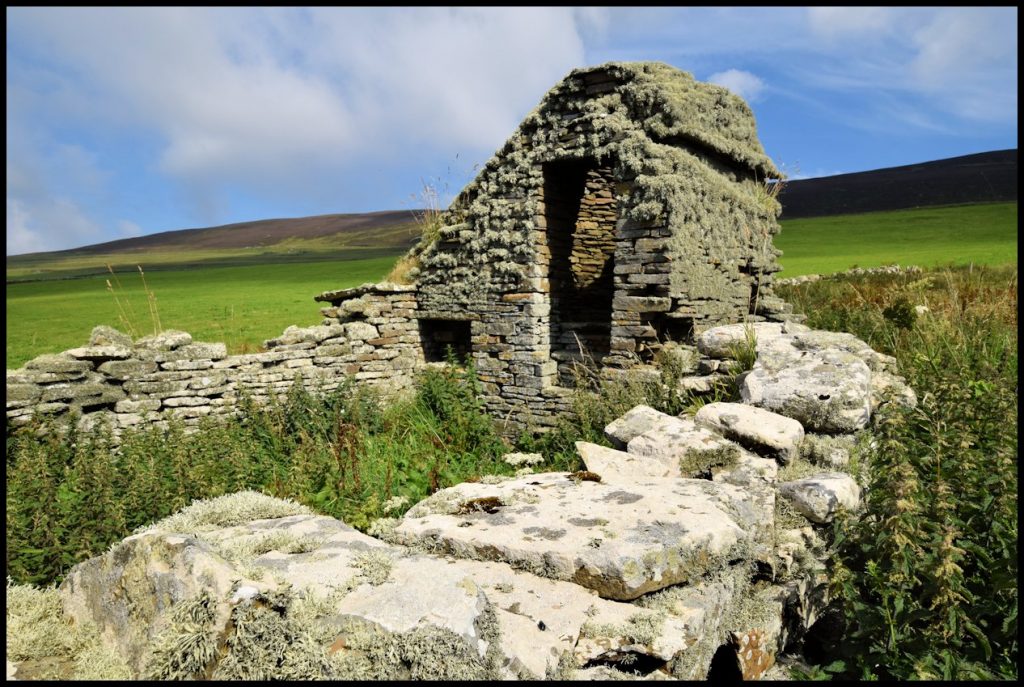
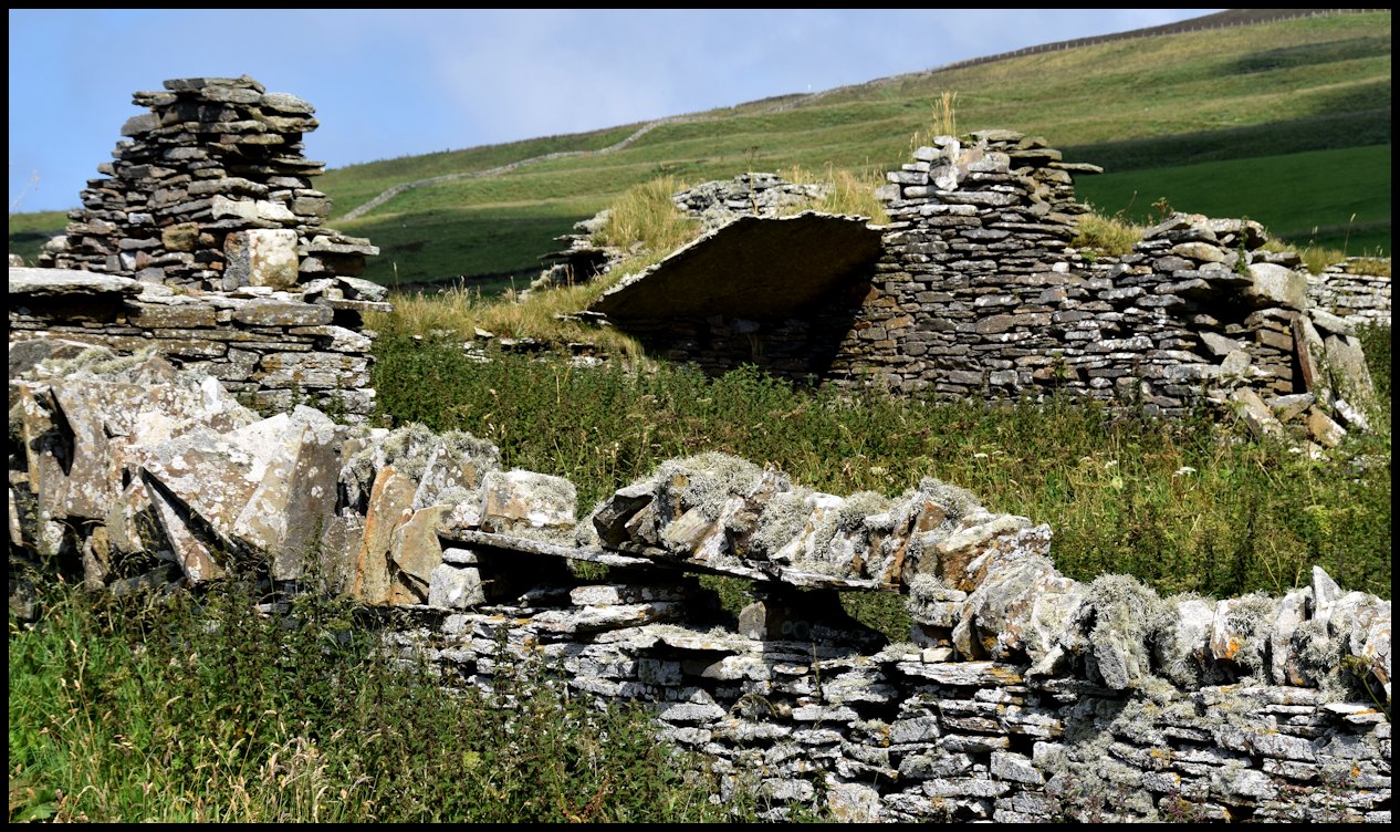
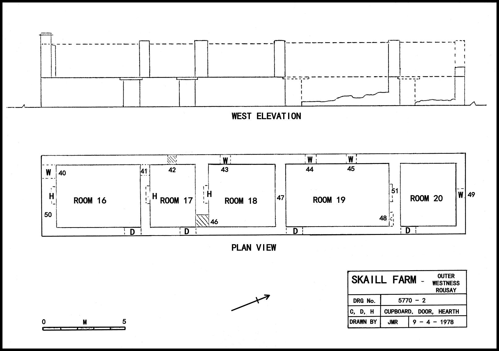
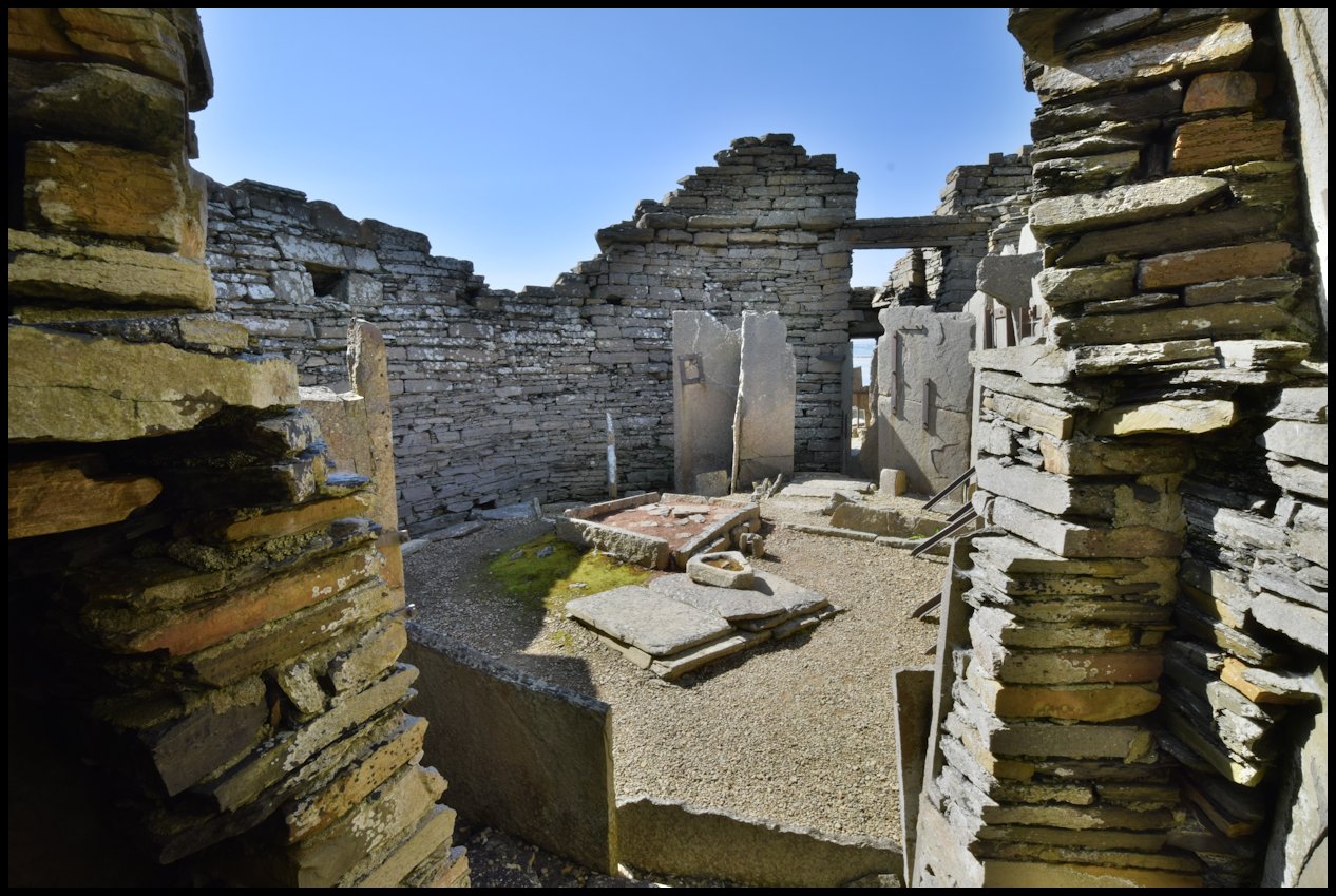
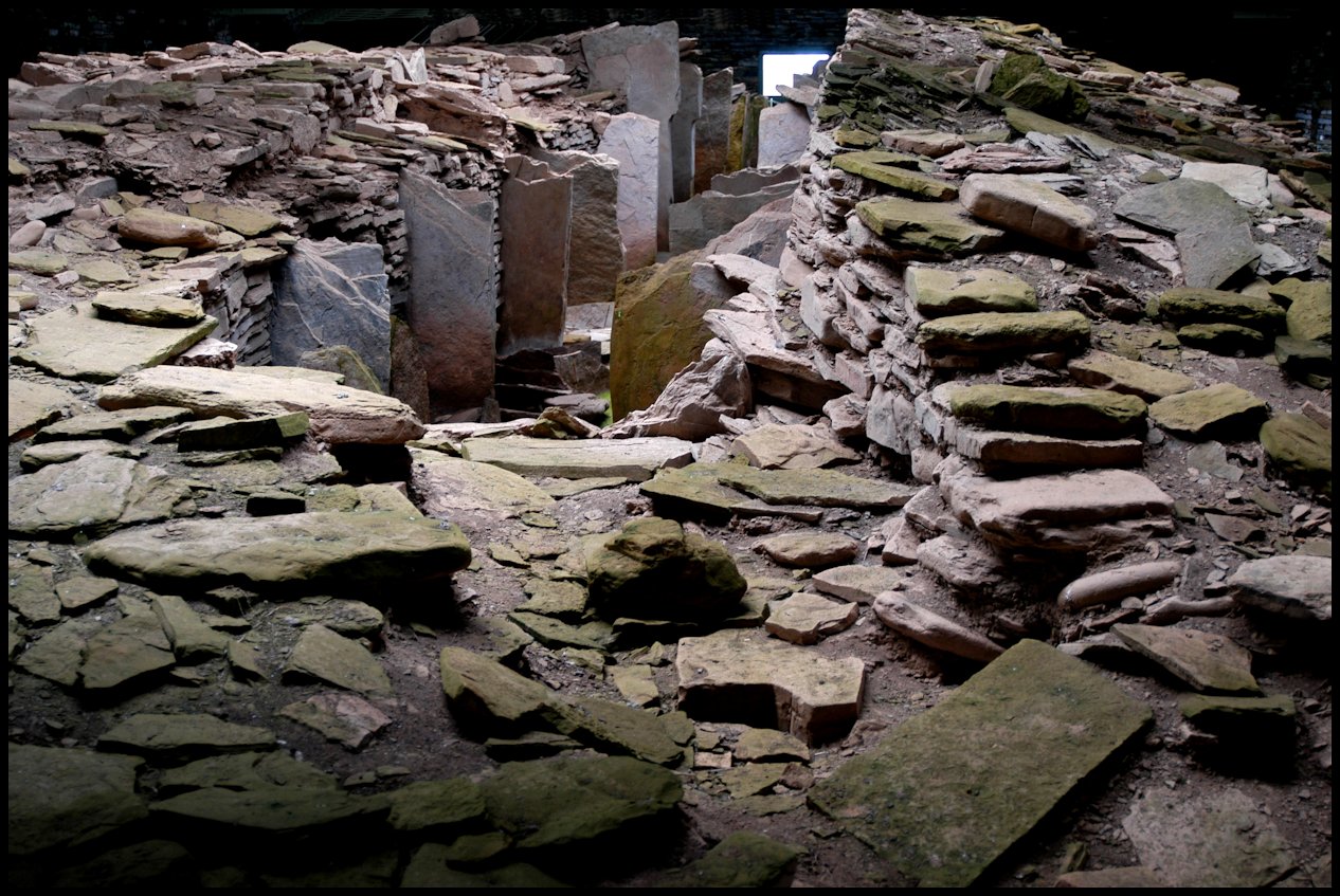
Moving to the second and larger complex at Skaill, we have a long building containing five rooms of unequal size, all with flag floors.
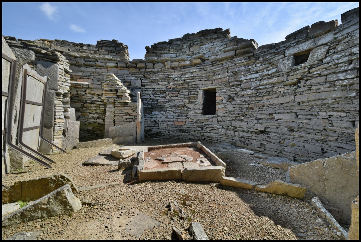
Room 16. This is the southernmost room, containing a hearth and a large window (40). The building seems to date from the early 18th Century, although the South wall has been rebuilt circa 1800. This gable now has an out-of-character chimney of mid l9th Century date. It seems likely that the tenants of Brough Farm made use of rooms 16 and 17. There is a door (41) leading to room 17. The gable (50) is in danger of falling due to subsidence which is probably the reason for its rebuild.
Room 17. This is a small room, again with a hearth in the gable and a window (42) in the West wall. Access was by the previously mentioned door (41) and also by the main door facing East. Leading off the room is a door (46) which – has been blocked, possibly at a similar date to window (42). when this was done room 18 fell into disuse, possibly due to roof collapse.
Room 18. There is no door from the East to this room, access was via the above mentioned door (46). There is still a hearth present, and a window (43) to the West. During the survey the gable (47) fell but had been fully recorded. The gable is thus shown as complete in the drawing.
Room 19. This is the largest room at Skaill and seems to have been used as a living room. There is evidence of a door to the East, but little is left of this wall. The west wall contains two windows (44) and (45). In the gable (51) there is a hearth and a wall cupboard (48).
Room 20. This room has no hearth, but a small window (49) to the 7 North. The upper half of this North gable has fallen, as too has most of the East wall. Enough of the East wall remains to show the position and size of the door, but little more.
South Howe Well.
This well is today overgrown and care should be taken when near. It is a simple unlined well of medium size and was used from uncertain times by the occupants of Brough Farm for domestic water supply.
Mary Well.
This well is known locally as a holy-well, and as its name implies, is connected with St. Marys Kirk. It lies about 200 metres North of the Kirk on a path leading to Brough Farm. It is also possible that the occupants of Skaill Farm used this water as their supply.
4. Discussion.
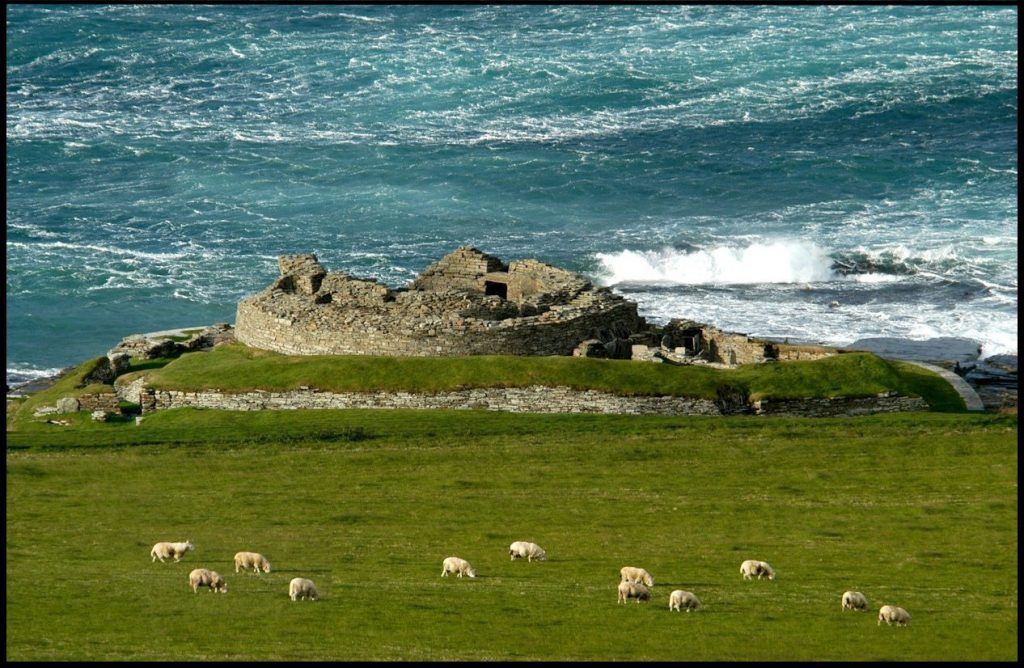
The Urisland. For at least 500 years the unit of land measurement was the urisland. For taxation purposes this unit was too large, and so we find it divided into 18 pennylands. Each pennyland could if required, be further divided into four farthing-lands. A farthing land equalled 1.322 English acres in 1850 and there is little to suggest that it equals any other figure today. The term has completely vanished now and thus we cannot be certain of its accuracy. From the Rental of Rousay in 1503, we see that Brough Farm was a six pennyland, and Skaill was a five pennyland. The remaining seven pennylands were composed of various small crofts, the exception being the Farm of Tofts, the subject of a future survey. From the various sources of reference material available we may visualise a fair picture of the times and lifestyles of Outer Westness, hard times, good and bitter times are all recorded. Few can visit the site today and fail to notice that the site is soaked in history. A few metres to the North is the Broch of Brough, a little further the Mid Howe Cairn and Broch, the latter two being magnificent examples of their type. About a kilometre South is the house of Sigurd, a vassal of Earl Paul Thorfinnson, here too is the Viking boat noust and cemetery. This small area of land then has been an important part of the Island for at least 3,000 years, our coverage of the last 600 of them, although the easiest to access, will be, we hope, both useful and enjoyable to the reader.
Ha’gate was an old house-site on the Westside, way up and virtually out of sight from the public road. In the census of 1841 the house was spelt Hawgate, and in 1851 Haa-gate. Living there then was Christian Flaws, a 50-year-old widow, and her daughter Mary Louttit, who was an eleven-year-old scholar. (A woman sometimes resumed her maiden name when she became a widow. Christy Flaws is a case in point. She was the daughter of James Flaws and Helen Flett and was christened on September 16th 1798. She married William Louttit on February 18th 1836, and daughter Mary was born in 1840.)
William Mainland was the son of David Mainland and Margaret Sinclair of Tratland. Born on January 25th 1795, he married Jane Sinclair in 1822. They lived at Clook, Frotoft and raised a family of six children before moving to Eynhallow where they lived in what was called the East House, part of the old monastic building there. A malignant fever broke out on the island in 1851, and caused the death of several members of the four crofter families who lived in the thatch-roofed houses. It claimed the lives of two of William’s children, Janet and William. Their mother Jane died in 1852, and they were all laid to rest in the Westside kirkyard. Eynhallow was evacuated and the survivors moved back to Rousay.
William later married Christy Flaws and they lived together at Highgate, as it was called in the census of 1861. He was then a 65-year-old agricultural labourer and Christy was in her 61st year. William died in 1870 and he was buried beside his first wife and two children.
The census of 1871 tells the sad story of Christy Mainland, widowed for the second time in her 72 years and living alone at Hallgate, as it was then called.
===============
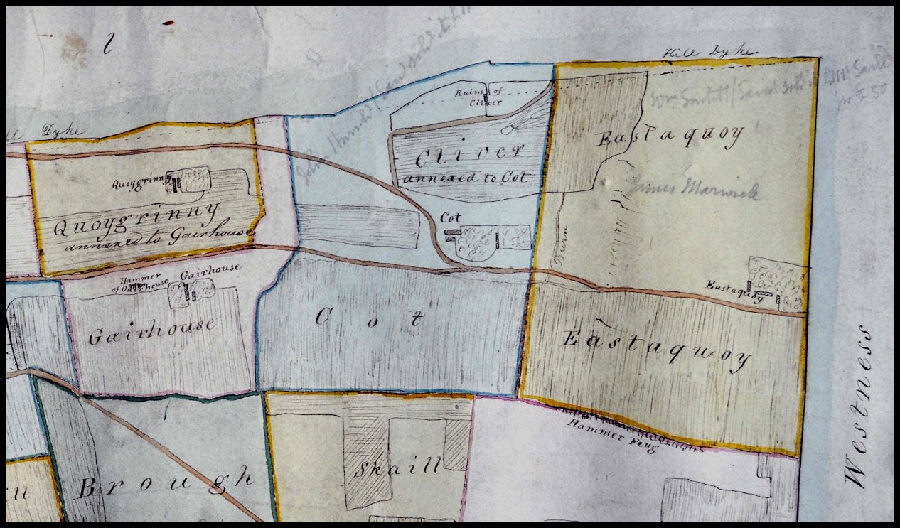
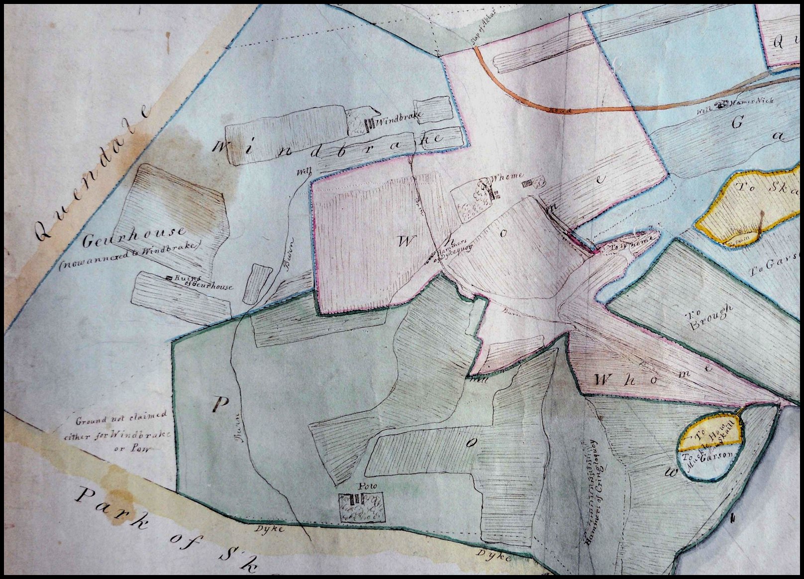
Map dated 1841, showing the location of the now vanished houses of Cot, Cliver, Gairhouse, and Eastaquoy
Cot was the name of an old cottage that stood near the public road above Skaill and Brough on the Westside. In 1851 it housed two tenants. Firstly there was 45-year-old farm labourer George Henderson, his wife Jane, who was 33, and their children Isaac, Helen, John, Robert, and George. Their ages ranged from 12 years to 12 months. The other tenant was Donald Sutherland, a 27-year-old shepherd, who lived there with Betsy Shearer, a 40-year-old house servant.
Ten years later there was just one tenant, a 22-year-old shepherd named James Oliver, born in Berwick, who lived there with his 19-year-old wife Eliza and 12-month-old daughter Elizabeth.
In 1871 Cot was occupied by unmarried sisters Marion and Betsy Logie, who were 42 and 44 years of age respectively, and they were employed as day labourers. They were the daughters of Alexander Logie and Isabel Harrold of Quoygrinnie. Betsy’s seven-year-old son, William, who was a schoolboy, lived with them and they occupied Cot for more than 20 years.
Cliver was an old cottage at the foot of the Sinian Hammers, a steep rocky hillside near the curve of the public road close to Cot on the Westside. This was the home of Peter Louttit who was born in 1778. He married 18-year-old Jean Craigie in 1808, and they had seven children; Peter and Jean were born in 1815 and 1816 at North House, James and Mary were born in 1818 and 1821 at Upper Quandale, Charles and John were born in 1824 and 1827 at Garson, and the youngest, David, was born on June 29th 1835, at Cliver.
Gairhouse, also spelled Garhouse, Guardhouse and Guarhouse in Rousay birth records in 1827 and 1855 respectively – is a vanished house on the Westside, below Quoygrinnie. In 1841 it was occupied by twenty-five-year-old fisherman David Craigie, his wife Jean Louttit and their twelve-month-old son James.
Eastaquoy was an old farm above Skaill on the Westside, occupied in 1737 by Magnus Bichan. In 1851 the head of the household was 53-year-old farmer James Marwick. James’s parents were Hugh Marwick and Betsy Sinclair of Scockness and he was one of their ten sons or “ten devils” as their mother used to call them.
He married Jean Marwick and they had five children, all born when the family was living at Pow, Sourin. William was born on October 1st 1827, James, on November 3rd 1829, Robina, on January 9th 1832, Ann, on June 18th 1834, and another Ann on April 14th 1836. James then married Janet Craigie on August 5th 1836, and she also bore him five children when living at Eastaquoy; John was born on March 31st 1838, Eleanor Traill on August 27th 1839, Hugh on January 21st 1842, Craigie on July 16th 1845, and David who was born on July 11th 1853. During the clearances the Marwick family were evicted from the Westside and they moved to Sourin, taking the name Eastaquoy with them. Between 1856 and 1866 James was paying an annual rent of £2.
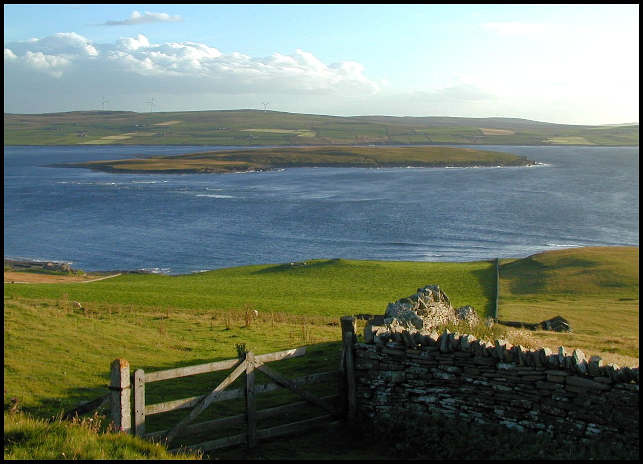
Garson was a farm on the Westside, now forming part of Westness farm. The house stood on a slope below Quoycare, and was the home of the Reid family in the 1840’s and 50’s. George Reid was born in Westray in 1755, and married Barbara Logie, daughter of Gilbert Logie and Helen Scott in Westray. George came to Rousay as a servant at Westness, and lived at nearby Pow where he and Barbara raised a family of six children between 1801 and 1819; Barbara was born in 1801, George in 1807, Peter in 1810, Jean in 1813, Elizabeth in 1815, and Mary in 1819. George and Barbara moved to Garson, and their son George stayed at Pow with his family and continued farming the surrounding land.
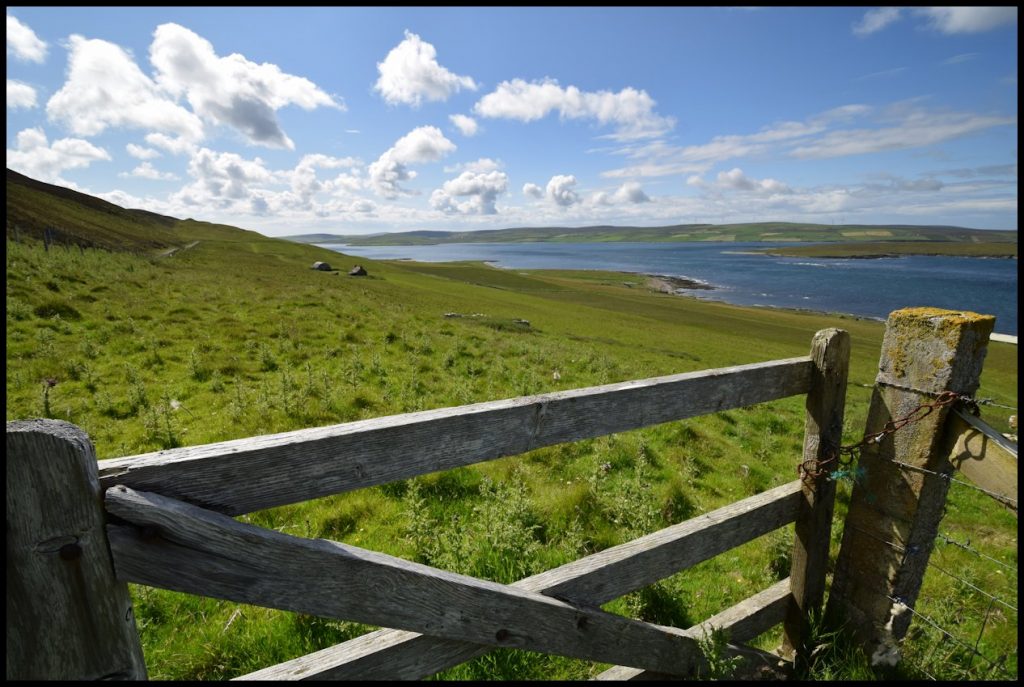
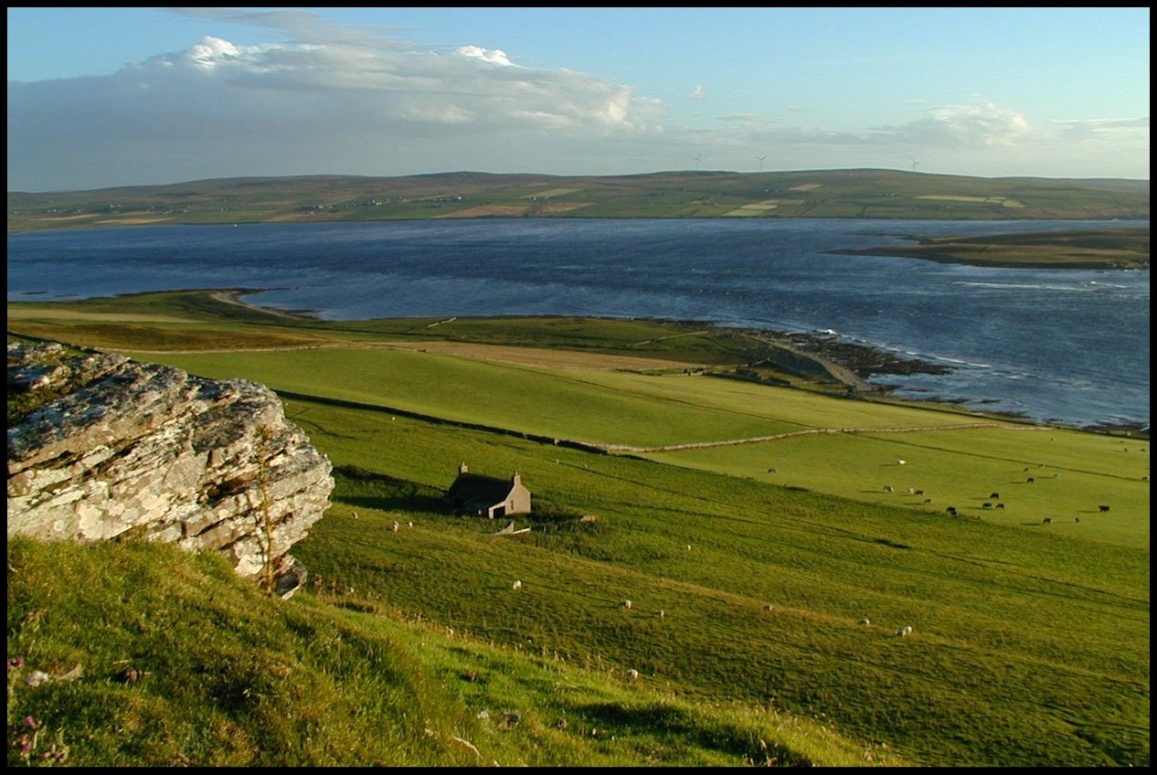
The view the Reid family would have had from Garson
Peter Reid, born in 1810, was a fisherman. He married Mary Louttit, daughter of Drummond Louttit and Betsy Flaws, who was born in 1807, and they had three children, Elizabeth Traill, Mary and Peter.
In 1862, daughter Mary had a son, and he was christened Alexander Learmonth Reid. He married Harriet Logie, a daughter of shepherd Robert Logie and Mary Murray, and they had two sons, Alexander, and Harry.
Harriet died of haemorrhage three hours after Harry’s birth at Brough, on 26th November 1894, her husband Alexander later moving to Melsetter on Hoy, where he was employed as a gardener. Come World War 1 Harry joined up, and served with the 3rd (Reserve) Seaforth Highlanders, and his brother Alex served in a Canadian artillery unit and survived the war. Harry was not so lucky though, for he died of measles and pneumonia on May 14th 1917 at the age of 22.
The following has been extracted from The Orcadian newspaper of May 23rd 1917:-
ROUSAY MILITARY FUNERAL:- On Thursday last the remains of Pte. Harry Reid, of the Seaforth Highlanders, the son of Mr. Alexander Reid, gardener, Melsetter, Longhope, was brought to the island by patrol boat and interred in Westside churchyard. The bearing and firing parties were of the O.R.G.A. Territorials, and they accompanied the remains from Kirkwall. There were present also a number of relations and friends from Longhope. They were met at Westness by a large number of inhabitants, who followed the cortege to the graveyard. The service, which was most impressive, was conducted by the Rev. Duncan Maclaren of Evie, who kindly officiated in the absence of the Rev. J. Deas Logie, who is now attending the assembly. The greatest sympathy is felt for Mr. Reid, father of the deceased, which was evidenced by the number of mourners who accompanied the remains to the churchyard. Mr. Reid’s other son joined the colours in Canada, and is now serving with the Canadians.
Quoygrinnie was a cottage at the side of the road on the Westside, above the old farm of Brough. A rental of 1740 records Gilbert and James Flaws as the tenants. One hundred years later its occupant was James Smith, though it was not long before he moved to No 3. Frotoft [Brough].
By 1841, the census tells us Helen Yorston took over the tenancy. A few years later, in 1846, Alexander Logie from nearby Windbreck, lived at Quoygrinnie. He was a merchant and lived there with his second wife Barbara Murray.
Alexander was born in 1796 and his first wife was Isabel Harrold. Their first three children, James, Charles, and Betty were born when they were living at Cott, Westside, between 1819 and 1823. They had three more daughters, Betty, Maria, and Mary, when living at nearby Windbreak, between 1825 and 1831. Alexander then married Barbara Murray, and they had five children born between 1839 and 1850; Magnus, Eliza, Margaret, Alexander, and John.
By 1881, the youngest of all these children, John Logie, who was born in 1850, was the tenant of Quoygrinnie. He was a shepherd and later a cattle dealer, and in 1872 he married 33-year-old Mary Gibson, daughter of John Gibson and Barbara Craigie of Vacquoy. They had three children; Mary, born in 1873, John in 1880, and Margaret in 1877, but she died at the age of just 5.
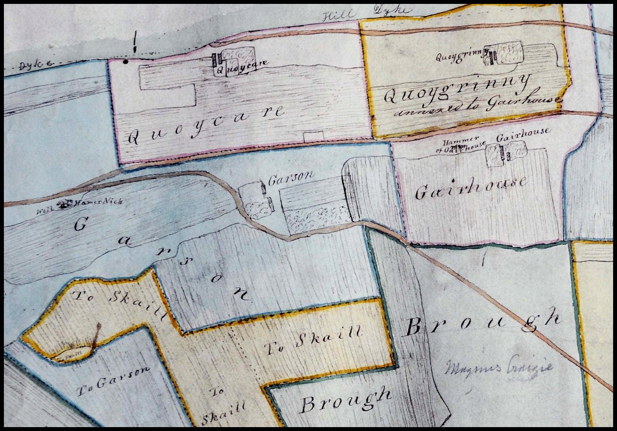
Quoycare was a cottar house on the roadside above Brough on the Westside close to Quoygrinnie, and described in 1880 as being ‘12 chains NW from Quoygreena, one storey, built of stone, thatched, and in fair repair.’
William Craigie was the son of Drummond and Isabel Craigie of Whome, Westside, and was born on May 3rd 1798. In 1822 he married 20-year-old Janet Leonard, the daughter of Peter Leonard and Isabella Flaws, and they had two children whilst living at Whome; James, born on May 4th 1823 and Peter on November 17th 1827. They moved to Mansmasshill where daughter Janet was born on October 19th 1829, and it was not long after they moved to nearby Quoycare, where four more children, Thomas, Magnus, Mary, and William, were born between 1831 and 1838.
The 1851 census described William as an agricultural labourer, as was his son Thomas. Magnus attended the nearby school, Mary was employed at home, and 12-year-old William was described as an invalid.
In the latter part of the century Magnus, then earning a living as a fisherman, was the only occupant of Quoycare. He married 21-year-old Mary Logie, daughter of Westness shepherd Robert Logie and his wife Mary Murray. Unfortunately Mary died in February 1891, aged just 29. She was buried in the Westside kirkyard alongside her siblings: Robert who died in April 1876 aged 19 years; James, who passed away in August 1884 aged 16, and her sister Eliza, who was 21 when she died on January 12th 1886.
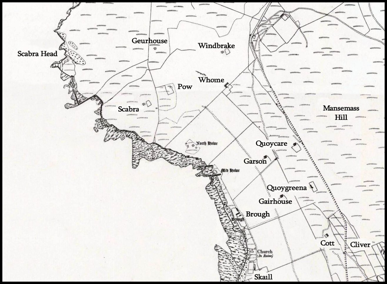
Edited section of the first Ordnance Survey map of Rousay, showing the location of the houses named above.
Whome was a farm on Rousay situated close to the dyke which separated Westness from Quandale. Spelt Quham in the Rental of 1503, it was skatted as a 3d. land. It is recorded that the rents of two and a quarter pennylands in Quham, which had belonged to Sir Malise Sperra, were then “in Sir Thomas Cragy’s and John Cragy’s hands”; the remaining three-quarter pennyland was called Breck. The old farm-buildings stood a little way below the public road above the old houses of Brough, and were later used as sheepfolds.
Drummond and Isabel Craigie lived and worked at Whome towards the end of the 18th century. They had three children; Mary was born in 1792, William on May 3rd 1798, and James, who was born on July 28th 1801. Drummond then married Barbara Murray in 1804, and they had two children; Betty was born on July 29th 1805, and Alexander who was born at Kettlewhoam on April 25th 1808. A lady known as Giles Craigie became Drummond’s third wife in 1822.
Living at Wholme, as it was spelt in the census of 1841, was Cecilia Craigie, a 70-year-old farmer, and Betsy Craigie, though the main tenant was the aforementioned Alexander Craigie. He married Ann Murray, the daughter of Magnus Murray and Janet Robertson of Tofts, Quandale, who was born in 1813. They had seven children; Mary, Janet, John, and Margaret, who were all born between 1837 and 1847 at Wholme. The family then moved to Loweshouse in the neighbourhood of Feolquoy in Wasbister, where James and Alexander were born in 1850 and 1853. They then they moved into Feolquoy, where another son Magnus was born in 1856.
The farm was spelt Whome in the census of 1851, and there were two tenants; Christian Danny, a 52-year-old widowed pauper, and her daughter Betsy, then a 15-year-old agricultural labourer.
The other tenant was James Murray, a 34-year-old agricultural labourer. Having been evicted from Tofts at Quandale the Murray family moved to Whome. Magnus Murray died in 1846, and his widow Janet was now in her 68th year and described in the census as independent. James’s 25-year-old sister Mary, who was an agricultural labourer, also lived there. They were the last inhabitants of Whome before it became incorporated within Westness farm.
Windbreck, or Windbreak as it was spelt in the census of 1841, was a house on the Westside situated below the Slap of Aklar, near the bend on the public road close to the old School. At this time it was occupied by farmer Alexander Logie and his family. Alexander was originally a merchant, living at Quoygrinnie and his first wife was Isabel Harold. They had six children, the first three of whom were born at Cott, Westside – James on December 13th 1819, Charles on December 13th 1821, and Betty on August 29th 1823. The other three were born at Windbreck – another Betty, born on November 13th 1825, Maria on July 20th 1828, and Mary on May 1st 1831. Alexander’s second wife was Barbara Murray and they had a further five children; Magnus, born in 1839, Eliza in 1842, Margaret in 1846, Alexander in 1849, and John, in 1850.
The land of Geurhouse, an even older farm to the south-west, had already been annexed to Windbreck by 1841. Nearer the cliffs was another farm called Skaebrae, or Scabra, reckoned sometime as a 5d. land. Between 1733 and 1740 it was occupied by Ursula Marwick. It then passed into the hands of John Couper who was married to Jean Ballenden and they had a son Magnus. In 1799 George Hercus and his wife Christian lived and worked there. The farm and its land later became part of Westness Farm.
Pow was a farm on Westside, later incorporated within Westness Farm. The old house-site was situated between Whome and Scabra Head and in the early 19th century it was occupied by the Reid family and they farmed the adjacent land.
George Reid was born in Westray in 1755 and he married Barbara Logie, the daughter of Gilbert Logie and Helen Scott of Westray. They had six children; Barbara, born in 1801; George in 1807; Peter in 1810; Jean in 1813; Elizabeth in 1815; and Mary who was born in 1819, but she died at a young age.
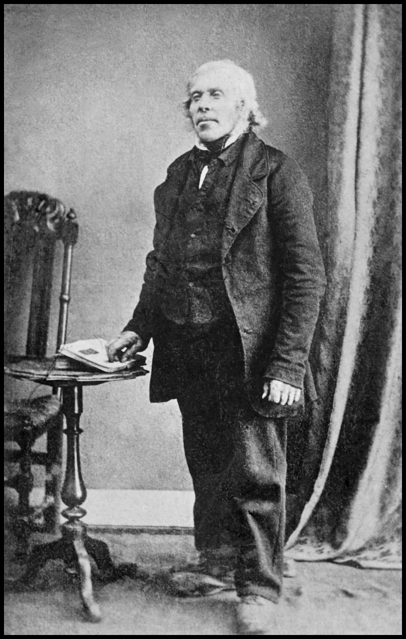
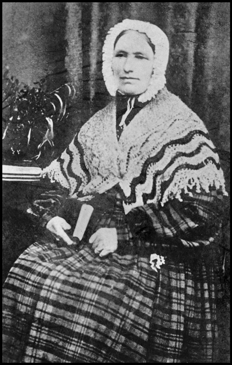
By the time the census of 1841 was carried out old George and his wife Barbara had moved along the Westside to Garson. In 1831 their son George married Janet Harcus, daughter of William Harcus and Christy Flaws, and between 1832 and 1844 they had eight children: firstborn was William, on April 10th 1832, but he died at the age of just ten; George, born on January 1st 1834; Mary, on March 28th 1835; John, born on November 6th 1837; Peter, on November 19th 1838; Hannah, on December 2nd 1840; William, on December 21st 1842; and Lydia, on October 11th 1844. George was a cottar sub-tenant at Pow, and during the Westness Clearances in 1848 he was deprived of the land. Having been evicted he and his family moved to the opposite side of the island where he built a new home – Wasdale.
George Reid the younger, and his wife Janet Harcus
[Both photos courtesy of the Tommy Gibson Collection]
Rousay abounds in prehistoric sites of archaeological interest, with over 100 recorded so far. It is likely that some have been lost forever by farming operations while others lie beneath the soil still hidden from sight. Less than a third of those on record have been examined through either complete or partial excavation. The variety of structures found include brochs, burial cairns, standing stones, Norse burial cists, earth-houses, burnt mounds or knowes, and Celtic chapels. The two best known and most visited of Rousay’s ancient monuments stand close to of each other on the Westside shoreline. They are the Midhowe Broch and the Midhowe Stalled Cairn.
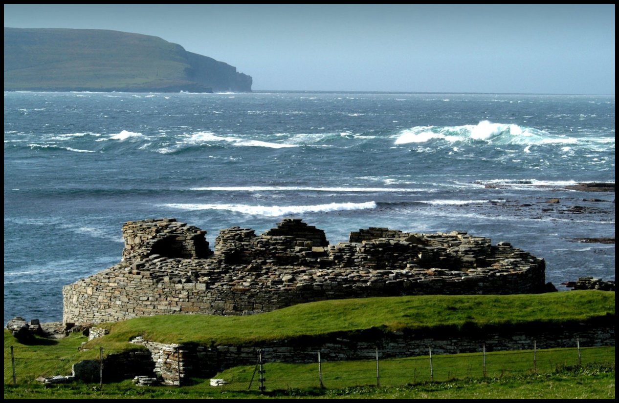
Constructed and used sometime between 200BC and 200AD, on first glance the broch at Midhowe would appear to have been built with defence in mind. Standing on a promontory formed by two geos, the broch is protected on one side by the sea and on the landward side by a stone rampart and ditch. This massive rampart is built in an arc between the two geos and effectively cuts the site off from the land.
Although there is no doubt that these outward defences would have looked impressive in their heyday, it may be that they were merely built for dramatic effect – the southern end of the rampart stops short of the geo and therefore leaves a ledge on the rock face by which a “visitor” could have easily access the promontory.
Like the Broch of Gurness on the Mainland coast almost opposite, Midhowe was surrounded by a group of external buildings but these were probably from a much later date when the need for defence was not as important. Coastal erosion, a problem for all shore sites such as Midhowe, has greatly damaged the remains of these outhouses
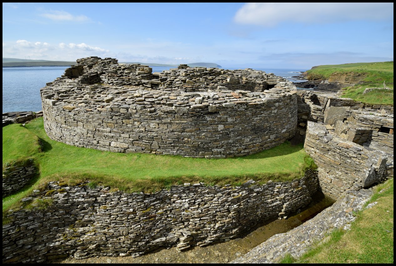
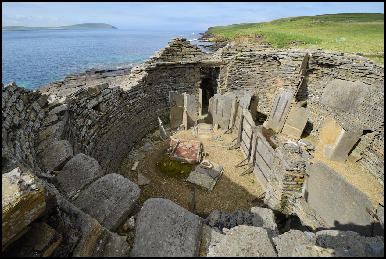
The remains of the broch’s circular wall stand to a height of approximately four metres and within the structure the general layout of the ground floor has been remarkably well-preserved.
Large slabs of local flagstone were used to divide the interior (diameter 9.6 metres) into two smaller, semi-circular rooms that were then further divided into smaller cells each with its own hearth and water-tank. Water was supplied from a spring that flowed up through a crack in the rocks and during the excavations, it was written that the main storage tank retained water which: “remained clear and drinkable all the years the work of excavation was going on.”
Midhowe’s broch structure is interesting in that it had a ground floor gallery built into the walls and as such differs from the normal solid walled brochs found in the islands.
This hollow base was probably not a good idea because at some point during its occupation, the broch’s gallery had to be blocked and filled in when the walls threatened to collapse. A projecting ledge, about three metres (11 feet) up would have at one time supported a timber first floor.
Perhaps the most interesting thing about Midhowe is the artefacts found within during excavation. The majority of these were the normal domestic items as you would expect to find on such a site – tools, whetstones, quern-stones etc. However, the Midhowe Broch yielded a few surprises as well. Among the items uncovered were the remains of a bronze ladle and some shards of pottery. These items had a definite Roman origin and as Orkney was well away from the areas of Roman control, they must either have been acquired as gifts or through trading or raiding excursions south.
The discovery of bronze jewellery on site also hints at the wealth and status of the family unit that lived at Midhowe. Archaeological evidence indicates that at some time a bronze-worker was based at the site but the small quantity of debris uncovered may simply mean that this craftsman was a travelling artisan.
The broch, a fortified and protected structure, was built as a place that could be retreated to in times of danger. It was excavated in the early 1930s and it was at that time also that the protective seawall was constructed in front of it.
Built by local stonemason Stanley Gibson, with assistance from Peemo Smith and Willie Grieve, this semi-circular seawall is a remarkable structure of five-inch thick slabs of rock set on edge on the rocky foreshore like giant books on a shelf. It slopes inwards for most of its height and outwards for the topmost two feet. Both the broch itself and this seawall rampart, built to protect it from the ferocity of the heavy seas that strike this side of the island, bear witness to the skill and craftsmanship of Orkney stonemasons working on the same site 2,500 years apart.
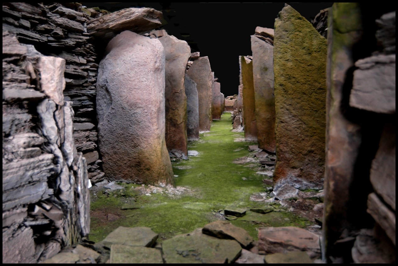
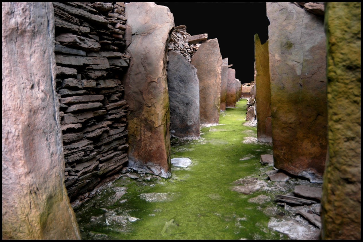
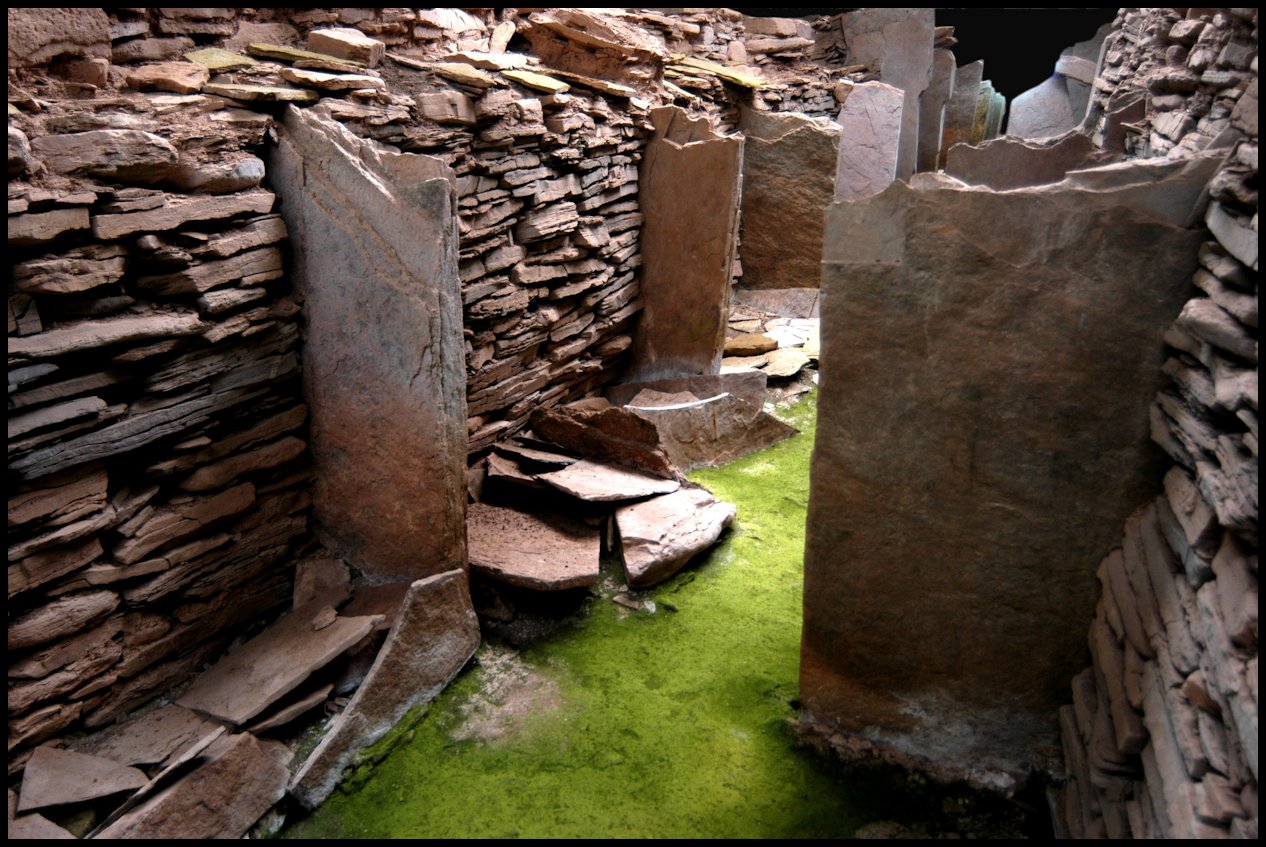
A stone’s throw from the broch is the stalled cairn, a burial place dating back about 5,000 years to the time of the Stone Age people. When it was excavated in the early 1930s it was found to be a building over 100 feet long and over 40 feet in width. The walls are a massive 18 feet thick leaving the interior as a long narrow chamber only a little over seven feet wide and varying in height from four to seven feet.
Down each side of a narrow central passage the chamber is divided into 12 compartments by flag-stones set on edge, giving an appearance very similar to that of a cow byre. It was in these compartments or stalls that the remains of 25 bodies were found, all on one side of the passageway. The bones of some animals and birds were also found.
This stalled cairn was considered so important a find that a stone building with overhead lighting and an overhead viewing gangway was erected over it to protect it from further decline.