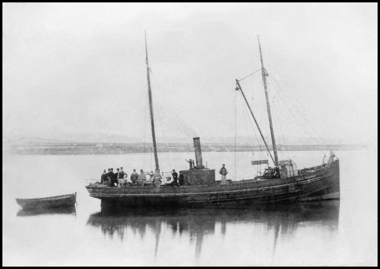
The ss Lizzie Burroughs lying off Rousay Pier in the 1880s
1879 April 5th Shetland Times. – LAUNCH THE LIZZIE BURROUGHS. – Last week there was launched from the building yards of Messrs J. McKenzie & Co., Albert Dock, Leith, a fine smart packet, intended for the coasting trade between Rousay and Kirkwall. Her length is 65 feet; beam, 15 feet; depth, 6 feet; and she is to be fitted with a large hold forward, and a cabin abaft for passengers. As she glided into the water she was named the “Lizzie Burroughs” by Mrs George McKenzie, in honour the wife of Colonel Burroughs the chairman of the Company, to whose order she has been built. She is a sister ship the “Sefton” launched the same firm last June, and she will be fitted out with her engines and other gear on the most improved principles by Mr M. P. Galloway, marine engineer, Leith. We may mention that the whole arrangements of the launch were very efficiently carried out, and it is very creditable to the firm – taking into consideration the position of the building yard – that the vessel was got into the water without a single hitch or the slightest damage.
1892 May 3rd John o’ Groat Journal. – SALE OF THE s.s. LIZZIE BURROUGHS. – lt having been agreed to wind the Rousay, Evie, and Rendall Steam Navigation Company, the steamer Lizzie Burroughs was offered for sale at Kirkwall on Monday the upset price of £250. After spirited competition, the vessel was knocked down to Mr Robert Garden, merchant, for £484. Mr T. S. Peace was the auctioneer. One of the conditions of the sale was that the name of the steamer was to be altered within three months. The steamer will therefore be called the Aberdonian, and will continue in the present trade between Kirkwall, Rousay, Evie, Rendall, etc.
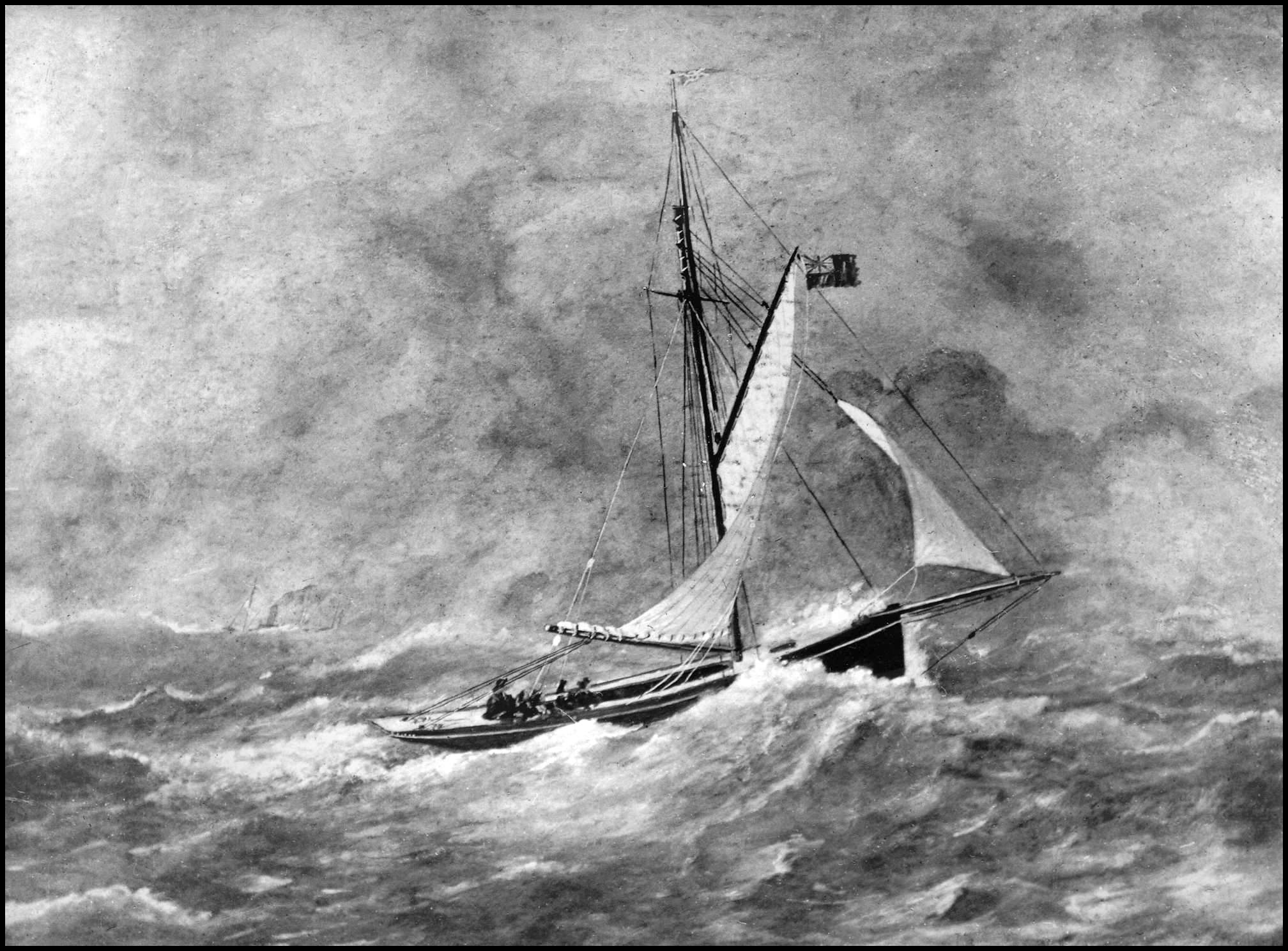
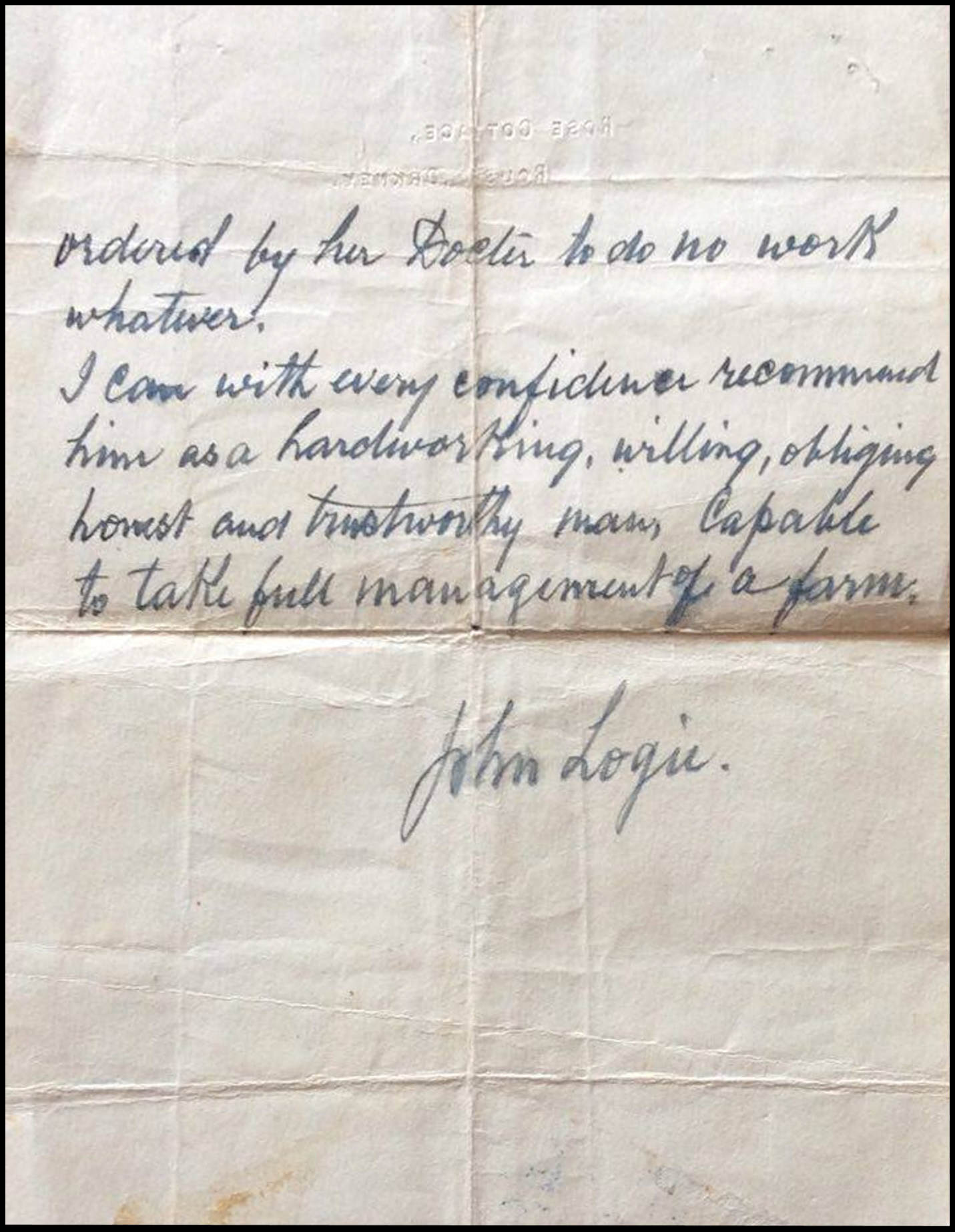
John Logie was the butler at Trumland House. He was also an accomplished photographer and artist, his expertise with the brush evident in his painting of General Burroughs’ yacht ‘Annie’.
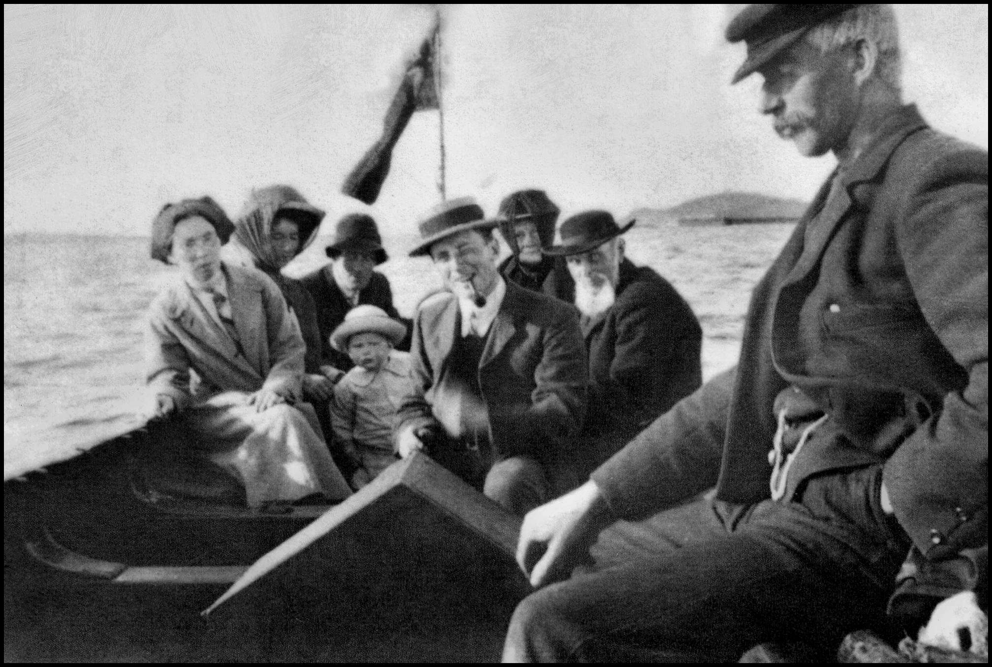
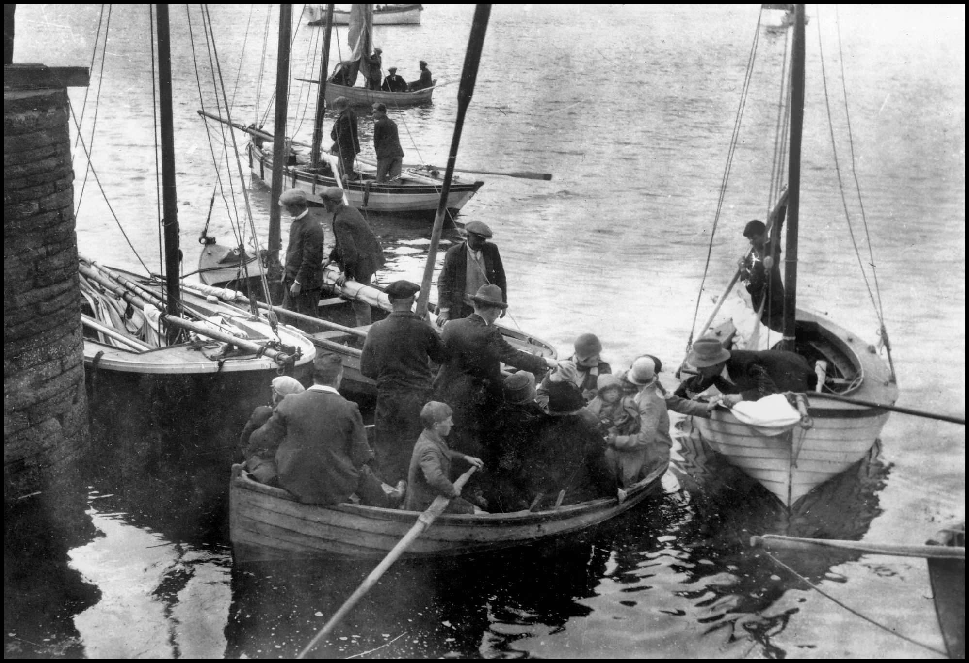
The Reverend Alexander Pirie, Rousay United Presbyterian Church minister, [white beard, second right] with his wife Elsie and family members aboard Alick Logie’s boat in a photo dated August 1913. Alick lived at Pier Cottage with his father John, a retired yachtsman, and mother Jane.
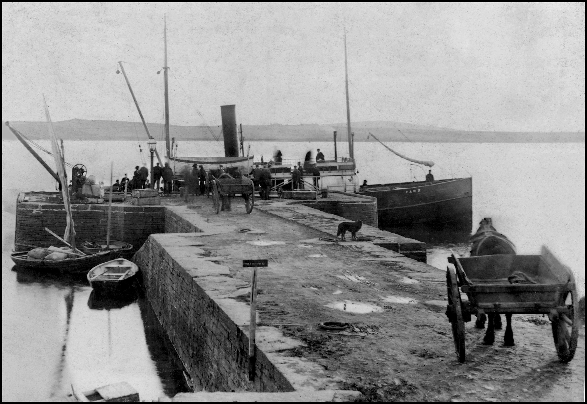
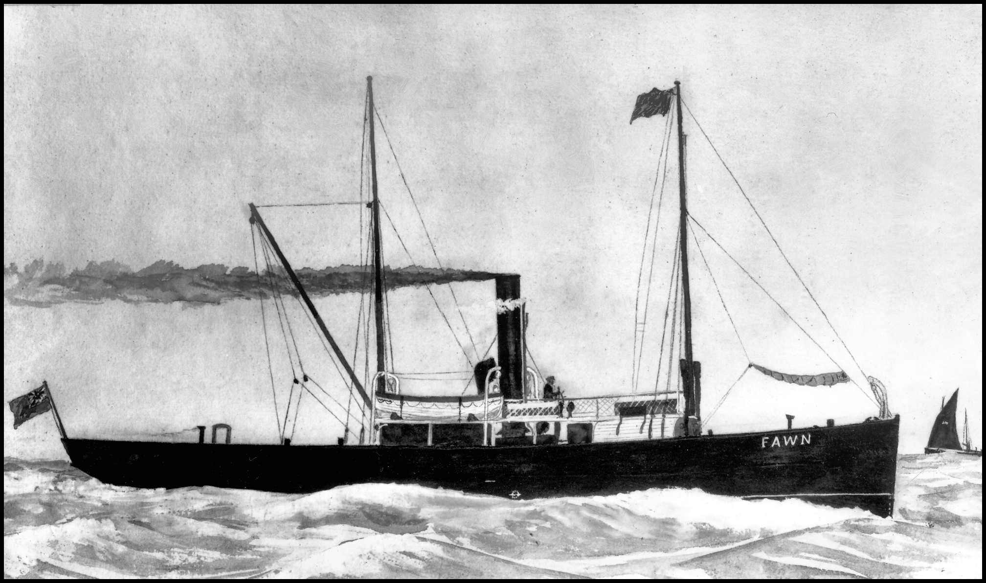
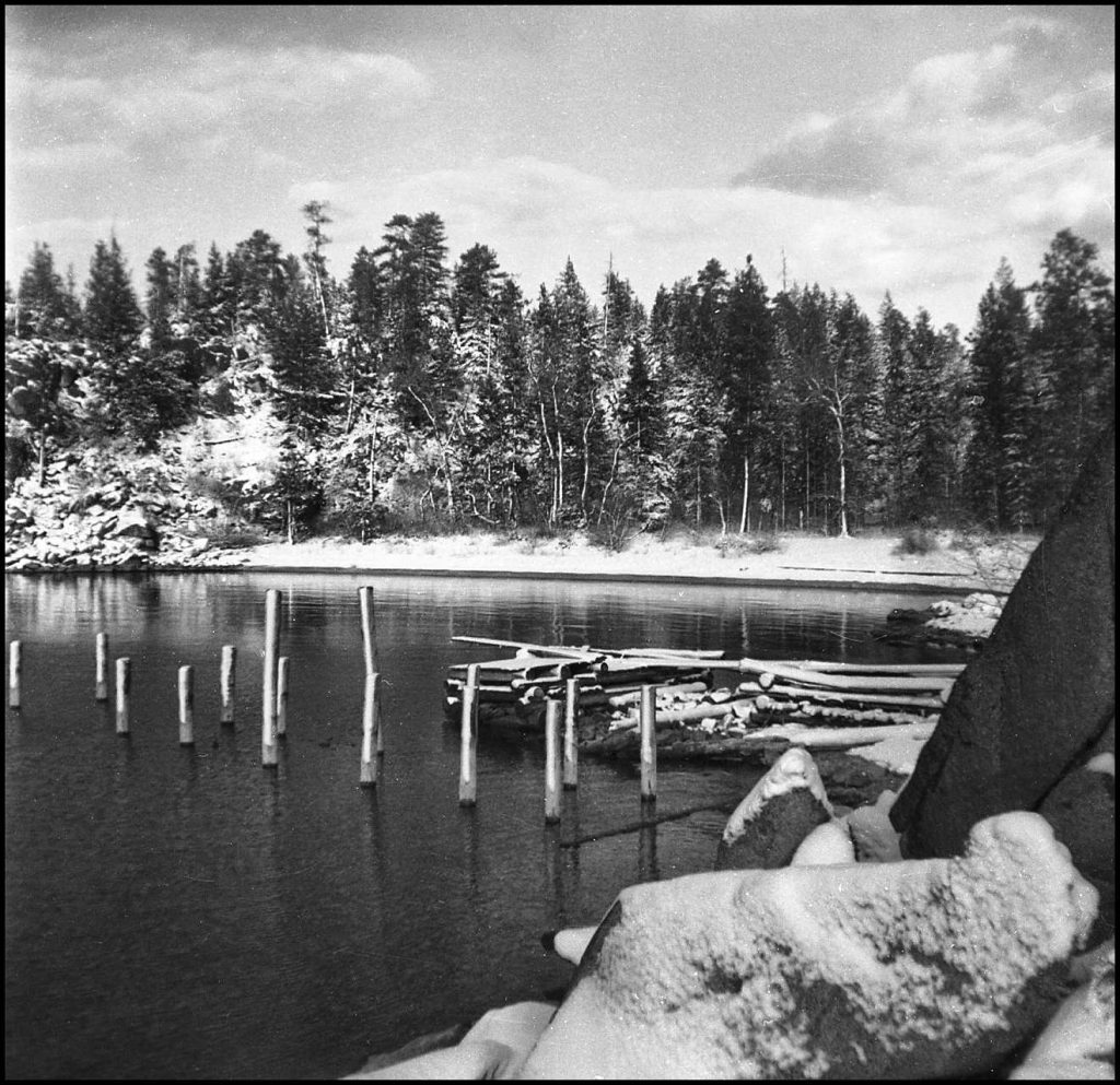
The ss Fawn at Rousay pier in the early 1900s
When George Robertson’s ship Orcadia (I) became uneconomical to maintain, he helped to create a company which could afford a new steamer for the North Isles of Orkney. He raised capital through selling shares, and managed the company himself, calling it the Orkney Steam Navigation Company. It operated Orcadia (I) for a matter of months before Orcadia (II) was launched. Soon the Fawn was purchased in 1892, and she began operating to Rousay. The company operated just these 2 vessels until 1919, by which time the Fawn had been disposed of and Countess of Bantry was acquired. She operated as second service to the North Isles covering Rousay and the main North Isles roster, if Orcadia (II) was unavailable.
A painting of the ss Fawn by another accomplished Rousay artist, George Mainland
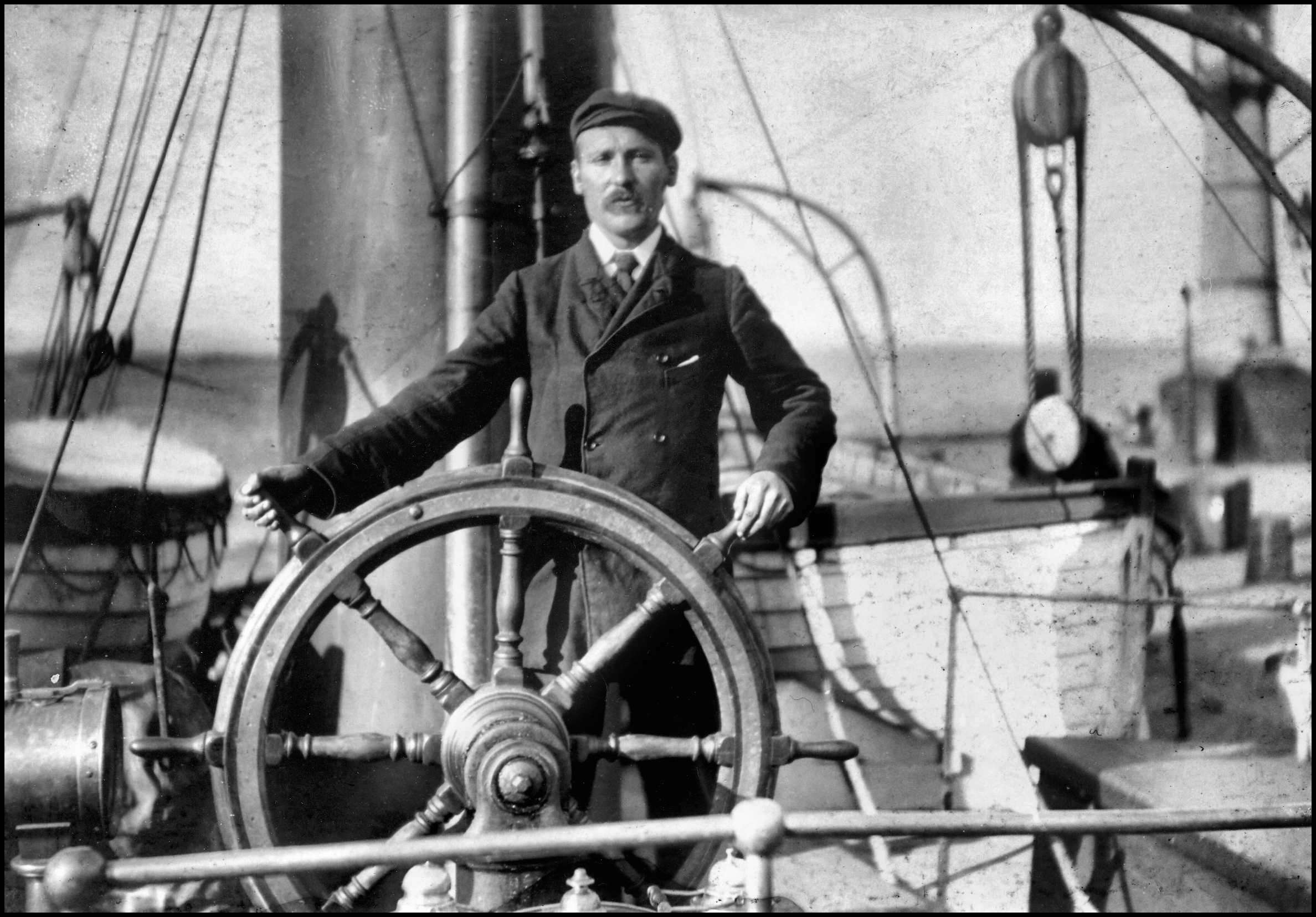
There was no wheelhouse on the Fawn. Therefore the ship’s master, Captain John Craigie [who lived at Lairo] had to man the exposed wheel in all weathers
1914 March 16th Dundee Evening Telegraph. PASSENGER STEAMER BECOMES TOTAL WRECK. – A Kirkwall telegram states that the steamer Fawn, of Kirkwall, while on passage from Kirkwall to the Island of Rousay, with passengers and general cargo, was driven by the tide onto the Holm of Boray and has become a total wreck. Crew and passengers were landed at Gairsay, and afterwards taken to Rousay.
[The above newspaper report is dated 1914, but the Fawn must have been refloated and repaired for she was eventually taken out of service in 1919]
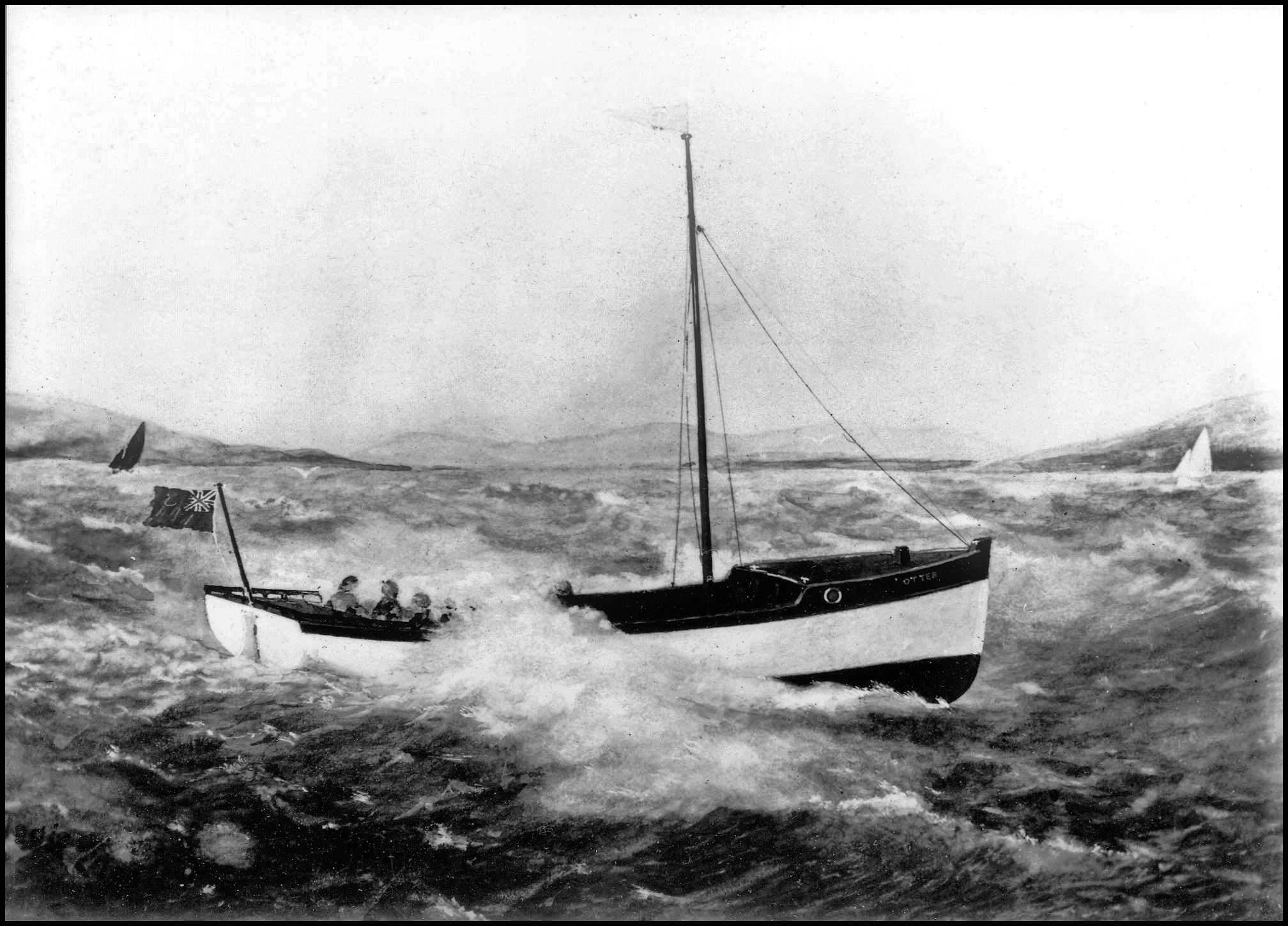
Another John Logie painting: the Otter, one of the best-known vessels in Orkney waters
The 32-foot Otter was built by Kirkwall boat builders James Maxwell & Son for Walter Gordon Grant of Highland Park distillers and Trumland Estate, Rousay. The 6.5-ton boat was launched in Kirkwall Basin on May 19th 1926.
Eventually the craft was bought by the National Commercial Bank of Scotland, which later became part of the Royal Bank of Scotland, with the idea of the Otter becoming a sea-going bank. Re-named Otter Bank, she was used to serve the more remote communities across Orkney during the 1960s, allowing islanders to manage their financial affairs without making the long journey to the mainland.
Taken out of service in 1970 the vessel changed hands, ending up rotting away in a Merseyside shipyard. She was rescued by the Friends of the Orkney Boat Museum and has since been restored to its former glory – and is now on display at the Lyness Museum and Visitor Centre, Hoy.
Rousay men James Stout, Rose Cottage, and Sandy Logie, Cubbie Roo, admiring the sleek lines of the Otter. c1950
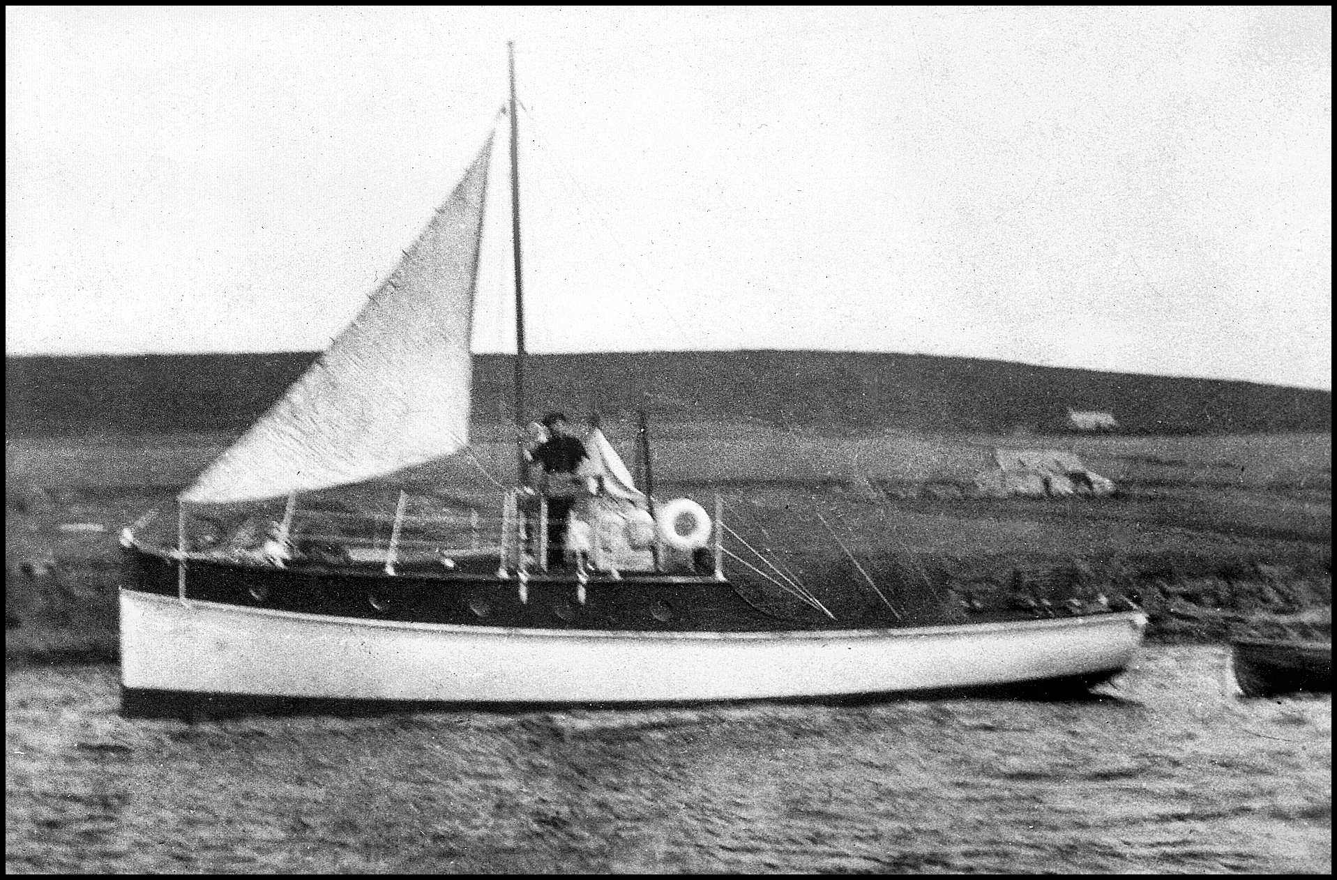
Not to be outdone by their brother’s fine craft, Walter Grant’s sisters, Mrs Low and Mrs Laurie [who lived at Westness House] owned the ‘Busso’. She is pictured here below Ivy Cottage, just east of Rousay pier.
A photo taken at the Rousay Regatta in 1924
The Aberdeen Press & Journal carried a report on the Rousay Regatta, held in July 1934…..Fresh to light westerly wind prevailed for the annual regatta at Rousay, in the Orkney Islands. Chief results: 22 Foot class – Sea Imp (W. Sinclair), 1 hr. 3 Foot – Ivy (J. Foulis), 1 hr. 2 mins. 13 secs. 14 Foot – Yala (N. Cooper), 36 mins 37 secs. All-comers – Sea Imp, 59 mins. 12 secs. Local race – Lottie (C. Craigie), 54 mins. 49 secs. Motor boat race – Elsie (W. Foulis). Rowing races – Men’s singles – John Wylie; men’s doubles – John and James. Wylie; Women – Mary Petrie and Molly Flaws. Among the spectators joy-riding in two planes over the regatta were two octogenarians, Malcolm Corsie and James Alexander.
Collision course! A photo taken at the 1948 Rousay Regatta
[All photographs from the Tommy Gibson Collection]
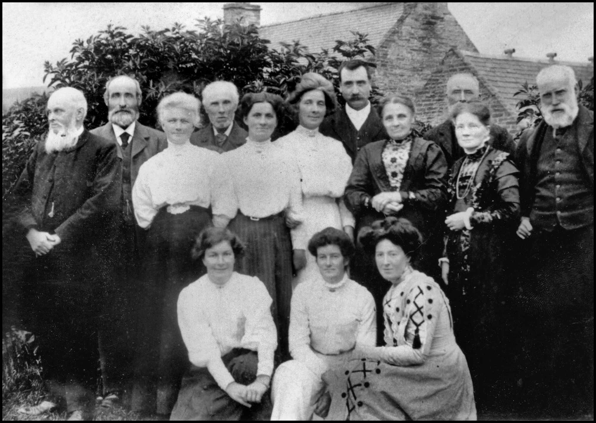
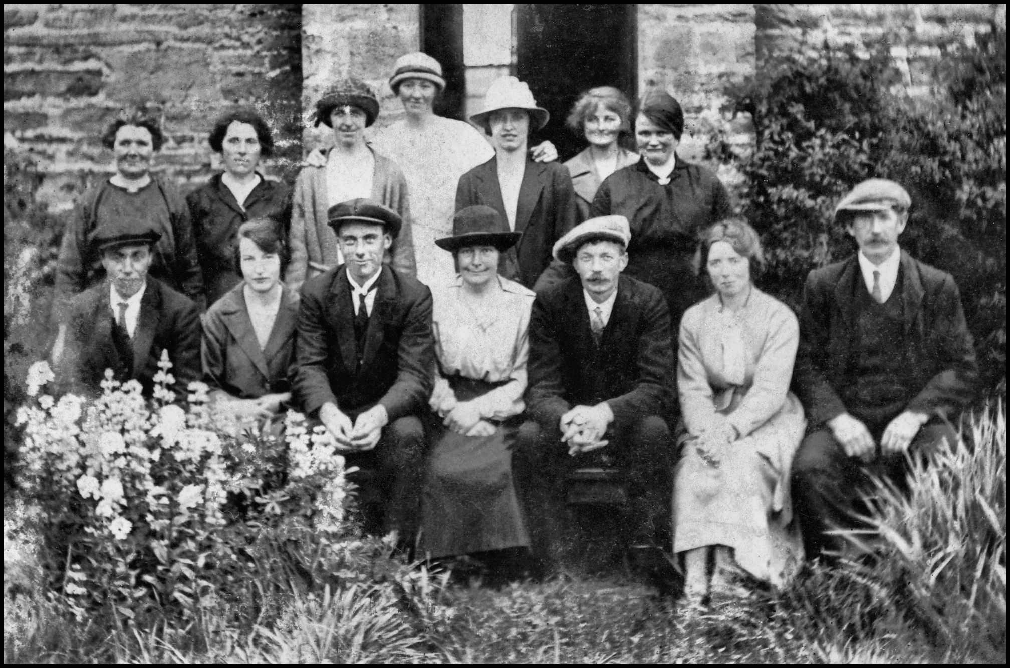
Here we have a group of fourteen folk. On the reverse of the photo there are just thirteen names, and I reproduce them as written!
From left: Rev Pirie; George & Annabella Gibson, Avelshay; Isaac Marwick & wife; David Gibson of the Bungalow, Jessie Marwick, Bella Robertson, Kirkwall, Hamish Horne & wife Betsy Ann Marwick. Seated: Mary Ann Inkster, Cogar; Annabella Clouston, Tou; Rose Ida Gibson, Hullion.
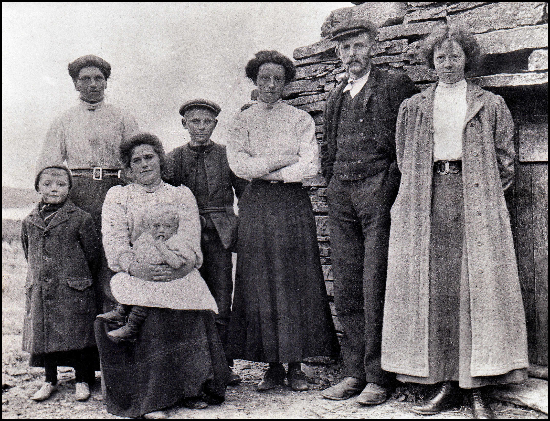
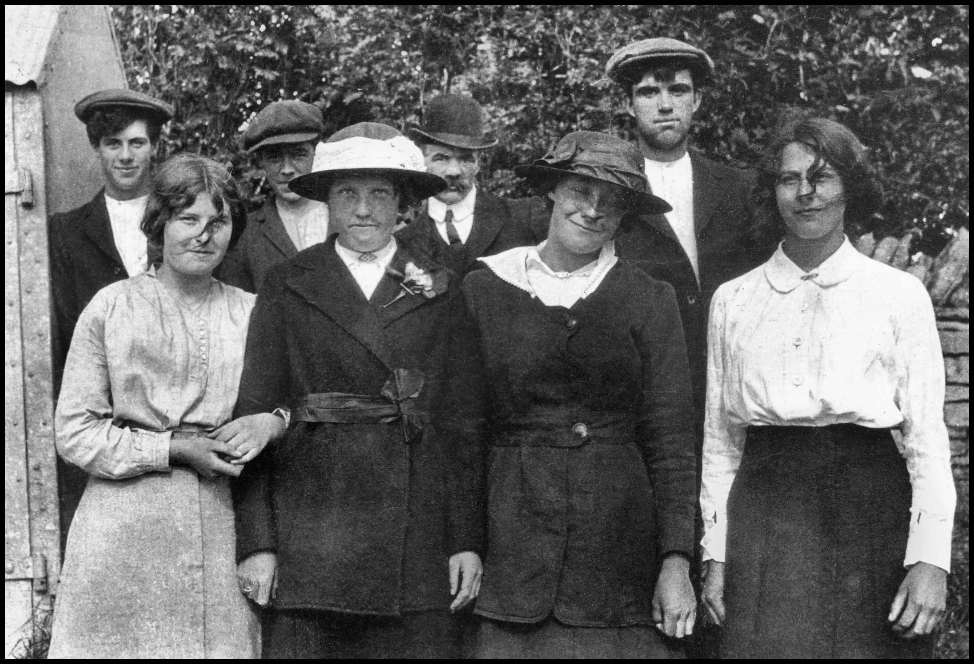
Rousay c1920. Left to right: ? ?; Jessie Gibson, Swartifield; Mrs Annie Craigie with baby; David Gibson, Swartifield; Agnes Corsie, Knarston; John Marwick, Innister; Janet Corsie, Knarston.
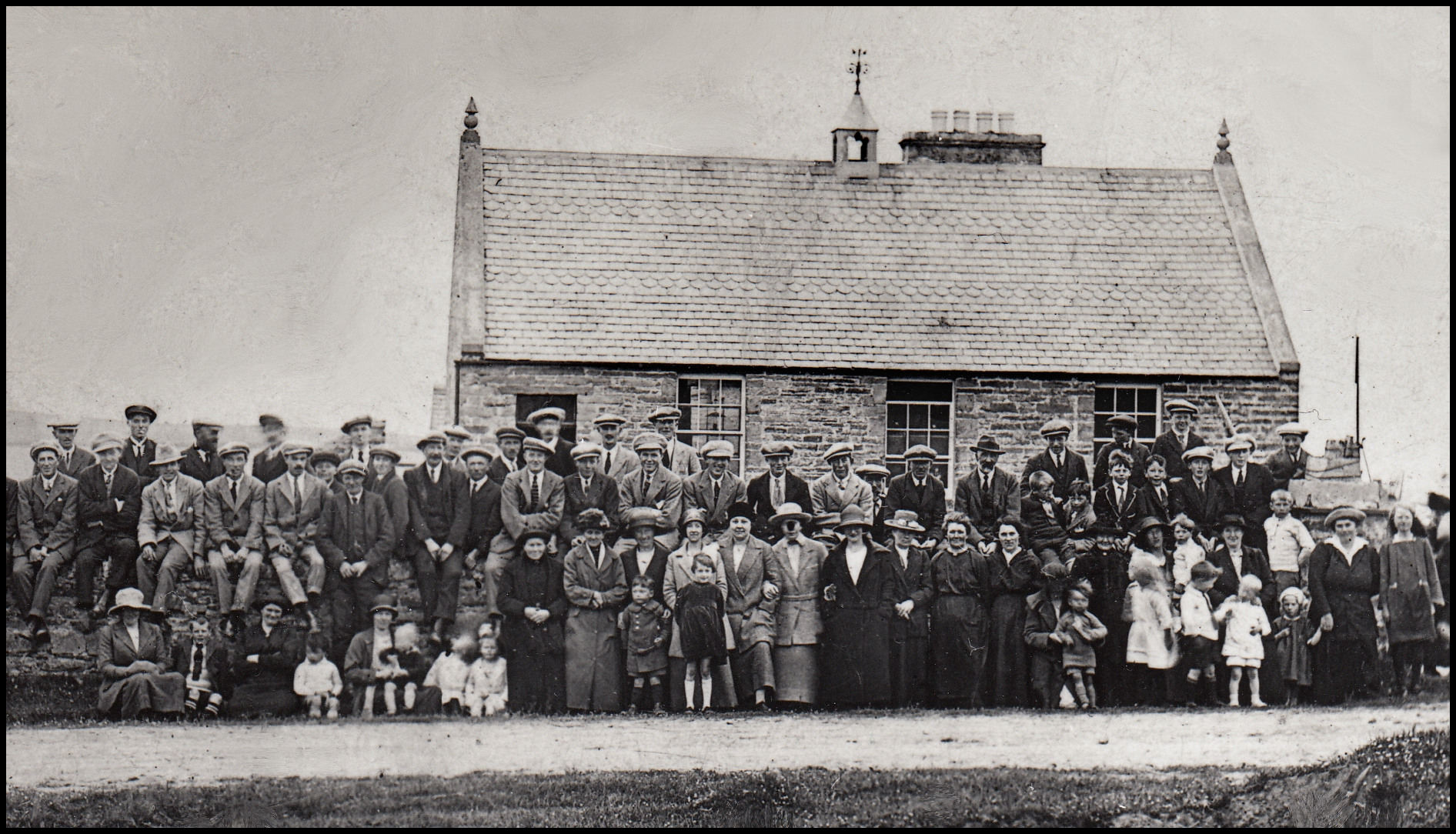
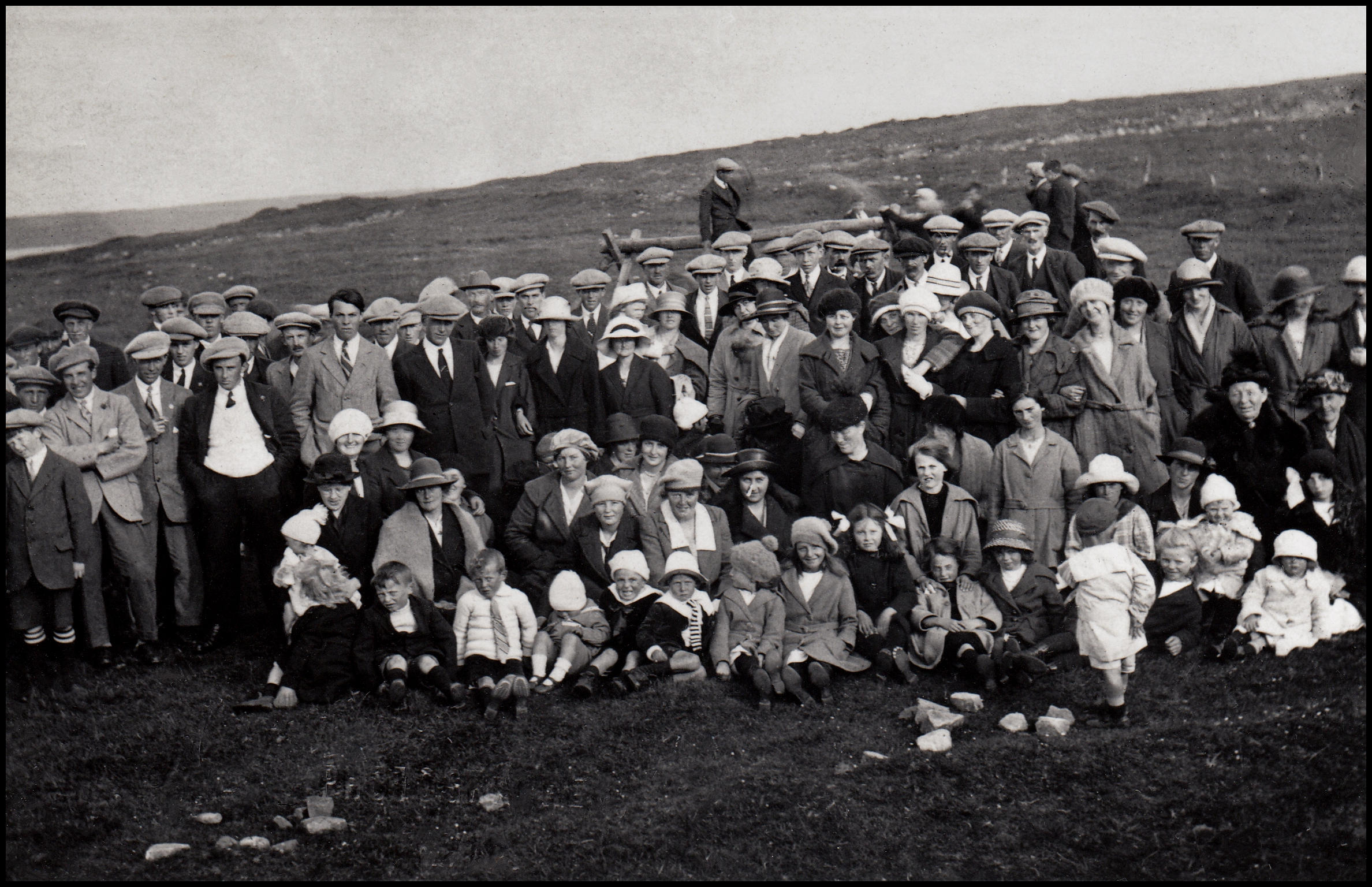
Wasbister School picnic, early 1920’s
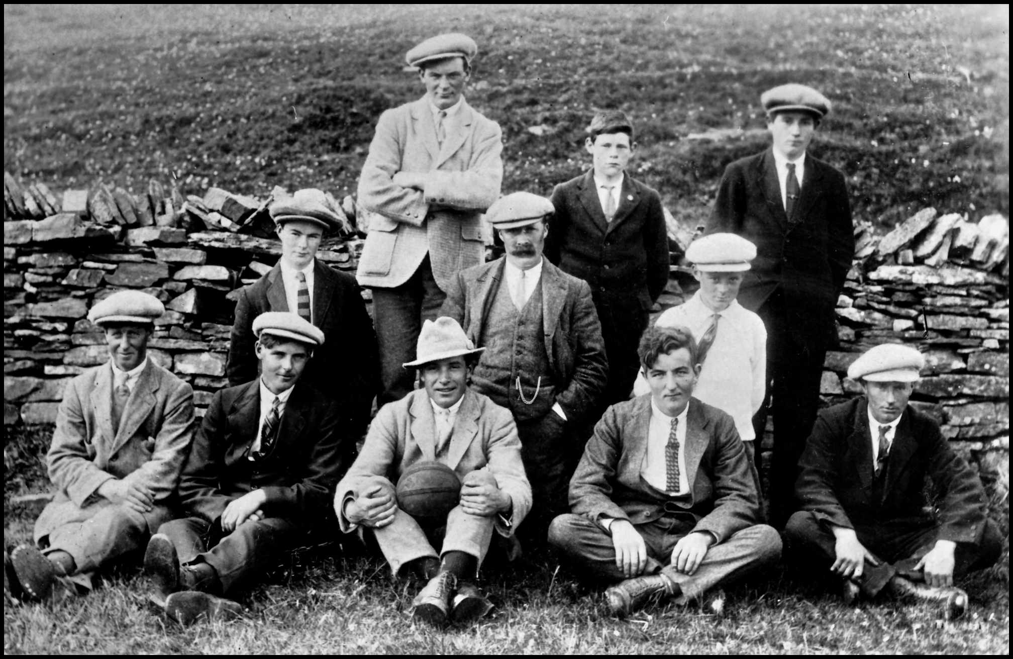
Rousay football team c1923: Back, from left: James Gibson, Hullion; ?; David Gibson, Brough; Middle row: Harry Logie, Ivy Cottage; ?; William Gibson, Hullion. Front row: Robert Sinclair, Newhouse; ?; Hugh Craigie, Deithe; Jim Craigie, Viera Lodge; Davidson Harrold, Rose Cottage.
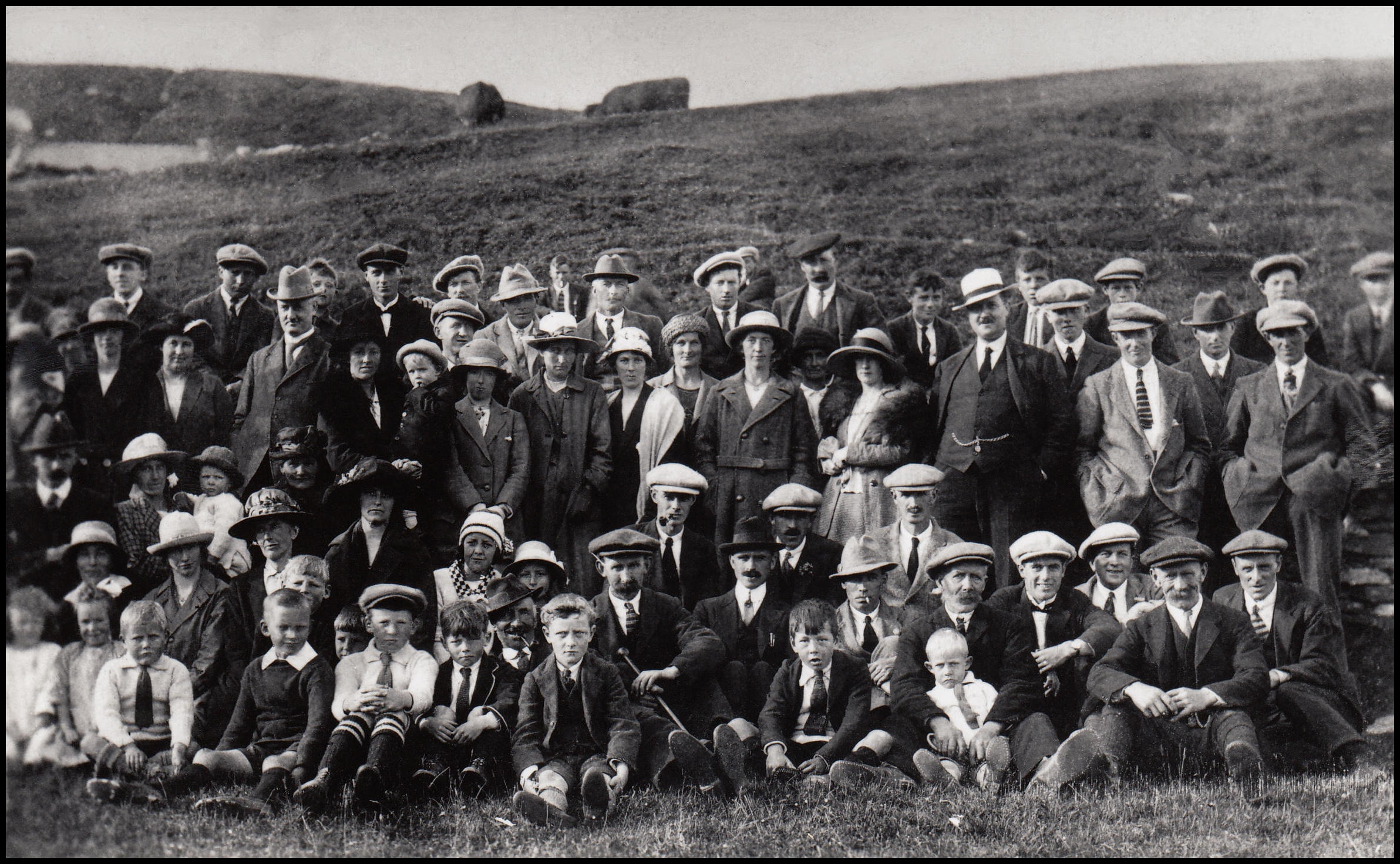
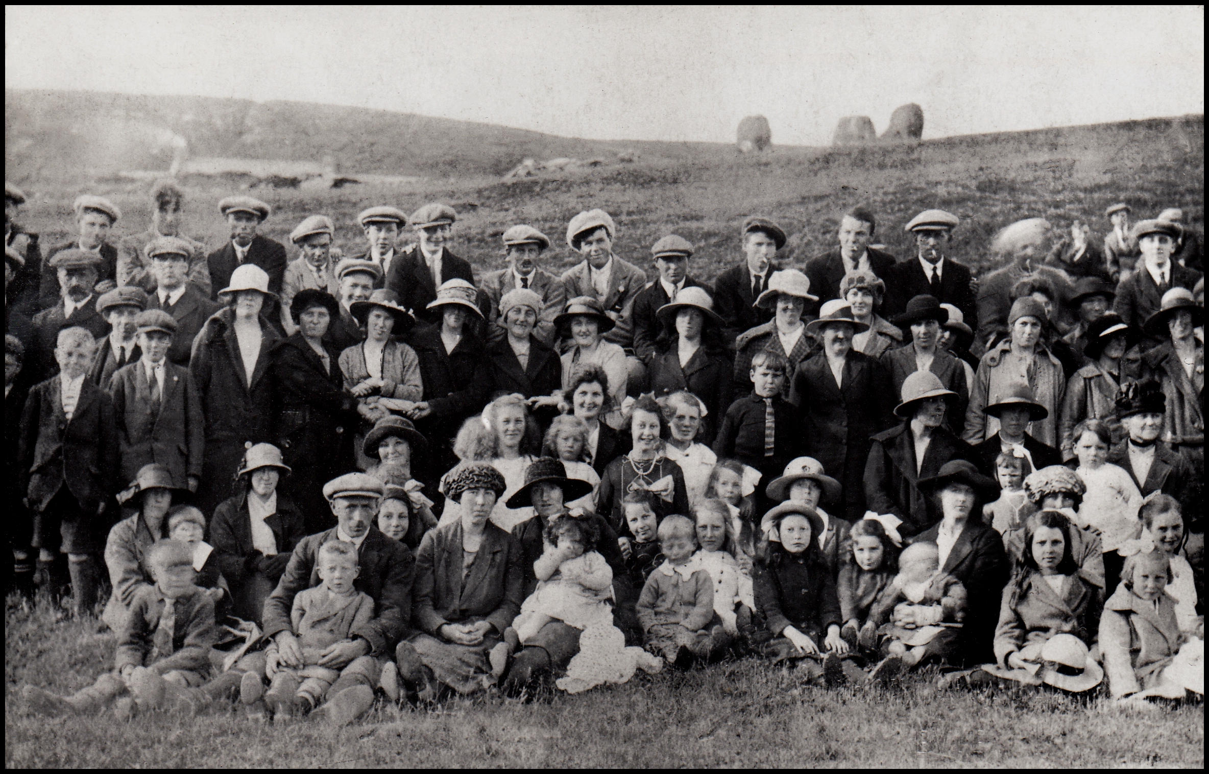
This and the two photos below show a gathering of folk at a Frotoft picnic held in 1923
A group of Wasbister folk pose for the camera in 1924.
Back row, from left: Annabella Clouston, Tou; Maggie Anne Craigie, Claybank; Ida Marwick, Grain; Ida Craigie, Turbital; Annie Craigie, Ivybank [teacher]; Liz Moar, Saviskaill; Lizzie Marwick, Whitemeadows. Front row: Jim Craigie, Deithe; Annabella Sinclair, Sketquoy; Robert Sinclair, Vaquoy; Mary Anne Inkster, Cogar; Hugh Sinclair, Sketquoy; Clara Clouston, Tou; James Craigie, Claybank.
Dated c1925. Rear, from left: Hugh Craigie, Treblo; James Marwick, Avelshay; John Gibson, Avelshay; John Harrold, Rose Cottage. Front row: Jeannie Harrold, Rose Cottage; Cissie Harrold, Springfield; Minnie and Lizzie Corsie, Knarston.
Annie Reid, Tratland; Kathleen Gibson, Avelshay; John Mainland, Cott; Edith Gibson, Avelshay; Minnie Reid, Tratland – photographed in the 1930s
Sandy Logie, Cubbie Roo; Willie & Peggy Marwick, Ronaldsay; George & Maggie Sutherland, Viera View; Barbara & George Harrold, The Hut. c1939.
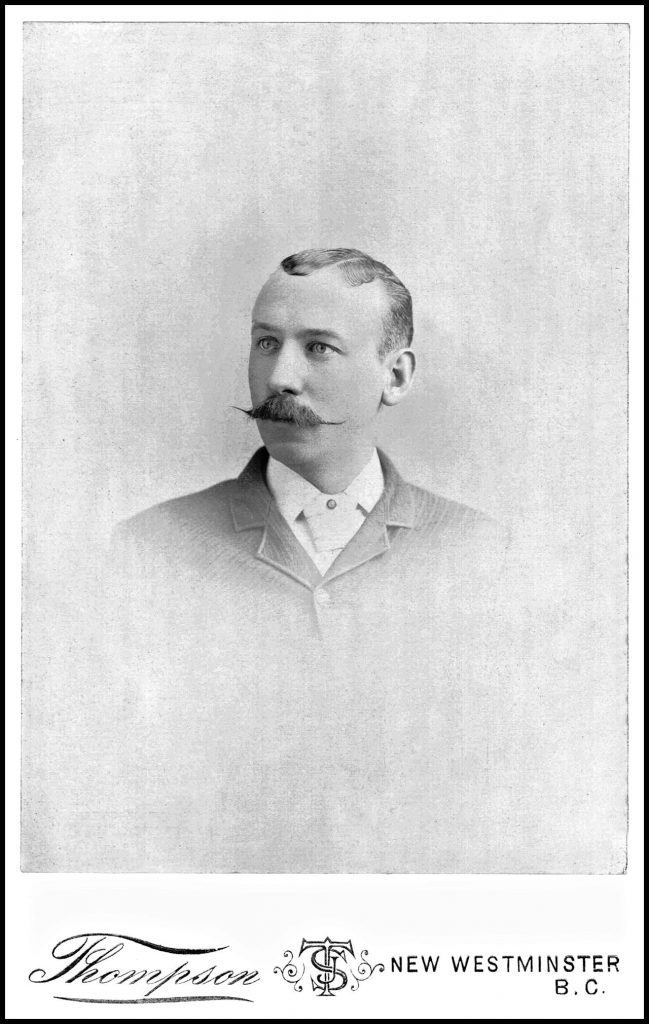
This is the life story of Rousay man William “Billy” Inkster. He was born at Quoys, Sourin, on October 11th 1866 – and died on February 13th 1940 in Okanagan Landing, British Columbia, Canada.
The first article is his obituary, which appeared in The Orcadian in April 1940. The second tells of Billy’s emigration to Canada and his involvement with Glasgow-born John Russell in the Vernon Granite and Marble Company. The article, written in 1977, is reproduced with the permission John Russell’s grand-daughter and great grand-daughter, who were also kind in supplying all the images and their captions.
FREESTONE CUTTER WHO GOT ON
ROUSAY MAN’S DEATH IN BRITISH COLUMBIA
Announcement of the death of Mr William Inkster, 0kanagan Lake, British Columbia, has brought to light the history of an enterprising Rousay family, who have done well in lands across the sea.
Mr. Inkster’s death was intimated in The Orcadian on March 28th. There are two nephews of the deceased in Rousay, namely Messrs. John and James Sabiston, late of Gripps in the Sourin district.
Mr. James Sabiston (whose mother was a sister of the late Mr. William Inkster) has in his possession a family Bible which dates back to 1836 and it contains full particulars of the Inkster family who resided at Quoys, in Sourin.
William Inkster served his apprenticeship as a freestone cutter in Kirkwall (firm unknown), after which he emigrated to California. After a short stay in California he moved to British Columbia, where, in company with a gentleman named Robert Hannah, the business known as Vernon Granite & Marble Company [quarrying and cut stone contractors, monuments and tombstones] was formed, and which, as far as is known, is still carried on.
Facts from Family Bible. – An up-to-date account of the progress of Mr. Inkster’s business is not known here, as it is many years since any correspondence has been received by his relations in Rousay. As a matter of fact, it was through The Orcadian that the news of Mr. Inkster’s death came to his nephews. As far as is known, the last letter from Mr. Inkster to Rousay dates to the late years of the last war.
The records of the births of the Inkster family is beautifully inscribed in the family Bible (mentioned at the beginning of this article) and is said to have been the work of the teacher in Sourin School at the time. The following particulars of the family may be of interest to readers and relatives at home and abroad.
Father and mother. – James Inkster [Ervadale, later Quoys, Sourin], born 18th March, 1836; Margaret Pearson [of Kirkgate], born 6th March, 1836.
Family. – Margaret Inkster, born 30th October, 1860; Mary Ann Inkster, born 28th December, 1862; James Inkster, born 3rd December, 1864; William Inkster, born 11th October, 1866; Hugh Inkster, born 17th January, 1869; John Inkster, born 13th May, 1873; David Inkster, born 8th May, 1876; Robert Inkster, born 26th November, 1879.
Abillty to go on. – All six sons were tradesmen and went abroad. James Inkster, a blacksmith, emigrated to South Africa. Hugh Inkster (whose widow resides with her sister Mrs. Baikie, Albert Street, Kirkwall) was also a freecutter by trade, and went to Africa. John Inkster, who served his apprenticeship as a grocer with Messrs. Cumming & Spence, Kirkwall, also went to Africa. David Inkster, a blacksmith, served in the Boer War with the Seaforth Highlanders, afterwards went to Hamilton, Canada, where he still resides. The youngest son Robert, a watchmaker and jeweller, still carries on his business in Hamilton, Canada. Margaret Inkster, who died in recent years, was married to the late Mr. John Sabiston of Gripps, Sourin, Rousay. Mary Ann Inkster died in Rousay at an early age.
The fact that the Inkster family were brought up on a small croft (their father being a fisherman) speaks highly of their ability to get on, and also of their parents who, undoubtedly sacrificed much towards the welfare of their family.
~~~~~~~~~~~~~~~~~~~~~~~~~~~~~
HEWERS OF GRANITE
by David G. Falconer
In the Okanagan Valley, as in many other regions of Canada, the term “building stone” was synonymous with the word “granite” for several decades. Attractive to the eye, and impervious to wear, granite was used for trimming or facing or for totally constructing public buildings, churches, business establishments and private homes. Much of the granite quarrying in the Okanagan Valley has been conducted by one small inter-related family group in the Vernon area.
John Russell, originally from Glasgow and Renton-on-the-Clyde, brought his Virginian-born wife, Emma L. Russell, and four children to Vernon in 1902. At that time, their eldest child, Jack, was ten; Jessie (nicknamed Jenny) was five; Hastings was two and Arnold was just one year. Russell was a journeyman stonecutter and a stonemason, with wide experience throughout the western states and Canada in the construction of stone buildings. (He had been Superintendent of the stonecutters on the construction of the British Columbia Parliament Buildings in Victoria.) Mrs. Russell’s health was failing and it was John’s hope that the drier climate of the Okanagan would be beneficial to her.
John Russell, photographed as a young man in Edinburgh before emigrating to Canada – and his wife Emma Louise Hays, daughter of Samuel Louis Hays, the Governor of Virginia.
Shortly after their arrival in Vernon, Russell purchased a building lot at the northeast corner of Pleasant Valley Road and what is now 25th Street. A two-storey frame house (still standing) was built at this location, and became the Russell’s home for several years. The Russell’s two youngest children, Jim and Howard Hays [1] were born in this house.
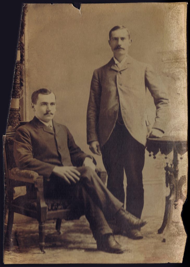
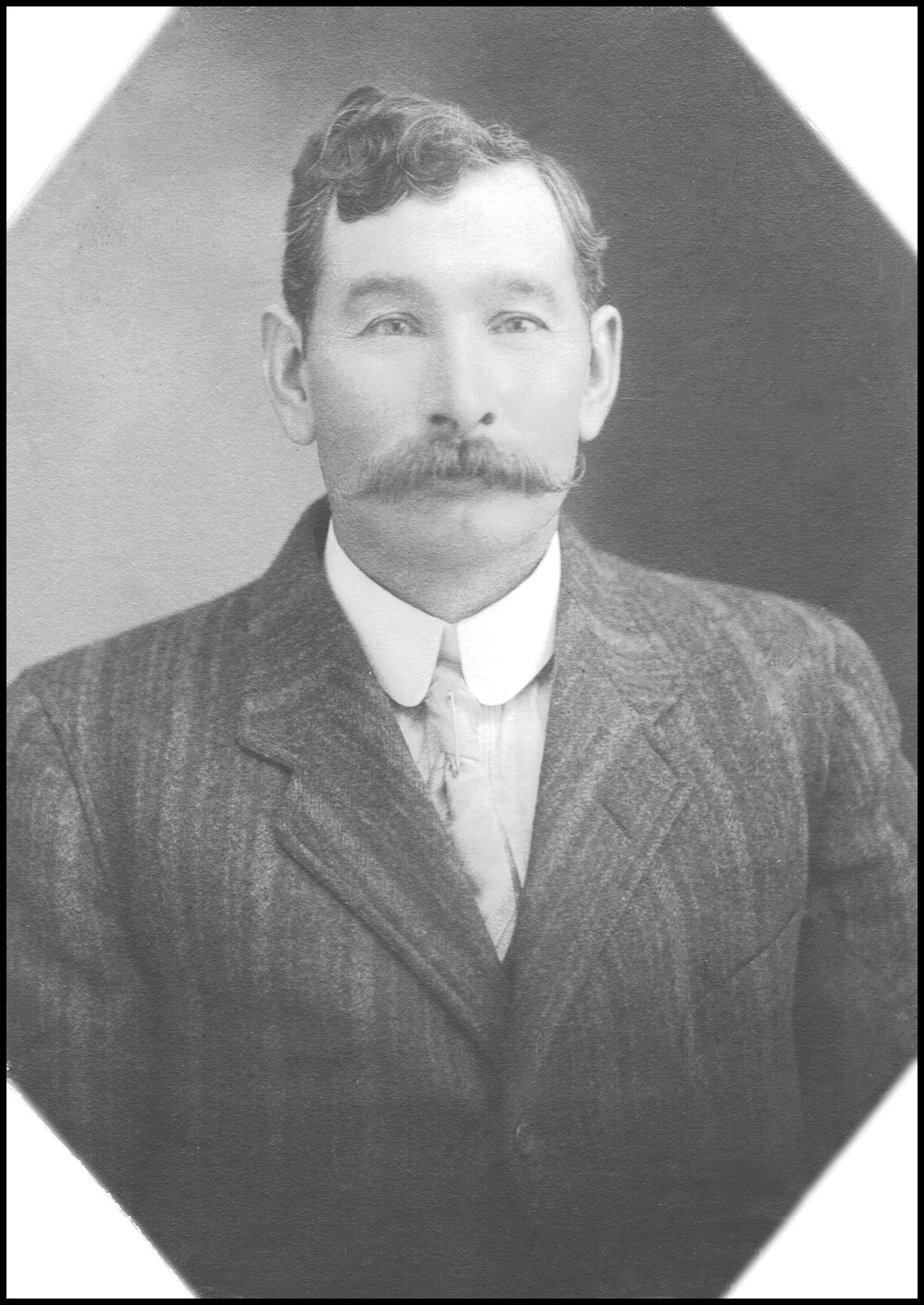
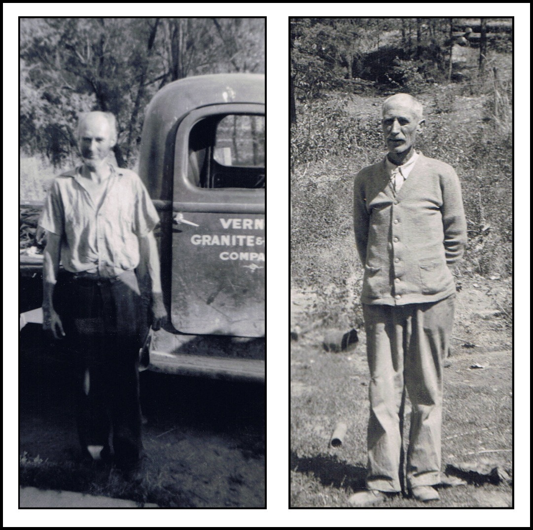
An old friend and fellow-stonecutter arrived in Vernon in 1903. William “Billy” Inkster was an Orkneyman by birth, and came to the Okanagan to seek relief for a respiratory ailment connected with the inhalation of silica dust. Being an experienced carpenter, Inkster assumed a major role in the construction of the Russell home. Following the completion of this building, Inkster decided to renew his involvement with the stone-trade, forming a partnership with two other stonecutters, Jack Hannah and Bob Kemp. “Inkster, Kemp and Hannah” established a stockyard for marble and granite immediately east of the railroad tracks on Barnard Avenue.
John Russell and Billy Inkster, pictured at the start of their venture
Their marble supplier was Sam McClay (Vancouver Harbour Commissioner), while their source of granite was a quarry they opened on Okanagan Lake about three miles south of Okanagan Landing [2]. A royalty, based on the cubic footage of stone removed, was paid to the landowner, Benjamin Lefroy, through his business agent, the well-known bird painter, Alan Brooks. Bob Kemp was not with the young company long, as he decided to move on to a better paying job in Sarnia, Ontario. He was bought out by Inkster and Hannah, and the name of the business was changed to “Vernon Granite and Marble Company”. [3]
A camp was established to the south of the quarry site, and a blacksmith shop with hand operated bellows was built just north of the quarry. The company’s blacksmith was a powerfully built Frenchman named Bouchard, while their original cook was an old-country man named Tom Oddie from the west side of Okanagan Lake. Before a month had passed, however, it became painfully apparent to the whole crew that Oddie’s top card was not cooking. Oddie’s replacement was an excellent cook named Dick Edwards. Edwards must have been an industrious individual to feed the fifteen (plus) man crew three hot meals per day, under conditions that were decidedly primitive.
There being no road, all supplies were transported to the Lefroy Quarry by boat. The granite was moved to the rail-head at Okanagan Landing with the use of a small steam tug and a barge owned by Shannon’s Mill.
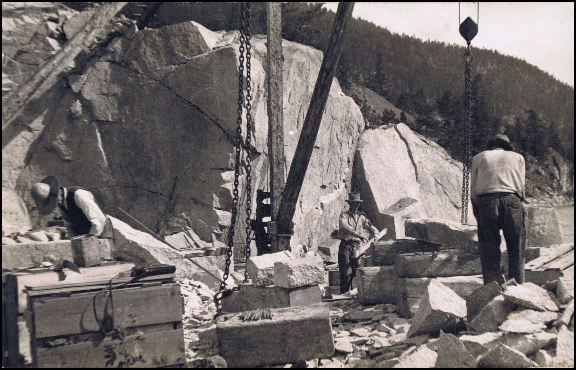
The actual quarry gang consisted of two quarrymen and a dozen or more stonecutters. The two quarrymen, Alex Hamilton and Jack McKinnell (spelling of McKinnell uncertain), were responsible for all the drilling and blasting. The stonecutters were mostly Scotsmen who had been apprenticed in Scottish granite quarries.
They included Bill Inkster, Jack Hannah, John Russell, Bob Hannah, Al Davis, Jack Burke, Jimmy Robb, Jimmy Glencross and Bill Mason. These quarry jobs were all unionized, with the stonecutters and quarrymen belonging to the A. F. of L. A quarry day was eight hours, 5½ days a week.
Billy Inkster – [Image courtesy of Vernon Museum & Archives]
The quarrying season in the Okanagan Valley generally lasted from mid-March to mid-November. The severity of the winter weather was the limiting factor. All granite is slightly porous and all unquarried or freshly-quarried granite contains a limited quantity of moisture throughout. When this moisture becomes frozen the stone is difficult to split or work. It was for this reason that quarries were not worked during the winter months.
According to William Parks, “the [Lefroy] stone [had] a good rift and grain; it [worked] easily under the hammer, and [was] practically devoid of knots or flaws , . . The weight per cubic foot, in pounds: 162.57.” [4]
Inkster Quarry prior to 1923 (no air tools evident). Left to right – Billy Inkster, Howard Hays Russell, and Arnold Russell
The pink granite from the Lefroy Quarry was used to varying degrees in the construction of the following buildings: the present C.P.R. station in Vernon; the Church of England, Kelowna; the Royal Bank, Kelowna; the former Hudson Bay Co. Store, Vernon (northwest corner of Barnard Avenue and 32nd Street); and the “old” Post Office, Vernon (northwest corner of Barnard Avenue and 30th Street).
The Vernon Post Office was started early in 1910, and completed the following year. All granite destined for this structure was cut to size, and finished to specification at the quarry site. When the structure was completed, the quarry had become so depleted that the last of the Post Office stone had to be obtained from loose granite on the beach. According to Parks, between 6,000 and 7,000 cubic feet of granite had been removed.
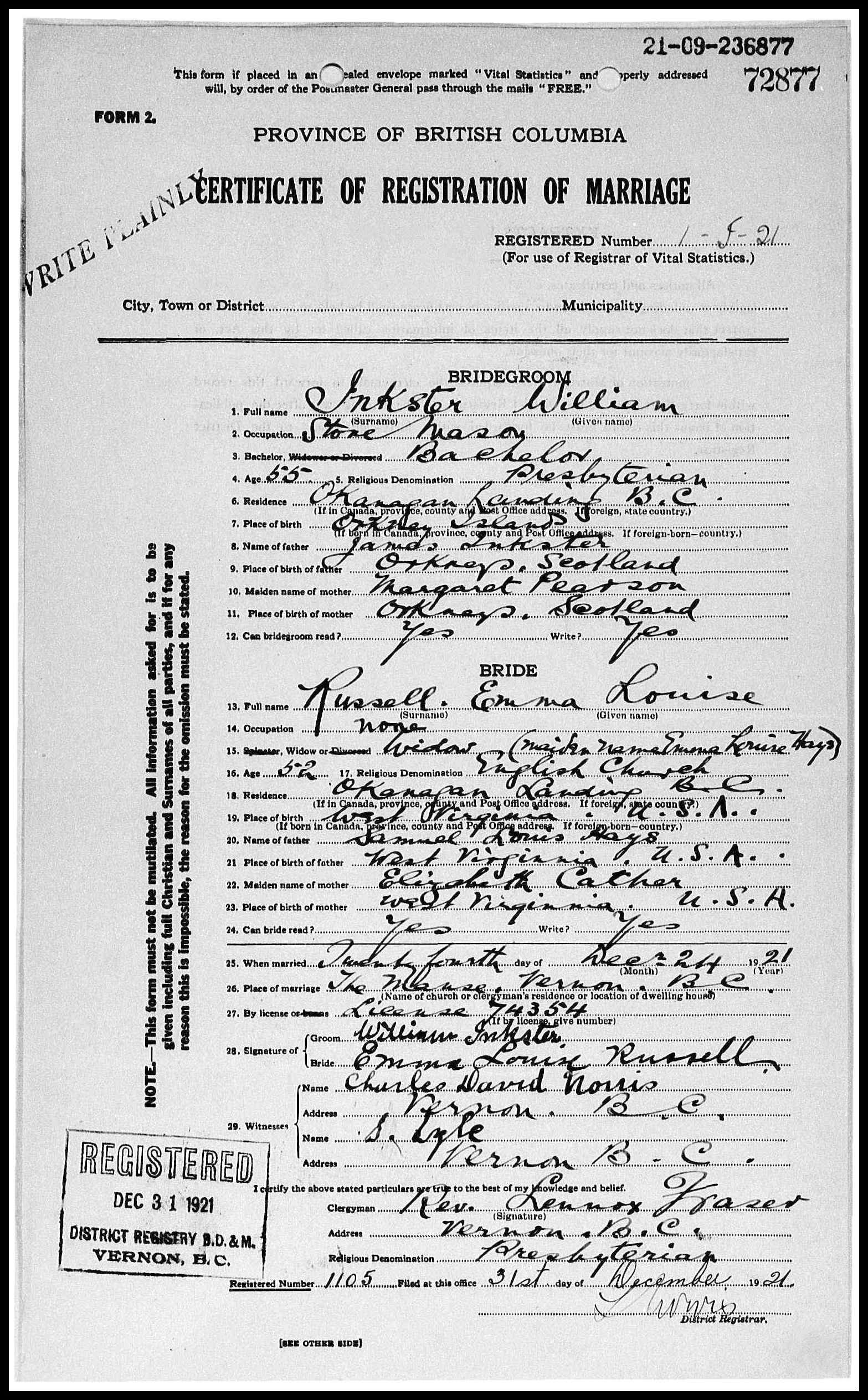
Late in 1909, John Russell journeyed to California for a big stone-cutting job, leaving his wife and family at home in Vernon. He did not return to the Okanagan, but died in California. Bill Inkster looked after the Russell family and eventually married Mrs. Russell.
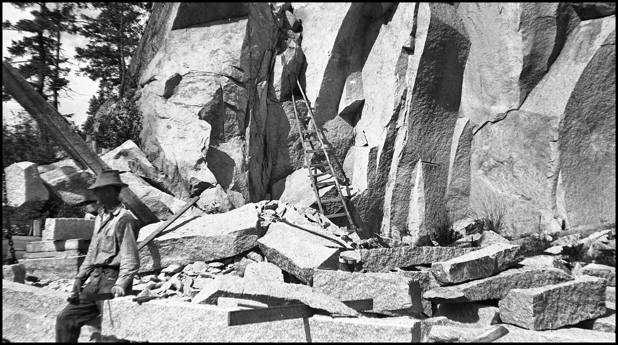
The move to a new quarry site was made in 1911, prior to the Provincial Courthouse construction job in Vernon. The site chosen by Inkster was a mile or more south of Cameron’s Point, and 3 miles north of Carr’s Landing on land owned by Price Ellison, then the local M.L.A. and Provincial Minister of Finance and Agriculture. Ellison received a footage royalty on all stone removed. Inkster moved his new family to a site that would be within walking distance of the new quarry. He built a frame bungalow just south of the present site of Howard Russell’s house. The new quarry camp was situated in a bay between the Inkster house and the quarry, on land presently owned by the Alan Trethewey family. During the Courthouse job, this camp housed about 35 men. It consisted of one large bunkhouse, a cookhouse manned by Dick Edwards and outbuildings. The men walked over the sawback ridge separating Inkster’s Bay from Quarry Bay each morning, again at lunch, and again at quitting time.
Billy Inkster
[Image courtesy of Vernon Museum & Archives]
In 1911, the point of land that was to become the new quarry was a large outcropping of silver-grey granite rising almost vertically out of the depths of Okanagan Lake to a height of fifty feet. Most of this out-cropping was blasted out and hauled away over the next three years. Today, the abandoned site is 80 to 100 feet long, running parallel to the lake and extending eastward some 50 feet. According to Wm. A. Parks (1917):
‘The rift of the stone is vertical at north 15° East and therefore is not parallel to the main jointing. The grain is horizontal. I am informed that very little difference in splitting is observed in the three directions; – rift, grain and hardway. Knots are practically absent…..Weight per cubic foot, in pounds: 164.30’. [5]
The Courthouse granite was quarried to rough specifications by Inkster’s crew, and shipped by C.P.R. lake service to Okanagan Landing, and thence by rail to Vernon. A C.P.R. tug, usually commanded by the well-liked Captain MacKinnon, would bring in a barge laden with railway flat-cars and remain with that barge until the loading was completed. The stone was loaded directly onto the flat-cars with the aid of the heavy quarry derrick. During the fruit shipping season, when the barge service was operating on a tight schedule, the stone was sometimes loaded at night, by the tug’s spot-light.
The two largest pieces of stone ever removed from this quarry (known as the Inkster Quarry), were destined to be the lintel stones capping the vertical frontal columns of the Courthouse. With utmost care and difficulty, the quarry crew cut the lintels to rough specifications and loaded each aboard the CPR. flat-car. Each measured fifteen feet by three feet by two feet, and weighed over seven tons. The flat-cars were oft-loaded at Okanagan Landing, and taken on the train to Vernon, where the real difficulties began. The teamsters were unable to haul the stones up the hill from the railroad tracks to the Courthouse site. The Courthouse contractor had considered taking them by rail to the north end of Vernon and using the teams to haul them back along 27th Street, but that street was so soft and muddy in most places, that it was not attempted. In the end, the contractor was forced to split each of the two lintels in half, lengthwise!
At the beginning of the Courthouse job, Inkster applied to the appropriate authorities to have his new home-bay designated an official C.P.R. landing, under the Federal Navigation Act. In due time his request was granted and he received an official document confirming the presence of “Inkster’s Landing”. The sternwheeler “Aberdeen” made regular stops at Inkster’s Landing to deliver provisions to the camp cook. In the absence of either a wharf or dolphins, the sternwheeler nosed gently up on the gravel beach at the head of this narrow bay. The provisions were then passed down from one of the large side cargo doors to a man in a rowboat alongside.
Following the Great War, a log cribbing filled with sizeable pieces of scrap granite was installed on the east side of the bay, as a wharf and breakwater. The first attempt by the large sternwheeler, “S. S. Sicamous” to reach the new wharf ended with the Sicamous’ bow jammed upon a rock outcropping at the northeast corner of the bay. Although able to extricate his boat without serious damage, the Sicamous captain requested the immediate installation of at least two dolphins, to prevent a recurrence of the incident. Inkster didn’t feel their small company could afford the $700.00 necessary for the work, and so ended “Inkster’s Landing” as a C.P.R. port-of-call. There was a wide trail, called a government road, between Okanagan Landing and Inkster’s Landing running along the bottom of a narrow valley between the present road and the Commonage Road. Supplies were henceforth brought in via this road.
The location of Inkster’s Landing
Following the completion of the Courthouse in 1914, and for the duration of the Great War, insufficient quantities of granite were being shipped from the Inkster Quarry to warrant a special stop by the CPR. lake-service. Inkster cleared this obstacle by building a rough, box-like barge capable of moving two tons of granite, very slowly! A double-ended clinker-built boat, powered by two sets of oars, was used to tow the barge to the nearest C.P.R. wharf on the east side. That was the Carr’s Landing wharf, three miles south. Arnold Russell recalls leaving the quarry after breakfast with his younger brother Jim manning the second set of oars. By rowing steadily they could have the boat and barge to Carr’s Landing by late afternoon. After the stone was stacked safely on the wharf, the brothers would leave the empty barge secured to a tree on the beach, and row home for a late supper. The following morning they would row back to Carr’s and collect the barge. It may be of interest to note that Inkster cut and lettered Reverend Philip Stock’s headstone during this period. The stone was delivered to Nahun landing in two pieces (cross and basse) and was later transported up the steep switch-back trail to Stock’s Meadows, on a single pack-horse.
Vernon Granite’s first power boat was purchased second-hand from Mrs. Oswald Pease of Ewing’s Landing in 1919. It bore the name “Grace Darling” when purchased, and this name was retained. It would appear that the “Grace” was originally one of the first boats on the lake powered by an internal combustion engine. In any case, it provided welcome relief for the chore of pulling the stone barge. When Jack Russell married Laura Tronson in the early 1920’s, Jack’s good friend, Mrs. Dudley-Ward of Carr’s Landing, gave him her boat for a wedding present. It was an eight H.P. double-ender named “Turn Turn” and being more powerful than the old “Grace Darling” inherited the duties of towing the stone barge.
In 1923, Inkster built a larger, heavier barge measuring 30 ft. x 12 ft. x 3 ft., capable of hauling twelve tons. A custom built Turner boat, 20 feet in length with a vertical towpost stepped amidship, was ordered from Vancouver. The C.P.R. delivered it to Okanagan Landing on a flat car. This boat was also named “Grace Darling”, after the then retired Pease boat. It was powered by a single-cylinder Easthope engine built for towing. The new “Grace” soon gained a fine reputation as a first rate rough-water vessel. She was well over forty years old and still going strongly in the late 1960’s. One night during a storm her mooring lines let go and she broke up on the rocks in Inkster’s Bay.
Billy Inkster [Image courtesy of Vernon Museum & Archives]
Following the courthouse construction, granite was used on smaller construction jobs. Parks reports the following prices quoted by Inkster, f.o.b. the quarry:
Sills up to 7½ in. high. 10 in. on bed, plain or lug, per lineal ft – $1.75 Sills up to 7½ in. high, 12 in. on bed, plain or lug, p.l.ft. – 2.00 Window heads up to 12 in. high, 8 in. on bed, plain or lug p.l.ft. – 1.75 Window archstones, 12 in. by 14 in. by 6 in., each – 2.25 Cut ashlar, 12 in. high, 8 in. on bed, 4-cut, p.l.ft. – 2.00 Cut ashlar, 12 in. high, 8 in. on bed, 6-cut, p.l.ft. – 2.25 Doors sills, up to 2 m. rise, 12 in. tread, 4-cut, p.l.ft. – 2.50 (Over 12 in. tread, add 50 cents per foot for every 3 in.) Rough blocks, random squared, per cu. ft. – .50 Rough blocks, dimension, per cu. ft. – .60 Lengths over 7 ft. up to 9 ft., add 10 per cent. Over 9 ft. special prices. [6]
By 1917, 30,000 cubic feet of granite had been shipped from the Inkster Quarry.
Following Jack Hannah’s death overseas in 1915, a half-interest in Vernon Granite and Marble was passed on to his brother, Bob. In 1919, Arnold and Jack Russell purchased a quarter section of land plus a fraction including the Inkster Quarry from Price Ellison. Jack was seeking good farm land and received that portion of the land which seemed best suited. He built a cottage on the present site of Mr. & Mrs. Trethewey’s house; with a log barn about a hundred yards north. Arnold took the quarry fraction, as well as a parcel to the south of Jack’s house. Although Arnold now owned the quarry-site, he did not have any financial interest in Vernon Granite and Marble. He corrected this in 1923 upon his return from a lucrative stone-cutting job in California. He bought out Bob Hannah’s share in the business for $600.00 cash.
A photo of Arnold Russell in his 20’s. The inlay at the bottom is of his daughter Gay at the age of 18.
The advent of compressed air, following the Great War, introduced a new era in the stone trade. This new era sounded the death knell of the old-time stonecutter. Quite suddenly, in the space of a few short years, many of the stone cutting skills so painstakingly acquired by the old-time stonecutters were totally obsolete. New skills, doubling or even tripling overall production had to be acquired, in a trade that had seen no significant changes in 200 years. Any stonecutter unwilling or unable to cope with the rapid changes found himself unemployed. Arnold Russell had worked extensively with compressed air tools in California, and realized their great labour-saving advantages. Vernon Granite and Marble purchased their first air compressor in 1924, prior to the construction of the Vernon Cenotaph. It delivered thirty lbs. of air and powered their plug-drills and bushing hammers.
The initial heavy drilling in the quarry, for blasting purposes, still had to be done by hand in the mid-twenties. An age-old technique known as “double-jacking” was employed. Two men alternately swung seven pound hammers, while a third man turned the drill bit to keep it from jamming.
The splitting up of quarried blocks of granite involved drilling a row of holes along the desired line of cleavage. Once this was accomplished, two shims were placed in each hole with a wedge between. [7] As these wedges were tapped lightly with a small hammer, there was a great increase in pressure exerted into the stone along the desired line of cleavage. It was this increase in pressure that split the rock. Therefore, the speed at which a stonecutter was able to drill the ½” x 4” holes for the wedges and shims became rather crucial. By hand, an experienced stonecutter could drill one of these holes in 15 or 20 minutes, but with an air-powered plug drill, an inexperienced labourer could drill a similar hole in about one minute! This one example will serve to illustrate the significance of the technological revolution underway in the stone trade at that time.
The granite for the Vernon Cenotaph was quarried at the Inkster Quarry and finished to specifications at the Cenotaph site on 30th Street. Bill Inkster and Arnold Russell set up a derrick at the construction site for manoeuvring the heavier pieces of granite into place. The largest single component weighed five tons. The reason for finishing the granite at the construction site rather than at the quarry or the Price Street yard, was to increase the general public’s awareness of the project during the fundraising drive.
Billy and Emma in their latter years
Designer Richard Curtis modelled the Vernon monument after a similar, but larger memorial in Barrie, Ontario. The original plans called for a bronze statue to be placed at its zenith, but lack of funds prevented this. The corner stone and sealed copper box were laid on September 7, 1924, by Bishop Doull. A record of the box’s contents and the engraved trowel used by Doull during the ceremony are in the possession of the Vernon Museum and Archives. The overall dedication for the completed memorial was held on November 11, 1924. [8]
The Peachland and Coldstream War Memorials were both built by Vernon Granite and Marble. They also provided the granite for the Lavington Memorial, although it was cut and set by stonecutter, Bill Mason.
Arnold Russell next to his old work truck and Billy Inkster, photographed in 1937
Most of the stone removed from the Inkster Quarry during the next three decades was for mortuary monuments. After buying out the retired Bill Inkster in 1930, the business was conducted by Arnold, with help from his younger brother Howard. But the quarry was permanently closed in 1956, when Arnold contacted silicosis, brought on by the inhalation of excessive amounts of granite dust. Although retired, Arnold is likely the last stonecutter in the Southern Interior capable of doing both lead-lettering, and hand-carved granite and marble lettering. [9] Stonecutting, as a trade and an art, is almost gone forever.
FOOTNOTES
1. “Hays” was Emma Russell’s maiden name. 2, This quarry may still be seen below Dr. H. Alexander‘s residence. Permission to view this site should be obtained from the Alexander family. 3. About 1911, the Vernon city-fathers persuaded Vernon Granite and Marble to move their stoneyard from its original location to Price Street (near the present site of Kal Tire). As it had been, one of the first impressions a newcomer by train had of Vernon, was the rows and rows of freshly cut tombstones in the stone company’s yard. 4, Canada, Department of Mines, Report on the Building and Ornamental Stones, Vol. 5. 1917. 5. Ibid. 6. Ibid. 7. These wedges and shims were more popularly known as “plugs and feathers”. 8. The original site of this memorial was about forty feet closer to 30th Street than it is today. 9. Since the introduction of air tools, most stone lettering has been done with sand blasters and pre-cut stencils.
CREDITS
Many thanks to Arnold Russell for providing much of the information presented here. Thanks also to Mr. J. Shephard and Mrs. H. Gorman of the Vernon Museum and Archives, for their help in tracing certain names and dates. Also interviewed were Howard Russell, Gay (Russell) Burgess, Mr. & Mrs. Alf. Brewer, Dr. H. Alexander and Dr. H. Campbell-Brown.
Members of the Russell family would like to say a huge thank you to Alice Lee and Gilda Koenig, of the Vernon Museum & Archives, for taking the time to locate and pass on to them the three portrait photos of Billy Inkster used within the text above.
Extracted from Hugh Marwick’s The Place-Names of Rousay
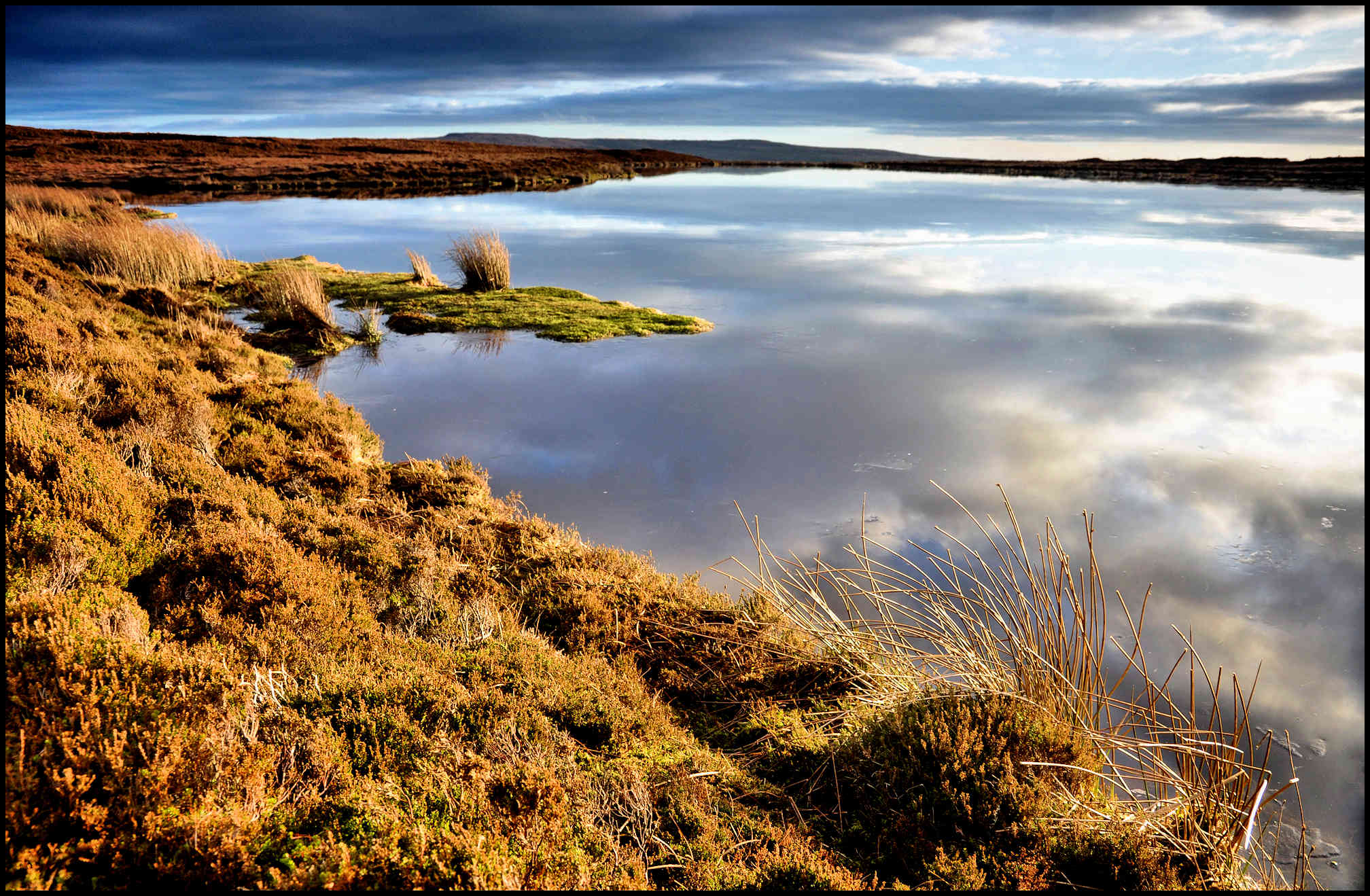
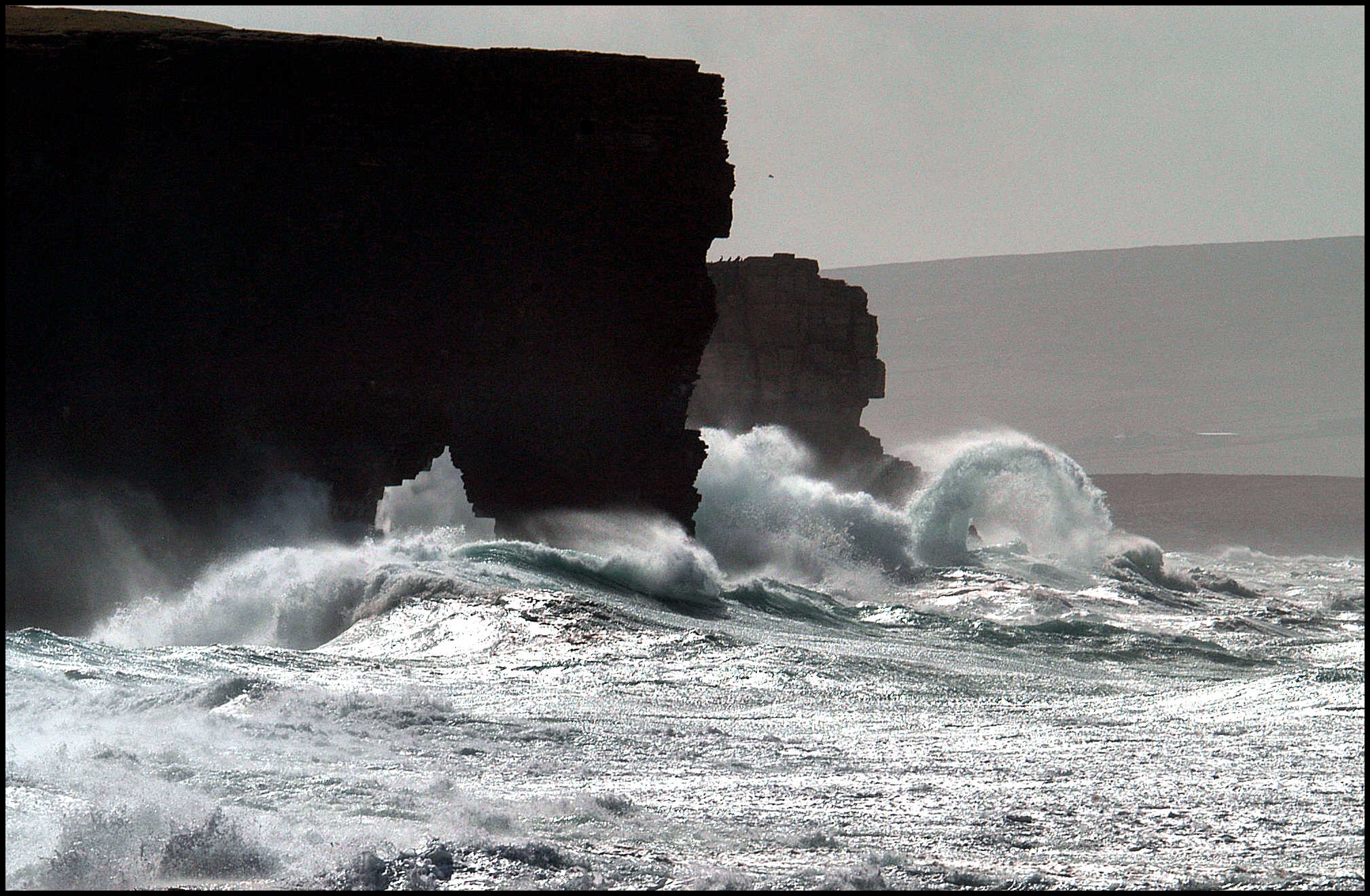
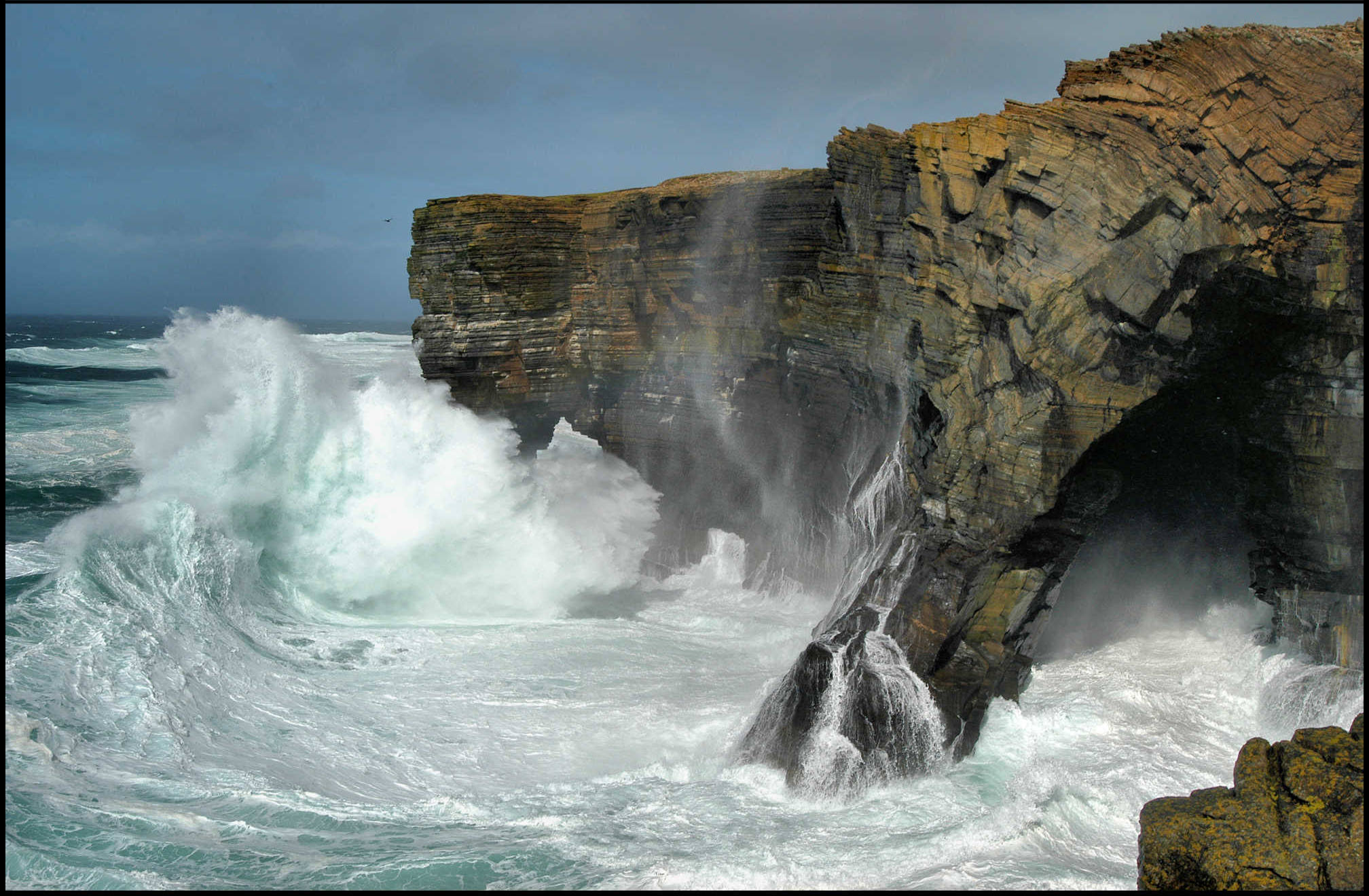
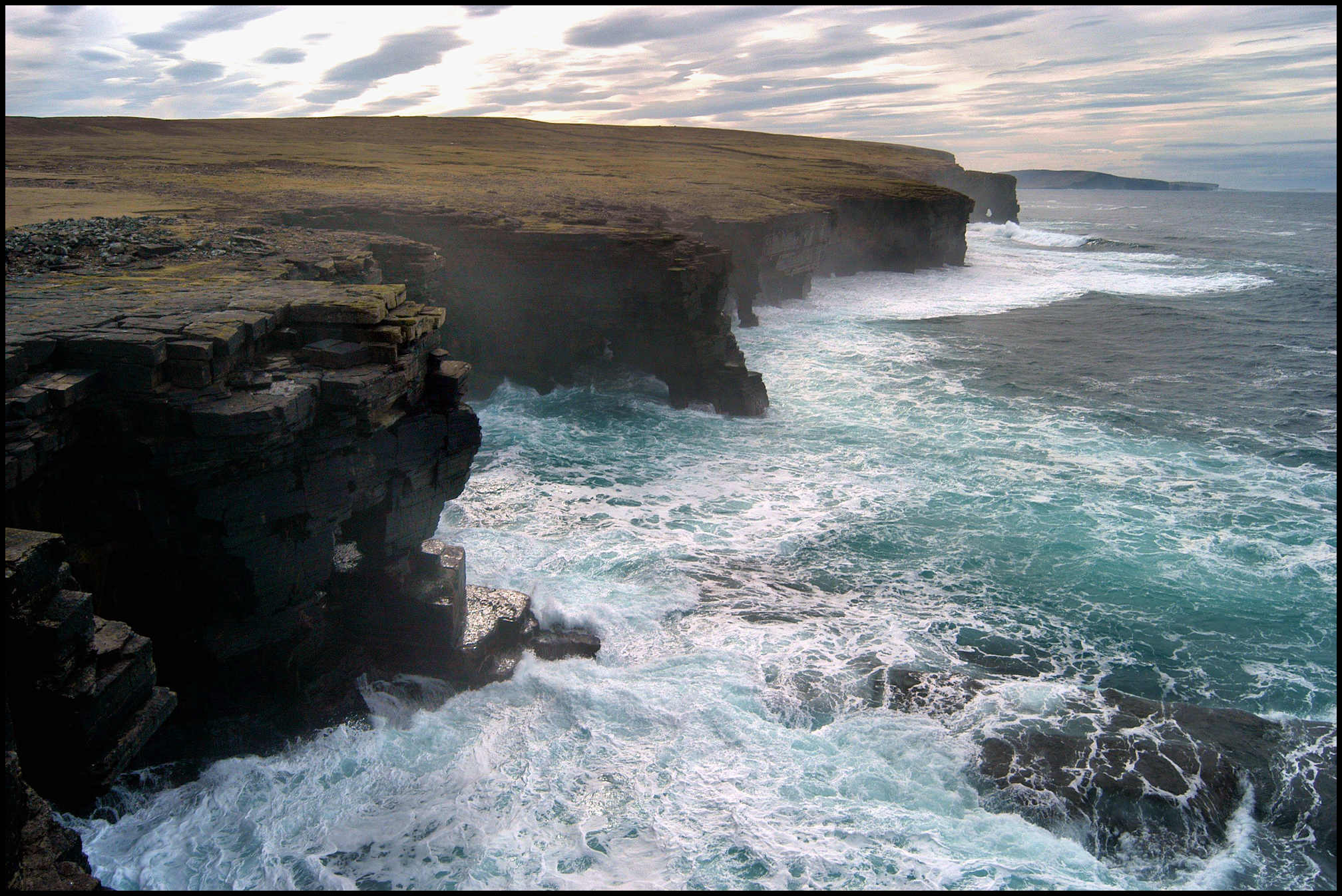
KILNS OF BRIN-NOVEN, slightly to the west of Sacquoy Head and pictured above, are great yawning chimney-like pits or chasms situated near the edge of the high cliffs which form the coastline here. Cavernous openings have been formed at the foot of the cliffs by the ceaseless wash of the waves. Through some weakness in the rock-formation over the inner ends of these caves, and aided by the tremendous pressure and suction of the waves, whole masses of rock have collapsed, leaving these awesome-looking chasms, at the bottom of which the waves can be seen dashing about and throwing up spray almost continually. On stormy days, spray and spume are blown up to a considerable height above the ground like smoke from a kiln – hence the use of that term. The photo below shows the Kiln of Dusty, to the west of here and closer to Bring Head.
KNAPKNOWES is the name of a vanished farm at Quandale, its occupants and the rest of the population in that area being driven off their land in the first clearance of 1845. In 1936 three mounds were excavated at Knapknowes by Walter Grant, his investigations revealing the fact they contained burials. The first covered a cist [small stone-built coffin-like box] containing cremated bone, ‘cramp’ [vitrified fuel ash slag, known as cramp in the context of Bronze Age Orcadian funerary practices] and six small pieces of flint. The second, crossed by a drystone dyke, covered two cists, one of them central, both containing cremated bone and cramp. The third mound covered an upright Cinerary Urn [an urn for holding a human’s ashes after cremation] in a stone setting and containing cremated bones and ‘cramp’. These three cairns were located close to the farmstead of Knapknowes, evidence of which was scarce for the footings and walls had been used to build the nearby dykes. One other mound on the site was also excavated by Grant, but it was in fact the remains of the corn-drying kiln associated with the farmstead.
KOLDEROSS is a narrow shelf on the face of a crag immediately west of Hunber, near the Knee of Faraclett. This is another of the well-known but dangerous fishing sites in Rousay – the shelf being so narrow that for safety anglers had to sit down to fish, their legs dangling over the edge: hence the name – in Old Norse kaldi-rass, ‘cold arse’!
John Gibson of Broland fell into the sea from this ledge. The men around him cast their ‘waands’ at him, and caught him on the collar with their ‘flees’ and saved him.
KOOGROO is a small green hollow covered with rough pasture, south-east of Loomachun and south-west of the Loch of Jan Janet. Part of this is known as the Courtha’ of Koogroo where kye used to be herded.
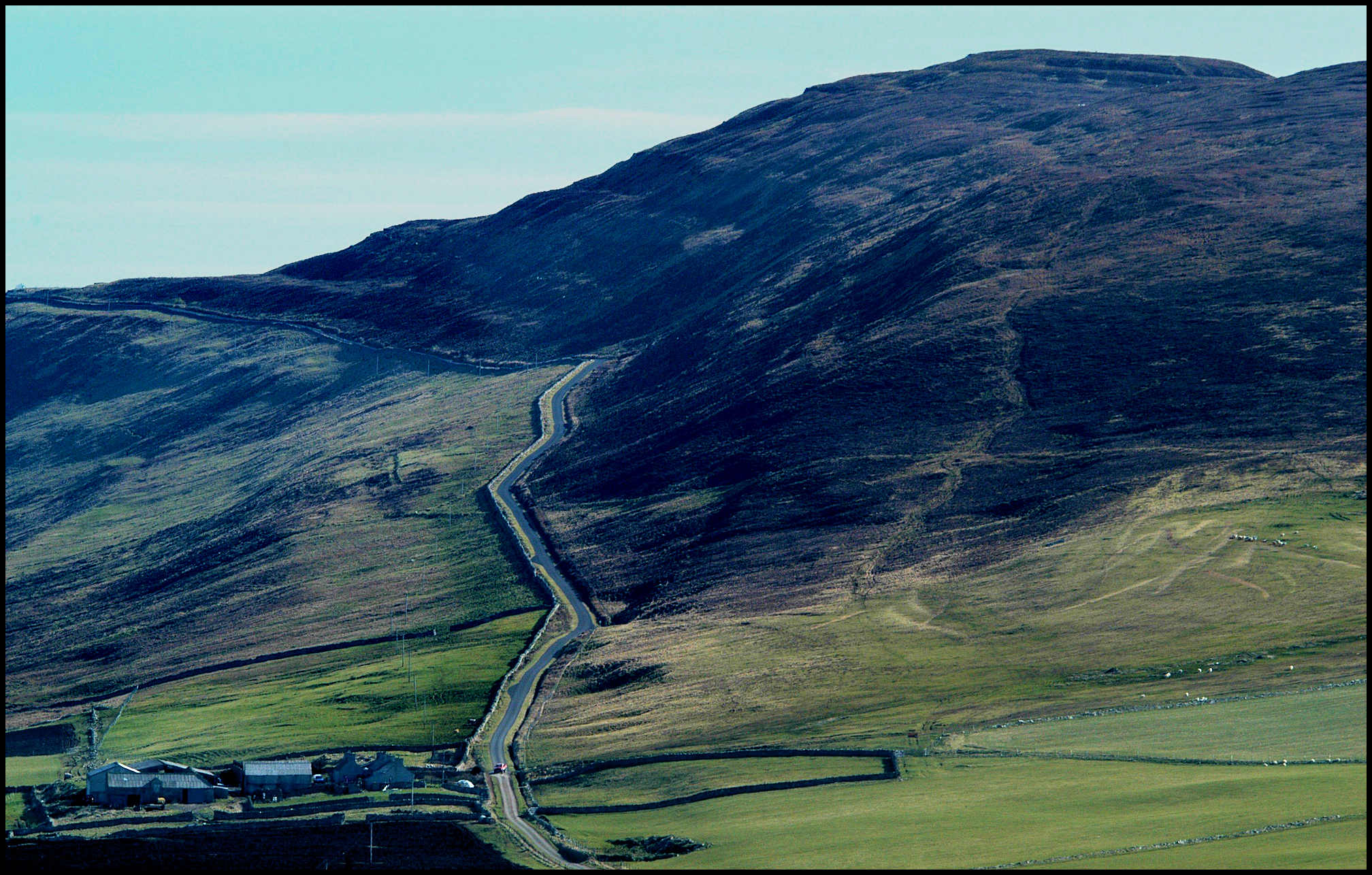
LEEAN is a mile-long stretch of the very steep northern slope of Kierfea Hill between Sourin and Wasbister, which ends in dramatic cliffs and caves and the sea at Saviskaill Bay, between Faraclett Head and Saviskaill Head. The photo above shows the road snaking up past Langskaill and disappearing as it passes Blossom Quarry top left.
Bya-steen is the name of the best fishing rocks in the Leean. Others, already mentioned above, include Garaber, Klettber, Kribbany, Salt Hellyie, Sandber, Steenathy, and Verpino. ‘Furto’ in the Orkney dialect is bait thrown out on the water to lure fish, especially in rock-fishing for cuithes or sillocks. The true old furto consisted of chewed limpets which had been previously ‘leeped,’ or scalded, to take off the shells. Fishermen then chewed these limpets into small portions and ‘spat out furto’, which caused an oily smooth patch on the water known in Rousay as a ‘linyo’.
Handi-Midgarthy is a name applied to a point about half-way up the Leean road where the hillside slopes down in a particularly abrupt and precipitous manner.
Garsnigeo is a deep precipitous geo at the point where the line of high cliffs running west from the Knee of Faraclett turns at right angles towards Wasbister; Campie Rowo is a prominent ridge of reddish cliff jutting out on the line of high cliffs north-west of Garsnigeo; the Riff of Lythe is part of the shore in the Leean, north of Campie Rowo. The Riff is an extensive reef of flat shelving rocks stretching out seawards from the base of the high cliffs, and usually covered at high water; and Ollyer Tong and Scaraber are points of rock on the Leean shore.
The photo above shows the Leean skirting Saviskaill Bay, the calm waters of the Loch of Wasbister in the foreground. Tommy Gibson of Brinola tells a story about a large ship partly laden with dried tea-leaves which went ashore in the Leean. The people of Wasbister and Quandale did not know what to do with the cargo. They tried to feed it to the cattle, with no success. They even tried to make porridge out of the tea and they also tried to smoke it. In the end they used the tea for bedding for the cattle and pigs!
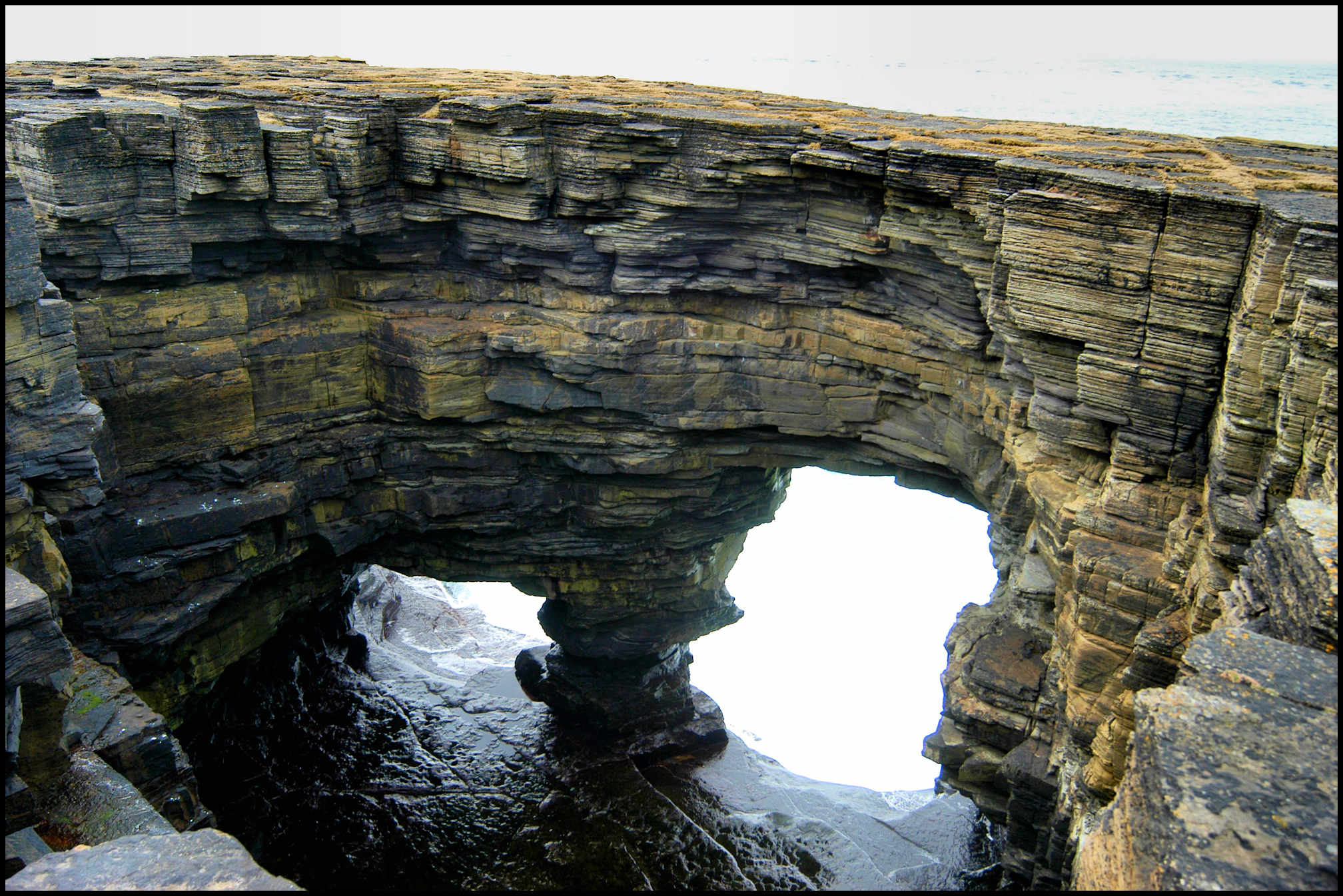
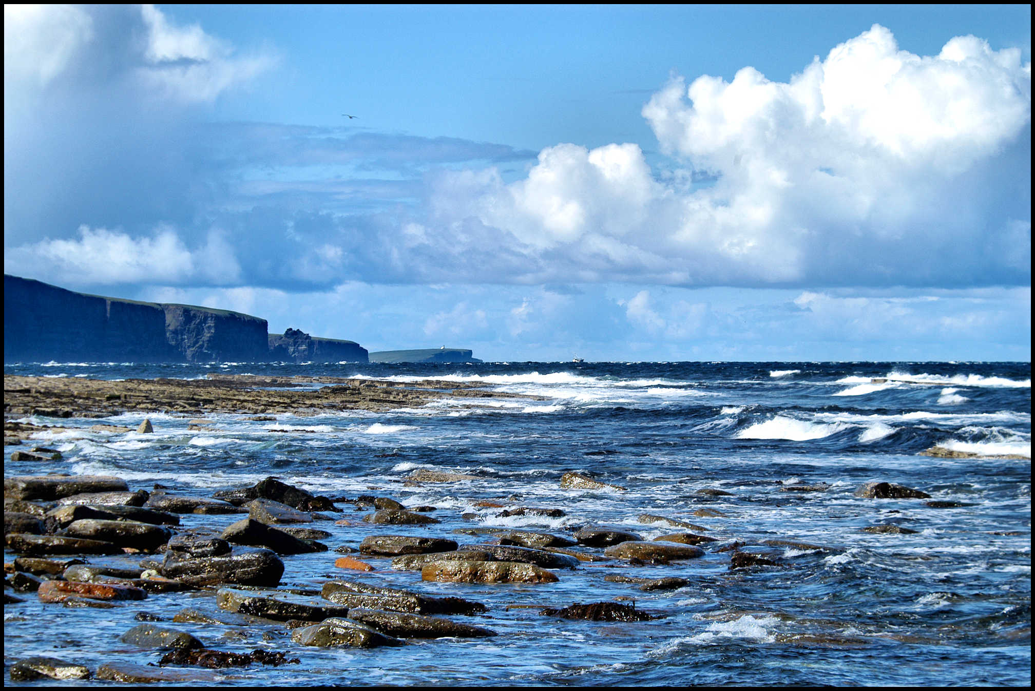
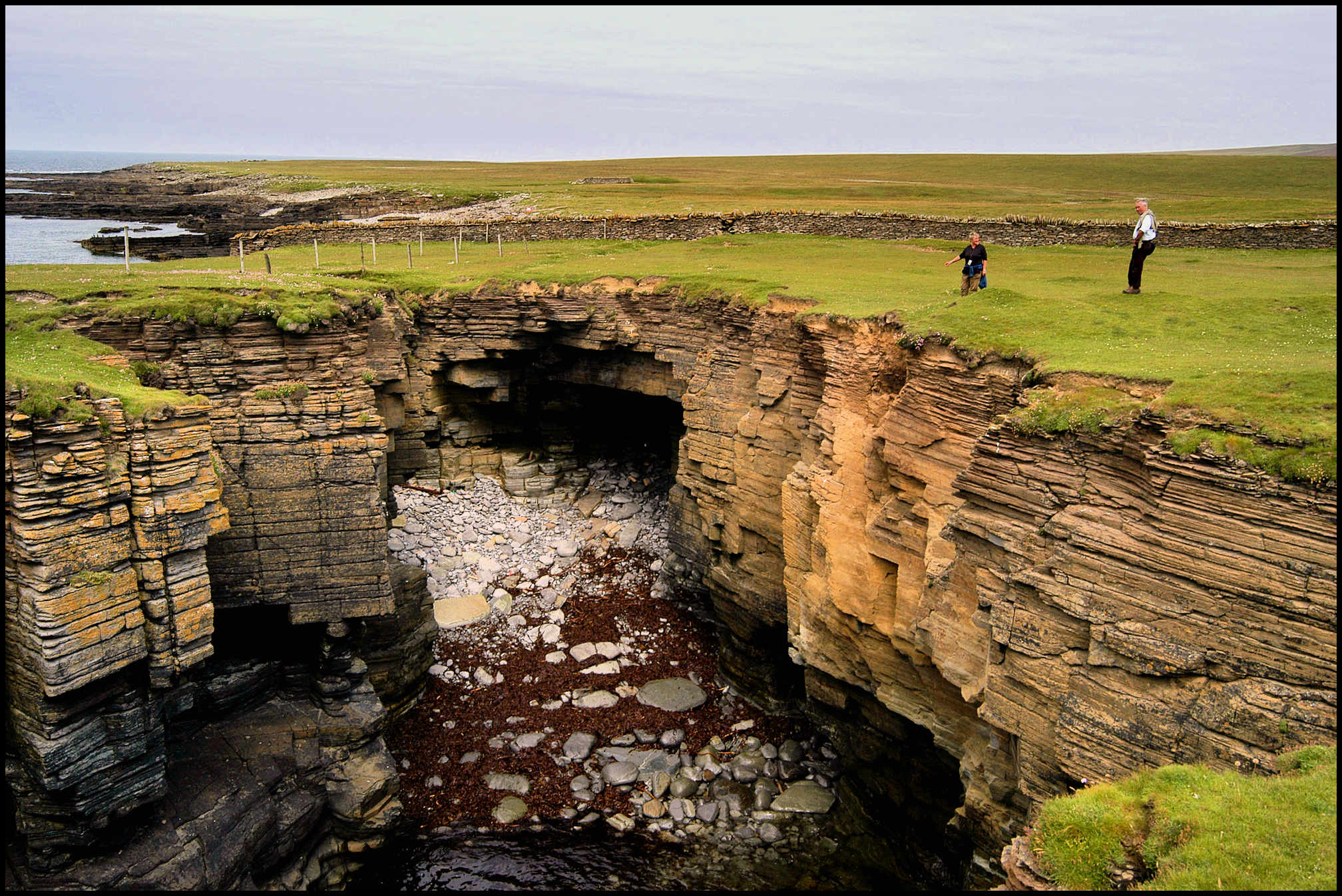
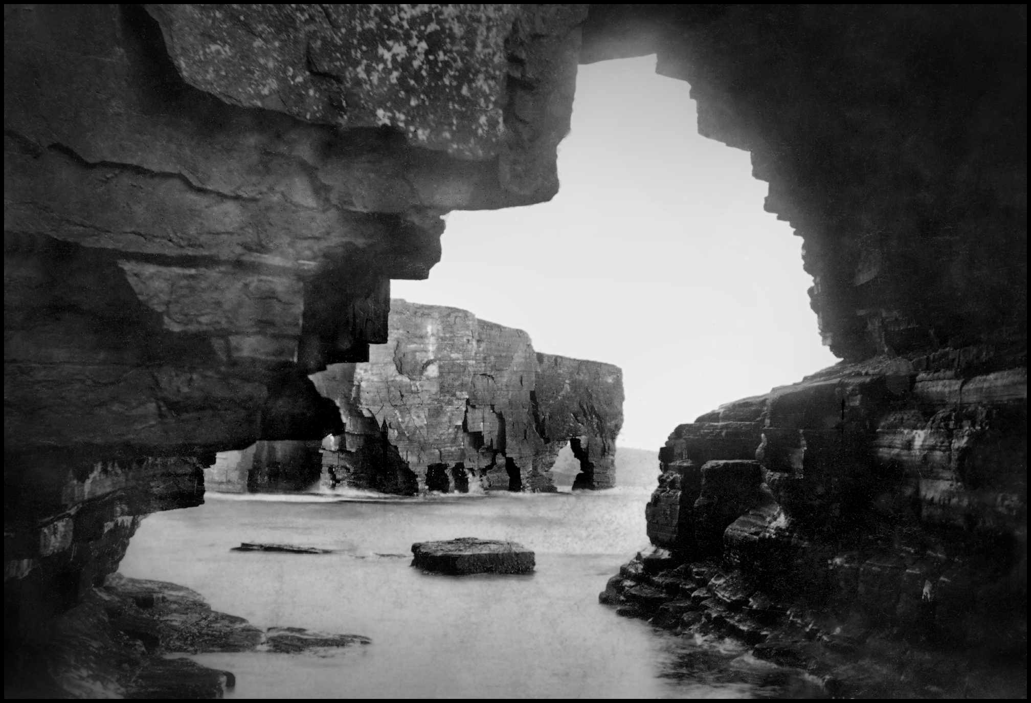
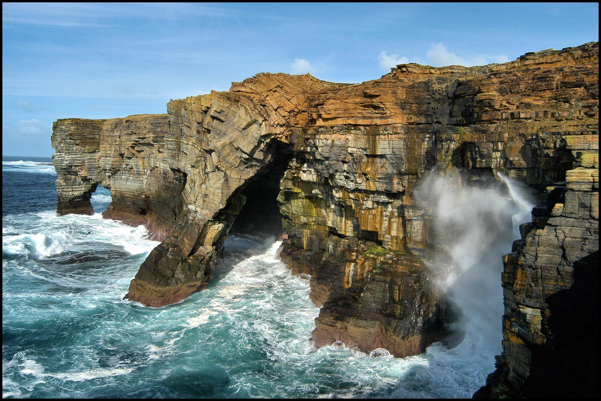
LOBUST. The Lobust is a massive pillar of rock or stack between Helliaspur and the Kilns of Brin-novan, with a natural arch bored through its base. It is separated from the coastal cliffs by a chasm just half a dozen yards or thereby, and rising precipitously from the sea to a height roughly level with the top of the adjacent cliffs. It is one of Rousay’s ‘sights’ and specially interesting by reason of its very inaccessibility. Above is a view from Sacquoy Head on Rousay, with Costa Head and the Brough of Birsay appearing on the far horizon. The dot of light in the dark cliffs to the left is the natural arch at the base of the Lobust.
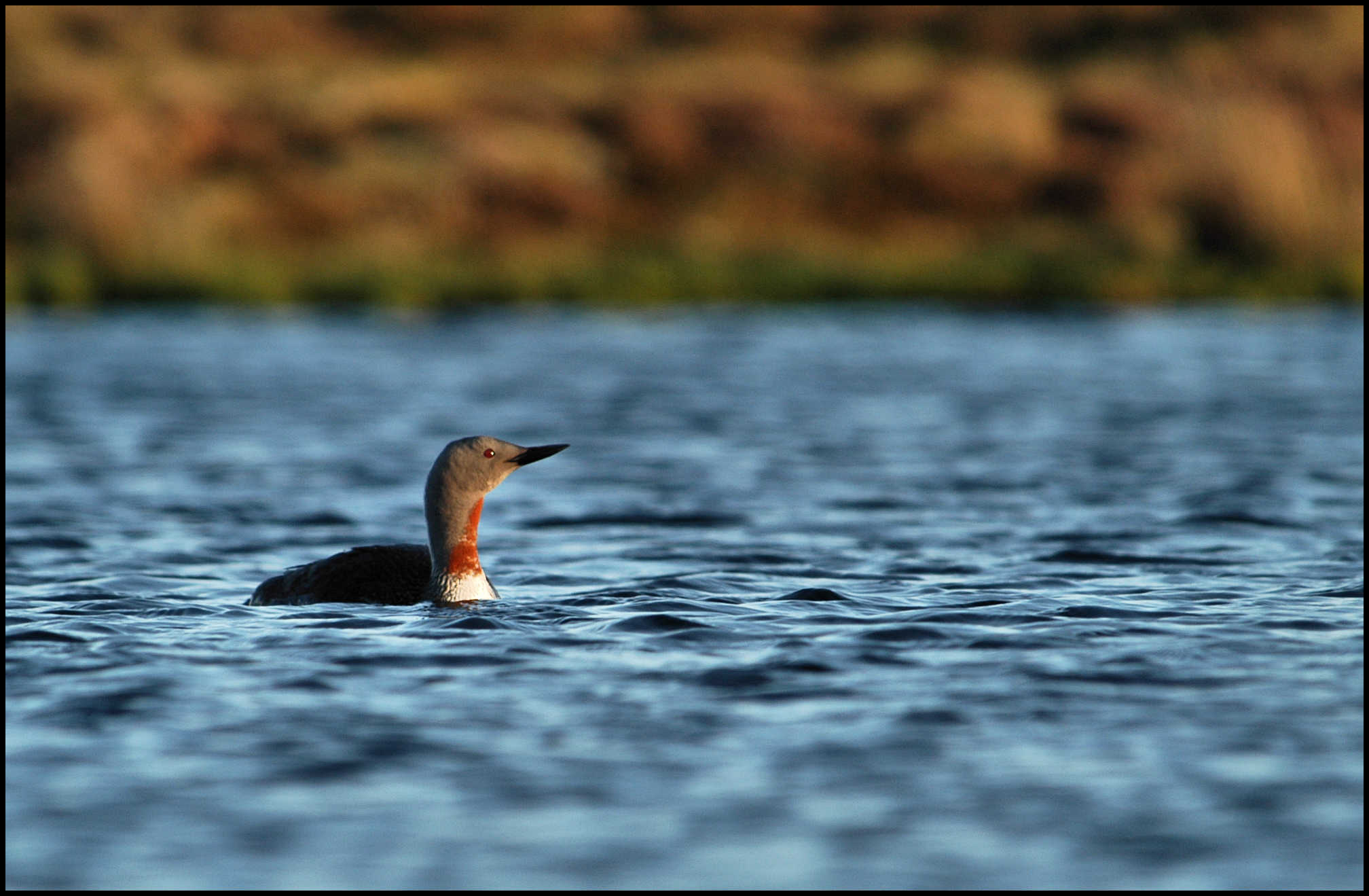
LOOMACHUN is a loch or tarn on the top of the Brown Hill, about half a mile north-east of Muckle Water. The Old Norse lóma-tjqrn translates to the ‘tarn of the loom,’ or red-throated diver. In Orkney this bird is known as the rain-goose. Hugh Marwick once asked an old Rousay man if he had ever seen a rain-goose. “Yea’m I, boy, an’ I’m seen the eggs o’ her, too.” “Where,” Marwick asked. “On the Loch o’ Loomachun,” was the reply. The same year a friend of Hugh Marwick’s told him that his son had found a rain-goose’s nest at the same place a few weeks before.
Year after year, down the ceaseless procession of the ages, amid the tumult and change of human affairs, instinct has brought this bird back to nest on a tiny islet in the Loch of Loomachun, just as it did when the name was first bestowed, and doubtless for centuries long before that.
A short distance to the east of Loomachun is the Loch of Chin-chinnet. On an old map it is spelt Jin-Janet, but Orcadians normally pronounce the letter ‘j’ as ‘ch’. This is a tiny tarn, supposedly very deep, but the origin of the name is unknown.
MYRES. Over 100 years ago an old man in Rousay recorded an account of something that had happened in the Brings area of Wasbister when he was young in the early 1800’s:
‘About the commencement of the century, a child by the name of Mowat, about two years old, strayed from the house of Myres in Sourin in a thick mist. His parents sought him for two days in vain. A dog belonging to Furse in Wasbister was missed the same day as the child went away. The dog came home on the third day and got some food. He went away as soon as he had taken it. He was followed by the servant man. The dog ran to a pigsty in the Brings, and when the man went to the sty the dog made for springing at him. He looked in and found the child alive and well. He took the child home and went and told the parents who gladly came for him. He lived in Rousay to an old age, I knew him well. The most remarkable thing about it was that before the dog would venture home for food he had sent all the swine about a mile from the sty in which the child was found.’
NUGGLE is the name of a pointed or rounded projection on the northern hill-ridge above Wasbister, between Moan and Innister. On the Ordnance Survey map of today it is called the Too of Nugle. In land charters of 1628 and 1655, the name Knowgill is on record, denoting a patch of udal land somewhere in Wasbister, and, according to Hugh Marwick, must be the same name. The Old Norse word knykill means a hump or protuberance.
OLDMAN was the name of a small hill croft in Sourin on the south bank of a burn of the same name. It is an example of another transferred name, for the original Oldman was on the Westside, between the present third and fourth fields out from Westness farm. Tenants were cleared from the Westside and their lands laid down as a sheep-walk. Some of the evicted settled on new sites in Sourin – as here at Oldman – and the old house name was applied to the new.
POPULATION. The population of Rousay in 1841 was 971. There were 287 folk living in Wasbister; 307 in Sourin; 42 in the Brinian; 121 in Frotoft; and 214 in Westness and Quandale.
PRAYER SITES. Praying crosses, by the wayside, were a familiar feature in the old days, and particularly at places where the traveller came into view, or lost sight of, a church or holy place. In Rousay there are two, if not more, of these sites commemorated in place-names.
Corse, in Frotoft, was one of these. It was a house built near an old Corsegate or road to the church. In this case the church was probably the old parish church of Our Lady at Skaill, but it is not improbable that the place to which pious eyes here turned was the more venerable church on the Holy Isle of Eynhallow.
On the western slope of Mansmass Hill, the northern spur of Ward Hill, a park just above the public road was known as Bonie Hole, the Old Norse bonnar-hill means prayer-hill. ‘Bonie’ was a word that occurred in the common Rousay phrase for prayers – especially a child’s prayers at bedtime – bonie-words. Here again we have another example of the same custom as we saw at Corse, and the church in this instance was also apparently the parish church at Skaill.
Further on into Wasbister the old road to that church is remembered in the house name of Kirkgate.
PRETTY was the name of a croft in Sourin [pictured above], having been shortened from its official name of Standpretty. In giving evidence before the Crofters Commission in 1888, the tenant James Cooper, Standpretty, deponed that his father and grandfather had been in the croft before him, that they “had settled on the bare hill, built all the buildings, and reclaimed all the land.”
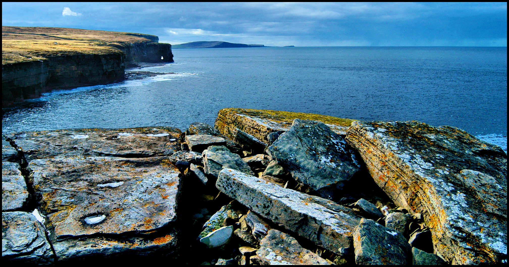
QUOYNALONGANESS is the western-most tip of Rousay, and in some instances was known as the Point of Treaudale. In Old Norse kvi-in-langa – ‘the long quoy’, and such a quoy [enclosure for animals] was once situated nearby. Part of the beach here is known as The Quoy of Quoynalonganess. The photo above was taken from here, and looks across the entrance of Eynhallow Sound, with Costa Head and the sea-stack known as The Standard. The lighthouse on the Brough of Birsay is just visible in the middle distance.
REEKY KNOWE is the name of a mound on the beach below the Westness farmhouses, on which fires were supposed to have been lit for communication with Eynhallow.
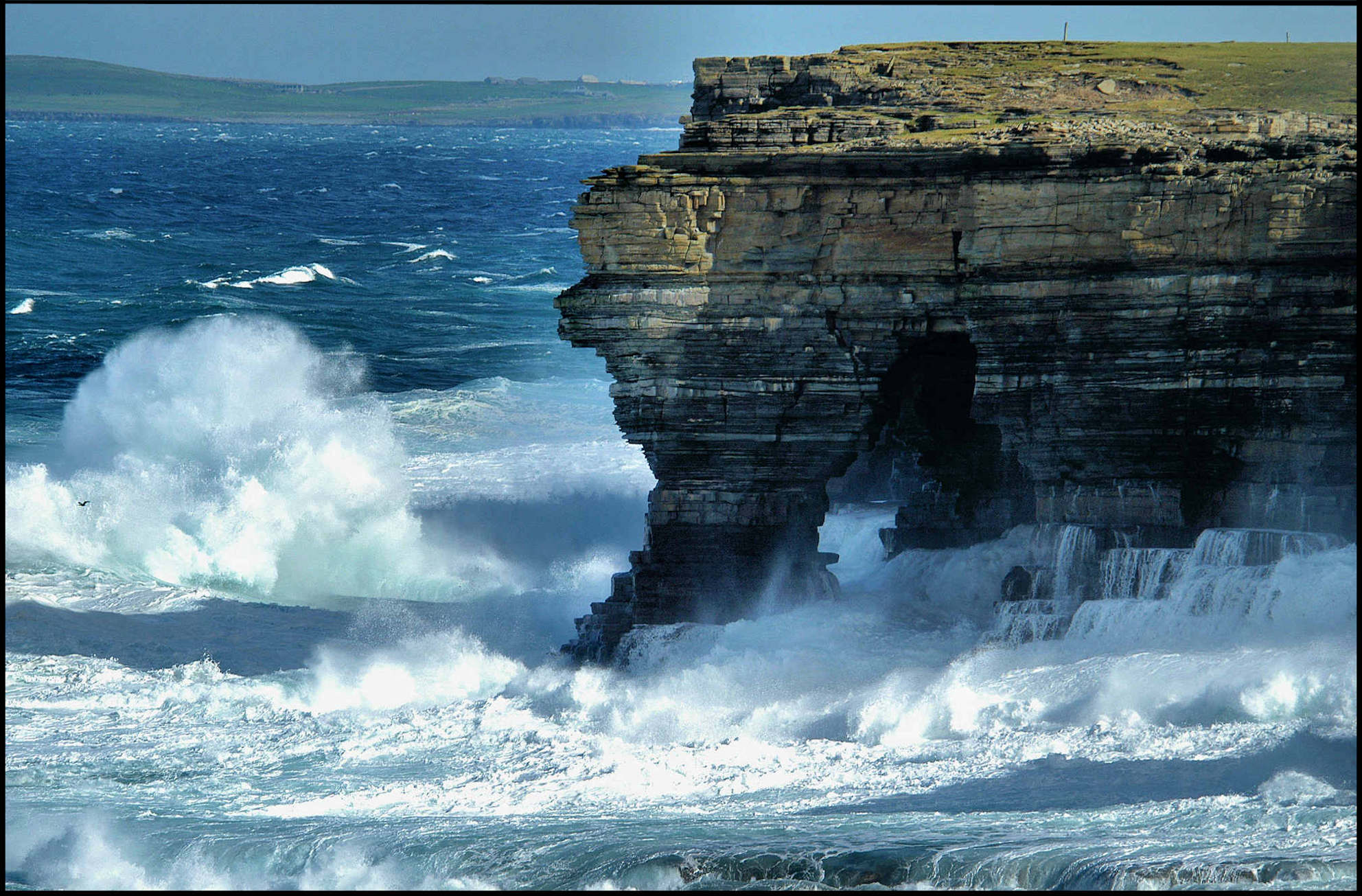
SCABRA HEAD, with its impressive Hole o’ the Horse natural arch, is the bold rocky head-land forming the dominant feature of the coastline on the west side of the island. The name derives from the Old Norse word skjald-breiðr, denoting some natural formation ‘broad, like a shield.’ Other geological features here include the Ha’ and Knee of Scabra.
There used to be a farm nearby called Skaebrae, reckoned sometime as a 5d. land. Between 1733 and 1740 it was occupied by Ursula Marwick. It then passed into the hands of John Couper who was married to Jean Ballenden and they had a son Magnus. In 1799 George Hercus and his wife Christian lived and worked there. The farm and its land later became part of Westness Farm.
SINCLAIR’S HILL is up above Hullion. A nearby valley is called the Hass of Glifter, and in the same vicinity are the Loch of Pitcho, Vassay and Upper Vassay. Turloul is east of Glifter, south-east of which is Lou-o’-fiold – and Kesburn is a hollow in the landscape south-west of there.
SINIANS o’ CUTCLAWS – a massive collapsed cave with cavernous openings on the seaward side of the adjacent cliff between Quoynalonganess and Scabra Head. Cutclaws was the name of a now vanished house that stood nearby, occupied in 1738 by William Bichan, and in 1841 by Alexander Logie who paid rent of £3.0.0. In 1843 it was absorbed into Knapknowes and later added to Westness farm.
Below is a Tom Kent photo [courtsey of Orkney Library & Archive] taken in the early 1900s from inside the Sinians, looking out towards Scabra Head and the Hole o’ the Horse.
SLAP OF AKLAR is a name found on an old estate map of Westside. It was the name given to a gateway, or slap, in the old hill-dyke above Whome. The Old Norse word axlar means a ‘shoulder.’ It is also used metaphorically for a shoulder of a hill or a knob on a hillside. In this case a shoulder of Mansemass Hill juts out here.
SUSO BURN, a small stream which flows out of the east end of Muckle Water and flowing in a north-easterly direction to Hanover in Sourin where it is joined by the Burn of Goustie. It then changes its name to Mill Burn from this point finally flowing into the sea.
STEENI-VESTIFAL was a name applied to part of the lower north-east slope of Blotchniefiold, just above the main Sourin peat-banks. In his Tour Through the Northern Isles of Orkney, which he made in 1778, the Reverend George Low refers to a ‘standing-stone’ in Rousay at Westoval. According to Hugh Marwick that name, now unknown, can be no other than the second element in this name, and the standing-stone, of which no sign is now visible, explains the first element, the whole compound thus meaning – ‘the standing-stone at west hill.’
STURDIE STEP is a name given to a point on the west side and near the north-west corner of Muckle Water, and consists of a few large rocks on raised ground. Strandy-Gate was the name of the road on the east side of the Loch of Wasbister running down to the beach, or strand.
STYES OF STEENIE-IRON, pronounced stin-i-ai-ern, is an old ruinous site about a quarter of a mile east of Peerie Water. Hugh Marwick thought it one of the most interesting of Rousay names, the apparent combination of stone and iron making. He thought it was not impossible that there may once have been styes here where the swine of Westness, which were sent to roam the hills in summer, might have found shelter. It is at least equally possible that some very ancient primitive buildings existed there, of such a rude nature that they were regarded by later generations as having been styes at one time.
Marwick thought the Steenie part of the name referred in all probability to the standing-stone earlier mentioned at Steeni-Vestifal, but greater interest was attached to the second element – Iron, though he stated that any idea of metal may at once be dismissed! He used a combination of Old Danish and Old Celtic to arrive at the Old Norse word airge, a shieling, the Modern Gaelic for that word being airigh.
A shieling was a roughly constructed building or shelter, originally as used by a shepherd, such as a shack or a hut; so he ended up with ‘the shielings at (or near) the standing-stone,’ what he thought could be one of the very few relics of the pre-Norse Celtic inhabitants of Rousay.
TIRHARROLD is part of the hill east of Cruseday in Frotoft, south-east of the Dam of Willievoy. The reason for the name is unknown, but tradition exists that a certain Jenny Harrold died on the hill “about a hundred years ago” and was buried nearby at Gurnaday.
TOOMAL is a generic name, surviving as a place-name for a field, and an example of this is the Toomal o’ Quoy Jenny, at Hunclet.
In the old days of the run-rig system, a toomal was the name for a patch of ground which was not shared in common with the rest of a tunship, but was the perpetual perquisite of an individual house in the tunship. Each tunship house had its own toomal, and as such, it received the best of the available manure, and thus became especially fertile.
TWELVE HOURS TOWER is the name of the peak on the hill-ridge north of Muckle Water. There is a small mound, or beacon site at the highest point, which had been used as a midday mark to dwellers in Wasbister when the sun was in line with it. Such hour-marks are common in Norway.
URADAY is a deep valley on the south-west slope of Ward Hill, between Cat Hill and the top of Ward Hill, above Westness. The water of the Loch of Uraday can be seen in the shadow of the hill in the photo above above.
VICARAGE LAND. There was some land in Knarston known as Vicarage land, of which, in 1503, the skats, or taxes, were drawn by the (Catholic) Vicar of Rousay. This land, represented by the later Rousay Glebe, came on record again over a century later.
At the time of the Reformation, Church lands which had not already been alienated otherwise, were annexed to the Crown, and many years were to pass before all Protestant ministers received adequate provision of manses and glebes. After a time, Acts of Parliament did make provision of a sort, but that was slow in being put into effect.
On May 1st 1626, it is recorded that George Grahame, Bishop of Orkney and Zetland, “compeared upon the ground aftermentioned,” and “with advice of Magnus Craigie in Skaill, Rolland Ingisger in Brugh, and Hew Craigie there, three honest and godlie men of yle and parochine of Rousay, market, designit and appointed to Mr. David Watsone, presently minister actually serving the cure at the Kirkis of the yles of Rousay, Egilsay, Wyre and Inhallow – All and haill the Threepenny land of auld callit Viccaris Land in the toune of Knarston with the house biggit thairupon, sumtyme pertaining to the viccar of the sd yle of Rousay, presently possesst and occupyit be Edward Alschunder…..to be ane mans and gleib for the said Mr. David Watsone.”
And there a manse and glebe were situated for many years afterwards.
WALLHOUSE is the name of a vanished house in Sourin. On December 1st 1817, Archibald Sinclair in Swandale “66 years of age come the 1st of May next,” giving evidence in a lawsuit, declared he was born at Wallhouse “in the neighbourhood of the Manse that is in Sowrick.” The actual site is unknown, but probably somewhere near the Well of Oro at Knarston.
WEDDINGS. Long ago, travel within an Orkney island, and between neighbouring islands, was much more difficult and therefore less frequent than it is today. Consequently, marriage partners were sought from within the island, often from within the same district. A degree of inbreeding in the population resulted from this but down through the generations there was an awareness of the problems that could arise. Marriage between first cousins was frowned upon and discouraged especially if the families concerned were aware of some weakness on one or both sides. However, this atmosphere of disapproval of such marriages did not prevent some taking place but the arrival of new blood in the island from time to time prevented any serious problems arising.
Until about 1930 a wedding in Rousay usually took place in the barn at the home of the bride. A meal would be provided in relays in the house for all the guests. If the wedding took place in the summer time the younger people would pair off and, preceded by a fiddler or a piper, would set out for a walk with the bridal party at the head of the column. In Wasbister, the walk went round the loch, pictured above, a distance approaching two miles. By the time they had returned, the older guests would have finished their meal and the walkers sat down to theirs. The celebrations usually went on all night and the weary dancers would wend their way home as breakfast time approached.
Farm weddings went out of favour as church weddings became more popular, but the reception was still held at the bride’s home after the church ceremony. Before long it became the common practice to have the wedding in the church and the reception in the local hall. Couples who preferred a simpler wedding could be married by the minister in his manse or could choose to have a civil wedding ceremony in Kirkwall.
WELL OF EASE was the name given to a fresh-water spring that bubbles up on the beach below Langskaill. Its origin is obscure; it is only a few hundred yards along the beach from the site of the ancient Colm’s Kirk – a ruinous chapel site of Celtic foundation, possibly dedicated to either St Colm or St Columba.
WESTSIDE. The Westness area of Rousay has been described as ‘the most important archaeological mile in Scotland,’ for it spans settlements from the first Stone Age farmers, the Pictish Iron Age, the Viking invaders, the period of the Earls of Orkney, through to the mid-19th century clearances when 210 people were evicted from Westness and Quandale by the laird, George William Traill.
A mile after leaving Wasbister the road turns southwards around the shoulder of Mansmass Hill. From here there is a splendid view over Quandale and its deserted crofts and across the Sound to the island of Eynhallow and beyond to Costa Head on the Mainland. It was from this point that the old track that came by Kirkgate in Wasbister and over the hill led in a straight line down the slope to the kirk of St Mary at Skaill, standing on the shore facing Eynhallow.
Robert Craigie Marwick told of an incident that was supposed to have taken place at this point on the track a long, long time ago, in the days before there was a proper road running round the island. An old woman had died at one of the small crofts on the Wasbister hillside and she was to be buried in the Westside kirkyard beside her late husband. It was a warm summer’s day and the men who were carrying the coffin in relays were feeling hot and uncomfortable in their heavy home-spun suits after the long trudge over the rough track. They decided to have a short rest before descending the hill to the kirkyard. The coffin was set down and the men sat down to catch their breath. As they sat there talking they heard a knocking sound coming from the coffin. They looked first at it and then at each other unable to believe what they were hearing. Then the chief mourner, quicker thinking than the others, responded to the ever increasing volume of knocking by taking out his knife and starting to prise up one of the boards that formed the lid of the roughly made coffin. Within a few minutes the whole lid was off and the old woman sat bolt upright and looked about her. When she realised that she was witnessing her own funeral she leapt up, grabbed one of the boards of the lid and started to lay about her like someone demented, shouting, “Ah’m no deid! Ah’m no deid!” That fact was plain for everyone to see and no-one felt inclined to dispute her claim, especially while she wielded the piece of wood. The hapless mourners kept their distance until the poor woman calmed down. After a hurried conversation with the chief mourner she agreed to resume her seat in the coffin. She was conveyed back to her home amid much banter and good cheer.
When the company reached the old woman’s cottage the coffin was set down at her door and she was helped to her feet. She turned to the chief mourner and said, “Next time thoo taks me tae the kirkyard I want thee tae stop at the sam place as thoo did the day. I want thee tae deu that even if hid’s poorin wae rain. Juist tae mak sure, thoo kens. Aye, juist tae mak sure.”
That instruction was complied with a few years later, but on that occasion no knocking was heard and the journey continued down to the kirkyard at the shore.
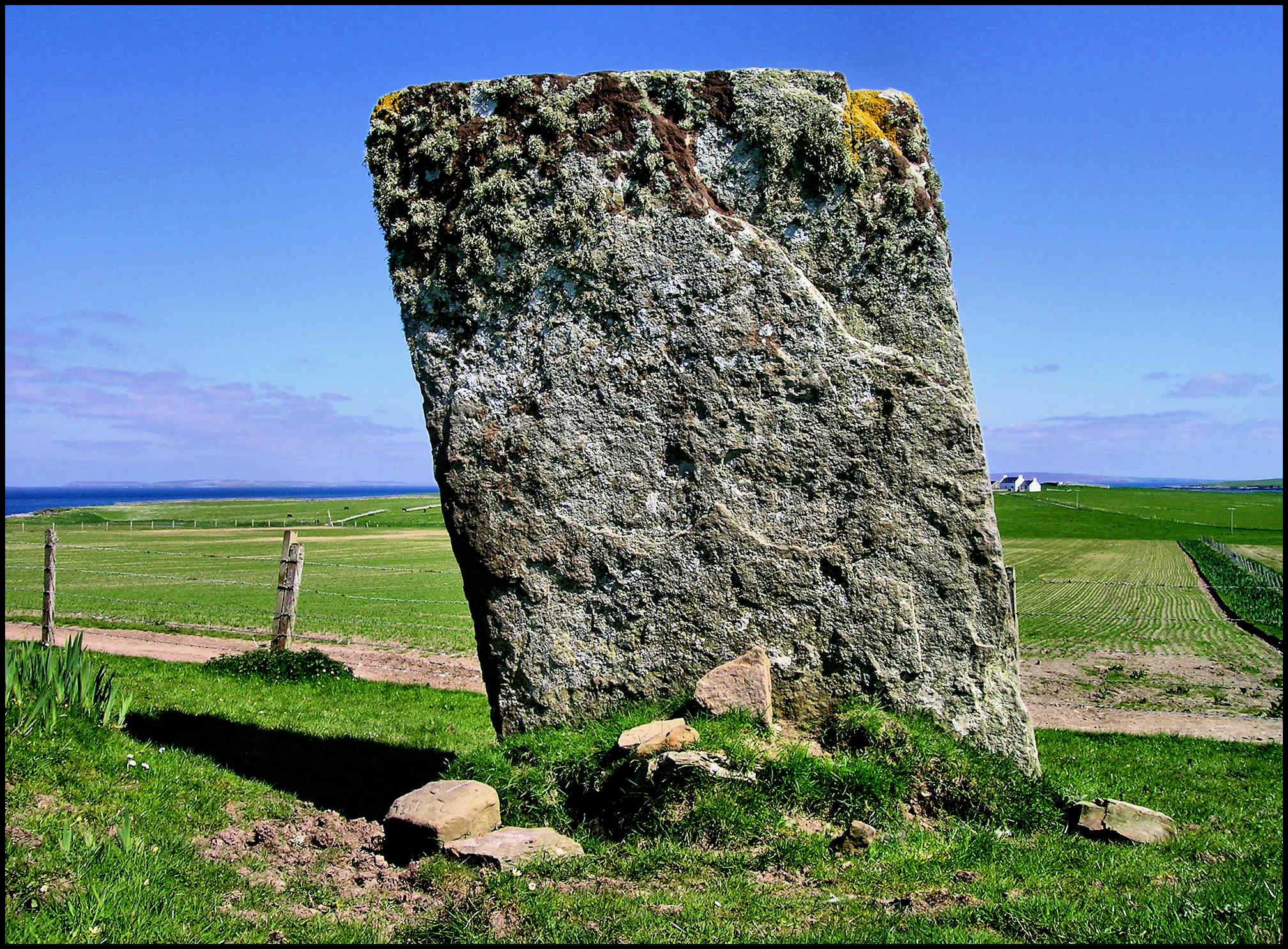
YETNASTEEN. Standing stones are a feature in many parts of the Orkney landscape – long slabs of rock standing upright in the ground. Some of them are in groups, the best known of which is the Ring of Brodgar in the parish of Stenness on the Mainland. It originally had about 60 stones of which 27 still remain standing, many to a height of ten feet or more. Rousay has some standing stones though none as tall as those at Brodgar.
One of them stands on the land of Faraclett. It is called the Yetnasteen, a name derived from Old Norse meaning ‘stone of the giants.’ It is a large slab of rock about three feet wide and ten inches thick standing about seven feet high. One cannot but wonder why and how these huge slabs of rock were put in place in many parts of the Orkney landscape. Vast numbers of people must have been marshalled to move and erect them. It is easy to envisage these monoliths, especially if seen in the last rays of the evening light, as silent sentinels standing guard over the surrounding countryside, and it is little wonder that, in some people’s minds, they came to be invested with unusual powers.
It is said that in the early hours of every New Year’s Day the Yetnasteen takes two giant strides down to the nearby loch for a drink. There are even those who claim to have witnessed this but somehow their accounts of the event always seem to lack the clarity necessary for them to be credited with any significant measure of accuracy. Something to do with the celebratory time of year no doubt!
Extracted from Hugh Marwick’s The Place-Names of Rousay
AXNI-GEO is a narrow geo on the coast at Scockness, the rocks on the north side of which form a natural ‘lade-berry’ or jetty.
BAILLIE COURTS. After Orkney came under Scottish rule, baillies and lawrightmen looked after local affairs. From old Baillie Records in the Sheriff Court Record Room we learn that about 1690 the Sourin district of Rousay, together with Egilsay, and Work and Carness in St Ola, formed one bailliewick with Douglas of Egilsay (the owner of these lands) as baillie-principal. From one record we get an insight into local matters that year.
“At St Magnus Kirk in Egilsay…The Balzie (name not stated) continues James Craigie in Avilshay, Patrick Yorstone in Banks, and John Allan in Faraclet as former Lawrightmen of Sowrick, and adds to them Magnus Banks in Cudraw.” There follow edicts requiring everyone to “keep their own cornland”; no one in Egilsay or Sowrick to take sheep “without the sheepman”; the people of both districts to pay a herd; the officer of Rousay has to keep an account of all beasts in Sowrick, and all dogs above a hundred are to be killed, except with special permission.
BENYIECOT: The lower part of Bregaday, a field on the north side of the Loch of Wasbister, is known as the Skuttos o’ Benyiecot. Skutto is an obsolete Orkney term for some small kind or portion of field, and the latter word might seem to indicate an Old Norse *boena-kot, ‘prayer-cot’ (= boena-hus, chapel), the more so as there happens to be a tradition of an old chapel at this site.
BLEACHING KNOWE. Surveyed in 1935 a much-destroyed burnt mound, known locally as ‘The Bleaching Knowe’, was discovered on the southern shore of the Loch of Wasbister [pictured below], immediately north of the school. There were also traces of cist-like boxes formed of slabs set on edge in and close to the water. Little or nothing survives today though.
BROKISLAND, also called Rigers-land, is on record in 1634 as a halfpenny-land situated somewhere in Wasbister, evidently so named after the owner named James Brok. In 1624 a daughter of umquhile [the late deceased] James Brok in Howatow, Wasbister, sold one third of the half-penny udal land under the house of Howatow to Thomas Alexander of Saviskaill.
CANNAMISURDY, the name of a well on the beach in Frotoft, below the house known as Cott, occupied in 1861 by Peter Louttit, an 89-year-old farmer of 5 acres. There is a local tradition that the body of a woman was washed ashore here. She was from Canisbay in Caithness and her name was McUrdy – or something similar.
CASTAL. In a field immediately to the north of the old house of Stennisgorn in Wasbister is a site known as the Castal. Here an old building once stood, and the late proprietor told Hugh Marwick that when his father was removing stones from the site he came across a metal basin-shaped object. It was broken, but standing out in relief on its outside were figures of what he termed ‘an angel and a dragon’. The dragon ‘had scales marked on it.’ Some who saw it thought it might have been a bell, but from his description it must have been too shallow for such a purpose. It ‘lay about the house’ for some time, but he had lost sight of it for many years.
CHRISTMAS. Alexander Marwick, who farmed Corse for many years, left a description of how Christmas was celebrated in his younger days in Rousay, early in the 19th century:- ‘In the first of my minding, the Christmas was kept as follows; every house that grew crop brewed some ale for Christmas. On Christmas Eve every house killed a sheep but they neither had white bread or tea; their bread was oatcakes and sowan scones. When they got cod in the Christmas week they baked a cake of bere meal and cod livers which was as good and as well liked as any shortbread of the present day.
The young men then played football till dark, then went to a fiddler’s house and danced until 12 o’clock at night. The Christmas Day well spent, on New Year’s Eve a number of young men went from house to house singing the New Year songs where the door was quickly opened and the singers sat down to the best that was in the house. It was looked upon as a token of respect to those they visited but ill-loved neighbours were generally passed over.’
CREYA. Two small crofts, East and West Creya, were sited in the face of the hill north of Curquoy in Sourin. In a legal process of 1823, John Gibson of Broland was prosecuted for slander by Janet McKinlay, wife of John Pearson of Cruannie. He was alleged to have called her ‘a thievish limmer,’ and this he did on ‘the day of the last sheep-shearing at Creya.’ This happened in the days when the hill was public common, and when the sheep of the whole district grazed upon it. Mrs Pearson must thus have been so insulted on the public sheep-shearing day when all the sheep were rounded up and confined in enclosures at Creya for shearing or ‘roo-ing.’
CUBBIE ROO. A cottage at the roadside in the Brinian, so named from a nearby mound known traditionally as ‘Cubbie Roo’s Burden’. Cubbie Roo is the modern form of the name of a famous Saga chieftain, Kolbein Hruga, who had his seat in Wyre [pictured above]. Somehow or other his name is commemorated all over Orkney as that of a giant who used to hurl boulders from one island to another. Rousay tradition has it that he once proposed to build a bridge between Rousay and Wyre, and for that purpose was carrying a kubby-load of stones when the fettle or shoulder-strap broke at this spot, and the mound of stones represents his fallen burden. It is in fact a pre-historic chambered burial cairn – now in a ruinous condition.
DIPHTHERIA. Early in 1879 there was an outbreak of diphtheria in Rousay which was to last for most of the year. Eight or nine people died of the disease, most of them being children. Three of the children were from one family, the Leonards of Digro. The youngsters’ names were Arthur, William and George. Although the outbreak first appeared in Sourin, and most of the victims belonged to that district, the school there does not appear to have been closed till August, by which time there had been several deaths. The school then remained closed for the rest of the year. Most pupils were kept at home for much of that year as parents were convinced that children ran a greater risk of catching the dreaded disease if they attended school. There were deaths in Wasbister and Frotoft too, and although Wasbister school was closed for a time early in the year, the Frotoft one remained open. Scarlet fever was also present in the island that year. The Frotoft teacher recorded that he took precautions against its spread by placing disinfectants in the school.
EASTAFEA is an old farm, later incorporated into the farm of Faraclett [pictured above] and mentioned in a rental dated 1595. Between this and the houses of Faraclett lay another old farm – Midfea, now also vanished.
FEELIE DYKES. At many points close to the Westside road remnants of the old hill dykes can still be seen. These dykes separated the common land on the higher ground from the arable land lower down. Most of them follow the contours of the land at a height of 200-250 feet above sea-level. In the old days, those who farmed the arable land had grazing rights on the common. These dykes, which are much older than most of the stone dykes now seen on the island, were built of turf and were commonly referred to as feelie dykes. They were built from material dug from the land near where they stood. To have been effective they must have stood at least four of five feet high and would have required frequent repairs. Stone, although plentiful enough, provided a dyke that needed little in the way of maintenance but in some instances the stones had to be transported quite a distance to where they were required. This would have been a difficult task until carts appeared on the island in about 1839, so most of the stone dykes in Rousay are little more than 150 years old. Long stretches of the feelie dykes, now reduced to grassy ridges a foot or two in height, can still be seen snaking across the rough pasture land in many parts of Rousay. The one pictured below is just to the west of Cat Hill, Westness.
FESBER is the name of a cliff to the east of Grithin on the north-west coast of Saviskaill Head. There used to be a large quoy or fold for sheep here known as The Queer o’ Fesber. The Old Norse word kvíar, pronounced ‘Queer,’ means fold or enclosure for animals.
FISHING ROCKS. Bya-steen was reputed to have been one of the best fishing rocks in the Leean. Nearby is the Finger Steen, a roughly cubical rock measuring about a fathom [six feet] each way, attached to which is a very old traditional story, as well as a little superstitious dread. It is told that once upon a time a giant on Fitty Hill across the firth in Westray (sometimes identified with Cubbie Roo) hurled this block at an enemy on Kierfea in Rousay, but falling short, it came to rest here. And in proof of that, tradition points to certain indentations on the stone which indicate the giant’s fingerprints – hence the present-day name. Before the public road was created between Sourin and Wasbister, the old track ran along the Leean shore and close past this Finger Stone. Hugh Marwick remembers how it was told that if on passing the stone a pebble or other trifle was not placed upon it, disaster would overtake the traveller on his return journey;…….
Garaber, below that curious ridge in the Leean known as The Green Gairsty; Hunber, one of the most renowned fishing rocks in Rousay, situated a little way east of the Knee of Faraclett; Klettber, between Lair Geo and Garaber in the Leean; Koldeross, a narrow shelf on the face of the crag immediately west of Hunber; Kribbany, another fishing rock in the Leean, the origin of which is doubtful, but a similar site in Faroe is so called as being a place on the crags which can only be reached by creeping; Kuthiny-klett, a rock on the Quandale shore south of Skarataing, noted for being a good spot to catch cuithes; Longapol, a long narrow spit of rock somewhat resembling a pier, running out obliquely from the line of cliffs in the Leean – another notable fishing site;……..
Luizber, part of the crags west of the Knee of Faraclett. Probably Old Norse ljos(a)-berg, ‘light-coloured rock(s)’, perhaps named by fishermen on account of guano on the cliff face; Lyber, a noted fishing rock east of Garsniegeo. In Orkney the usual name for the pollack is lythe – though it is puzzling why such a name should be applied to a rock where tens or hundreds of cuithes were caught for every one lythe or pollack!; The Queer o’ Myres is a name applied to some low crags at the beach below Myres in Sourin – a notable fishing site for ‘pocking’ sillocks in the old days; Salt Hellyie, Sandber, Sandber’s Tongle, Steenathy, and Verpino – more fishing rocks in the Leean.
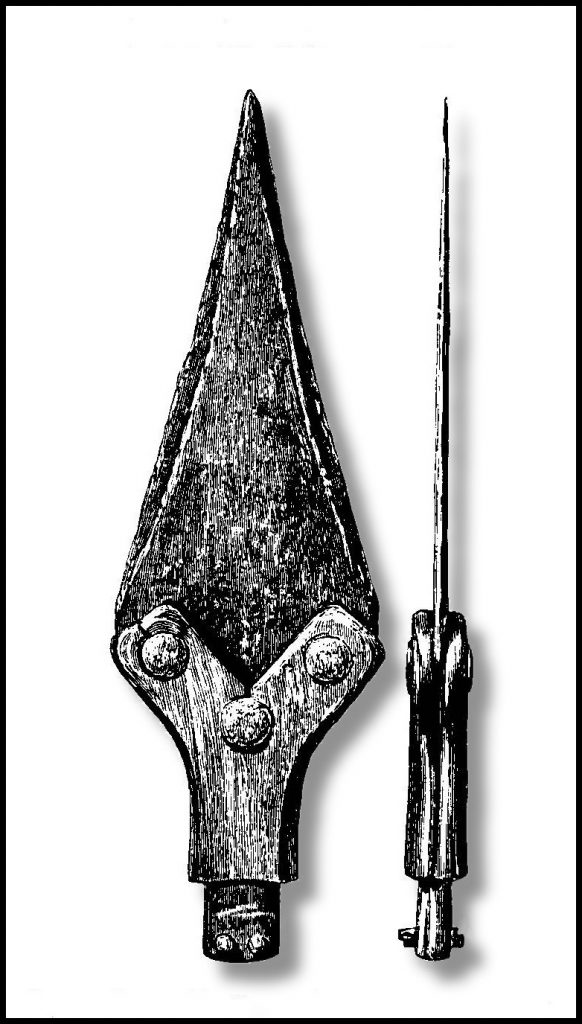
FLANDERS MOSS. In the spring of 1905, Fred Inkster, tenant of the farm of Innister, found a bronze dagger or spear-head while cutting peats at Flanders Moss, an area to the right of the peat track up from Westness, just to the south of Peerie Water. It was handed to James W. Cursiter, a Fellow of the Society of Antiquaries (Scot) in Kirkwall. It was found to consist of a thin flat blade of bronze, about six inches in length, inserted into a horn shaft. In early days light spears or javelins were frequently used for throwing, both in hunting and in fighting, a use to which, it was thought, this particular weapon might well have been applied.
FLOTTAHALL. Flotty was the name of a field on the south side of the road at Langskaill. An entry made in 1821 in the Rousay Birth Register records a house called Flottahall in Wasbister, and in the census of 1841 its entry was located somewhere on the hill between Whitemeadows and Langskaill. At that time it was occupied by 40-year-old fisherman James Flaws and his 30-year-old wife Betty Barnetson. They had four children; James was born on July 22nd 1829 when they lived at Vacquoy, and the other three were born at Flottahall; William, on May 27th 1831, Betsy Sutherland, on August 3rd 1834, and Margaret, who was born on August 25th 1836.
GALLOWS. The methods of administering law and order in the old Norse days are very obscure, but, arguing from what is known of other Norse lands, there were local assemblies or ‘things,’ as well as a central ‘thing’ for the whole group. In Rousay this would appear to have been held at a place half-way up the Sourin burn, where a rocky knoll deflects the course of the burn and is half-encircled by it. This place is called the Gallows. It is practically in the centre of Rousay and its name testifies to the summary methods of punishment in those downright times.
GOLF COURSE CORNER. In the l920’s a golf club was formed in Rousay and a nine hole course was created in Inner Quandale, the site of which is pictured above. This was a very popular pastime with a large membership of young and not so young men. Hugh Marwick of Moan in Wasbister was employed as the green keeper. A corrugated iron shed was bought and placed above Whome to keep the mowers and flags. Members of the Kirkwall and Stromness golf clubs were invited and came out to Rousay and played many tournaments. This club was finished by the end of the l930’s.
GREEN GAIRSTY is a prominent earth-dyke or ridge running down at right-angles to the beach in the Leean, half a mile or so east of the house of Langskaill. The adjective is applied by reason of the fact that this grass-grown ridge stands out prominently green against the adjacent pasture ground. At the shore end of the gairsty is a fishing-rock called Garaber, meaning ‘garth – or dyke-rock.’
HAMMER-CHUNKY is a name applied to ‘hammers’ [rocks projecting from the face of a hill] on the hillside above Shalter in Wasbister. Netherbow is another feature in the landscape in this area. The name applies to a hollow striped with portions of rough pasture situate 19 chains N. from “Erne Tower” & 10 chains N.E. from “Brae of the Pits” & 18 chains N.W. from Tower of Loomashun. Years ago James Campbell Bruce Craigie, Jim o’ Deithe [pictured above in 1975], composed many a fine fiddle tune and ‘The Road to Hammer Junkie’ and ‘Netherbow’ were just two of them. Both of these have been recently recorded by Orkney bands The Chair and Saltfishforty. Other interestingly-named sites in this area include Betenlongie, Brae of the Pits, Cuppers of Vacquoy, Hogsets of Catagreen, Knowe of Whirliegar, and Withamo.
HAMMERS OF KNARSTON is the name given to a short stretch of coastline below Knarston consisting of rocks projecting into deepish water, and providing, in the old days, excellent opportunities for sillock fishing by the use of ‘pock-nets.’ Here vast quantities of these fish used to be caught in late autumn, and their livers, when ‘braithed’ or melted down, provided oil for use in old-time ‘cruisies’ or ‘koly-lamps’ before the introduction of paraffin.
HOUSTEITH. On 31 March 1614 Robert Craigie disponed to Robert Chalmer ‘his fourth part udal lands extending to a fourth part of the whole town and lands called Housteith lying in Trimland in the isle of Rousay.’ Sasine [a legal document that records the transfer of ownership (usually a sale or an inheritance) of a piece of land or of a building] was given on December 10th 1619 by William Trimland, indweller in Hunclet as bailie in that part. John and Henry Trimland in Trimland were among the witnesses.
HOWATOFT was the name of an old Wasbister house, probably in the neighbourhood of Saviskaill, the farm buildings of which are closest to the shore in the picture above. In Heart’s Sasines is a record of a sale to Thomas Alexander, eldest lawful son of Henry Alexander in Saviskaill, by Katherin Brok, one of the lawful daughters and heirs portioners of James Brok in Howatow of her third of the halfpenny udal land under the house of Howatow in Wasbister. Sasine was given on March 5th 1624.
On April 26th 1625 Thomas Alexander obtained sasine on a charter to him from William Craigie of Papdale of 1 pennyland of udal land in Howatoft, of which half was called Brokeisland half Rigersland, which had been sold to him by James Craigie in Westray and Margaret Brok with consent of Magnus Hourston in Skabrae – heritors thereof.
In 1634 William Craigie got a decree against Thomas Alexander’s widow for unpaid dues in respect of Howatoft, and two centuries later, in 1828, John Inkster had the cot-house of Howatoft included in his sasine of Saviskaill lands. The Brok ownership of lands in Howatow and Howatoft seems to be sufficient proof that both names refer to the same property, and are only different forms of the same name.
To Hugh Marwick the name seemed to point to an Old Norse hauga-topt, ‘taft of mounds,’ the site of some structure at or near mounds. He could not say definitely though that Howatoft actually meant a site marked by natural hillocks, or whether the mounds marked the ruins of previous structures, or whether they were perhaps prehistoric burial cairns, so-called picts-houses.
INSKIFT was the name of a landing place and boat-noust below the old house of Hurtiso in Sourin, and of the field above it. Hugh Marwick thought this an interesting name, dating from a time when the run-rig system prevailed, and most probably before Orkney came under Scottish rule. The word represents the Old Norse eignarskipti, a division of land in such a manner that the portion divided became the sole property of one individual, and was not held in joint ownership with the other proprietors of the tunship or farm. In other words, the Inskift was a field that was owned by one, and not shared with the other proprietors of Hurtiso.
JUPITER FRING. On a line between the eastern end of Muckle Water and the top of Blotchniefield is a curious ridge called the Camp of Jupiter Fring, some 600 yards long by 40 or 50 broad, and having very steep scarped sides on its northern and southern sides. How it came by this name no one knows; Wallace referred to it in his ‘Description of Orkney’ of 1693, and seemed to think the name had been given by some ‘dominie from Jupiter Feriens’ [an expert on the Greek epic poem Homer’s Odyssey] on account of its being ‘frequented by Jove’s bird’ [an eagle]. Hugh Marwick, on the other hand, suggests an alternative, more plausible suggestion which stems from the Old Norse ‘djupi torf hringr’, which translates to ‘deep turf ring’, and refers more to the surrounding hollow than the ridge itself.
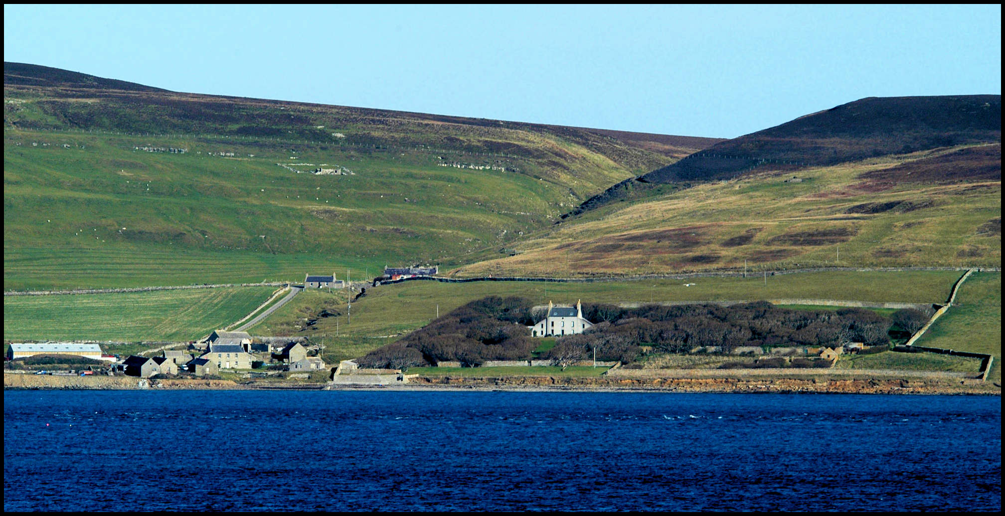
In Thursday’s Rod and Gun, Rousay and Viera form the subject of the eleventh article of the series on “The Sporting Estates of Scotland.” The article is illustrated by views of Trumland House and the more striking features of the coastline. The following extracts may be of interest: –
[There were in fact no images in this particular version of the article – so I have added my own!]
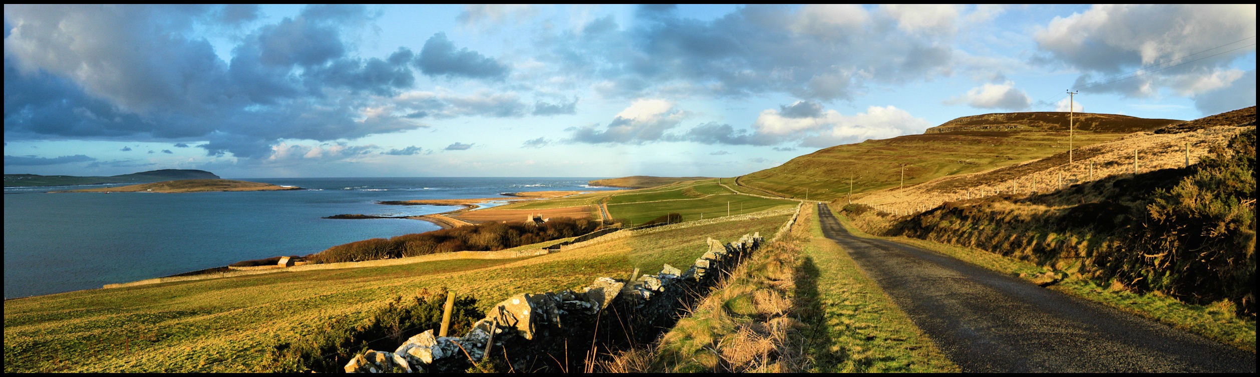
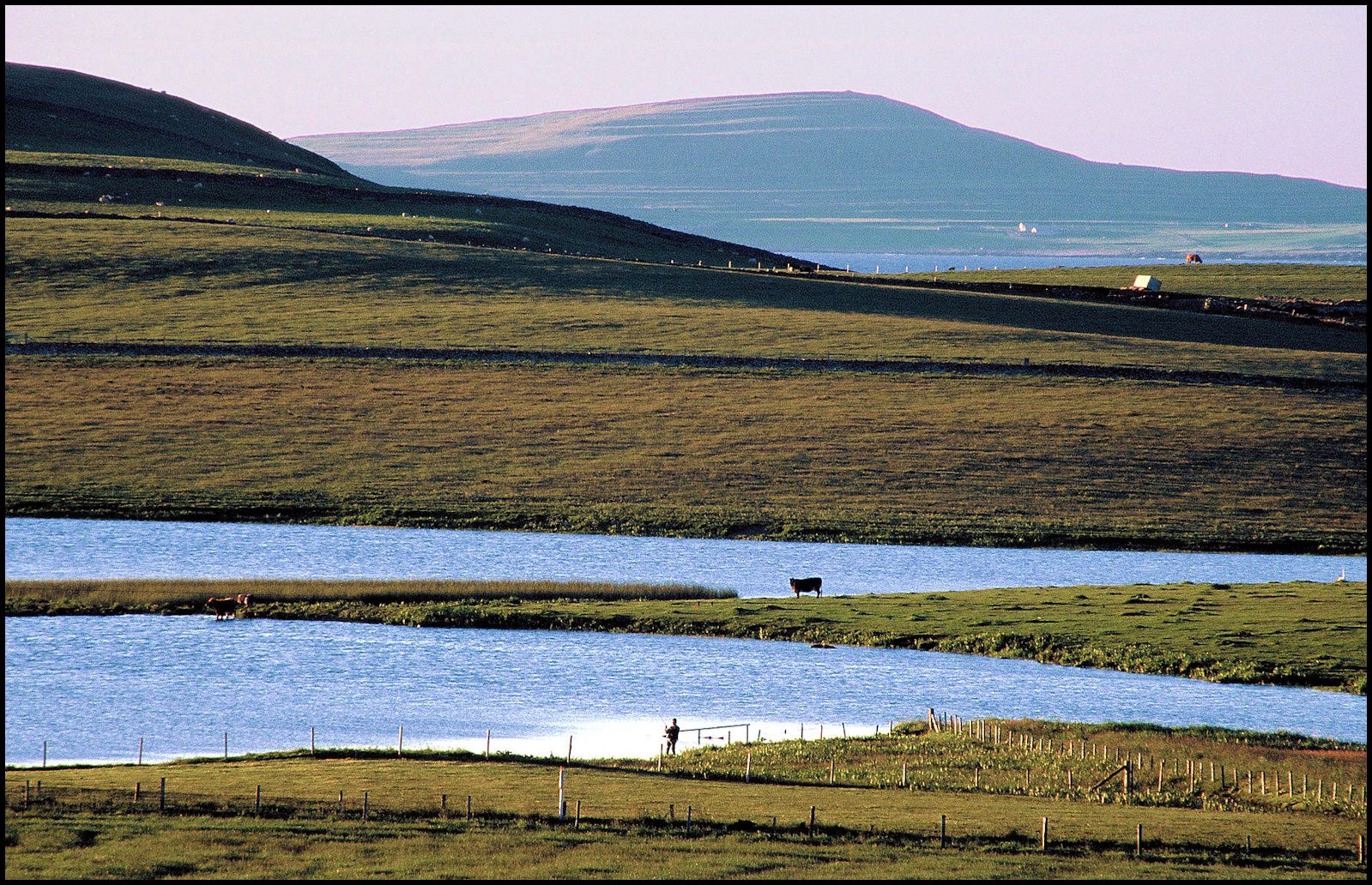
Today’s view of Rousay, looking across Eynhallow Sound from Costa
The estates of Rousay and Viera consist of three islands in the well-known Orkney group, off the northern coast of Scotland, from which they are separated by the Pentland Firth. Rousay is an island of considerable size, and is separated from Viera, which is much smaller, by a channel about a half-a-mile broad. All three islands are exceedingly fertile. The whole of Viera is cultivated land, and all round the coast of Rousay there is a broad strip of the finest arable and pastoral land in the extreme north of Scotland. The centre of the island of Rousay is chiefly moorland and rough pasture, and yields large bags of grouse and other Highland game, while over the whole of the other portions of the estate there is excellent low-ground shooting. There are several first-rate trout lochs in which sea-trout are got; and salmon might easily be introduced into one of the lochs. The sea fishing round the coasts may fairly be said to be unrivalled in Scotland, and there is a small salt-water loch at Rousay that offers exceptionally good facilities for oyster culture. There are two mansion houses, one of them quite new, fitted with all modern conveniences, and containing accommodation for a large establishment, and the other well adapted for a lodge with a separate shooting. Valuable minerals are to be found on the larger island; but they have not yet been worked. The climate throughout the year is remarkably equable; and the whole estate is in first-rate order, great improvements having been quite recently effected in farm buildings, cottages, roads, fencing, drainage, &c. Both of the islands are in the county of Orkney and Shetland, and form part of the united parish of Rousay and Egilsay.
Rousay’s NW coast, between Sacquoy Head and the Lobust.
The geological upheaval that is Scabra Head
The Orkneys embrace altogether fifty-six islands at high water, and about thirty of these are inhabited. They cover an area of about 610 square miles, and have a coastline exceeding 570 miles. This group of islands, as seen from the higher grounds of Rousay, presents a beautiful panorama as they repose on the blue waters of the North Sea. There is a wonderful variety in the forms they assume, and the irregularity of outline and shore is very picturesque. Some of the islands lie low in the water, and others, chiefly facing the Atlantic Ocean, dash off white sparkling foam from their bold headlands. Throughout the whole of the islands there are numerous quiet, secluded bays, which afford shelter for vessels in stormy weather, and where the long Atlantic waves break in silvery spray over bright beaches of yellow sand. The late Mr. Frank Buckland, when in Orkney with the Fishery Commission, was so agreeably surprised and pleased with the islands that he said to a friend, “The fact is Orkney has not been discovered yet.” The inhabitants of these islands are Scandinavians, not Celtic, and quite different from the people of the Hebrides.
The Lobust, with Sacquoy Head and Westray in the distance.
Sacquoy Head, part of Rousay’s dramatic north-west coast.
Rousay is one of the most romantic islands in the Orkney group, and about the sixth in point of size. It may be roughly described as a circular island from five to six miles in diameter. On its eastern, southern, and south-western shores, it slopes gently to the sea in banks of fine arable land, whilst from Scabra Head, round to Faraclett, or “The Knee of Rousay,” as it is called on the chart, the coast is more or less precipitous, with the exception of a small portion of the Bay of Saviskaill. The north-western and south-western sides of the coast present numerous examples of the grandest rock scenery in Scotland, exhibiting a bewildering variety of form, and startling in their wilderness. Among the most note- worthy of these is an extraordinary series of gloups or blow-holes, known as the Sinians of Cut-Claws, great sea-caves which in some instances penetrate for several hundred yards through the land, terminating in large circular openings in the level ground hundreds of feet in depth, and into which the sea swirls and surges with a weird hollow roar. Between the Sinians of Cut-Claws and Scabra Head are some curiously-formed arches, known as the Hole of the Horse and Auk Hall, the cliffs of which are remarkably picturesque and bold. About one mile further on there is another Sinian known as the Kiln of Dusty. About this point Bring Head begins: a very fine strip of cliffs, in some places over-hanging the sea, and having its highest part in Hellia Spur, about 300 feet above the swelling waters of the Atlantic. Close to this spur is the Stack of Lobust, a long narrow portion of rock which has slipped away from the cliff, from which it is separated by a straight, deep chasm, a little over twenty feet in width. Close to this part of the island are the wonderful Kilns of Brimnovan, consisting of a great natural colonnade, arches, and caves, worn out of the solid rock by the continuous action of the sea. Seizing hold of a weaker than usual spot in the stratification of the cliff-line the sea has carved out a huge gateway or embrasure, sufficient to allow an ordinary fishing boat to pass through in full sail, and the stones from which are piled in great heaps to the rear. There are altogether a series of three groups in these kilns, extending about 300 yards from east to west. The western one is a fearful abyss; and both of the eastern ones have arches opening seawards, through one of which an exquisite peep is got of the sea outside. To be properly appreciated, the whole of this magnificent coastline should be seen from a boat, by which a large number of caves may be explored. On the ledges of the rock countless rock-pigeons, gulls, cormorants, &c., take up their abode; and the seal is a regular dweller among the rocks and caves. For about an average of one mile all round the island, there is a nice strip of agricultural land; after which the ground rises in a series of terraces, culminating in three ranges of hills, having for their highest points, respectively, Blotchinfield, 811 feet; Kierfea, 762 feet; and Knitchenfield, 732 feet. The lower part of the hill land is chiefly clothed with coarse grass; but as the hills are ascended the grass becomes well mixed with heather. At one part of the moor there is a rough bit of broken-up bog ground, clothed with heather, and fissured with numerous holes. This is the habitat of the Pyrola Rotundifolia, and is said to be the only spot in the Orkneys where this flower, known in the island as the “round-leaved winter green,” is to be found. These hills and moors are drained by several lochs and burns, all within easy walking distance from the mansion house.
North-eastern view from the summit of Knitchen. [Picture: Jo Inkster, Langskaill].
South-eastern view from Mansemass Hill, looking towards Muckle Water.
Trumland House, the mansion-house of the estate, is a magnificent modern building in the Scottish baronial style of architecture, built as recently as 1875 from designs by that well-known architect, the late Mr D. Bryce, R.S.A., Edinburgh. It stands on a series of terraces overlooking Viera Sound, and commands a splendid view of most of the northern group….. About 50 acres of policies, pleasure-grounds, and gardens surround the house. The offices are extremely commodious, and include stables, coach-house, kennels, keeper’s house, &c. There is also an excellent garden. The beautiful little Trumland Burn flows close by the house, and forms a series of small waterfalls amidst thriving young trees. Owing to the extraordinary mildness of the climate, the fuchsia is grown as an ordinary hedgerow plant around the Trumland policies. The building and furnishing of Trumland House alone cost £10,734. Including the expenditure on the laying-out of the grounds, the cost of the mansion amounted to £11,887. Since the year 1840 about £40,000 have been expended upon improving the estate. Westness House was the old family residence previously to the completion of Trumland House, and is at present let as a shooting lodge. It is situated close to the sea, about four miles west of Trumland, and is a very substantial and commodious old square Scottish baronial structure of three storeys, beautifully surrounded with wood, in which the sycamore predominates. The gardens of Westness have been described in a local history as “the most beautiful things of their kind in the islands.” There are altogether about nine acres laid out as gardens and woodlands, and they are intersected by pleasing walks. The offices are complete and most commodious.
Work started on the building of Trumland House in 1873, the eventual cost of house, grounds and furnishings amounting to just under £12,000
The original Westness House was burnt to the ground during the Jacobite rebellion. Its replacement, pictured above from Evie, was built in 1792
The Island of Viera – the Vigr of the Norse days – is a peculiarly-shaped island lying on the water about half-a-mile distant from Rousay. It was the place of residence of Holbein Hruga, the collector of the King of Norway’s taxes in Orkney. It is remarkable for the fertility of the soil, and between it and Rousay there is excellent anchorage for vessels in Viera Sound.
Rousay still supports good numbers of Grouse [Muirhen]…
…and Golden Plover [Hill Laverock]
The entire estate, including the two islands, extends to about 12,000 acres, of which about 3,148 acres are arable, 3,827 acres moor and pasture, and about 25 acres plantation. The whole of the islands of Rousay and Viera belong to the estate, with the exception of about 250 acres in Rousay, which are held by another proprietor. There is thus a large extent of low-ground and high-ground shooting. The moorland rises immediately behind the mansion, in a series of fine terraces, along which the ground is quite level, and reaches its highest point in Blotchinfield at a height of 811 feet above the sea. From the top of this hill, on a clear day, a magnificent and far-reaching prospect is to be had of sea and land. The moor is well clothed with good heather and grass, and is abundantly watered with springs and rivulets. The ground is so favourable for grouse that no disease has ever occurred on the island. About 300 brace of grouse may be expected over the whole ground at Rousay; but there are none on Viera. Between 400 and 500 brace of grouse have been killed in a season; but the bag is now limited to 300, being 150 brace for Trumland and 150 for Westness. About 200 snipes may be killed, and the rest of the bag should include between 20 and 30 woodcock, the same number of wood-pigeon, 20 wild-duck, 25 or 30 golden plover, 50 brown hares, and 200 rabbits. Wild swans visit the island in winter, and there are numerous seals in summer. There is indeed, plenty of shooting all the year round, and the estate has always been very lightly shot over.
The Bay of Ham in Sourin, where almost sixty ‘bottle-nosed wanderers from the polar regions’ beached and were killed in August 1861
With the exception of fox-hunting and deer-stalking, the estate gives almost every kind of British sport. In summer there is excellent trout-fishing, yachting, sailing, and rowing among the islands, where there are harbours providing shelter from every wind. There is sea and fresh-water bathing, riding, driving, and picnicking on beautiful spots in all directions, lawn-tennis, &c. Many yachts visit the Orkneys in summer. In autumn there are a variety of winged game shooting; also hares, rabbits, otters, and seal-stalking. In winter there is grouse shooting over dogs until December 10, woodcock shooting, and wild-fowling. In spring, and, in fact, all the year round, there is sea-fishing, which affords great sport. Occasionally there is a whale hunt. In 1875, 100 whales were killed between Rousay and Kirkwall.
The Loch of Wasbister…
…still a popular location for landing Brown Trout.
The principal fishing lochs are the Muckle Water, Peerie Water, and the Loch of Wasbister or Saviskaill. The Muckle Water is 124 acres in extent, and is connected with Peerie Water, which lies close to it, by a small burn, both locks being connected to the sea by another burn. These lochs are situated amidst the hills of Blotchinfield at a height of over 320 feet above the level of the sea, and are well stocked with trout. There is also a small salt-water loch at Scockness, about four acres in extent, which is most advantageously situated for an oyster farm. There are sea-trout in all the fresh-water lochs; and salmon might easily be introduced into the Loch of Saviskaill or Wasbister, as it is quite close to the sea, and connected to it by a very good burn. About 1,000 trout are usually got in the various waters in the course of a year.
The whole of the island of Rousay is fringed by fine agricultural land, while the island of Viera almost entirely consists of deep rich loam. Aided by the excellent climate, the lands produce first-rate crops, and the rest of the estate is admirably adapted for grazing cattle and sheep. As showing the excellent character of the grazing, it may be mentioned that the stock on the island consists of 172 horses, 798 cattle, and 1,350 sheep; and, as no disease has ever been known to occur on the island, the southern markets have always been open to the raisers of stock in Orkney.
We notice that this fine estate is to be exposed to public sale at the Mart, Tokenhouse Yard, on June 27. It should bring a high price.
==============================================
* General Frederick William Traill-Burroughs of Rousay and Viera had the reputation of being the worst of the 19th century Orkney lairds. He would have left Rousay in 1889 if he had been able to do so, but for a proprietor who was unfortunate enough to be encumbered with a crofting estate, it was not so easy to move as it was for a poor crofter. Because of depressed agricultural conditions, it was difficult to get a good price for an estate, particularly so if the land was held on crofting tenure. Burroughs’ own actions – the publicity there had been about bad landlord-tenant relations – made the sale of Rousay doubly difficult.
Burroughs set about the task of disposing of his estate in a systematic way. First he wrote the article in Rod and Gun, in which he was optimistic to the last. He described the estate as very low-rented and considered that ‘as soon as the agricultural outlook improves, it would admit of a considerable increase.’
He followed his article with a series of advertisements, and although they appeared intermittently over the next few years, he failed to find a buyer. His price was £100,000 but, as Orkney agriculture became increasingly depressed in the 1890s, he was less likely to find anyone willing to offer as much as that. Eventually he resigned himself to remaining on the island.
* Extracted from The Little General and the Rousay Crofters
by
William Paterson Loudoun Thomson
Published in 1981 by John Donald Publishers Ltd, Edinburgh and imprinted by Birlinn Limited, Edinburgh in 2000
James Kirkness, Quoyostray, later Grain, Wasbister, was 22 years of age when he married 21-year-old Grace Craigie of Deithe in 1842. They had five children; James, born March 28th 1843; Isabella in 1846; Janet in 1849; Mary in 1850; and John, who was born in 1857. John became a stonemason and married Isabella Ann Mainland of Gorehouse. They had two children; John born in 1881, and Mary, who was born the following year. John built a new house at Grain, but tragically drowned when a small boat he was in capsized in Eynhallow Sound at noon on March 18th 1884.
Within a year his widow Isabella married again, this time to 21-year-old Hugh Marwick of Whitemeadows. He was one of ten children born to Hugh Marwick of Quoys, Wasbister, later Whitemeadows, and Mary Inkster of Innister. The oldest, Janet, was born in November 1859; Sarah Ann was born in April 1862; Hugh, in November 1864; David, in September 1866; James Mowat in June 1869; William in July 1871; Thomas in June 1873; John in November 1875; Alexander in December 1878; and Magnus in October 1880. Their parents Hugh and Mary died in 1882 within a month of each other. Seven of the children were younger than 18 when they were orphaned.
Grain in Wasbister – built by John Kirkness
Back to Hugh and Isabella Marwick, now living at Grain, where they raised a family of five – three boys and two girls. First-born was Hugh, born on October 19th 1886; Sarah Ann was born on March 4th 1890; Ida, on June 4th 1894; Thomas, on March 8th 1896; and James Gibson, who was born on October 28th 1899. Hugh married Mary Leonard, Cruannie; Sarah Ann married John Corsie, Knarston, later Orphir; Ida married John Flett and lived in Kirkcaldy; James Gibson married Sally Craigie of Furse; and Thomas married Emily Seatter Craigie of Everybist.
Emily was one of seven daughters born to Alexander Gibson Craigie of Falquoy, later Everybist, and Jane Elizabeth Gillespie. She was born on February 17th 1891. She and Thomas were married on May 6th 1921, after banns according to the terms of the Established Church of Scotland. Thomas, then aged 25, was working as a gamekeeper on the Trumland estate, while Emily earned a living as a domestic servant. John Williamson was the officiating minister and Emily’s sister Ivy Cooper Craigie and Thomas’s brother James Gibson Marwick were witnesses.
Both Thomas and Emily suffered from bad health, and there came a time they decided to move south, hoping a more suitable climate would help them. Before he left Rousay, Thomas was handed a letter of reference by John Logie, former butler to the late Lieutenant General Frederick William Traill-Burroughs at Trumland House, and later Land Steward and Caretaker. At the time of writing he was resident at Rose Cottage, and his letter reads as follows:-
18th June 1927. Rose Cottage, Rousay.
This is to certify that I have known the bearer – Thomas Marwick all his life. He always bore a good character and was constantly employed at farm work while a young man until he “joined up” in 1915.
He served in France, was wounded and served until the end of the war. He was at Admiralty work for one year and was then employed by me for a year when he became tenant of the Glebe farm, Rousay, which he farmed successfully for four years when he had to give it up owing to his wife’s health. She being ordered by her doctor to do no work whatever.
I can with every confidence recommend him as a hardworking, willing, obliging, honest and trust-worthy man, capable to take full management of a farm.
John Logie.
Emily and Thomas had one child, Moira, before Emily sadly died in April 1930. It was her wish to be buried in Rousay, and below is the inscription on her gravestone in the Wasbister kirkyard:-
“God hath appointed a day.” Erected by Thomas Marwick in memory of his beloved wife Emily Seatter Craigie who died 19th April 1930 aged 39 years.
On September 17th 1937 Thomas married Isabella Jack at Avoch Congregational Church. At that time Thomas was a 41-year-old chauffeur at Flowerburn House at Rosemarkie on the Black Isle where 30-year-old Isabella was employed as a house/table maid. Her parents were Robert Jack, a fisherman, and Janet Skinner. James Sutherland worked for many years within the Public Works Department of the Government of India before returning to the UK, and he purchased Flowerburn in the 1920s. His wife, Norah Kathleen Karine Dawson, became very active in the community, acting as President of Rosemarkie and Fortrose WRI in the 1930s.
Thomas and Isabella’s wedding day – 1937
Flowerburn House, Rosemarkie
Thomas and Isabella had three children, the youngest of whom is Mary, who married Neil Mowat. Mary, who now lives in Linlithgow, West Lothian, was very kind to send the letter of reference and the accompanying images to Rousay Remembered. Here are her comments regarding the rest of her father’s life:-
“After getting married they lived in Edinburgh where my brother and I were born but they moved back to live in Avoch where my dad started a fruit and vegetable business in 1950. He worked hard to make it succeed but fell ill and was for a long time unable to work which meant the end of the business. He had been wounded during WWI and for the rest of his life had a bullet in his lung which caused him problems as he got older. However he recovered and worked until he was in his seventies, again doing chauffeuring work and other things. He loved gardening and did that for some years before he died in 1973 aged 76. Dad is buried in Avoch as is my mother. I loved my dad dearly and I never heard him speak a bad word against anyone. I now wish I had asked him more about life in Rousay when he was young. We visited when he was older but I think now that I didn’t ask him enough at that time.
Interestingly dad always called mum Isobel as that was how she was known when they met and worked in Flowerburn. He was the only one who called her that as her family called her Isie. One of our granddaughters is now called Isabella Jack so the name continues down the family. She, for the present anyway, is known as Isabella! My brother Dennis (christened Thomas Dennis) is a twin but his twin brother died at birth and was never named. Dad’s best man was his cousin Alec whose father, I think, was dad’s uncle John who had an egg merchant’s business in Edinburgh. I believe dad’s half brother John died young as did his half sister Mary who was married to Charles Louttit.
When I was born my auntie Ida gave me Mary’s wedding ring and then, many years later, my cousin Madgie (also known as Meg), on a visit home from Australia, gave me two little photos of Mary and Charles which had been in Mary’s locket and which Madgie’s mother, Sarah, had been given when her half sister died. I still treasure them. Neil and I got married in 1966 and have now enjoyed more than fifty years of happily married life. We have three children, a daughter and two sons, and now have ten grandchildren.”
Thomas and his daughter Mary on her wedding day in 1966 – and the ring and locket photos.
There was an interesting and interested gathering at the home of Mr. and Mrs. William Corsie,11 Albert Street, Kirkwall, on Monday evening [February 1913]. The occasion was the celebration of the aged couple’s diamond wedding – an event which the members of the family fittingly honoured.
William and Annie Corsie were married on February 16th 1853.The husband is 82 years of age and the spouse 79 as the following certificates show:-
“March 6th1830, William, son of Malcolm Corsie and Isabella Loutit, London, Frotoft, was born 24th August,1830,and baptised 6th March,1831,before witnesses. Extracted from the Register of Births and Baptisms of the United Parishes of Rousay and Egilshay by George Robson, Session Clerk.”
“Ann, daughter of Peter Leonard and Isabel McKinlay, Digro, Sourin, was born 23rd September, and baptised 8th December,1833, before witnesses. Extracted from the Register of Births and Baptisms in the parish of Rousay and Egilshay by James Gardener, minister of Rousay and Egilshay.”
William and Annie Corsie of Brendale, Sourin
Mr. Corsie served an apprenticeship as tailor in Kirkwall, and afterwards worked at his trade on his father’s farm. He also occupied the farm of Brendale on the Rousay estate, and on retiring in 1889 came to Kirkwall to live. Mr. Corsie was for many years a member of the Naval Volunteer Reserve, and is now the doyen of the National Reserve in Orkney. Mrs Corsie is a sister of the late Mr. Peter Leonard, cabinetmaker, Kirkwall, and it is of interest to note that her brother James, who acted as best man to her husband is still alive, and is resident in Oban. Mr. Corsie’s only sister who was Mrs. Corsie’s bridesmaid, died many years ago.
Of the marriage thirteen children were born – eight sons and five daughters – of whom six sons and all the daughters now survive. The grandchildren number 66, of whom 57 are alive, and the great-grand children 23 of whom 18 survive. The table annexed gives these particulars in more detail:-
Children
Grand Children
Great Grand Children
Margaret
6 (1 dead)
17 (3 dead)
Annie
4
–
William (dead)
–
–
Malcolm
6 (3 dead)
–
James
6
–
Peter
–
–
George (dead)
11 (2 dead)
–
John
13 (1 dead
6 (2 dead)
Charles
–
–
Frederick
10 (2 dead)
–
Minnie
–
–
Jessie
7
–
Bella
3
–
The company which met with Mr. and Mrs. Corsie on Monday night numbered about 35, including 6 of their children – Malcolm the eldest son, who came all the way from South Queensferry; Minnie, from Edinburgh; James, resident in Kirkwall; John, from Rousay; Margaret, from Egilshay: and Annie from Evie. Of the five remaining children unable to be present, most of them live in Midlothian, and as far away as Johannesburg.
The Rev. W. P. Craig, of St. Magnus was asked to preside and opened the proceedings with prayer. He thereafter read Mr. and Mrs. Corsie’s marriage, which is in the following terms:-
“Rousay, 9th. Februrary,1853. This is to certify that Wm. Corsie in Nears, and Annie Leonard in Digro, have been regularly proclaimed with a view to marriage and no objection offered. George Robson, S.C.”
“Digro, 16th.February 1853. I have this day married the above parties. James Gardener, Minister of Rousay and Egilshay.”
Mr. Craig heartily congratulated Mr. and Mrs. Corsie on attaining the unique distinction of celebrating their diamond wedding. Referring to the extreme rarity of such celebrations, he remarked that they were impossible without an unusual conjunction of circumstances – those of great longevity on the part of both husband and wife, and also an early marriage. After contrasting an ordinary wedding, and its thoughts of anticipation and prospect with a diamond wedding, and its thoughts of retrospect and thanksgiving he went on to speak of the early life of Mr. and Mrs. Corsie in their island home, and of their present joy in the reflection that of all their large number of descendants – almost, he said, the population of a village there was not one that was not a credit and a comfort to them. In this connection, he recalled the old wedding wish, “Long life and prosperity, and may your troubles be little ones,” and said that Mr. and Mrs. Corsie had had no fewer than thirteen “little troubles”, who had all however, turned out “great blessings”. He concluded by speaking of the many excellent qualities of their venerable friends, and by wishing them happiness and peace in the eventide of their life. 0n behalf of the family he then presented Mr. Corsie with a handsome purse of sovereigns to mark the interesting occasion.
Mr. Corsie replied in a speech reminiscent of his younger days, and concluded by handing over the purse to his “better half”, who bowed her acknowledgement of the applause with which the company greeted her.
Later in the evening Mr. Craig presented Lena Paton, one of the grandchildren, whom Mr. and Mrs. Corsie have brought up, since the death of the father, with a Bible and Hymnary to commemorate the notable event. The company then sat down to a sumptuous supper presided over by Mr. Craig, and the remainder of the happy evening was spent in song and sentiment. Before leaving, Mr. Craig was awarded a hearty vote of thanks by Mr. Hugh Robertson (son-in-law), Egilshay.
[Copied from a newspaper cutting in the possession of Tommy Gibson, Brinola, Rousay – who also provided the photograph]
Three reports of Rousay Ploughing Matches from the columns of The Orcadian
…………………….
Rousay and Veira Agricultural Society – 1881
The annual ploughing competition of this society came off on Wednesday 2nd inst. on the farm of Trumbland. The weather was favourable. Fourteen competitors came forward, and before commencing work were kindly provided with breakfast from Trumbland House, and refreshments were abundantly served on the field during the day. A great many people were present. About 9.30 am work commenced. The field was rather steep, and an allowance of time had to be admitted. The judges were Messrs Sinclair, Evie, and Marshall, Shapinsay, who described the work as superior to the previous years. Grooming and harness also showed that the men had improved very much, and deserved encouragement. Prizes were awarded as follows:
Ploughing: 1 and Highland Society’s medal, John Harrold, Trumbland; 2 D. Allan, Trumbland; 3 William Sabiston, Westness; 4 Jas. Marwick, Trumbland; 5, Robert Sinclair, Langskaill; 6 George Gibson, Langskaill; 7 Allan Gibson, Scockness; 8 William Johnston, Saviskaill; 9 Alex Craigie, Falquoy; 10 (youngest ploughman) James Inkster, Saviskaill.
Grooming: With best kept harness. 1 John Craigie, Westness; 2 Charles Johnston, Trumbland; 3 George Learmonth, Westness; 4 Donald Allan, Trumbland; 5 William Johnston, Trumbland; 6 John Elphinston, Faraclett.
Special Prizes were presented to the competitors, as undernoted, to the donors of whom the society tender their best thanks. 1 William Johnston, Saviskaill, for the best feering; 2 D. Allan for the best finish; 3 George Gibson, for best ploughing with least ‘high cut’; 4 James Marwick, Trumbland, for the best decorations; 5 Charles Johnston, Trumbland, for the best groomed horses; 6 James Inkster, Saviskaill, first done; 7 and 8 James Inkster, youngest ploughman; 9 Malcolm Leonard. 10 James Inkster, first done; 11 Robert Inkster, second youngest ploughman; 12 J Marwick, Trumbland, best kept harness; 13 William Sabiston, longest in one master service; 14 Alex Craigie, last married ploughman; 15 R. Sinclair, youngest abstainer; 16 M. Leonard. 17 Ann Gibson, Trumbland, prettiest young girl at the competition. Mr. Geddes, having been appointed a judge, awarded as above, and caused a great amount of merriment.
Mrs. Burroughs kindly distributed the prizes; and afterwards three hearty cheers were given for the judges and also for General Burroughs, C.B. and his esteemed lady. An excellent dinner provided by Mrs. Burroughs, to which all the members of the society were invited, of whom a large number were present. The room was beautifully ornamented with flowers and evergreens. General Burroughs, C.B. occupied the chair, and Mr. Gibson acted as croupier. Grace was said by the Rev. Mr. M’Callum, and the guests enjoyed an excellent dinner. Thanks having been returned, the usual loyal and patriotic toasts were proposed and responded to – ‘The church’, ‘The Society’, ‘The health of General Burroughs, C.B. and Mrs. Burroughs’ were duly honoured. The health of Mr and Mrs. Munson, Mr. Sinclair, Newhouse, and others, were also duly responded to. A very happy evening was spent, and all seemed to appreciate the kindness shown to them. The whole day’s proceedings turned out to be a success.
…………………….
Rousay Ploughing Match of 1888
The Rousay ploughing match came off on the farm of Saviskaill, Rousay, on Wednesday. The judges were Mr. O. Laughton, Soulisquoy, and Mr. S. McAdie, Balfour Mains, (Shapinsay) whose decisions gave complete satisfaction. The judges, committee and a few friends were entertained to a excellent dinner by Mr. and Mrs. Seatter, Saviskaill and the usual patriotic toasts were given and duly responded to. The committee take this opportunity to thank all the donors of special prize donations, for their contributions and also their worthy president and vice president for their handsome donations.
Ploughing Ordinary:- 1 Charles Corsie, Brendale; 2 John Mainland, Ervadale; 3 William Learmonth, Faraclett; 4 P. Swanson, Avelshay; 5 Robert Sinclair, Stennisgorn; 6 William Lowe, Saviskaill; 7 James Grey, Hurtiso; 8 Charles Johnston, Trumland; 9 John Craigie, Saviskaill.
Grooming:- 1 Allan Gibson, Bigland; 2 William Learmonth, Faraclett; 3 Peter Swanson, Avelshay; 4 James Craigie, Langskaill.
Harness:- 1 Peter Swanson, Avelshay; 2 C. Corsie, Brendale; 3 C. Johnston, Trumland; 4 William Learmonth, Faraclett.
Champion ploughers:- 1 John Harrold, Trumbland; 2 George Gibson, Langskaill, 3 Allan Gibson, Scockness.
Special Prizes. A lantern and razor to youngest ploughman, Robert Grey, Hurtiso; half a pound of tea for longest with present master, C. Johnston, Trumbland; purse to youngest ploughman who took a prize for ploughing, John Mainland, Ervadale; a tie for the best finish, Allan Gibson, Scockness; Tam o Shanter to youngest ploughman who took a prize for harness, C. Corsie, Brendale; Picture to youngest married man, George Gibson, Langskaill; pair of braces as a fifth prize for grooming, John Harrold, Trumbland; tie for neatest ends, George Gibson, Langskaill; tie for tallest ploughman, John Gibson, Vacquoy; Bible to the second champion, George Gibson, Langskaill; pair of socks to the oldest ploughman, Malcolm Leonard, Gripps; 2/6d to the third champion, Allan Gibson, Scockness; whip for best harness, P. Swanson, Trumbland; comb and brush for last prize in grooming, James Craigie, Langskaill.
…………………….
Jim (Mainland) o’ Westness with his prize harness at a Rousay ploughing match.
Jim Nicolson, who was married to Cilla Corsie, Knarston, competing in a match at Trumland. See the newly erected War Memorial in the background, unveiled in 1923.
…………………….
The Annual Ploughing of the Rousay Agricultural Society was held at Trumland on February 18th 1922, where 15 ploughs competed and the judge was Mr R Ritch, Grind, Rendall.
Ploughing:
1st H.S. Medal and Cup – James Smith, No 2 Frotoft. Prize – 6s 2nd James Linklater, Curquoy – 5s 6d 3rd Tom Marwick, Glebe – 5s 4th John Leonard, Faraclett – 4s 6d 5th John Gibson, Avelshay – 4s 6th James Lyon, Ervadale – 3s 6d 7th John Marwick, No 1 Frotoft – 3s 8th Robert Seatter, Banks – 2s 6d 9th David Marwick, Quoys, Wasbister – 2s 10th James Nicolson, Nearhouse – 1s 6d Youngest Ploughman, James Gibson, Hullion – 2s 6d Feering and Finish, James Smith Straightest Ploughing, Tom Marwick Best Ploughed Rig, James Smith
Grooming
1st James Nicolson, Nearhouse – 3s 6d 2nd Tom Marwick, Glebe – 3s 3rd James Gibson, Hullion – 2s 6d 4th James Smith, No 2 Frotoft – 2s 5th James Linklater, Curquoy – 1s 6d
Harness
1st James Nicolson, Nearhouse – 4s 6d 2nd John Leonard, Faraclett – 4s 3rd John Shearer, Trumland Farm – 3s 6d 4th James Taylor, Trumland Farm – 3s 5th James Smith, No 2 Frotoft – 2s 6d
A large number of Special Prizes were distributed which caused much amusement to the Spectators.
………………………………….
H.S. Medal and Cup winner in the above ploughing match James Smith [born 1885], who lived at No 2. Frotoft [Burrian] with his wife Catherine and son James.
George Grieve, Cruannie, competing in a Rousay ploughing match held at Banks, Sourin, c1936
The Kirks and Kirkyards of Rousay, Egilshay and Veira – Part 4
by
Tommy Gibson
On Eynhallow there is a Monastery. A very famous monastery that dates back to the twelfth century. Much is written about the Island and its Church. John Mooney who wrote “Eynhallow, The Holy Island of the Orkneys”. Mr. Mooney certainly did a lot of research on Eynhallow, but a lot of it is conjecture. This book goes mostly over ordinary folks head. Having read the book several times I still do not fully understand it. Eynhallow was evacuated in c1853-4 for various reasons.
One of the reasons for the evictions was that the people on Eynhallow believed that the water was poisonous through the daytime but at night the water was all right to drink. Water beetles locally known as ‘clocks’ could not live in the wells in Eynhallow. (The problem being, that there was a midden above the well). Some of the Eynhallow folk were buried in the Westside Kirkyard, although Evie was the preferred Kirkyard by many of the families, although there are not any headstones erected to them. When a death occurred on Eynhallow, the body was placed in a boat and towed across to either Rousay or Evie. The people were very superstitious and would not travel in a small boat with a body. This must have been awkward in the wintertime if gales were imminent and a swell on.
Eynhallow – basking in winter sunlight
The white-walled Lodge and monastic ruins on Eynhallow
Below the Lodge is the most suitable place on Eynhallow to launch a boat but swell comes around even there and hampers boat work. Eynhallow is one of the most interesting of all the Orkney Islands. The lodge, a wooden building, built about 1860 was added on later by Thomas Middlemore, Westness House. This building, I believe, was built in case a shipwreck took place on Eynhallow. There was supposed to be provisions in the building, this would have been shelter in case of survivors. I was in the lodge a year or two back and it is a most interesting building in its own right. The furniture is now antique, but nothing fancy. Orkney Islands Council now owns the Island.
In the mid 1980’s Charlie Wilkinson who resided at Breck built a small Roman Catholic Church in what was an implement shed. Outside there is no indication that the shed contains a Chapel, but inside it is lovely. It seats around 20. The windows on the south end looks across at St. Magnus Church in Egilshay.
The Egilshay Kirk was built on a prominent part of the Island, but not the highest point. This would make it one of the oldest and most famous places of worship in Scotland. Some authorities consider to have been built before the advent of the Norsemen in 876. The present building was probably built around 1115. Its construction is unique to Orkney, with a tower built to a height of 63 feet. Local tradition says that the tower was once struck by lightning and this knocked it down by 20 feet. It was closed for worship about 1805 due to the state of repair of the roof. Some of the timbers were in a bad state of decay with no money to repair the roof. The slates from the roof were removed and taken down to the point of Vaardy where it was to go on the Store House, but this was never done. Many years later the roof was transported to the other side of the island to Meaness and put on one of the buildings, and is probably still there. The best of the timbers (couples) were cut into fencing stabs and used at Vaardy.
This unique Kirk is still a strong construction and is looked after by Historic Scotland. It is not known when the kirkyard dyke was built. The construction of the dyke is old but I suspect that it was built at a later date. If the stone in the wall was built over 800 years ago, the walls would not be as straight or in as good a condition as it is today without major repair or having been completely rebuilt at a later date. When the Kirkyard was built, the masons did not build a gate for access. To gain entry to the kirkyard was by stone steps built into the wall. Coffins were lifted and mourners had to climb over the wall. This practice must have been superstition about a body once in the kirkyard, it was in for evermore. There was no escape from the kirkyard through a gate.
The 74 headstones in the kirkyard, which is 33 yards north and south by 41 yards east and west, are only at the east and south sides of the Kirk. This being the only burial ground, I believe this is the second or third time round. There must be untold hundreds of people buried here. The population of Egilshay in the 1841 census was 194. In earlier years in 1790 the population was 210, and in 1961 the population was down to 54. There are some graves inside the building but over the years the inscriptions have disappeared. The late Ernest Alexander of Kirbust, told me that my great-great-great-grandfather James Grieve, born in Egilshay in 1776, is buried in the Southeast corner of the Kirk. He was a navy pensioner. A stone is laid alongside but again no inscription; this may be his wife Elizabeth Davie. I often wonder why he was buried inside the Kirk? Who knows?? There is also a vertical stone laid near the door, but the inscription is not readable. The Laird of Egilshay, Robert Baikie MD, HEICS, of Tankerness died on the 5th August 1890 aged 98, and his wife Helen Elizabeth Davidson, who died on the 11th of January 1888 aged 72, are both buried under the small roofed section on the East end. That is five bodies we know of, but who knows how many more are buried inside?
Mounted on the organ screen in the presbytery of St Magnus Cathedral in Kirkwall are a collection of panels depicting the events surrounding the martyrdom of St Magnus. The two above portray ‘Divided Loyalties’ and ‘Magnus setting sail for Egilsay’, whilst those below show ‘Magnus’s Betrayal’, and lastly his Martyrdom. The panels, painted by fifteen children from the Isle of Arran, were presented to the people of Orkney on June 10th 1980 as a tribute to the St Magnus Festival.
Magnus Erlendson, arguably the most famous of all the Norsemen who came across to this country, was murdered in Egilshay at Easter 1116. Many books have been written about this episode in history. In 1937 a memorial was built in his memory. This was financed by the London Church St. Magnus the Martyr. About a quarter of a mile to the south east of the church was a grassy mound. It was, says Egilshay tradition, the spot where St. Magnus was killed. A victim of the treachery of his cousin Haakon. Magnus, who was trying to escape, was running towards the shore to what now is Howan and the Knows to hide. Howan, the Lairds house, on the east shore, was first recorded in 1657. Hugh Robertson of Kirbust, who died in 1939 aged 92 was recorded saying that his father David who lived to be 95, died 1899, remembers that a large flat stone was sunk into the mound and mothers forbade their children to play there because on that mound blood had been shed. Since those days, however, the mound had been ploughed over and the stone removed. After that the mound had not been regarded with the awe as previously.
The Memorial was unveiled on the 7th of September 1938 by the Rev. G. Arthur Fryer M.A. BSc. from St. Magnus Cathedral, Kirkwall. The address was given by the Rev. H.F. Fynes-Clinton, Rector of the Church of St. Magnus the Martyr, by London Bridge. The Kirkwall town Band led the praise. Scripture reading was by Mr. David Turner, Lay Preacher, from Egilshay.
A new Kirk was built in Egilshay, 35 ft by 22ft with two arched windows at either side of the pulpit. Three windows each on the north and south walls, and a small window for the vestry. The door was on the south wall nearest the road. The Rev. David Webster opened the Kirk on the 18th of February 1885, with a large crowd in attendance. The manse was then erected in 1893.The first minister was The Rev. John Hendrie, former missionary in India and Trinidad. This Kirk was affiliated to the Paterson Kirk in Kirkwall and to the U.P. in Rousay. Ministers and Missionaries continued to live and work in Egilshay till the late 1930’s, Mr. Turner being the last. Of all the Kirks, I think that the Kirk in Egilshay was the nicest with the pulpit on the west end. A small vestry at the door, and a half-timbered ceiling. There is also a small War Memorial in the kirkyard for James Bews, Menis, who was killed in 1916, aged 20, and James Mainland of Weyland, who was killed on HMS Dasher, in the Clyde on 27.3.1944 aged 22.
St Mary’s Kirk, Wyre, with Cubbie Roo’s castle just visible on the hilltop
St. Mary’s Kirk, Wyre, (some say it is St. Peters, or Peterkirk), nestles in a valley near the Bu, a warm tranquil area with a lot of wild birds. Close by is Cubbie Roo’s Castle. The building is the smallest of the old Kirks. Well built with strong walls, small windows, but the inside was plastered with a white lime to reflect the light. It is not known when the Wyre Kirk closed down but I suspect that it was about the same time as the St. Magnus in Egilshay. It was in a ruinous state in 1845.
In the early 1930’s Cubbie Roo’s Castle [pictured above] and the interior of the Kirk was cleared of stones and Earth, clay, etc. The men dug down deep and came on some graves in which one was a large skeleton. This may have been Cubbie Roo or Kolbein Hruga. Cubbie Roo was supposed to have stood seven feet tall. All the bones and many artefacts etc from the Kirk and the castle was thrown in a small quarry close by. It is also known that most of the castle was taken down and the stones were used in the building of farm steadings nearby. No one knows what the castle looked like when it was in its splendour. The circumference may be known, but not the height. Very little of the castle remains. It is a pity that all that information is lost. Today when any site is excavated, every detail however small is recorded. 70 years ago very little was kept, if anything.
In 1790 the population of Wyre was 65, but in 1821 it went up to 80. In 1961 the population was down to 47, and now it is 15, which is too small for Wyre. In the old Kirkyard there are 48 headstones. A flat elevated tomb, (three in the Wasbister yard) was supposed to have appeared overnight. No one knows how or when it was built. Another interesting story is about a woman, Margaret Halcro, who “died” at Cavit. She was dressed in a shift and was laid out in the Kirk. The family tried to remove a ring from her finger, but failed. The undertaker also failed, so he took a knife to cut the finger. The first cut the woman woke up. (She may have been in a coma). The undertaker got a fright; the woman walked home to Cavit, and gave her family a bigger fright. She recovered. She left Wyre, got married, and her son built the “Kirk abune the Hill”, Birsay. The Kirkyard filled up and a small area was built on the South side. The first interment was in 1966.
The Wyre War Memorial is a portrait of Edith Cavell by Eleanor M. Ross. The text was written by a Wyre schoolteacher. In grateful and loving memory of Private John Craigie – Seaforth Highlanders, of The Bu, Veira, who was killed in France between the 23rd & 24th April 1917 during the Great War. This painting hung in the Wyre School for many, many years. It is now in the Old Hall. I remember latterly, when the ministers went to Wyre, this was usually once a fortnight, took the services in the school or the old Community Centre. There was a small organ, which was used to accompany the hymn singing.
The Rousay War Memorial was unveiled on Sunday 3rd July 1921. The Service was in the U.P. Kirk; this was taken by The Rev. Pirie assisted by Mr. Shepherd from Egilshay. This was the largest ever congregation in the U.P. Kirk. Inside it was standing room only and a lot of people stood outside the door unable to get in. A total of 18 families in the parish were bereaved, and with a lot more men wounded, this was a very, very, sad occasion, which affected most of the parish. For WW2 three more names were added to the list, John S. Gibson, who was killed in France, Hullion; Thomas Walls, Store Cottage, Rousay, who died on the Burma Railway; James S. Mainland, Weyland, Egilshay, who was killed when his ship, HMS Dasher blew up on the Clyde.
Through the week all the ministers were good friends but on Sunday would not talk to each other. Each went about his duties on a Sunday, ignoring his colleagues.
Conclusion. The three main kirks in Rousay and the ones in Egilshay and Wyre are no longer in use. Some of the people don’t care, but a lot do. It is quite sad sight to see four good buildings go into a state of disrepair then to a ruin. These buildings used to be the heart of a community. Baptisement, christening, weddings and funerals were all linked to the Kirk. They were filled every week with four preachers giving their all. The wintertime Kirk Socials and Soirees filled the buildings with music. Teaching of music. Good music. All long gone, all in the past…..